Bagelkhand
Baghelkhand | |
|---|---|
Region | |
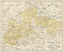
 Location of Baghelkhand in India | |
 Baghelkhand Location of Baghelkhand | |
| Coordinates: Coordinates: 24°30′N 81°12′E / 24.5°N 81.2°E | |
| Country | |
| State | Madhya Pradesh and Uttar Pradesh |
| Covering territory |
|
| Languages | Bagheli language |
| Area | |
| • Total | 42,179 km2 (16,285 sq mi) |
| Population (2011) | |
| • Total | 10,351,135 |
| • Density | 250/km2 (640/sq mi) |


Bagelkhand or Baghelkhand is a region and also a mountain range in central India that covers the northeastern regions of Madhya Pradesh and a small area of southeastern Uttar Pradesh.
History[]
Dahala[]
Baghelkhand was known as Dahala 6th–12th century, Kalachuri dynasty with stronghold at Kalinjar Fort. The area got its current name after Baghela Rajputs in the 14th century, later it was absorbed state.[1]
Princely state of rewa[2](CE 1234-1700) was established by Vyaghradev Singh.Rewa remained freeded even in the British colonial in India because it had always a male heir and britishers couldn't capture it according to doctrine of lapse.
Bagelkhand Agency[]
The Bagelkhand Agency was a British political unit which managed the relations of the British with a number of autonomous princely states existing outside British India, namely Rewa and 11 minor states, of which the most prominent were Maihar, Nagod and Sohawal. Other principalities included Jaso, Kothi, Baraundha (aka Patharkachhar) as well as the Kalinjar Chaubes, consisting of the princely estates of Paldeo, Kamta-Rajaula, , Pahra and Bhaisaunda.[3]
Geography[]
Bagelkhand is surrounded by the Indo-Gangetic plains in the north and east, Bundelkhand in the west and the Vindhya range in the south.[1]
Administration[]

Currently it divided between Madhya Pradesh and Uttar Pradesh. It includes the Madhya Pradesh districts Rewa, Satna, Shahdol, Sidhi, and Singrauli of Madhya Pradesh and Chitrakoot of Uttar Pradesh.[1]
Demographics[]
The inhabitants of Bagelkhand are called Bagheli and they speak the Bagheli language which is also designated as a dialect of Hindi.[1]
Religion[]
Languages[]
References[]
- ^ a b c d "Baghelkhand | historical region, India". Encyclopedia Britannica. Retrieved 30 April 2020.
- ^ Gururāmapyāre., Agnihotrī (1972). Rīvā Rājya kā itihāsa. OCLC 583425735.
- ^ Malleson, G. B. An historical sketch of the native states of India, London 1875, Reprint Delhi 1984
- ^ a b http://censusindia.gov.in/
| Proposed states |
|  |
|---|---|---|
| Proposed union territories |
| |
This Indian biographical article is a stub. You can help Wikipedia by . |
- Regions of Madhya Pradesh
- Regions of Uttar Pradesh
- Regions of India
- Indian people stubs