Bainbridge, Georgia
Bainbridge, Georgia | |
|---|---|
 Bainbridge City Hall | |
| Motto(s): "Georgia's First Inland Port"[1] | |
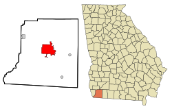 Location in Decatur County and the state of Georgia | |
| Coordinates: 30°54′17″N 84°34′16″W / 30.90472°N 84.57111°WCoordinates: 30°54′17″N 84°34′16″W / 30.90472°N 84.57111°W | |
| Country | United States |
| State | Georgia |
| County | Decatur |
| Government | |
| • Mayor | Edward Reynolds |
| Area | |
| • City | 19.83 sq mi (51.36 km2) |
| • Land | 18.60 sq mi (48.18 km2) |
| • Water | 1.23 sq mi (3.18 km2) |
| Elevation | 121 ft (37 m) |
| Population (2010) | |
| • City | 12,697 |
| • Estimate (2019)[6] | 12,081 |
| • Density | 649.45/sq mi (250.75/km2) |
| • Metro | 27,842 |
| Time zone | UTC-5 (Eastern (EST)) |
| • Summer (DST) | UTC-4 (EDT) |
| ZIP code | 39817, 39819 |
| Area code(s) | 229 |
| FIPS code | 13-04896[4] |
| GNIS feature ID | 0354431[5] |
| Website | bainbridgecity |

Bainbridge is a city in Decatur County, Georgia, United States. The city is the county seat of Decatur County.[7] As of the 2010 census, the city had a population of 12,697.[8]
History[]
The first European settlement in what is today Bainbridge was a trading post set up by James Burges in the late 18th century. From him comes the name Burges's Bluff.[9]:120 The town was named after U.S. Navy Commodore William Bainbridge,[10] commander of the USS Constitution ("Old Ironsides"), and was incorporated on December 22, 1829.[2]
In 1824, Bainbridge was designated seat of the newly formed Decatur County.[11]
On October 10, 2018, Bainbridge was victim to Hurricane Michael. The storm left widespread damage through the city limits, including downed trees, power lines, and structural damage. Many residents affected suffered severe damage to their homes.
Geography[]
Bainbridge is located in the center of Decatur County. The city is in southwestern Georgia along U.S. Routes 27 and 84, which form a bypass around the southern part of the city. U.S. Route 27 leads southeast 42 miles (68 km) to Tallahassee, Florida, and north 128 miles (206 km) to Columbus. U.S. Route 84 leads east 38 miles (61 km) to Thomasville and northwest 54 miles (87 km) to Dothan, Alabama. Other highways which run through the city include Georgia State Routes 97, 253, 309, and 311.
According to the United States Census Bureau, the city has a total area of 20.1 square miles (52.0 km2), of which 18.8 square miles (48.7 km2) is land and 1.3 square miles (3.3 km2), or 6.40%, is water.[8]
Bainbridge is located on the Flint River, which flows southwest to meet the Chattahoochee. Together they form the Apalachicola River which flows to the Gulf of Mexico. At the junction of the two rivers, the Jim Woodruff Dam forms Lake Seminole. A system of locks at the dam allows barge traffic to travel between the inland port at Bainbridge and the Gulf of Mexico.
Demographics[]
| Historical population | |||
|---|---|---|---|
| Census | Pop. | %± | |
| 1860 | 1,869 | — | |
| 1870 | 1,351 | −27.7% | |
| 1880 | 1,436 | 6.3% | |
| 1890 | 1,668 | 16.2% | |
| 1900 | 2,641 | 58.3% | |
| 1910 | 4,217 | 59.7% | |
| 1920 | 4,792 | 13.6% | |
| 1930 | 6,141 | 28.2% | |
| 1940 | 6,352 | 3.4% | |
| 1950 | 7,562 | 19.0% | |
| 1960 | 12,714 | 68.1% | |
| 1970 | 10,887 | −14.4% | |
| 1980 | 10,553 | −3.1% | |
| 1990 | 10,712 | 1.5% | |
| 2000 | 11,722 | 9.4% | |
| 2010 | 12,697 | 8.3% | |
| 2019 (est.) | 12,081 | [6] | −4.9% |
| U.S. Decennial Census[12] | |||
As of the 2010 United States Census, there were 12,697 people living in the city. The racial makeup of the city was 54.4% Black, 39.6% White, 0.1% Native American, 0.7% Asian, 0.1% from some other race and 1.0% from two or more races. 4.1% were Hispanic or Latino of any race.
As of the census[4] of 2000, there were 11,722 people, 4,444 households, and 3,013 families living in the city. The population density was 255.6/km2 (661.8/sq mi, Georgia average is 141.4/sq mi, U.S. average is 79.6/sq mi). There were 5,051 housing units at an average density of 285.2 per square mile (110.1/km2). The racial makeup of the city was 50.34% African American (Georgia 28.7%, U.S. 12.3%), 47.48% White (Georgia 65.1%, U.S. 75.1%), 0.12% Native American (Georgia 0.3%, U.S. 0.9%), 0.64% Asian (Georgia 2.1%, U.S. 3.6%), 0.02% Pacific Islander (Georgia 0.1%, U.S. 0.1%), 0.78% from other races (Georgia 2.4%, U.S. 5.5%), and 0.61% from two or more races (Georgia 1.4%, U.S. 2.4%). 2.00% of the population were Hispanic or Latino of any race (Georgia 5.3%, U.S. 12.5%).
There were 4,444 households, out of which 33.7% had children under the age of 18 living with them, 39.7% were married couples living together, 24.2% had a female householder with no husband present, and 32.2% were non-families. 28.5% of all households were made up of individuals, and 12.9% had someone living alone who was 65 years of age or older. The average household size was 2.52 and the average family size was 3.09.

In the city, the population was spread out, with 28.0% under the age of 18, 9.9% from 18 to 24, 26.9% from 25 to 44, 19.2% from 45 to 64, and 16.0% who were 65 years of age or older. The median age was 34 years. For every 100 females, there were 84.3 males. For every 100 females age 18 and over, there were 78.4 males.
The median income for a household in the city was $24,869, and the median income for a family was $30,557. Males had a median income of $28,918 versus $21,518 for females. The per capita income for the city was $15,589. About 24.0% of families and 26.9% of the population were below the poverty line, including 41.1% of those under age 18 and 18.9% of those age 65 or over.
Economy[]
It was announced in December 2019 that Brazil-based gun manufacturer Taurus had been granted a $39 million tax-incentive package to move from the Miami, Florida area to Bainbridge in return for creating 300 jobs. The package includes $20 million for construction, $7.9 million in tax credits, $4.5 million for infrastructure, $4.3 million in property-tax abatements, and $3 million for equipment, in addition to a land lease arrangement of $1/year for 73 acres (20 hectares) of land. The subsidy totals $130,000 per job.[13]
Arts and culture[]
Arts[]
- The Firehouse Gallery Art Gallery
Annual cultural events[]
River Town Days is held each year the second weekend of March.
The Swine Time Festival and Decatur County Fall Festival and Fair are annual events.[2]
National Register of Historic Places[]
The Decatur County Courthouse was constructed in 1902, and is listed on the National Register of Historic Places.[2] Also listed on the Register is the First African Missionary Baptist Church.[14]
Public library[]
The Decatur County Gilbert H. Gragg Library is located in Bainbridge. The library serves the population of Decatur County and acts as the headquarters for the Southwest Georgia Regional Library.[15]
Education[]
Decatur County School District[]
The Decatur County School District holds pre-school to grade 12, and consists of two elementary schools, one primary school, one middle school, and a high school.[16] The district has 384 full-time teachers and over 5,782 students.[17]
Schools include:[18]
- Jones-Wheat Elementary School (grades PreK-2)
- West Bainbridge Elementary School (grades PreK-2)
- Hutto Primary School (grades 3-5)
- Bainbridge Middle School (grades 6-8)
- Bainbridge High School (grades 9-12)
Other schools[]
- (ABAC affiliations)
- Grace Christian Academy (PreK-12)
- Spring Creek Charter Academy (PreK-6)
Infrastructure[]
Transportation[]
The city is a seaport linked to the Gulf of Mexico via Florida's Apalachicola River. Officially known as Port Bainbridge, these facilities are managed entirely by the Georgia Ports Authority.
The Decatur County Industrial Air Park, located 6 miles (10 km) northwest of the city, provides general aviation service to the community.
Parks and recreation[]
The Bainbridge-Decatur County YMCA opened on September 15, 1986. Its building had a cost of $1,000,000.[19]
Notable people[]
- James Butler, NFL player
- Alfred Corn, poet and essayist; born Bainbridge, raised in Valdosta
- Marvin Griffin, former Georgia governor
- Miriam Hopkins, Academy Award-nominated film actress
- Paul Kwilecki, documentary photographer
- Jason Lancaster, Singer and guitarist of Mayday Parade, singer of Go Radio, and solo career
- David Ross, MLB catcher, two-time World Series champion, Dancing with the Stars contestant
- Kirby Smart, head football coach for the University of Georgia
- Travis Smith, former drummer of Trivium
- Young Stribling, professional heavyweight boxer
References[]
- ^ "City of Bainbridge website". City of Bainbridge Georgia. Archived from the original on 2012-09-05. Retrieved September 6, 2012.
- ^ Jump up to: a b c d "Bainbridge". Georgia Department of Community Affairs. Archived from the original on December 24, 2012. Retrieved September 6, 2012.
- ^ "2019 U.S. Gazetteer Files". United States Census Bureau. Retrieved July 9, 2020.
- ^ Jump up to: a b "U.S. Census website". United States Census Bureau. Retrieved 2008-01-31.
- ^ "US Board on Geographic Names". United States Geological Survey. 2007-10-25. Retrieved 2008-01-31.
- ^ Jump up to: a b "Population and Housing Unit Estimates". United States Census Bureau. May 24, 2020. Retrieved May 27, 2020.
- ^ "Find a County". National Association of Counties. Archived from the original on 2011-05-31. Retrieved 2011-06-07.
- ^ Jump up to: a b "Geographic Identifiers: 2010 Demographic Profile Data (G001): Bainbridge city, Georgia". U.S. Census Bureau, American Factfinder. Retrieved October 20, 2015.[dead link]
- ^ Cox, Dale; Conrad, Rachael (2017). Fowltown. Neamathla, Tutakosi Talofa & the first battle of the Seminole Wars. Old Kitchen Books. ISBN 978-0692977880.
- ^ "Profile for Bainbridge, Georgia, GA". ePodunk. Retrieved September 6, 2012.
- ^ Hellmann, Paul T. (May 13, 2013). Historical Gazetteer of the United States. Routledge. p. 220. ISBN 978-1135948597. Retrieved 30 November 2013.
- ^ "Census of Population and Housing". Census.gov. Retrieved June 4, 2015.
- ^ Polly Mosendz; Caleb Melby (Dec 19, 2019), "Gunmaker Gets $39 Million From Taxpayers for 300 Small-Town Jobs", Bloomberg Business
- ^ Steven Moffson (June 2001). "National Register of Historic Places Registration: First African Missionary Baptist Church". National Park Service. with 12 photos
- ^ "Homepage". Southwest Georgia Regional Library System. Retrieved 21 July 2017.
- ^ Georgia Board of Education[permanent dead link], Retrieved June 8, 2010.
- ^ School Stats, Retrieved June 8, 2010.
- ^ "Our Schools". Decatur County School District. Retrieved December 31, 2020.
- ^ "Too small for a YMCA? … No way!". . 2012-03-21. Retrieved 2021-04-25. - Author was the interim CEO of the YMCA.
External links[]
| Wikivoyage has a travel guide for Bainbridge, Georgia. |
| Wikimedia Commons has media related to Bainbridge, Georgia. |
- City of Bainbridge official website
- "Bainbridge" entry in New Georgia Encyclopedia
- South Georgia Historic Newspapers Archive - Digital Library of Georgia
| show Municipalities and communities of Decatur County, Georgia, United States |
|---|

| show Authority control |
|---|
- Cities in Georgia (U.S. state)
- Cities in Decatur County, Georgia
- County seats in Georgia (U.S. state)