Balgo Hill Airport
Balgo Hill Airport | |||||||||||||||
|---|---|---|---|---|---|---|---|---|---|---|---|---|---|---|---|
| |||||||||||||||
| Summary | |||||||||||||||
| Airport type | Public | ||||||||||||||
| Operator | Wirrimanu Aboriginal Community | ||||||||||||||
| Location | Balgo, Western Australia | ||||||||||||||
| Elevation AMSL | 1,440 ft / 439 m | ||||||||||||||
| Coordinates | 20°08′54″S 127°58′24″E / 20.14833°S 127.97333°ECoordinates: 20°08′54″S 127°58′24″E / 20.14833°S 127.97333°E | ||||||||||||||
| Map | |||||||||||||||
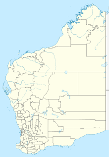 YBGO Location in Western Australia | |||||||||||||||
| Runways | |||||||||||||||
| |||||||||||||||
Sources: Australian AIP and aerodrome chart[1] | |||||||||||||||

Balgo Hill Airport (IATA: BQW, ICAO: YBGO) is located 1 nautical mile (1.9 km; 1.2 mi) south[1] of Balgo, Western Australia.[2][3]
See also[]
- List of airports in Western Australia
- Aviation transport in Australia
References[]
- ^ a b YBGO – Balgo Hill (PDF). AIP En Route Supplement from Airservices Australia, effective 2 Dec 2021, Aeronautical Chart Archived 10 April 2012 at the Wayback Machine
- ^ Australia. Department of Civil Aviation (1963), [Aerial photographs of Western Australian airfields], Dept. of Civil Aviation, retrieved 29 January 2021
- ^ Crothers, John; LG Auditing and Consulting Services Pty Ltd, (issuing body.) (2001), Kimberley remote Aboriginal communities aerodromes/airstrips : upgrade/enhancement study, Balgo [Wirrimanu], LG Consulting Services Pty Ltd, retrieved 29 January 2021
External links[]
This Western Australia airport related article is a stub. You can help Wikipedia by . |
Categories:
- Kimberley airports
- Western Australia airport stubs