Forrest Airport
Forrest Airport | |||||||||||||||
|---|---|---|---|---|---|---|---|---|---|---|---|---|---|---|---|
| |||||||||||||||
| Summary | |||||||||||||||
| Airport type | Public | ||||||||||||||
| Operator | Fayburn Pty Ltd. | ||||||||||||||
| Location | Forrest, Western Australia | ||||||||||||||
| Elevation AMSL | 511 ft / 156 m | ||||||||||||||
| Coordinates | 30°50′19″S 128°06′46″E / 30.83861°S 128.11278°ECoordinates: 30°50′19″S 128°06′46″E / 30.83861°S 128.11278°E | ||||||||||||||
| Website | http://www.forrestairport.com.au | ||||||||||||||
| Map | |||||||||||||||
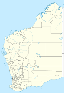 YFRT Location in Western Australia | |||||||||||||||
| Runways | |||||||||||||||
| |||||||||||||||
Sources: Australian AIP and aerodrome chart[1] | |||||||||||||||

Forrest Airport (IATA: FOS, ICAO: YFRT) is an airport located in the tiny hamlet of Forrest, Western Australia. The airport is clearly visible from the Indian Pacific train, which services the Trans-Australian Railway.
History[]
The airport was built by the Department of Civil Aviation in 1929 as a fuel stop for West Australian Airways which had won a government contract to carry mail between Adelaide and Perth using the de Havilland Hercules. During World War II it was operated by the Royal Australian Air Force as a transit and fuel stop, and a communications base. It remains in use as an important stopping place for refuelling short range planes, for the Royal Flying Doctor Service and the Australian Defence Force.[2][3]
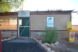
Forrest Airport terminal building

See also[]
- List of airports in Western Australia
- Aviation transport in Australia
References[]
- ^ YFRT – Forrest (PDF). AIP En Route Supplement from Airservices Australia, effective 2 Dec 2021, Aeronautical Chart
- ^ "AIRWAY SERVICES". The West Australian. Perth. 4 May 1937. p. 17. Retrieved 14 December 2015 – via National Library of Australia.
- ^ http://www.forrestairport.com.au/
External links[]
- Airservices Aerodromes & Procedure Charts
- Forrest Airport WA archived version – compiled by Geoff Goodall
This Western Australia airport related article is a stub. You can help Wikipedia by . |
- Airports in Western Australia
- Goldfields-Esperance
- Nullarbor Plain
- Western Australia airport stubs