Batavia, Ohio
Batavia, Ohio | |
|---|---|
 Looking east along Main Street | |
| Motto(s): Historic past – Bright future | |
 Location of Batavia, Ohio | |
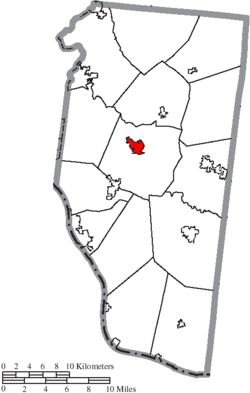 Location of Batavia in Clermont County | |
 Batavia Location in Ohio | |
| Coordinates: 39°4′38″N 84°10′45″W / 39.07722°N 84.17917°WCoordinates: 39°4′38″N 84°10′45″W / 39.07722°N 84.17917°W | |
| Country | United States |
| State | Ohio |
| County | Clermont |
| Township | Batavia |
| Settled | Fall 1797[3] |
| Platted | October 24, 1814[3] |
| Incorporated | February 10, 1842[3] |
| Government | |
| • Mayor | John Q. Thebout[1][2] |
| Area | |
| • Total | 2.97 sq mi (7.70 km2) |
| • Land | 2.91 sq mi (7.54 km2) |
| • Water | 0.06 sq mi (0.15 km2) |
| Elevation | 594 ft (181 m) |
| Population | |
| • Total | 1,509 |
| • Estimate (2019)[8] | 1,983 |
| • Density | 680.98/sq mi (262.92/km2) |
| Time zone | UTC−5 (Eastern (EST)) |
| • Summer (DST) | UTC−4 (EDT) |
| ZIP code | 45103 |
| Area code | 513 |
| FIPS code | 39-04150[7] |
| GNIS feature ID | 1037672[6] |
| Website | bataviavillage |


Batavia (/bəˈteɪviə/ bə-TAY-vee-ə)[9] is a village in and the county seat of Clermont County, Ohio, United States.[10] The population was 1,509 at the 2010 census.
Geography[]

Batavia is located at 39°4′38″N 84°10′45″W / 39.07722°N 84.17917°W (39.077332, -84.179160).[11]
According to the United States Census Bureau, the village has a total area of 1.62 square miles (4.20 km2), of which 1.59 square miles (4.12 km2) is land and 0.03 square miles (0.08 km2) is water.[12] It is surrounded by Batavia Township.
Transportation[]
Batavia is on Ohio State Route 32, also known as the Appalachian Highway, a major east–west highway that connects Interstate 275 and the Cincinnati area to the rural counties of Southern Ohio. State Routes Ohio State Route 132 and 222 also pass through Batavia's downtown area.
The Clermont Transportation Connection provides daily bus service to downtown Cincinnati. The Cincinnati Eastern Railroad (CCET) passes through Batavia.
History[]

Batavia was surveyed on May 28, 1788, by Captain Francis Minnis, John O'Bannon, Nicholas Keller, Archelus Price, and John Ormsley. Virginian Ezekiel Dimmitt became the area's first settler in the fall of 1797. George Ely purchased the Minnis survey in 1807 and platted the town on October 24, 1814, possibly naming it after Batavia, New York. The Clermont County seat moved from New Richmond to Batavia on February 24, 1824.[3] Batavia finally incorporated as a village on February 10, 1842.[13]
The Norfolk and Western Railway stopped at Batavia from March 1877 to April 1971. The Cincinnati, Georgetown and Portsmouth Railroad, an interurban railroad, also ran through town from 1903 to 1934. Norfolk Southern can sometimes roll through Batavia about 3 times a day.[3]
Demographics[]
| Historical population | |||
|---|---|---|---|
| Census | Pop. | %± | |
| 1820 | 208 | — | |
| 1830 | 426 | 104.8% | |
| 1840 | 350 | −17.8% | |
| 1850 | 400 | 14.3% | |
| 1860 | 500 | 25.0% | |
| 1870 | 827 | 65.4% | |
| 1880 | 1,015 | 22.7% | |
| 1890 | 953 | −6.1% | |
| 1900 | 1,029 | 8.0% | |
| 1910 | 1,034 | 0.5% | |
| 1920 | 1,088 | 5.2% | |
| 1930 | 1,119 | 2.8% | |
| 1940 | 1,320 | 18.0% | |
| 1950 | 1,445 | 9.5% | |
| 1960 | 1,729 | 19.7% | |
| 1970 | 1,894 | 9.5% | |
| 1980 | 1,896 | 0.1% | |
| 1990 | 1,700 | −10.3% | |
| 2000 | 1,617 | −4.9% | |
| 2010 | 1,509 | −6.7% | |
| 2019 (est.) | 1,983 | [8] | 31.4% |
| U.S. Decennial Census[14] | |||
2010 census[]
As of the census[5] of 2010, there were 1,509 people, 629 households, and 411 families living in the village. The population density was 949.1 inhabitants per square mile (366.4/km2). There were 713 housing units at an average density of 448.4 per square mile (173.1/km2). The racial makeup of the village was 93.6% White, 3.4% African American, 0.5% Native American, 0.6% Asian, 0.1% from other races, and 1.8% from two or more races. Hispanic or Latino of any race were 0.9% of the population.
There were 629 households, of which 31.3% had children under the age of 18 living with them, 43.7% were married couples living together, 16.7% had a female householder with no husband present, 4.9% had a male householder with no wife present, and 34.7% were non-families. 30.8% of all households were made up of individuals, and 9.7% had someone living alone who was 65 years of age or older. The average household size was 2.37 and the average family size was 2.91.
The median age in the village was 37.7 years. 24.5% of residents were under the age of 18; 8.3% were between the ages of 18 and 24; 26.5% were from 25 to 44; 27.3% were from 45 to 64; and 13.5% were 65 years of age or older. The gender makeup of the village was 47.1% male and 52.9% female.
2000 census[]
As of the census[7] of 2000, there were 1,617 people, 651 households, and 453 families living in the village. The population density was 1,105.4 people per square mile (427.6/km2). There were 696 housing units at an average density of 475.8 per square mile (184.1/km2). The racial makeup of the village was 94.50% White, 3.28% African American, 0.12% Native American, 0.25% Asian, 0.06% Pacific Islander, 0.25% from other races, and 1.55% from two or more races. Hispanic or Latino of any race were 0.37% of the population.
There were 651 households, out of which 34.4% had children under the age of 18 living with them, 52.2% were married couples living together, 13.8% had a female householder with no husband present, and 30.3% were non-families. 25.7% of all households were made up of individuals, and 9.4% had someone living alone who was 65 years of age or older. The average household size was 2.48 and the average family size was 2.96.
In the village, the age distribution of the population shows 25.9% under the age of 18, 8.4% from 18 to 24, 30.2% from 25 to 44, 23.3% from 45 to 64, and 12.3% who were 65 years of age or older. The median age was 36 years. For every 100 females there were 97.2 males. For every 100 females age 18 and over, there were 92.5 males.
The median income for a household in the village was $40,804, and the median income for a family was $50,238. Males had a median income of $36,190 versus $25,583 for females. The per capita income for the village was $20,171. About 6.4% of families and 6.6% of the population were below the poverty line, including 8.4% of those under age 18 and none of those age 65 or over.
Economy[]
Batavia was home to Ford Motor Company's Batavia Transmission plant until it closed in 2009 under a corporate plan called "The Way Forward". Batavia anchored an industrial area that also includes rollercoaster manufacturer Clermont Steel Fabricators.
Education[]

University of Cincinnati Clermont College, a regional campus of the University of Cincinnati, is in Batavia. UC Clermont's satellite campus, UC East, operates out of the administrative offices of the former Ford plant. Due to declining enrollment at UC Clermont, UC East was closed and is vacated as of 2020.
Batavia and the surrounding township belongs to the Batavia Local School District. The village annexed its only high school, Batavia High School, in 2012.[15]
Batavia has a public library, a branch of the Clermont County Public Library.[16]
Media and attractions[]
WOBO-FM broadcasts from Batavia at 88.7 MHz. has published weekly since 1828.[3] The Tri-State Warbird Museum is located at the Clermont County Airport.[17]
Notable people[]
The following notable people have lived in Batavia:
- Audrey Bolte – beauty queen, 2012 Miss Ohio USA
- Charlie Case – baseball player, Pittsburgh Pirates
- Reader W. Clarke – lawyer, Whig newspaper publisher, and Republican member of the U.S. House of Representatives
- Lt. Gen. Henry Clark Corbin – Army officer, Adjutant General of the U.S. Army[3]
- William Howard – soldier, lawyer, and Democratic member of the U.S. House of Representatives
- George W. Hulick – teacher, lawyer, soldier, judge, and Republican member of the U.S. House of Representatives
- Josephine Johnson – novelist, 1935 Pulitzer Prize for Fiction winner
- Charles Cyrus Kearns – lawyer, Republican member of the U.S. House of Representatives
- Staff Sgt. Matt Maupin – Army soldier captured in Iraq in 2004, whose death was not confirmed until 2008
- Jonathan D. Morris – lawyer, Democratic member of the U.S. House of Representatives
- Earl Mossor – baseball player, Brooklyn Dodgers
- Bill Mussey – journalist and Republican member of the Ohio General Assembly
- Hugh L. Nichols – politician and judge, Lieutenant Governor of Ohio and Chief Justice of the Ohio Supreme Court[3]
- Joel Peckham – poet
- Julius Penn – U.S. Army brigadier general in World War I[18]
- Gene Schott – baseball player, Cincinnati Reds
- Joe Smith – baseball player, Houston Astros
- Philip Bergen Swing – United States federal judge, S.D. Ohio
- Murray Thurston Titus – Christian missionary to India
References[]
- ^ "Administration". Village of Batavia. July 18, 2013. Retrieved January 28, 2020.
- ^ "Thebout elected president of Clermont County Mayor's Association". . Batavia, Ohio. April 7, 2013. Retrieved September 16, 2013.
- ^ Jump up to: a b c d e f g h Crawford, Richard. "History of Batavia Township". Archived from the original on September 11, 2013. Retrieved September 16, 2013.
- ^ "2019 U.S. Gazetteer Files". United States Census Bureau. Retrieved July 27, 2020.
- ^ Jump up to: a b "U.S. Census website". United States Census Bureau. Retrieved 2013-01-06.
- ^ Jump up to: a b "US Board on Geographic Names". United States Geological Survey. 2007-10-25. Retrieved 2008-01-31.
- ^ Jump up to: a b "U.S. Census website". United States Census Bureau. Retrieved 2008-01-31.
- ^ Jump up to: a b "Population and Housing Unit Estimates". Retrieved May 21, 2020.
- ^ "A Pronunciation Guide to places in Ohio -- E.W.Scripps School of". scrippsjschool.org. Archived from the original on 2017-07-25. Retrieved 2008-12-17.
- ^ "Find a County". National Association of Counties. Archived from the original on 2012-07-12. Retrieved 2011-06-07.
- ^ "US Gazetteer files: 2010, 2000, and 1990". United States Census Bureau. 2011-02-12. Retrieved 2011-04-23.
- ^ "US Gazetteer files 2010". United States Census Bureau. Archived from the original on 2012-01-25. Retrieved 2013-01-06.
- ^ Everts, Louis H. (1880). History of Clermont County, Ohio, with Illustrations and Biographical Sketches of Its Prominent Men and Pioneers. Philadelphia: J.B. Lippincott & Co. p. 255.
- ^ "Census of Population and Housing". Census.gov. Retrieved June 4, 2015.
- ^ Bednarski, Kristin (September 14, 2012). "Commissioners approve Batavia annexation". The Clermont Sun. Batavia, Ohio. Retrieved September 16, 2013.
- ^ "Locations". Clermont County Public Library. Retrieved 25 February 2018.
- ^ "Tri-state War Bird Museum". Archived from the original on August 30, 2006.
- ^ Andrews, Avery Delano (1911). 1886-1911: In Commemoration of the 25th Anniversary of Graduation of the Class of '86, U.S.M.A. West Point, June, 1911. Philadelphia, PA: The Holmes Press. pp. 165–166.
External links[]
| Wikimedia Commons has media related to Batavia, Ohio. |
| Wikivoyage has a travel guide for Batavia (Ohio). |
| show Municipalities and communities of Clermont County, Ohio, United States |
|---|

| show Authority control |
|---|
- County seats in Ohio
- Villages in Clermont County, Ohio
- Villages in Ohio
- Populated places established in 1797