Beechboro Road
Beechboro Road
| |||
|---|---|---|---|
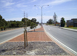 | |||
| Looking north, in Bennett Springs | |||
| General information | |||
| Type | Road | ||
| Length | 11.8 km (7.3 mi) | ||
| Route number(s) | State Route 53 (Tonkin Highway to Walter Road East) | ||
| Major junctions | |||
| |||
| North end | |||
| |||
| South end | Cul-de-sac north of Tonkin Highway, Embleton | ||
| |||
| North end | Cul-de-sac south of Tonkin Highway, Embleton | ||
| |||
| South end | Coode Street, Bayswater | ||
| Location(s) | |||
| Major suburbs | Morley, Beechboro, Cullacabardee | ||
Beechboro Road is a north–south arterial road located in the northeastern suburbs of Perth, Western Australia, connecting Morley and Bayswater with areas further north.[1] Until the construction of the nearby section of Tonkin Highway between 1984 and 1992, and later, during the NorthLink WA road project between 2016 and 2019, Beechboro Road was one of northeastern Perth's most important routes. The road is discontinuous at Tonkin Highway, with the section from Tonkin Highway to Walter Road officially known as Beechboro Road North, and the section running through Bayswater as Beechboro Road South.[1]
Beechboro Road North is allocated State Route 53 for almost its entire length. Prior to 2019, this allocation extended northwards to Gnangara Road, but had since been truncated at Tonkin Highway and Hepburn Avenue due to the NorthLink WA road project.
Route description[]
Beechboro Road South[]
Beechboro Road South runs entirely through Bayswater and is 2.6 kilometres (1.6 mi) long. The road is mostly a two-lane single carriageway and runs through residential and some industrial areas upon reaching its northern end.
Beechboro Road South commences at a traffic light controlled T-junction with Coode Street in the Bayswater town centre. The road initially runs through residential areas but transitions to industrial areas after 1 kilometre (0.62 mi). Another 800 metres (2,600 ft) takes the road to a traffic light controlled intersection with Collier Road. The road turns right after 100 metres (330 ft), while the main traffic flow continues northwards as Embleton Avenue, and terminates in a cul-de-sac north of Tonkin Highway 700 metres (2,300 ft) north-eastwards.
Beechboro Road North[]
Beechboro Road North is 9.2 kilometres (5.7 mi) long and is part of State Route 53. The road is mostly two lanes in each direction which alternates between single and dual carriageway.
Beechboro Road North commences at a cul-de-sac north of Tonkin Highway in Embleton. 350 metres (1,150 ft) later, the road encounters a traffic light intersection with Broun Avenue to the west and Walter Road East to the east, gaining the State Route 53 north of that intersection. Now within the suburb of Morley and a four-lane single carriageway, the road intersects at traffic lights with Morley Drive East 650 metres (2,130 ft) later, and then, now a dual carriageway, another 1.5 kilometres (0.93 mi) later takes the road to Benara Road, also at traffic lights. The road travels through the suburb of Beechboro for another 1.5 kilometres (0.93 mi) before reaching Reid Highway, which Beechboro Road passes over, with the two roads having had formerly intersected with each other at traffic lights before 2018. Following this flyover the suburb is now within the residential suburb of Bennett Springs, encountering a roundabout with Orchid Avenue and Bridgeman Drive and a T-junction with Bennett Springs Drive, all within 750 metres (2,460 ft) before intersecting with Marshall Road at traffic lights. Following this intersection Beechboro Road North promptly reduces to a two-lane single carriageway, travelling northwards within Whiteman for about 1.8 kilometres (1.1 mi), during which it forms part of the western border of Whiteman Park, sits near bushland which is expected to be the location for the future Malaga railway station on the upcoming Ellenbrook railway line as part of the Metronet project, and intersects with Whiteman Drive (an entrance to Whiteman Park) and Hennessey Road (the former section of Beechboro Road North between Hepburn Avenue and Gnangara Road). Beechboro Road North ends at a roundabout interchange with Tonkin Highway, continuing westwards as Hepburn Avenue.
History[]
The road was first commissioned during the 1970s as a road that tracked the then-new northeastern suburbs of Perth, running all the way to Gnangara Road.[2]
Upon the completion of the nearby section of Tonkin Highway from Railway Parade to Morley Drive in 1984, Beechboro Road was split into two parts, becoming discontinuous on both sides of the highway. In 1992, the intersection with Reid Highway opened when it was extended eastwards from Tonkin Highway. The location of this intersection required impact analysis and environmental review.[3][4][5]
In 2010, a new extension of Hepburn Avenue to Beechboro Road North opened nearby, resulting in the latter being realigned with Beechboro Road traffic coming from the south continuing as Pass Way that would terminate at Hepburn Avenue. To continue onto Beechboro Road North, traffic had to turn right at the roundabout. This alignment was later removed in 2018 as part of nearby works for the NorthLink WA project.
Beechboro Road North was heavily affected during the NorthLink WA road project during 2018 and 2019. The intersection with Reid Highway was converted to a flyover due to its close proximity to the combination interchange between Reid and Tonkin Highways. The road was also realigned to connect with Hepburn Avenue at a roundabout interchange with Tonkin Highway, which shortened its original length by nearly 7 km, and the road was duplicated in the vicinity of the interchange. The section from Hepburn Avenue to Gnangara Road was also affected due to Tonkin Highway crossing its path and passing just south of its original northern terminus with Gnangara Road, with said section becoming a cul-de-sac at its northern end, and renamed Hennessey Road.[2]
Hennessey Road[]
Hennessey Road is the current name of the original section of Beechboro Road North between Hepburn Avenue and Gnangara Road. This section of the route provided a link to Gnangara Road and Ellenbrook from Marshall Road when it was still part of Beechboro Road North, as well as provide access to the Cullacabardee community and Whiteman Park hobby clubs, which it still does today. As a result of the NorthLink WA works, the road was permanently closed north of Jules Steiner Memorial Drive (the entrance road to the shooting complex) in January 2019, and reduced to a local access road. The road is accessible from a left-in/left-out intersection at Beechboro Road North.
Major intersections[]
This article contains a bulleted list or table of intersections which should be presented in a properly formatted junction table. (December 2021) |
Beechboro Road North:
 Tonkin Highway, Ballajura, Whiteman and Cullacabardee (roundabout interchange, continues as
  Hepburn Avenue westwards)
- Marshall Road, Whiteman and Beechboro
- Benara Road, Morley
 Morley Drive East (State Route 76) - Morley
 Walter Road East (State Route 53 west) - Embleton and Bayswater
Beechboro Road South:
Former intersections[]
The following intersections were removed during 2018-19 as part of the NorthLink WA project.
 Gnangara Road (State Route 84), Whiteman and Lexia (formerly traffic light intersection, now replaced by the Tonkin Highway and Gnangara Road interchange)
 Reid Highway (State Route 3), Beechboro (formerly traffic light intersection, now a flyover)
See also[]
![]() Australian Roads portal
Australian Roads portal
References[]
- ^ a b 2011 UBD Perth and Surrounds Street Directory. Australia: Universal Publishers Pty Ltd. 2011. pp. 190, 210, 230, 250. ISBN 978 0 7319 2653 4.
- ^ a b "Landgate Map Viewer Plus". maps.landgate.wa.gov.au. Retrieved 1 September 2020.
- ^ Western Australia. Main Roads Dept; Western Australia. Environmental Protection Authority; Western Australia. Main Roads Dept. Metropolitan Operations Directorate (1993), Reid Highway, Beechboro Road to Great Northern Highway : public environmental review, Main Roads, Western Australia ; [Perth, W.A. : distributed by the Environmental Protection Authority], retrieved 28 December 2013
- ^ Reid Highway : Beechboro Road to Great Northern Highway : public environmental review, The Dept, 1993, retrieved 28 December 2013
- ^ Western Australia. Environmental Protection Authority (1994), Reid Highway - Beechboro Road to Great Northern Highway : Main Roads of Western Australia : report and recommendations of the Environmental Protection Authority, Environmental Protection Authority, ISBN 978-0-7309-5668-6
Route map:

| ( • help)
|
| |||
| National Highways |
| ||
| National Routes |
| ||
| State Routes |
| ||
| Tourist Drives |
| ||
- Roads in Perth, Western Australia