Beit Zayit
Beit Zayit
בֵּית זַיִת بيت زايت | |
|---|---|
 | |
 Beit Zayit | |
| Coordinates: 31°46′58″N 35°9′34″E / 31.78278°N 35.15944°ECoordinates: 31°46′58″N 35°9′34″E / 31.78278°N 35.15944°E | |
| Country | |
| District | Jerusalem |
| Council | Mateh Yehuda |
| Affiliation | Moshavim Movement |
| Founded | 1949 |
| Founded by | Jewish immigrants from Hungary, Romania and Yugoslavia |
| Population (2019)[1] | 1,708 |
| Name meaning | House of Olives |
| Website | www |


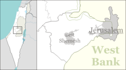
Beit Zayit (Hebrew: בֵּית זַיִת, lit. House of Olives) is a moshav in Israel. Located just outside the Jerusalem municipal border to the west, it falls under the jurisdiction of Mateh Yehuda Regional Council. In 2019 it had a population of 1,708.[1]
Beit Zayit lies on the edge of the Jerusalem Forest and operates a public swimming pool. Nearby is the Ein Kerem dam, built to store winter flood waters.[2]
History[]
A village named Beit Zayit is mentioned in the book of the Maccabees, but it is believed to have been further north, possibly at the site of the Palestinian Christian town of Bir Zeit, north of Ramallah.[2] Beit Zayit was established on land that had belonged to the depopulated Palestinian village of 'Ayn Karim.[3]
The village was established in 1949 by Jewish immigrants from Egypt, Romania and Yugoslavia. The economy was based on fruit orchards, vegetables, poultry, and other farm products.[2]
With the expansion of the moshav in the late 1990s, including the purchase of land by newcomers and renovation of old homes, Beit Zayit became a trendy alternative to living in Jerusalem.[4]
Dinosaur footprints[]
In 1962, dinosaur footprints were discovered in the garden of one of Beit Zayit's residents, and are on display at the Hebrew University of Jerusalem.[5] This is the only place in Israel where evidence of dinosaurs was discovered, and one of few such sites in the Middle East.[6]
References[]
- ^ Jump up to: a b "Population in the Localities 2019" (XLS). Israel Central Bureau of Statistics. Retrieved 16 August 2020.
- ^ Jump up to: a b c Bard, Mitchell G. (2016). "Bet Zayit". Jewish Virtual Library. . Retrieved May 2, 2019.
- ^ Khalidi, W. (1992). All That Remains: The Palestinian Villages Occupied and Depopulated by Israel in 1948. Washington D.C.: Institute for Palestine Studies. p. 273. ISBN 0-88728-224-5.
- ^ Steinberg, Jessica (2 January 2009). "Posh Israeli suburb grows out of a farming co-op". The New York Times. Retrieved May 2, 2019.
- ^ Sofer, Barbara (1995). Kids Love Israel, Israel Loves Kids: A Travel Guide for Families. Kar-Ben Publishing. p. 103. ISBN 9780929371894.
- ^ Feinberg Vamosh, Miriam (16 September 2013). "Way Before the Flood: Dinosaur Tracks by Jerusalem". Haaretz. Retrieved 2 May 2019.
External links[]
- Village website (in Hebrew)
| show Authority control |
|---|
- Mateh Yehuda Regional Council
- Moshavim
- Populated places established in 1949
- Populated places in Jerusalem District
- 1949 establishments in Israel
- Egyptian-Jewish culture in Israel
- Hungarian-Jewish culture in Israel
- Romanian-Jewish culture in Israel
- Yugoslav-Jewish culture in Israel
- Paleontology in Israel