Ein Naqquba
Ein Naqquba
עֵין נַקוּבָּא عين نقوبا | |
|---|---|
 | |
 Ein Naqquba | |
| Coordinates: 31°47′36.06″N 35°7′6.2″E / 31.7933500°N 35.118389°ECoordinates: 31°47′36.06″N 35°7′6.2″E / 31.7933500°N 35.118389°E | |
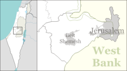
| Country | Israel |
| District | Jerusalem |
| Council | Mateh Yehuda |
| Founded | 1962 |
| Founded by | Former residents of Bayt Naqquba |
| Population (2019)[1] | 3,505 |


Ein Naqquba (Arabic: عين نقوبا, Hebrew: עֵין נַקוּבָּא) is an Arab village in central Israel. Located west of Jerusalem, it falls under the jurisdiction of Mateh Yehuda Regional Council. In 2019 it had a population of 3,505.[1].[1]
History

The historical village lands of Beit Naqquba as shown in this 1940s Survey of Palestine map; the village was depopulated in 1948 (its inhabitants returning to create Ein Naqquba in 1962) and was replaced by the moshav of Beit Nekofa.
The village was established in 1962 by refugees from the village of Bayt Naqquba, which had been depopulated during the 1948 Arab–Israeli War and whose lands had become Beit Nekofa. It was part of Ein Rafa until 1976, when it was recognised as a separate village.
References
- ^ Jump up to: a b c "Population in the Localities 2019" (XLS). Israel Central Bureau of Statistics. Retrieved 16 August 2020.
| Authority control |
|
|---|
Categories:
- Mateh Yehuda Regional Council
- Arab villages in Israel
- Populated places established in 1962
- Populated places in Jerusalem District
- 1962 establishments in Israel