Ramat Raziel
Ramat Raziel
רמת רזיאל رامات رازيئيل | |
|---|---|
 | |
 Ramat Raziel | |
| Coordinates: 31°46′26″N 35°4′22″E / 31.77389°N 35.07278°ECoordinates: 31°46′26″N 35°4′22″E / 31.77389°N 35.07278°E | |
| Country | Israel |
| District | Jerusalem |
| Council | Mateh Yehuda |
| Affiliation | Mishkei Herut Beitar |
| Founded | 1948 |
| Population (2019)[1] | 660 |

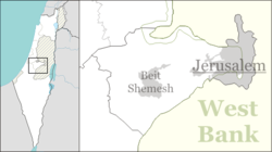
Ramat Raziel (Hebrew: רָמַת רָזִיאֵל, lit. Raziel Heights) is a moshav in central Israel. Located in the centre of the Jerusalem corridor, it falls under the jurisdiction of Mateh Yehuda Regional Council. In 2019 it had a population of 660.[1]
History[]
The village was established in 1948, and was named after David Raziel, a commander of the Irgun.[citation needed]
It is located on land belonging to the depopulated Palestinian village of Kasla, Jerusalem.[2]
References[]
- ^ Jump up to: a b "Population in the Localities 2019" (XLS). Israel Central Bureau of Statistics. Retrieved 16 August 2020.
- ^ Khalidi, Walid (1992). All That Remains: The Palestinian Villages Occupied and Depopulated by Israel in 1948. Washington D.C.: Institute for Palestine Studies. p. 299. ISBN 0-88728-224-5.
| Authority control |
|
|---|
Categories:
- Mateh Yehuda Regional Council
- Moshavim
- Populated places established in 1948
- Populated places in Jerusalem District
- 1948 establishments in Israel