Bellefontaine Neighbors, Missouri
Bellefontaine Neighbors, Missouri | |
|---|---|
City | |
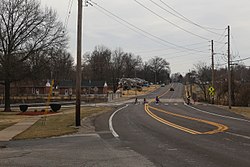 Bellefontaine Road in Bellefontaine Neighbors, Missouri, February 2017 | |
 Location of Bellefontaine Neighbors, Missouri | |
| Coordinates: 38°44′54″N 90°13′41″W / 38.74833°N 90.22806°WCoordinates: 38°44′54″N 90°13′41″W / 38.74833°N 90.22806°W | |
| Country | |
| State | |
| County | St. Louis |
| Incorporated | June 19, 1950[1] |
| Area | |
| • Total | 4.40 sq mi (11.39 km2) |
| • Land | 4.40 sq mi (11.39 km2) |
| • Water | 0.00 sq mi (0.00 km2) |
| Elevation | 459 ft (140 m) |
| Population | |
| • Total | 10,860 |
| • Estimate (2019)[6] | 10,397 |
| • Density | 2,365.10/sq mi (913.20/km2) |
| Time zone | UTC-6 (Central (CST)) |
| • Summer (DST) | UTC-5 (CDT) |
| FIPS code | 29-04222[4] |
| GNIS feature ID | 0755748[5] |
| Website | http://www.cityofbn.com |

Bellefontaine Neighbors (/bɛlˈfaʊntən/ bel-FOWN-tən) is an inner-ring suburb city in St. Louis County, Missouri, United States. The population was 10,860 at the 2010 census.[7]
Geography[]
Bellefontaine Neighbors is a second-ring northern suburb of St. Louis. Bellefontaine Neighbors is located at 38°44′54″N 90°13′41″W / 38.74833°N 90.22806°W (38.748217, -90.227917).[8]
According to the United States Census Bureau, the city has a total area of 4.32 square miles (11.19 km2), all land.[9]
Demographics[]
| Historical population | |||
|---|---|---|---|
| Census | Pop. | %± | |
| 1960 | 13,650 | — | |
| 1970 | 14,084 | 3.2% | |
| 1980 | 12,082 | −14.2% | |
| 1990 | 10,922 | −9.6% | |
| 2000 | 11,271 | 3.2% | |
| 2010 | 10,860 | −3.6% | |
| 2019 (est.) | 10,397 | [6] | −4.3% |
| U.S. Decennial Census | |||
2013 American Community Survey[]
As of the 2013 American Community Survey, the racial makeup of the city was:
73.1% Black or African American
24.3% White
0.1% Asian
0.1% Some other race
2.4% Two or more races
1.1% Hispanic or Latino (of any race)
2010 census[]
As of the census[3] of 2010, there were 10,860 people, 4,311 households, and 2,784 families living in the city. The population density was 2,513.9 inhabitants per square mile (970.6/km2). There were 4,645 housing units at an average density of 1,075.2 per square mile (415.1/km2). The racial makeup of the city was 25.7% White, 72.7% African American, 0.1% Native American, 0.2% Asian, 0.2% from other races, and 1.1% from two or more races. Hispanic or Latino of any race were 0.5% of the population.
There were 4,311 households, of which 33.7% had children under the age of 18 living with them, 32.0% were married couples living together, 27.1% had a female householder with no husband present, 5.5% had a male householder with no wife present, and 35.4% were non-families. 31.3% of all households were made up of individuals, and 10.1% had someone living alone who was 65 years of age or older. The average household size was 2.41 and the average family size was 2.98.
The median age in the city was 40.5 years. 23% of residents were under the age of 18; 7.8% were between the ages of 18 and 24; 25.8% were from 25 to 44; 29.5% were from 45 to 64; and 13.8% were 65 years of age or older. The gender makeup of the city was 46.1% male and 53.9% female.
2000 census[]
As of the census[4] of 2000, there were 11,271 people, 4,388 households, and 2,966 families living in the city. The population density was 2,573.2 people per square mile (993.6/km2). There were 4,550 housing units at an average density of 1,038.8 per square mile (401.1/km2). The racial makeup of the city was 53.73% White, 44.41% African American, 0.20% Native American, 0.26% Asian, 0.02% Pacific Islander, 0.31% from other races, and 1.07% from two or more races. Hispanic or Latino of any race were 0.67% of the population.
There were 4,388 households, out of which 32.8% had children under the age of 18 living with them, 42.8% were married couples living together, 20.7% had a female householder with no husband present, and 32.4% were non-families. 29.4% of all households were made up of individuals, and 14.5% had someone living alone who was 65 years of age or older. The average household size was 2.39 and the average family size was 2.93.
In the city, the population was spread out, with 24.1% under the age of 18, 8.2% from 18 to 24, 29.8% from 25 to 44, 20.2% from 45 to 64, and 17.7% who were 65 years of age or older. The median age was 38 years. For every 100 females, there were 88.1 males. For every 100 females age 18 and over, there were 83.2 males.
The median income for a household in the city was $40,007, and the median income for a family was $44,314. Males had a median income of $34,909 versus $26,202 for females. The per capita income for the city was $18,911. About 5.4% of families and 6.5% of the population were below the poverty line, including 7.3% of those under age 18 and 4.7% of those age 65 or over.
Notable people[]
- Tommie Pierson Jr., state representative
- Gina Walsh, state senator
References[]
- ^ http://www.cityofbn.com/files/3013/7839/8703/Printing_-_QuickCode_--_Municipal_Code_of_the_City_of_Bellefontaine_Neighbors_MO_v_43_6_2013_.pdf
- ^ "2019 U.S. Gazetteer Files". United States Census Bureau. Retrieved July 26, 2020.
- ^ Jump up to: a b "U.S. Census website". United States Census Bureau. Retrieved 2012-07-08.
- ^ Jump up to: a b "U.S. Census website". United States Census Bureau. Retrieved 2008-01-31.
- ^ "US Board on Geographic Names". United States Geological Survey. 2007-10-25. Retrieved 2008-01-31.
- ^ Jump up to: a b "Population and Housing Unit Estimates". United States Census Bureau. May 24, 2020. Retrieved May 27, 2020.
- ^ "Race, Hispanic or Latino, Age, and Housing Occupancy: 2010 Census Redistricting Data (Public Law 94-171) Summary File (QT-PL), Bellefontaine Neighbors city, Missouri". United States Census Bureau. Retrieved October 18, 2011.
- ^ "US Gazetteer files: 2010, 2000, and 1990". United States Census Bureau. 2011-02-12. Retrieved 2011-04-23.
- ^ "US Gazetteer files 2010". United States Census Bureau. Archived from the original on 2012-01-25. Retrieved 2012-07-08.

| show Municipalities and communities of St. Louis County, Missouri, United States |
|---|

| show Authority control |
|---|
- Cities in St. Louis County, Missouri
- Missouri populated places on the Mississippi River
- Cities in Missouri