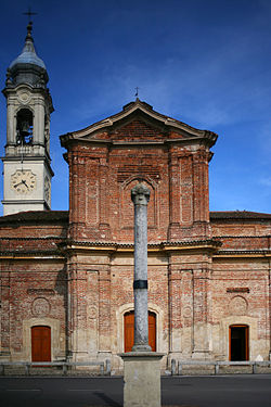
Bereguardo
Bereguardo | |
|---|---|
| Comune di Bereguardo | |
 | |
 Coat of arms | |
show Location of Bereguardo | |
 Bereguardo Location of Bereguardo in Italy | |
| Coordinates: 45°15′N 9°2′E / 45.250°N 9.033°ECoordinates: 45°15′N 9°2′E / 45.250°N 9.033°E | |
| Country | Italy |
| Region | Lombardy |
| Province | Pavia (PV) |
| Frazioni | Casottole, Frutteto, Vigna del Pero, Villette, Zelata |
| Government | |
| • Mayor | Robetro Battagin |
| Area | |
| • Total | 17.7 km2 (6.8 sq mi) |
| Elevation | 98 m (322 ft) |
| Population (31 July 2010)[3] | |
| • Total | 2,816 |
| • Density | 160/km2 (410/sq mi) |
| Demonym(s) | Bereguardini |
| Time zone | UTC+1 (CET) |
| • Summer (DST) | UTC+2 (CEST) |
| Postal code | 27021 |
| Dialing code | 0382 |
| Website | Official website |


Bereguardo (Lombard: Balguàrt) is a comune (municipality) in the Province of Pavia in the Italian region Lombardy, located about 25 kilometres (16 mi) southwest of Milan and about 12 kilometres (7 mi) northwest of Pavia.
Bereguardo borders the following municipalities: Borgo San Siro, Motta Visconti, Torre d'Isola, Trivolzio, Trovo, Vigevano, Zerbolò.
The remnants of the moated 14th-century Castello di Bereguardo are now used for municipal offices.
References[]
- ^ "Superficie di Comuni Province e Regioni italiane al 9 ottobre 2011". Istat. Retrieved 16 March 2019.
- ^ "Popolazione Residente al 1° Gennaio 2018". Istat. Retrieved 16 March 2019.
- ^ All demographics and other statistics: Italian statistical institute Istat.
| Authority control |
|
|---|
This article on a location in the Province of Pavia is a stub. You can help Wikipedia by . |
Categories:
- Cities and towns in Lombardy
- Municipalities of the Province of Pavia
- Province of Pavia geography stubs