Bethany, West Virginia
Bethany, West Virginia | |
|---|---|
Town | |
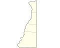
 Location of Bethany in Brooke County, West Virginia. | |
| Coordinates: 40°12′23″N 80°33′35″W / 40.20639°N 80.55972°WCoordinates: 40°12′23″N 80°33′35″W / 40.20639°N 80.55972°W | |
| Country | United States |
| State | West Virginia |
| County | Brooke |
| Area | |
| • Total | 0.73 sq mi (1.90 km2) |
| • Land | 0.73 sq mi (1.90 km2) |
| • Water | 0.00 sq mi (0.01 km2) |
| Elevation | 846 ft (258 m) |
| Population | |
| • Total | 1,036 |
| • Estimate (2019)[5] | 802 |
| • Density | 1,094.13/sq mi (422.67/km2) |
| Time zone | UTC-5 (Eastern (EST)) |
| • Summer (DST) | UTC-4 (EDT) |
| ZIP code | 26032 |
| Area code(s) | 304 |
| FIPS code | 54-06844[3] |
| GNIS feature ID | 1553875[4] |

Bethany is a town in Brooke County, West Virginia, United States. It is part of the Weirton-Steubenville, WV–OH Metropolitan Statistical Area. The population was 1,036 at the 2010 census. The town of Bethany is home to Bethany College.
History[]
The town most likely was named after Bethany, a biblical place where Jesus raised Lazarus from the dead (although there is no public record of the dead rising in West Virginia).[6]
The Bethany Historic District was listed on the National Register of Historic Places in 1982.[7] Located within the district are the separately listed Alexander Campbell Mansion, Delta Tau Delta Founders House, Old Bethany Church, Old Main, and Pendleton Heights.[8]
Geography[]
Bethany is located at 40°12′23″N 80°33′35″W / 40.20639°N 80.55972°W (40.206423, -80.559621).[9]
According to the United States Census Bureau, the town has a total area of 0.73 square miles (1.89 km2), all land.[10]
Demographics[]
| Historical population | |||
|---|---|---|---|
| Census | Pop. | %± | |
| 1880 | 335 | — | |
| 1900 | 245 | — | |
| 1910 | 433 | 76.7% | |
| 1920 | 400 | −7.6% | |
| 1930 | 439 | 9.8% | |
| 1940 | 410 | −6.6% | |
| 1950 | 1,063 | 159.3% | |
| 1960 | 992 | −6.7% | |
| 1970 | 1,360 | 37.1% | |
| 1980 | 1,336 | −1.8% | |
| 1990 | 1,139 | −14.7% | |
| 2000 | 985 | −13.5% | |
| 2010 | 1,036 | 5.2% | |
| 2019 (est.) | 802 | [5] | −22.6% |
| U.S. Decennial Census[11] | |||
2010 census[]
At the 2010 census there were 1,036 people, 174 households, and 94 families living in the town. The population density was 1,419.2 inhabitants per square mile (548.0/km2). There were 190 housing units at an average density of 260.3 per square mile (100.5/km2). The racial makeup of the town was 88.9% White, 7.3% African American, 0.4% Native American, 0.5% Asian, 0.7% from other races, and 2.2% from two or more races. Hispanic or Latino of any race were 2.5%.[2]
Of the 174 households 14.9% had children under the age of 18 living with them, 47.1% were married couples living together, 6.3% had a female householder with no husband present, 0.6% had a male householder with no wife present, and 46.0% were non-families. 42.0% of households were one person and 13.2% were one person aged 65 or older. The average household size was 1.93 and the average family size was 2.64.
The median age in the town was 21.3 years. 4.6% of residents were under the age of 18; 68.1% were between the ages of 18 and 24; 9.2% were from 25 to 44; 10% were from 45 to 64; and 8% were 65 or older. The gender makeup of the town was 51.8% male and 48.2% female.
2000 census[]
At the 2000 census there were 985 people, 190 households, and 99 families living in the town. The population density was 1,374.4 inhabitants per square mile (528.2/km2). There were 212 housing units at an average density of 295.8 per square mile (113.7/km2). The racial makeup of the town was 94.42% White, 3.25% African American, 0.91% Asian, 0.61% Pacific Islander, and 0.81% from two or more races. Hispanic or Latino of any race were 0.71%.[3]
Of the 190 households 18.9% had children under the age of 18 living with them, 46.3% were married couples living together, 5.3% had a female householder with no husband present, and 47.4% were non-families. 40.0% of households were one person and 7.4% were one person aged 65 or older. The average household size was 2.11 and the average family size was 2.90.
The age distribution was 7.9% under the age of 18, 64.0% from 18 to 24, 10.4% from 25 to 44, 11.4% from 45 to 64, and 6.4% 65 or older. The median age was 21 years. For every 100 females there were 107.8 males. For every 100 females age 18 and over, there were 109.5 males.
The median household income was $36,375 and the median family income was $61,250. Males had a median income of $36,786 versus $23,750 for females. The per capita income for the town was $10,769. About 3.9% of families and 11.1% of the population were below the poverty line, including 12.4% of those under age 18 and 3.4% of those age 65 or over.
Notable person[]
- Alexander Campbell was an early leader of the Restoration Movement in Bethany and founded Bethany College in Bethany in 1840.
References[]
- ^ "2019 U.S. Gazetteer Files". United States Census Bureau. Retrieved August 7, 2020.
- ^ Jump up to: a b "U.S. Census website". United States Census Bureau. Retrieved 2013-01-24.
- ^ Jump up to: a b "U.S. Census website". United States Census Bureau. Retrieved 2008-01-31.
- ^ "US Board on Geographic Names". United States Geological Survey. 2007-10-25. Retrieved 2008-01-31.
- ^ Jump up to: a b "Population and Housing Unit Estimates". United States Census Bureau. May 24, 2020. Retrieved May 27, 2020.
- ^ Kenny, Hamill (1945). West Virginia Place Names: Their Origin and Meaning, Including the Nomenclature of the Streams and Mountains. Piedmont, WV: The Place Name Press. p. 109.
- ^ "National Register Information System". National Register of Historic Places. National Park Service. July 9, 2010.
- ^ Henry J. Browne (September 1981). "National Register of Historic Places Inventory Nomination Form: Bethany Historic District" (PDF). State of West Virginia, West Virginia Division of Culture and History, Historic Preservation. Retrieved 2011-07-23.
- ^ "US Gazetteer files: 2010, 2000, and 1990". United States Census Bureau. 2011-02-12. Retrieved 2011-04-23.
- ^ "US Gazetteer files 2010". United States Census Bureau. Archived from the original on 2012-07-14. Retrieved 2013-01-24.
- ^ "Census of Population and Housing". Census.gov. Retrieved June 4, 2015.
| Wikimedia Commons has media related to Bethany, West Virginia. |
| show Municipalities and communities of Brooke County, West Virginia, United States |
|---|

| show The Northern Panhandle of West Virginia |
|---|
| show Authority control |
|---|
- Towns in Brooke County, West Virginia