Bethune, Saskatchewan
Bethune | |
|---|---|
Village | |
| Village of Bethune | |
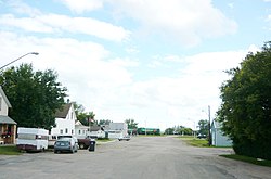 Main Street Bethune | |
 Bethune Location of Bethune in Saskatchewan | |
| Coordinates: 50°43′N 105°13′W / 50.717°N 105.217°WCoordinates: 50°43′N 105°13′W / 50.717°N 105.217°W | |
| Country | Canada |
| Province | Saskatchewan |
| Region | Southwest |
| Census division | 6 |
| Rural Municipality | Dufferin No. 190 |
| Post office Founded | 1905-06-05 |
| Incorporated (Village) | 1912 |
| Government | |
| • Type | Municipal |
| • Governing body | Bethune Village Council |
| • Mayor | Derek Shaw[1] |
| • Administrator | Rodney Audette |
| Area | |
| • Total | 1.04 km2 (0.40 sq mi) |
| Population (2016)[2] | |
| • Total | 399 |
| • Density | 383.1/km2 (992/sq mi) |
| Time zone | UTC-6 (Central) |
| Postal code | S0G 0H0 |
| Area code(s) | 306 |
| Highways | Hwy 642 |
| Website | www |
| [3][4] | |

Bethune /ˈbɛθ.juːn/[5] (2016 population: 399) is a village in the Canadian province of Saskatchewan within the Rural Municipality of Dufferin No. 190 and Census Division No. 6. The village is 56 km north-west of Regina on Highway 11 (Louis Riel Trail).[6] Arm River flows along a river valley north of Bethune, which features camping sites, and the Qu'Appelle River is a short way south. Last Mountain Lake or Long Lake is north-east of Bethune whereas Buffalo Pound Lake is just south-west.
The post office of Bethune, Assiniboia, NWT was established 5 June 1905, three months before Saskatchewan became a province. The village takes its name from C.B. Bethune, the engineer on the first train to travel the railway in 1887.[7]
History[]
Bethune incorporated as a village on August 2, 1912.[8]
Demographics[]
In the 2016 Census of Population conducted by Statistics Canada, the Village of Bethune recorded a population of 399 living in 158 of its 181 total private dwellings, a -1.5% change from its 2011 population of 405. With a land area of 2.38 km2 (0.92 sq mi), it had a population density of 167.6/km2 (434.2/sq mi) in 2016.[11]
In the 2011 Census of Population, the Village of Bethune recorded a population of 400, a 8.4% change from its 2006 population of 369. With a land area of 1.04 km2 (0.40 sq mi), it had a population density of 384.6/km2 (996.1/sq mi) in 2011.[12]
Attractions[]
Buffalo Pound Provincial Park is located within 19 km or 12 mi. Grandview Beach is also located 19 km or 12 mi from Bethune. Kedleston Beach is closer: 15 km or 9 mi from Bethune. Another conservation area named Regina Beach Recreation Site is located 19 km or 12 mi from Bethune. Bethune also has a skating rink, curling rink, park, school, and baseball diamonds located on the outskirts of town at McLean Park. It has a playground splash pad and four baseball diamonds. Bethune is home to the Bethune Bulldogs of the senior men's Highway Hockey League.[13]
The Gillis Blakley Bethune and District Heritage Museum is a Municipal Heritage Property on the Canadian Register of Historic Places.[14]

See also[]
- List of villages in Saskatchewan
- List of communities in Saskatchewan
- List of rural municipalities in Saskatchewan
References[]
- ^ Administration & Governance
- ^ "2011 Community Profiles". Statistics Canada. Government of Canada. Retrieved 2014-08-21.
- ^ National Archives, Archivia Net. "Post Offices and Postmasters". Archived from the original on 2006-10-06. Retrieved 2014-08-21.
- ^ Government of Saskatchewan, MRD Home. "Municipal Directory System". Archived from the original on 2016-01-15. Retrieved 2014-08-21.
- ^ The Canadian Press (2017), The Canadian Press Stylebook (18th ed.), Toronto: The Canadian Press
- ^ http://www.villageofbethune.com/
- ^ Village of Bethune
- ^ "Urban Municipality Incorporations". Saskatchewan Ministry of Government Relations. Archived from the original on October 15, 2014. Retrieved June 1, 2020.
- ^ "Saskatchewan Census Population" (PDF). Saskatchewan Bureau of Statistics. Archived from the original (PDF) on September 24, 2015. Retrieved May 31, 2020.
- ^ "Saskatchewan Census Population". Saskatchewan Bureau of Statistics. Retrieved May 31, 2020.
- ^ "Population and dwelling counts, for Canada, provinces and territories, and census subdivisions (municipalities), 2016 and 2011 censuses – 100% data (Saskatchewan)". Statistics Canada. February 8, 2017. Retrieved May 30, 2020.
- ^ "Population and dwelling counts, for Canada, provinces and territories, and census subdivisions (municipalities), 2011 and 2006 censuses (Saskatchewan)". Statistics Canada. June 3, 2019. Retrieved May 30, 2020.
- ^ http://www.highwayhockey.ca/
- ^ "Archived copy". Archived from the original on 2012-02-24. Retrieved 2009-01-06.CS1 maint: archived copy as title (link) Canadian Register of Historic Places.
Further reading[]
- Wagon trails to blacktop: A history of Bethune. Published: Bethune, Sask. Bethune & District Historical Society. 1983. ISBN 0-919845-12-6.[1]
External links[]
 Definitions from Wiktionary
 Media from Wikimedia Commons
 News from Wikinews
 Quotations from Wikiquote
 Texts from Wikisource
 Textbooks from Wikibooks
 Travel guides from Wikivoyage
 Resources from Wikiversity
| show Places adjacent to Bethune, Saskatchewan |
|---|
| show |
|---|
| show Division No. 6, Saskatchewan |
|---|

This article about a location in the Census Division No. 6 of Saskatchewan is a stub. You can help Wikipedia by . |
- ^ WebPAC PRO © Innovative Interfaces, Inc., University of Saskatchewan Online Library Database, retrieved August 6, 2007
- Villages in Saskatchewan
- Dufferin No. 190, Saskatchewan
- Division No. 6, Saskatchewan
- Saskatchewan Division No. 6 geography stubs