Rural Municipality of Lipton No. 217
Lipton No. 217 | |
|---|---|
| Rural Municipality of Lipton No. 217 | |
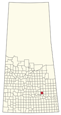 Location of the RM of Lipton No. 217 in Saskatchewan | |
| Coordinates: 50°57′07″N 103°53′24″W / 50.952°N 103.890°WCoordinates: 50°57′07″N 103°53′24″W / 50.952°N 103.890°W[1] | |
| Country | Canada |
| Province | Saskatchewan |
| Census division | 6 |
| SARM division | 1 |
| Formed[2] | December 11, 1911 |
| Government | |
| • Reeve | Corey Senft |
| • Governing body | RM of Lipton No. 217 Council |
| • Administrator | Frank Kosa |
| • Office location | Lipton |
| Area (2016)[4] | |
| • Land | 813.69 km2 (314.17 sq mi) |
| Population (2016)[4] | |
| • Total | 381 |
| • Density | 0.5/km2 (1/sq mi) |
| Time zone | CST |
| • Summer (DST) | CST |
| Area code(s) | 306 and 639 |
The Rural Municipality of Lipton No. 217 (2016 population: 381) is a rural municipality (RM) in the Canadian province of Saskatchewan within Census Division No. 6 and SARM Division No. 1.
History[]
The RM of Lipton No. 217 incorporated as a rural municipality on December 11, 1911.[2]
- Heritage properties
There are three historical sites located within the RM.
- Hayward School – Constructed in 1904–1952, the site contains a one-room school house and barns.[5]
- Lipton Jewish Cemetery – Established in 1902, the cemetery is the resting place for early Jewish immigrants.[6]
- Tomecko House – Constructed in 1917–18, by Mr. Stephen Tomecko, the house served as a gathering place for dances after harvest.[7]
Geography[]
Communities and localities[]
The following urban municipalities are surrounded by the RM.
- Villages
It also surrounds the Village of Dysart.
Demographics[]
In the 2016 Census of Population conducted by Statistics Canada, the RM of Lipton No. 217 recorded a population of 381 living in 158 of its 189 total private dwellings, a -10.1% change from its 2011 population of 424. With a land area of 813.69 km2 (314.17 sq mi), it had a population density of 0.5/km2 (1.2/sq mi) in 2016.[4]
In the 2011 Census of Population, the RM of Lipton No. 217 recorded a population of 424, a -0.7% change from its 2006 population of 427. With a land area of 813.69 km2 (314.17 sq mi), it had a population density of 0.5/km2 (1.3/sq mi) in 2011.[10]
Government[]
The RM of Lipton No. 217 is governed by an elected municipal council and an appointed administrator that meets on the first Tuesday of every month.[3] The reeve of the RM is Corey Senft while its administrator is Frank Kosa.[3] The RM's office is located in Lipton.[3]
References[]
- ^ "Pre-packaged CSV files - CGN, Canada/Province/Territory (cgn_sk_csv_eng.zip)". Government of Canada. July 24, 2019. Retrieved May 23, 2020.
- ^ a b "Rural Municipality Incorporations (Alphabetical)". Saskatchewan Ministry of Municipal Affairs. Archived from the original on April 21, 2011. Retrieved May 9, 2020.
- ^ a b c d "Municipality Details: RM of Lipton No. 217". Government of Saskatchewan. Retrieved May 21, 2020.
- ^ a b c "Population and dwelling counts, for Canada, provinces and territories, and census subdivisions (municipalities), 2016 and 2011 censuses – 100% data (Saskatchewan)". Statistics Canada. February 8, 2017. Retrieved May 1, 2020.
- ^ Hayward School
- ^ Jewish Cemetery
- ^ Tomecko House
- ^ "Saskatchewan Census Population" (PDF). Saskatchewan Bureau of Statistics. Archived from the original (PDF) on September 24, 2015. Retrieved May 9, 2020.
- ^ "Saskatchewan Census Population". Saskatchewan Bureau of Statistics. Retrieved May 9, 2020.
- ^ "Population and dwelling counts, for Canada, provinces and territories, and census subdivisions (municipalities), 2011 and 2006 censuses (Saskatchewan)". Statistics Canada. June 3, 2019. Retrieved May 1, 2020.
| Subdivisions | |
|---|---|
| Communities |
|
| Cities |
|
| Rural municipalities |
|
| Topics |
|
| |

- Rural municipalities in Saskatchewan
- Lipton No. 217, Saskatchewan
- Division No. 6, Saskatchewan