Rural Municipality of Hudson Bay No. 394
Hudson Bay No. 394 | |
|---|---|
| Rural Municipality of Hudson Bay No. 394 | |
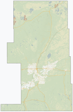
 Location of the RM of Hudson Bay No. 394 in Saskatchewan | |
| Coordinates: 53°08′13″N 102°12′22″W / 53.137°N 102.206°WCoordinates: 53°08′13″N 102°12′22″W / 53.137°N 102.206°W[1] | |
| Country | Canada |
| Province | Saskatchewan |
| Census division | 14 |
| SARM division | 4 |
| Federal riding | Desnethé—Missinippi—Churchill River Yorkton—Melville |
| Provincial riding | Carrot River Valley |
| Formed[2] | May 1, 1977 |
| Government | |
| • Reeve | Neal Hardy |
| • Governing body | RM of Hudson Bay No. 394 Council |
| • Administrator | Tracy Smith |
| • Office location | Hudson Bay |
| Area (2016)[4] | |
| • Land | 12,462.61 km2 (4,811.84 sq mi) |
| Population (2016)[4] | |
| • Total | 1,114 |
| • Density | 0.1/km2 (0.3/sq mi) |
| Time zone | CST |
| • Summer (DST) | CST |
| Postal code | S0E 0Y0 |
| Area code(s) | 306 and 639 |

The Rural Municipality of Hudson Bay No. 394 (2016 population: 1,114) is a rural municipality (RM) in the Canadian province of Saskatchewan within Census Division No. 14 and SARM Division No. 4. At 12,462 square kilometres in area, it is the largest rural municipality in Saskatchewan. It is located in the northeast-central portion of the province.
History[]
The RM of Hudson Bay No. 394 incorporated as a rural municipality on May 1, 1977.[2]
Geography[]
Communities and localities[]
The following urban municipalities are surrounded by the RM.
- Towns
- Hudson Bay
The following unincorporated communities are within the RM.
- Organized hamlets[5]
- Localities
- Bertwell
- Reserve
The RM also surrounds several First Nations communities.
Demographics[]
In the 2016 Census of Population conducted by Statistics Canada, the RM of Hudson Bay No. 394 recorded a population of 1,114 living in 485 of its 852 total private dwellings, a -0.7% change from its 2011 population of 1,122. With a land area of 12,462.61 km2 (4,811.84 sq mi), it had a population density of 0.1/km2 (0.2/sq mi) in 2016.[4] It is the least densely populated rural municipality in Saskatchewan.
In the 2011 Census of Population, the RM of Hudson Bay No. 394 recorded a population of 1,122, a -17.4% change from its 2006 population of 1,359. With a land area of 12,462.61 km2 (4,811.84 sq mi), it had a population density of 0.1/km2 (0.2/sq mi) in 2011.[8]
Government[]
The RM of Hudson Bay No. 394 is governed by an elected municipal council and an appointed administrator that meets on the second Tuesday of every month.[3] The reeve of the RM is Neal Hardy while its administrator is Tracy Smith.[3] The RM's office is located in Hudson Bay.[3]
Transportation[]
- Rail[9]
- Hudson Bay Branch C.N.R. - serves Hudson Bay Junction, Wachee, Ceba, Chemong)
- Swan River - Prince Albert Branch C.N.R. - serves Baden, Powell, Barrows Junction, Westgate, Roscoe, Erwood, Hudson Bay Junction, Greenbush, Prairie River, Bannock, Mistatim, Peesane, Crooked River, Eldersley, Tisdale, Valparaiso
- Roads[10]
- Highway 3—serves Hudson Bay and Erwood
- Highway 9—serves Hudson Bay
- Highway 55—Comes near Shoal Lake First Nation and Red Earth First Nation
- Highway 980—serves Woody River Recreation Site
- Highway 981—serves Erwood
- Highway 982 (Little Swan Road)—connects Hudson Bay and Swan Plain, Saskatchewan
- Highway 983 (McBride Lake Road)—serves Reserve
See also[]
References[]
- ^ "Pre-packaged CSV files - CGN, Canada/Province/Territory (cgn_sk_csv_eng.zip)". Government of Canada. July 24, 2019. Retrieved May 23, 2020.
- ^ a b "Rural Municipality Incorporations (Alphabetical)". Saskatchewan Ministry of Municipal Affairs. Archived from the original on April 21, 2011. Retrieved May 9, 2020.
- ^ a b c d "Municipality Details: RM of Hudson Bay No. 394". Government of Saskatchewan. Retrieved May 21, 2020.
- ^ a b c "Population and dwelling counts, for Canada, provinces and territories, and census subdivisions (municipalities), 2016 and 2011 censuses – 100% data (Saskatchewan)". Statistics Canada. February 8, 2017. Retrieved May 1, 2020.
- ^ "2019-2020 Rural Revenue Sharing Organized Hamlet Grant". Government of Saskatchewan. Retrieved May 4, 2020.
- ^ "Saskatchewan Census Population" (PDF). Saskatchewan Bureau of Statistics. Archived from the original (PDF) on September 24, 2015. Retrieved May 9, 2020.
- ^ "Saskatchewan Census Population". Saskatchewan Bureau of Statistics. Retrieved May 9, 2020.
- ^ "Population and dwelling counts, for Canada, provinces and territories, and census subdivisions (municipalities), 2011 and 2006 censuses (Saskatchewan)". Statistics Canada. June 3, 2019. Retrieved May 1, 2020.
- ^ Canadian Maps: January 1925 Waghorn's Guide. Post Offices in Man. Sask. Alta. and West Ontario.
- ^ Eversoft Streets and Trips
Places adjacent to Rural Municipality of Hudson Bay No. 394 | ||||||||||||||||
|---|---|---|---|---|---|---|---|---|---|---|---|---|---|---|---|---|
| ||||||||||||||||
Subdivisions of Saskatchewan | |
|---|---|
| Subdivisions | |
| Communities |
|
| Cities |
|
| Rural municipalities |
|
| Topics |
|
| |
Division No. 14, Saskatchewan | ||
|---|---|---|
| Cities |
|  |
| Towns |
| |
| Villages |
| |
| Resort villages | ||
| Rural municipalities |
| |
| First Nations |
| |
| Indian reserves |
| |
| Unincorporated communities | ||
- Rural municipalities in Saskatchewan
- Hudson Bay No. 394, Saskatchewan