Rural Municipality of Kinistino No. 459
Kinistino No. 459 | |
|---|---|
| Rural Municipality of Kinistino No. 459 | |
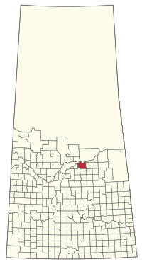 Location of the RM of Kinistino No. 459 in Saskatchewan | |
| Coordinates: 53°05′56″N 104°55′01″W / 53.099°N 104.917°WCoordinates: 53°05′56″N 104°55′01″W / 53.099°N 104.917°W[1] | |
| Country | Canada |
| Province | Saskatchewan |
| Census division | 15 |
| SARM division | 5 |
| Formed[2] | December 11, 1911 |
| Government | |
| • Reeve | Vance Shmyr |
| • Governing body | RM of Kinistino No. 459 Council |
| • Administrator | Jacquelynne Mann |
| • Office location | Kinistino |
| Area (2016)[4] | |
| • Land | 948.46 km2 (366.20 sq mi) |
| Population (2016)[4] | |
| • Total | 554 |
| • Density | 0.6/km2 (2/sq mi) |
| Time zone | CST |
| • Summer (DST) | CST |
| Area code(s) | 306 and 639 |

The Rural Municipality of Kinistino No. 459 (2016 population: 554) is a rural municipality (RM) in the Canadian province of Saskatchewan within Census Division No. 15 and SARM Division No. 5.
History[]
The RM of Kinistino No. 459 incorporated as a rural municipality on December 11, 1911.[2]
Geography[]
Communities and localities[]
The following urban municipalities are surrounded by the RM.
- Towns
- Kinistino
- Villages
- Weldon
- Localities
A reserves of the James Smith First Nation is also surrounded by the RM.
Demographics[]
In the 2016 Census of Population conducted by Statistics Canada, the RM of Kinistino No. 459 recorded a population of 554 living in 205 of its 231 total private dwellings, a -9.6% change from its 2011 population of 613. With a land area of 948.46 km2 (366.20 sq mi), it had a population density of 0.6/km2 (1.5/sq mi) in 2016.[4]
In the 2011 Census of Population, the RM of Kinistino No. 459 recorded a population of 613, a -14% change from its 2006 population of 713. With a land area of 949.04 km2 (366.43 sq mi), it had a population density of 0.6/km2 (1.7/sq mi) in 2011.[7]
Attractions[]
- Fort a la Corne Provincial Forest
- Fort de la Corne
Government[]
The RM of Kinistino No. 459 is governed by an elected municipal council and an appointed administrator that meets on the second Thursday of every month.[3] The reeve of the RM is Vance Shmyr while its administrator is Jacquelynne Mann.[3] The RM's office is located in Kinistino.[3]
Transportation[]
- Saskatchewan Highway 3
- Saskatchewan Highway 682
- Saskatchewan Highway 778
- Saskatchewan Highway 789
- Canadian National Railway
- Weldon Ferry
See also[]
References[]
- ^ "Pre-packaged CSV files - CGN, Canada/Province/Territory (cgn_sk_csv_eng.zip)". Government of Canada. July 24, 2019. Retrieved May 23, 2020.
- ^ a b "Rural Municipality Incorporations (Alphabetical)". Saskatchewan Ministry of Municipal Affairs. Archived from the original on April 21, 2011. Retrieved May 9, 2020.
- ^ a b c d "Municipality Details: RM of Kinistino No. 459". Government of Saskatchewan. Retrieved May 21, 2020.
- ^ a b c "Population and dwelling counts, for Canada, provinces and territories, and census subdivisions (municipalities), 2016 and 2011 censuses – 100% data (Saskatchewan)". Statistics Canada. February 8, 2017. Retrieved May 1, 2020.
- ^ "Saskatchewan Census Population" (PDF). Saskatchewan Bureau of Statistics. Archived from the original (PDF) on September 24, 2015. Retrieved May 9, 2020.
- ^ "Saskatchewan Census Population". Saskatchewan Bureau of Statistics. Retrieved May 9, 2020.
- ^ "Population and dwelling counts, for Canada, provinces and territories, and census subdivisions (municipalities), 2011 and 2006 censuses (Saskatchewan)". Statistics Canada. June 3, 2019. Retrieved May 1, 2020.
| Subdivisions | |
|---|---|
| Communities |
|
| Cities |
|
| Rural municipalities |
|
| Topics |
|
| |
Division No. 15, Saskatchewan | |||
|---|---|---|---|
| Cities |
|  | |
| Towns | |||
| Villages |
| ||
| Resort villages | |||
| Rural municipalities |
| ||
| First Nations |
| ||
| Indian reserves | |||
| Unincorporated communities |
| ||
- Rural municipalities in Saskatchewan
- Kinistino No. 459, Saskatchewan
- Division No. 15, Saskatchewan