Rural Municipality of Corman Park No. 344
Corman Park No. 344 | |
|---|---|
| Rural Municipality of Corman Park No. 344 | |
 RM office and police station | |
|
Logo | |
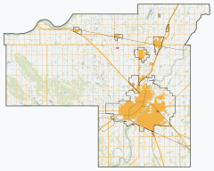
 Location of the RM of Corman Park No. 344 in Saskatchewan | |
| Coordinates: 52°14′28″N 106°40′08″W / 52.241°N 106.669°WCoordinates: 52°14′28″N 106°40′08″W / 52.241°N 106.669°W[1] | |
| Country | Canada |
| Province | Saskatchewan |
| Census division | 11 |
| SARM division | 5 |
| Federal riding | Carlton Trail—Eagle Creek Saskatoon—Grasswood |
| Provincial riding | Biggar-Sask Valley Martensville-Warman Rosetown-Elrose Saskatoon Stonebridge-Dakota |
| Formed[2] | January 1, 1970 |
| Amalgamated[3] | December 31, 1969 (RMs of Cory No. 344, Warman No. 374 and Park No. 375) |
| Government | |
| • Reeve | Judy Harwood |
| • Governing body | RM of Corman Park No. 344 Council |
| • Chief Administrative Officer | Ken Kolb |
| • Office location | Saskatoon |
| Area (2016)[5] | |
| • Land | 1,911.35 km2 (737.98 sq mi) |
| Population (2016)[5] | |
| • Total | 8,568 |
| • Density | 4.5/km2 (12/sq mi) |
| Time zone | CST |
| • Summer (DST) | CST |
| Postal code | S7K 5W1 |
| Area code(s) | 306 and 639 |
| Website | Official website |

The Rural Municipality of Corman Park No. 344 (2016 population: 8,568) is a rural municipality (RM) in the Canadian province of Saskatchewan within Census Division No. 11 and SARM Division No. 5. Located in the central portion of the province, the RM surrounds the City of Saskatoon.
History[]
The RM of Corman Park No. 344 was formed by the amalgamation of three rural municipalities – the RMs of Cory No. 344, Warman No. 374 and Park No. 375.[3] The three RMs were disorganized on December 31, 1969[6] to enable the incorporation of the RM of Corman Park No. 344 on January 1, 1970.[2]
- Heritage properties
Two designated historical properties are located in the RM.
- Opimihaw (now referred to as Wanuskewin Heritage Park) is a 58 hectare property with 14 precontact archaeological sites in the Opimihaw Creek valley.[7]
- Bone Trail in the 1800s buffalo bones were collected on the prairie, and transported along this trail to Saskatoon for transfer onto rail cars so that they could be sent to eastern Canada where they were crushed into fertilizer.[8]
Geography[]
The South Saskatchewan River flows from the southwest corner to the northeast corner of the RM while the North Saskatchewan River forms the RM's northwest boundary.[9] The RM works closely with the Meewasin Valley Authority to protect the South Saskatchewan River valley.[3]
Communities and localities[]
The following urban municipalities are surrounded by the RM.
- Martensville
- Saskatoon
- Warman
- Towns
- Dalmeny
- Langham
- Osler
The following unincorporated communities are within the RM.
- Organized hamlets[10]
- Beaver Creek
- Casa Rio
- Cathedral Bluffs
- Cedar Villa Estates
- Discovery Ridge
- Eagle Ridge Country Estates
- Furdale
- Merrill Hills
- Neuhorst
- River's Edge
- Riverside Estates
- Localities
- Blumenheim
- Floral
- Grasswood
Demographics[]
In the 2016 Census of Population conducted by Statistics Canada, the RM of Corman Park No. 344 recorded a population of 8,568 living in 2,952 of its 3,037 total private dwellings, a 3.5% change from its 2011 population of 8,277. With a land area of 1,911.35 km2 (737.98 sq mi), it had a population density of 4.5/km2 (11.6/sq mi) in 2016.[5]
In the 2011 Census of Population, the RM of Corman Park No. 344 recorded a population of 8,354, a 1.1% change from its 2006 population of 8,266. With a land area of 1,934.2 km2 (746.8 sq mi), it had a population density of 4.3/km2 (11.2/sq mi) in 2011.[13]
The RM's German Canadian population is much higher proportionately than the national or provincial averages: 43.4% (3,645 persons).[14]
Attractions[]
The RM of Corman Park No. 344 is home to a Super Dual Auroral Radar Network radar site operated by the University of Saskatchewan.
Government[]
The RM of Corman Park No. 344 is governed by an elected municipal council and an appointed administrator that meets on the second and third Monday of every month.[4] The reeve of the RM is Judy Harwood while its Chief Administrative Officer is Ken Kolb.[4] The RM's office is located in Saskatoon.[4] As of October 2018 the reeve is Judy Harwood, and the eight councillors are:[4]
- Division 1: John Germs
- Division 2: Michelle Chuhaniuk
- Division 3: Lyndon Haduik
- Division 4: David Greenwood
- Division 5: Arthur Pruim
- Division 6: Bas Froese-Kooijenga;
- Division 7: Calvin Vaandrager
- Division 8: Wendy Trask
A majority of voters in a November 2011 plebiscite favoured the council be changed from 11 to 8 councillors, a move that was controversial. The elected councillors of the day requested that the provincial government not take action on the plebiscite.[15] However, the request was ignored and the municipal boundaries were redrawn with 8 divisions.[16] A new council was elected on February 29, 2012 with four incumbents and four new councillors.[17]
Emergency response[]
The RM of Corman Park No. 344 contracts with the City of Saskatoon and the other municipalities for the provision of fire protection.
The RM operates a police service of 10 officers who work in partnership with the Royal Canadian Mounted Police (RCMP). Corman Park Police Service actively partners with all other law enforcement agencies in the Saskatoon and district police universe including the Saskatoon Police Service and Dalmeny Police Service.
The acts in partnership with the RCMP under the terms of Order in Council (OIC) 109/2001 as amended by OIC 92/2006. The service operates out of the municipal office in Saskatoon.[18]
Transportation[]
- Rail[19]
- Colonsay Branch C.P.R—serves Saskatoon, Colonsay, Forslund, Zangwill, Young and Plassey.
- Minnedosa–Saskatoon–Edmonton Section C.P.R—serves Colonsay, Elstow, Blucher, Cheviot, Floral, Sutherland, Saskatoon, Cory, Dunfermline, Asquith, Rhyl, Kinley, Perdue Keppel, Vance and Biggar.
- Carlton Branch, C.N.R—serves Saskatoon, Warman, Dalmeny
- Delisle Elrose Branch C.N.R—serves Saskatoon, Delisle, Birdview, Swanson and Ardath.
- Regina Branch, C.N.R—serves Kenaston, Strong, Hanley, Indi, Dundurn, Strehlow, Haultain, Grasswood, Nutana, Saskatoon, Clarks Crossing, Warmsn and Osler.
- Winnipeg, Edmonton, Prince Rupert Division, C.N.R—serves Winnipeg, Saskatoon, Edmonton and Jasper.
- Air
- Saskatoon/Banga International Air Aerodrome (id:
CJN5; aka "Corman Park Airport") formerly Saskatoon/Corman Air Park
See also[]
References[]
- ^ "Pre-packaged CSV files - CGN, Canada/Province/Territory (cgn_sk_csv_eng.zip)". Government of Canada. July 24, 2019. Retrieved May 23, 2020.
- ^ a b "Rural Municipality Incorporations (Alphabetical)". Saskatchewan Ministry of Municipal Affairs. Archived from the original on April 21, 2011. Retrieved January 8, 2017.
- ^ a b c "Governance". Rural Municipality of Corman Park No. 344. Retrieved January 8, 2017.
- ^ a b c d e "Municipality Details: RM of Corman Park No. 344". Government of Saskatchewan. Retrieved May 21, 2020.
- ^ a b c "Population and dwelling counts, for Canada, provinces and territories, and census subdivisions (municipalities), 2016 and 2011 censuses – 100% data (Saskatchewan)". Statistics Canada. February 8, 2017. Retrieved May 1, 2020.
- ^ "Disorganized Rural Municipalities". Saskatchewan Ministry of Municipal Relations. Archived from the original on February 25, 2012. Retrieved January 8, 2017.
- ^ Opimihaw Provincial Heritage Property
- ^ Bone Trail Municipal Heritage Property
- ^ Rural Municipality of Corman Park No. 344 (Map). Rural Municipality of Corman Park No. 344. September 2019. Retrieved May 8, 2020.
- ^ "2019-2020 Rural Revenue Sharing Organized Hamlet Grant". Government of Saskatchewan. Retrieved May 4, 2020.
- ^ "Saskatchewan Census Population" (PDF). Saskatchewan Bureau of Statistics. Archived from the original (PDF) on September 24, 2015. Retrieved May 9, 2020.
- ^ "Saskatchewan Census Population". Saskatchewan Bureau of Statistics. Retrieved May 9, 2020.
- ^ "Population and dwelling counts, for Canada, provinces and territories, and census subdivisions (municipalities), 2011 and 2006 censuses (Saskatchewan)". Statistics Canada. June 3, 2019. Retrieved May 1, 2020.
- ^ Ethnocultural portrait of Canada, Corman Park No. 344, Saskatchewan
- ^ French, Janet (November 19, 2011). "Disregard referendum: Corman Park council asks Minister to ignore vote result". The StarPhoenix. Postmedia Network. Retrieved November 19, 2011.
- ^ Couture, Joe (December 12, 2011). "Saskatchewan government enacts Corman Park boundary, council changes". The StarPhoenix. Postmedia Network. Retrieved March 16, 2012.
- ^ "New 8-person Corman Park council voted in". CBC News. February 29, 2012. Retrieved March 16, 2012.
- ^ "Corman Park No. 344". SaskBiz.ca. Retrieved March 16, 2012.
- ^ Canadian Maps: January 1925 Waghorn's Guide. Post Offices in Man. Sask. Alta. and West Ontario.
External links[]
Subdivisions of Saskatchewan | |
|---|---|
| Subdivisions | |
| Communities |
|
| Cities |
|
| Rural municipalities |
|
| Topics |
|
| |
Division No. 11, Saskatchewan | |||||
|---|---|---|---|---|---|
| Cities |
|  | |||
| Towns | |||||
| Villages |
| ||||
| Resort villages | |||||
| Rural municipalities |
| ||||
| First Nations | |||||
| Indian reserves | |||||
| Unincorporated communities |
| ||||
- Rural municipalities in Saskatchewan
- Corman Park No. 344, Saskatchewan