Rural Municipality of Fertile Valley No. 285
Fertile Valley No. 285 | |
|---|---|
| Rural Municipality of Fertile Valley No. 285 | |
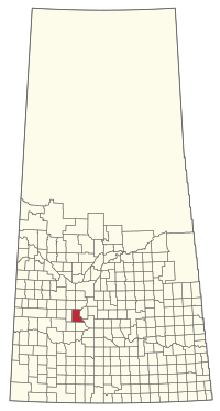 Location of the RM of Fertile Valley No. 285 in Saskatchewan | |
| Coordinates: 51°24′04″N 107°04′48″W / 51.401°N 107.080°WCoordinates: 51°24′04″N 107°04′48″W / 51.401°N 107.080°W[1] | |
| Country | Canada |
| Province | Saskatchewan |
| Census division | 12 |
| SARM division | 5 |
| Formed[2] | December 13, 1909 |
| Government | |
| • Reeve | Barry Friesen |
| • Governing body | RM of Fertile Valley No. 285 Council |
| • Administrator | L Jean Jones |
| • Office location | Conquest |
| Area (2016)[4] | |
| • Land | 1,016.37 km2 (392.42 sq mi) |
| Population (2016)[4] | |
| • Total | 539 |
| • Density | 0.5/km2 (1/sq mi) |
| Time zone | CST |
| • Summer (DST) | CST |
| Postal code | S0L 0L0 |
| Area code(s) | 306 and 639 |
| Highway(s) | Highway 15 Highway 44 Highway 45 |
| Waterway(s) | South Saskatchewan |


The Rural Municipality of Fertile Valley No. 285 (2016 population: 539) is a rural municipality (RM) in the Canadian province of Saskatchewan within Census Division No. 12 and SARM Division No. 5. It is located in the southwest portion of the province.
History[]
The RM of Fertile Valley No. 285 incorporated as a rural municipality on December 13, 1909.[2]
Geography[]
Communities and localities[]
The following urban municipalities are surrounded by the RM.
- Villages
- Conquest
- Macrorie
The following unincorporated communities are within the RM.
- Localities
- Anerley
- Ardath (dissolved as a village December 31, 1972)
- Betalock
- Bounty (dissolved as a village November 25, 1997)
- Bratton
- Surbiton
Demographics[]
In the 2016 Census of Population conducted by Statistics Canada, the RM of Fertile Valley No. 285 recorded a population of 539 living in 170 of its 182 total private dwellings, a 5.5% change from its 2011 population of 511. With a land area of 1,016.37 km2 (392.42 sq mi), it had a population density of 0.5/km2 (1.4/sq mi) in 2016.[4]
In the 2011 Census of Population, the RM of Fertile Valley No. 285 recorded a population of 511, a -16.1% change from its 2006 population of 609. With a land area of 1,016.37 km2 (392.42 sq mi), it had a population density of 0.5/km2 (1.3/sq mi) in 2011.[7]
Government[]
The RM of Fertile Valley No. 285 is governed by an elected municipal council and an appointed administrator that meets on the second Wednesday of every month.[3] The reeve of the RM is Barry Friesen while its administrator is L Jean Jones.[3] The RM's office is located in Conquest.[3]
Transportation[]
| Highway | Starting point | Community | Ending point |
|---|---|---|---|
| Highway 15 | Highway 4 | None | Highway 20 |
| Highway 44 | Highway 9 | Macrorie | Highway 11 |
| Highway 45 | Highway 7 | Macrorie | Highway 42 |
See also[]
References[]
- ^ "Pre-packaged CSV files - CGN, Canada/Province/Territory (cgn_sk_csv_eng.zip)". Government of Canada. July 24, 2019. Retrieved May 23, 2020.
- ^ a b "Rural Municipality Incorporations (Alphabetical)". Saskatchewan Ministry of Municipal Affairs. Archived from the original on April 21, 2011. Retrieved May 9, 2020.
- ^ a b c d "Municipality Details: RM of Fertile Valley No. 285". Government of Saskatchewan. Retrieved May 21, 2020.
- ^ a b c "Population and dwelling counts, for Canada, provinces and territories, and census subdivisions (municipalities), 2016 and 2011 censuses – 100% data (Saskatchewan)". Statistics Canada. February 8, 2017. Retrieved May 1, 2020.
- ^ "Saskatchewan Census Population" (PDF). Saskatchewan Bureau of Statistics. Archived from the original (PDF) on September 24, 2015. Retrieved May 9, 2020.
- ^ "Saskatchewan Census Population". Saskatchewan Bureau of Statistics. Retrieved May 9, 2020.
- ^ "Population and dwelling counts, for Canada, provinces and territories, and census subdivisions (municipalities), 2011 and 2006 censuses (Saskatchewan)". Statistics Canada. June 3, 2019. Retrieved May 1, 2020.
Subdivisions of Saskatchewan | |
|---|---|
| Subdivisions | |
| Communities |
|
| Cities |
|
| Rural municipalities |
|
| Topics |
|
| |
Division No. 12, Saskatchewan | |||||
|---|---|---|---|---|---|
| Towns |
|  | |||
| Villages | |||||
| Rural municipalities |
| ||||
| First Nations |
| ||||
| Indian reserves |
| ||||
| Unincorporated communities |
| ||||
- Rural municipalities in Saskatchewan
- Fertile Valley No. 285, Saskatchewan