Rural Municipality of Excel No. 71
Excel No. 71 | |
|---|---|
| Rural Municipality of Excel No. 71 | |
 Wheat stook sign at Viceroy | |
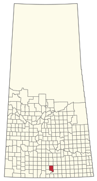 Location of the RM of Excel No. 71 in Saskatchewan | |
| Coordinates: 49°36′18″N 105°26′38″W / 49.605°N 105.444°WCoordinates: 49°36′18″N 105°26′38″W / 49.605°N 105.444°W[1] | |
| Country | Canada |
| Province | Saskatchewan |
| Census division | 3 |
| SARM division | 2 |
| Federal riding | Souris—Moose Mountain |
| Provincial riding | Wood River |
| Formed[2] | January 1, 1913 |
| Government | |
| • Reeve | Arnold Montgomery |
| • Governing body | RM of Excel No. 71 Council |
| • Administrator | Jan McDonald |
| • Office location | Viceroy |
| Area (2016)[4] | |
| • Land | 1,122.02 km2 (433.21 sq mi) |
| Population (2016)[4] | |
| • Total | 391 |
| • Density | 0.3/km2 (0.8/sq mi) |
| Time zone | CST |
| • Summer (DST) | CST |
| Postal code | S0H 4H0 |
| Area code(s) | 306 and 639 |

The Rural Municipality of Excel No. 71 (2016 population: 391) is a rural municipality (RM) in the Canadian province of Saskatchewan within Census Division No. 3 and SARM Division No. 2. It is located in the south-central portion of the province.
History[]
The RM of Excel No. 71 incorporated as a rural municipality on January 1, 1913.[2]
Geography[]
Communities and localities[]
The following unincorporated communities are within the RM.
- Organized hamlets[5]
- Localities
- Crane Valley
- Maxwellton
- Readlyn, dissolved as a village, December 31, 1955
- Verwood, dissolved as a village, December 31, 1954
- Viceroy, dissolved as a village, May 10, 2002
Demographics[]
In the 2016 Census of Population conducted by Statistics Canada, the RM of Excel No. 71 recorded a population of 391 living in 124 of its 177 total private dwellings, a -8.4% change from its 2011 population of 427. With a land area of 1,122.02 km2 (433.21 sq mi), it had a population density of 0.3/km2 (0.9/sq mi) in 2016.[4]
In the 2011 Census of Population, the RM of Excel No. 71 recorded a population of 427, a -8.4% change from its 2006 population of 466. With a land area of 1,122.02 km2 (433.21 sq mi), it had a population density of 0.4/km2 (1.0/sq mi) in 2011.[8]
Government[]
The RM of Excel No. 71 is governed by an elected municipal council and an appointed administrator that meets on the first Tuesday of every month.[3] The reeve of the RM is Arnold Montgomery while its administrator is Jan McDonald.[3] The RM's office is located in Viceroy.[3]
Transportation[]
The Red Coat & Rail Ltd. operates a short-line railway through the rural municipality. It is primarily used for the transport of agricultural products.[9]
References[]
- ^ "Pre-packaged CSV files - CGN, Canada/Province/Territory (cgn_sk_csv_eng.zip)". Government of Canada. July 24, 2019. Retrieved May 23, 2020.
- ^ a b "Rural Municipality Incorporations (Alphabetical)". Saskatchewan Ministry of Municipal Affairs. Archived from the original on April 21, 2011. Retrieved May 9, 2020.
- ^ a b c d "Municipality Details: RM of Excel No. 71". Government of Saskatchewan. Retrieved May 21, 2020.
- ^ a b c "Population and dwelling counts, for Canada, provinces and territories, and census subdivisions (municipalities), 2016 and 2011 censuses – 100% data (Saskatchewan)". Statistics Canada. February 8, 2017. Retrieved May 1, 2020.
- ^ "2019-2020 Rural Revenue Sharing Organized Hamlet Grant". Government of Saskatchewan. Retrieved May 4, 2020.
- ^ "Saskatchewan Census Population" (PDF). Saskatchewan Bureau of Statistics. Archived from the original (PDF) on September 24, 2015. Retrieved May 9, 2020.
- ^ "Saskatchewan Census Population". Saskatchewan Bureau of Statistics. Retrieved May 9, 2020.
- ^ "Population and dwelling counts, for Canada, provinces and territories, and census subdivisions (municipalities), 2011 and 2006 censuses (Saskatchewan)". Statistics Canada. June 3, 2019. Retrieved May 1, 2020.
- ^ Sask Biz
| Subdivisions | |
|---|---|
| Communities |
|
| Cities |
|
| Rural municipalities |
|
| Topics |
|
| |
Division No. 3, Saskatchewan | |||||||
|---|---|---|---|---|---|---|---|
| Towns |  | ||||||
| Villages |
| ||||||
| Rural municipalities |
| ||||||
| First Nations |
| ||||||
| Indian reserves | |||||||
| Unincorporated communities |
| ||||||
- Rural municipalities in Saskatchewan
- Excel No. 71, Saskatchewan
- Division No. 3, Saskatchewan