
Bhongir
Bhuvanagiri
భువనగిరి Bhongiri | |
|---|---|
        Clockwise from top: Bhuvanagiri Fort Main Entrance, Bhuvanagiri Fort on Diwali, Bhuvanagiri Bus Terminal & Railway station, Rock Climbing school, other pics belongs to Bhuvanagiri Fort, Hyderabad Metropolitan City Area Bhuvanagiri Town | |
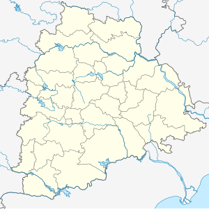 Bhuvanagiri Bhuvanagiri in Telangana | |
| Coordinates: 17°31′N 78°53′E / 17.51°N 78.89°E | |
| Country | India |
| State | Telangana |
| District | Yadadri Bhuvanagiri district |
| Metropolitan | Hyderabad Metropolitan Region |
| Founded | 11 Century |
| Named for | Tribhuvana Malla Vikramaditya VI(King of Fort) |
| Government | |
| • Type | Municipal Council |
| • Body | Bhuvanagiri Municipal corporation(4th Oldest in T.S) |
| • MLA | Pailla Shekar Reddy |
| • MP | Komatireddy Venkat Reddy |
| Area | |
| • Total | 76.537 km2 (29.551 sq mi) |
| Elevation | 430 m (1,410 ft) |
| Population (2011)[2] | |
| • Total | 55,000 |
| • Density | 720/km2 (1,900/sq mi) |
| Demonym(s) | Bhongir wala |
| Languages | |
| • Official | Telugu , |
| Time zone | UTC+5:30 (IST) |
| PIN | 508116, 508117 |
| Area codes | +91-08685 |
| Vehicle registration | TS-30 (previously TS-05 and AP-24) |
| Website | bhongirmunicipality |


Bhuvanagiri is also known as Tribhuvanagiri is a district headquarters of the Yadadri Bhuvanagiri and part of the Greater Hyderabad Metropolitan City of the Indian state of Telangana.[1] Falling under Hyderabad Metropolitan Development Authority, the town is located on National Highway 163 & National Highway 161AA (India), about 47 km from state capital Hyderabad Central Point[3]
Etymology[]
Bhuvanagiri Fort is one of the isolated monolithic rocks carved by the Western Chalukya ruler Tribhuvanamalla Vikramaditya VI and was thus named after him as Tribhuvanagiri. This name gradually became Bhuvanagiri and subsequently Bhongir.[4]
The fort is associated with the rule of the Kakatiya queen Rudramadevi and her Grandson Prataparudhra.
The town was constituted as a city Municipality in the year 1910(4th Oldest in Telangana). Subsequently, constituted as Municipality in the year of 1952 and recently as per the Government orders 3 Nos. Grampanchayats namely Raigiri(North East), Pagidipally(West) & Bommaipally(South) Areas have been merged in Bhuvanagiri Municipality and town having spread over 76.537 km2. The famous Pilgrim of Lord Yadadri Lakshmi Narasimha Swamy Temple is located nearby 13 km.
Geography[]
Bhuvanagiri is located at 17°30′39″N 78°53′20″E / 17.5108°N 78.8889°E.[5] It has an average elevation of 329 metres (1,079 ft).
Demographics[]
As of 2011 India census,[6] Bhuvanagiri had a population of 53,339.[7] Males constitute 51% of the population and females 49%. Bhuvanagiri has an average literacy rate of 70%, less than the national average of 74.04%; with male literacy of 78% and female literacy of 61%. 12% of the population is under 6 years of age.
Politics[]
Bhuvanagiri as a Lok Sabha constituency came into existence in 2008 as per Delimitation Act of 2002. Pailla Shekar Reddy is the present MLA.[8]
Nearest cities[]
West (NH163)
- Hyderabad 47 km
- Uppal X Road, Hyderabad 37 km
- Hyderabad City Boundary 14 km
- ORR 24 km
South (NH161AA)
- Nalgonda 70 km
East (NH163)
North (NH161AA)
- Gajwel 45km
Transport[]
- Nearest Bus station: Bhuvanagiri (Platform:16)- 0 Km
- Nearest Railway Station: Bhuvanagiri (Platform:3) Code:BG- 2.5Km
- Nearest Railway Division(All Trains): Secunderabad Code:SC-47Km
- Nearest Airport: RGIA Hyderabad(Shamshabad)-69Km
Culture[]

Notable persons from the town are Raavi Narayana Reddy, Alimineti Madhava Reddy, Belli Lalitha, and Pratyusha.
There are certain notable landmarks in the town. Bhuvanagiri Fort is one such structure.
Rock Climbing School (RCSB)[]
Rock Climbing School at Bhuvanagiri Fort, Hyderabad is the training center for rock climbing. [9][10]

See also[]
References[]
- ^ a b "District Census Handbook – Nalgonda" (PDF). Census of India. p. 13,52. Retrieved 8 February 2016.
- ^ "Census 2018". The Registrar General & Census Commissioner, India. Retrieved 25 July 2014.
- ^ "Revenue divisions and mandals in Yadadri district" (PDF). The official website of Yadadri Bhuvanagiri district. Revenue Department, Telangana. 11 October 2016. pp. 3, 4. Archived from the original (PDF) on 23 April 2019. Retrieved 19 May 2019.
- ^ "Bhongir Fort is a shutterbug's paradise". The Hindu. 9 October 2004. Archived from the original on 14 October 2004.
- ^ "Bhongir at Fallingrain.com". fallingrain.com.
- ^ "Census of India 2001: Data from the 2001 Census, including cities, villages and towns (Provisional)". Census Commission of India. Archived from the original on 16 June 2004. Retrieved 1 November 2008.
- ^ "Alphabetical list of towns and their population" (PDF). censusindia.gov.in. 8 July 2014.
- ^ "Bhongir Assembly Constituency Election Results 2009". Electionaffairs.com.
- ^ [1] The Hindu 4 October 2013.
- ^ "It's the climb!". The New Indian Express.
External links[]
| Wikimedia Commons has media related to Bhuvanagiri. |
- Mandal headquarters in Yadadri Bhuvanagiri district