Blairstown, New Jersey
Blairstown, New Jersey | |
|---|---|
| Township of Blairstown | |
 Blair Lake Spillway and Footbridge | |
 Map of Blairstown Township in Warren County. Inset: Location of Warren County highlighted in the State of New Jersey. | |
 Census Bureau map of Blairstown, New Jersey | |
 Blairstown Location in Warren County | |
| Coordinates: 40°58′49″N 74°59′49″W / 40.980156°N 74.996849°WCoordinates: 40°58′49″N 74°59′49″W / 40.980156°N 74.996849°W[1][2] | |
| Country | |
| State | |
| County | |
| Incorporated | April 14, 1845 |
| Named for | John Insley Blair |
| Government | |
| • Type | Township |
| • Body | Township Committee |
| • Mayor | Rob Moorhead(R, term ends December 31, 2023)[3][4] |
| • Municipal clerk | Kristin Shipps [5] |
| Area | |
| • Total | 30.78 sq mi (79.71 km2) |
| • Land | 29.89 sq mi (77.41 km2) |
| • Water | 0.89 sq mi (2.30 km2) 2.88% |
| Area rank | 87th of 565 in state 2nd of 22 in county[1] |
| Elevation | 364 ft (111 m) |
| Population | |
| • Total | 5,967 |
| • Estimate (2019)[11] | 5,691 |
| • Rank | 346th of 566 in state 7th of 22 in county[12] |
| • Density | 193.6/sq mi (74.7/km2) |
| • Density rank | 508th of 566 in state 15th of 22 in county[12] |
| Time zone | UTC−05:00 (Eastern (EST)) |
| • Summer (DST) | UTC−04:00 (Eastern (EDT)) |
| ZIP Code | |
| Area code(s) | 908[15] |
| FIPS code | 3404106160[1][16][17] |
| GNIS feature ID | 0882317[1][18] |
| Website | www |


Blairstown is a township in Warren County, New Jersey, United States. As of the 2010 United States Census, the township's population was 5,967[8][9][10] reflecting an increase of 220 (+3.8%) from the 5,747 counted in the 2000 Census, which had in turn increased by 416 (+7.8%) from the 5,331 counted in the 1990 Census.[19]
The area had been known as Smith's Mill and was later called Butts Bridge (variously spelled as "Butt's Bridge" and "Butts' Bridge"), named for a family that owned the eponymous crossing of the Paulins Kill.[20]
Blairstown was incorporated as a township by an act of the New Jersey Legislature on April 14, 1845, from portions of Knowlton Township, based on the results of a referendum held that day.[21] The township was named for John Insley Blair.[22][23]
Geography[]
According to the United States Census Bureau, the township had a total area of 30.78 square miles (79.71 km2), including 29.89 square miles (77.41 km2) of land and 0.89 square miles (2.30 km2) of water (2.88%).[1][2] The township is located in the Kittatinny Valley which is a section of the Great Appalachian Valley that stretches for 700 miles (1,100 km) from Canada to Alabama.
Blairstown CDP (with a 2010 Census population of 515[24]) is an unincorporated community and census-designated place (CDP) located within the township.[25][26][27]
Other unincorporated communities, localities and place names located partially or completely within the township include Blair Lake, Cedar Lake, Cooks Pond, Jacksonburg, Kalaroma, Lake Susquehanna, Mount Vernon, Paulina, Vail and Walnut Valley.[28]
White Township borders the Warren County municipalities of Frelinghuysen Township, Hardwick Township, Hope Township and Knowlton Township.[29][30]
Demographics[]
| Historical population | |||
|---|---|---|---|
| Census | Pop. | %± | |
| 1850 | 1,405 | — | |
| 1860 | 1,542 | 9.8% | |
| 1870 | 1,379 | −10.6% | |
| 1880 | 1,458 | 5.7% | |
| 1890 | 1,662 | 14.0% | |
| 1900 | 1,576 | −5.2% | |
| 1910 | 1,718 | 9.0% | |
| 1920 | 1,361 | −20.8% | |
| 1930 | 1,416 | 4.0% | |
| 1940 | 1,449 | 2.3% | |
| 1950 | 1,571 | 8.4% | |
| 1960 | 1,797 | 14.4% | |
| 1970 | 2,189 | 21.8% | |
| 1980 | 4,360 | 99.2% | |
| 1990 | 5,331 | 22.3% | |
| 2000 | 5,747 | 7.8% | |
| 2010 | 5,967 | 3.8% | |
| 2019 (est.) | 5,691 | [11][31][32] | −4.6% |
| Population sources: 1850-1920[33] 1850-1870[34] 1850[35] 1870[36] 1880-1890[37] 1890-1910[38] 1910-1930[39] 1930-1990[40] 2000[41][42] 2010[8][9][10] | |||
The Township's economic data (as is all of Warren County) is calculated by the United States Census Bureau as part of the Allentown–Bethlehem–Easton metropolitan area which also includes Carbon County, Lehigh County and Northampton County counties in Pennsylvania.
Census 2010[]
The 2010 United States census counted 5,967 people, 2,124 households, and 1,703 families in the township. The population density was 193.6 per square mile (74.7/km2). There were 2,272 housing units at an average density of 73.7 per square mile (28.5/km2). The racial makeup was 96.03% (5,730) White, 1.12% (67) Black or African American, 0.12% (7) Native American, 1.14% (68) Asian, 0.00% (0) Pacific Islander, 0.45% (27) from other races, and 1.14% (68) from two or more races. Hispanic or Latino of any race were 3.79% (226) of the population.[8]
Of the 2,124 households, 32.8% had children under the age of 18; 66.8% were married couples living together; 9.4% had a female householder with no husband present and 19.8% were non-families. Of all households, 15.8% were made up of individuals and 6.3% had someone living alone who was 65 years of age or older. The average household size was 2.78 and the average family size was 3.11.[8]
23.9% of the population were under the age of 18, 7.2% from 18 to 24, 20.1% from 25 to 44, 33.3% from 45 to 64, and 15.5% who were 65 years of age or older. The median age was 44.3 years. For every 100 females, the population had 99.4 males. For every 100 females ages 18 and older there were 96.8 males.[8]
The Census Bureau's 2006-2010 American Community Survey showed that (in 2010 inflation-adjusted dollars) median household income was $82,952 (with a margin of error of +/- $10,269) and the median family income was $92,063 (+/- $14,594). Males had a median income of $73,818 (+/- $7,161) versus $54,959 (+/- $13,254) for females. The per capita income for the borough was $38,393 (+/- $7,342). About 4.1% of families and 5.0% of the population were below the poverty line, including 8.1% of those under age 18 and 1.4% of those age 65 or over.[43]
Census 2000[]
As of the 2000 United States Census[16] there were 5,747 people, 2,040 households, and 1,638 families residing in the township. The population density was 185.3 people per square mile (71.5/km2). There were 2,136 housing units at an average density of 68.9 per square mile (26.6/km2). The racial makeup of the township was 98.17% White, 0.26% African American, 0.14% Native American, 0.56% Asian, 0.02% Pacific Islander, 0.28% from other races, and 0.57% from two or more races. Hispanic or Latino of any race were 1.98% of the population.[41][42]
There were 2,040 households, out of which 35.0% had children under the age of 18 living with them, 69.6% were married couples living together, 7.3% had a female householder with no husband present, and 19.7% were non-families. 15.3% of all households were made up of individuals, and 7.1% had someone living alone who was 65 years of age or older. The average household size was 2.81 and the average family size was 3.14.[41][42]
In the township the population was spread out, with 25.6% under the age of 18, 5.8% from 18 to 24, 26.7% from 25 to 44, 29.5% from 45 to 64, and 12.4% who were 65 years of age or older. The median age was 40 years. For every 100 females, there were 99.5 males. For every 100 females age 18 and over, there were 96.2 males.[41][42]
The median income for a household in the township was $64,809, and the median income for a family was $71,214. Males had a median income of $51,931 versus $33,646 for females. The per capita income for the township was $27,775. About 3.0% of families and 4.5% of the population were below the poverty line, including 2.4% of those under age 18 and 3.4% of those age 65 or over.[41][42]
Government[]
Local government[]
Blairstown is governed under the Township form of New Jersey municipal government, one of 141 municipalities (of the 565) statewide that use this form, the second-most commonly used form of government in the state.[44] The Township Committee is comprised of five members, who are elected directly by the voters at-large in partisan elections to serve three-year terms of office on a staggered basis, with either one or two seats coming up for election each year as part of the November general election in a three-year cycle.[6][45] At a reorganization meeting held each year during the first week of January, the Committee members select one of their members to serve as Mayor and another to serve as Deputy Mayor.[3]
As of 2020, the Blairstown Township Committee consists of Mayor Stephen J. Lance (R, term on committee and as mayor ends December 31, 2020), Deputy Mayor Giovanna "JoAnne" VanValkenburg (R, term on committee ends December 31, 2022; term as deputy mayor ends 2020), Rob Moorhead (R, 2021), Steven Sikkes (R, 2021) and Debra Waldron (R, 2020).[3][46][47][48][49][50]
Federal, state and county representation[]
Blairstown Township is located in the 5th Congressional District[51] and is part of New Jersey's 24th state legislative district.[9][52][53] Prior to the 2011 reapportionment following the 2010 Census, Blairstown Township had been in the 23rd state legislative district.[54]
For the 117th United States Congress, New Jersey's Fifth Congressional District is represented by Josh Gottheimer (D, Wyckoff).[55][56] New Jersey is represented in the United States Senate by Democrats Cory Booker (Newark, term ends 2027)[57] and Bob Menendez (Harrison, term ends 2025).[58][59]
For the 2018–2019 session (Senate, General Assembly), the 24th Legislative District of the New Jersey Legislature is represented in the State Senate by Steve Oroho (R, Franklin) and in the General Assembly by Parker Space (R, Wantage Township) and Harold J. Wirths (R, Hamburg).[60][61]
Warren County is governed by a Board of Chosen Freeholders whose three members are chosen at-large on a staggered basis in partisan elections with one seat coming up for election each year as part of the November general election. At an annual reorganization meeting held in the beginning of January, the board selects one of its members to serve as Freeholder Director and other as Deputy Director. As of 2014, Warren County's Freeholders are Freeholder Director Edward J. Smith (R, Asbury / Franklin Township, 2015), Freeholder Deputy Director Richard D. Gardner (R, Asbury / Franklin Township, 2014) and Freeholder Jason Sarnoski (R, Lopatcong Township, 2016).[62] Constitutional officers elected on a countywide basis are County Clerk Patricia J. Kolb (Blairstown Township),[63] Sheriff David Gallant (Blairstown Township) and Surrogate Kevin O'Neill (Hackettstown).[64][65] The County Administrator, Steve Marvin, is responsible for overseeing the day-to-day operation of the county and its departments.[66]
Politics[]
As of March 23, 2011, there were a total of 4,294 registered voters in Blairstown Township, of which 707 (16.5% vs. 21.5% countywide) were registered as Democrats, 1,882 (43.8% vs. 35.3%) were registered as Republicans and 1,702 (39.6% vs. 43.1%) were registered as Unaffiliated. There were 3 voters registered to other parties.[67] Among the township's 2010 Census population, 72.0% (vs. 62.3% in Warren County) were registered to vote, including 94.6% of those ages 18 and over (vs. 81.5% countywide).[67][68]
In the 2012 presidential election, Republican Mitt Romney received 1,654 votes (63.2% vs. 56.0% countywide), ahead of Democrat Barack Obama with 910 votes (34.8% vs. 40.8%) and other candidates with 28 votes (1.1% vs. 1.7%), among the 2,616 ballots cast by the township's 4,326 registered voters, for a turnout of 60.5% (vs. 66.7% in Warren County).[69][70] In the 2008 presidential election, Republican John McCain received 1,986 votes (60.7% vs. 55.2% countywide), ahead of Democrat Barack Obama with 1,192 votes (36.4% vs. 41.4%) and other candidates with 39 votes (1.2% vs. 1.6%), among the 3,271 ballots cast by the township's 4,332 registered voters, for a turnout of 75.5% (vs. 73.4% in Warren County).[71] In the 2004 presidential election, Republican George W. Bush received 2,141 votes (65.8% vs. 61.0% countywide), ahead of Democrat John Kerry with 1,068 votes (32.8% vs. 37.2%) and other candidates with 33 votes (1.0% vs. 1.3%), among the 3,256 ballots cast by the township's 4,021 registered voters, for a turnout of 81.0% (vs. 76.3% in the whole county).[72]
In the 2013 gubernatorial election, Republican Chris Christie received 74.0% of the vote (1,335 cast), ahead of Democrat Barbara Buono with 23.7% (427 votes), and other candidates with 2.3% (42 votes), among the 1,850 ballots cast by the township's 4,338 registered voters (46 ballots were spoiled), for a turnout of 42.6%.[73][74] In the 2009 gubernatorial election, Republican Chris Christie received 1,252 votes (63.5% vs. 61.3% countywide), ahead of Democrat Jon Corzine with 489 votes (24.8% vs. 25.7%), Independent Chris Daggett with 180 votes (9.1% vs. 9.8%) and other candidates with 24 votes (1.2% vs. 1.5%), among the 1,971 ballots cast by the township's 4,236 registered voters, yielding a 46.5% turnout (vs. 49.6% in the county).[75]
Former Mayors
   2021 - Rob Moorhead (R)
   2018-20 - Stephen Lance (R)
   2014–17 - Herman Shoemaker (R)
   2013 - Richard Mach (R)
   2012 - Frank Anderson (R)
   2009-11 - Richard Mach (R)
   2006-08 - Stephen Lance (R)
   2005 - Alfred Handy (R)
   2004 - George Joest (R)
   2003 - William Horsey (R)
   2002 - George Joest (R)
   2001 - William Seal (R)
   2000 - Jane Santini (D)
   1999 - Joseph DiGrazia (R)
   1998 - Anita Ardia (I)
   1996-97 - Franklin D Shotwell (R)
   1995 - Charles Eble (R)
   1990-94 - Walter Orcutt (R)
   1989 - Frank Kelly (D)
   1988 - Howard Mott, Sr (D)
Former Committee Members
   2021-23 - Walter Orcutt (R)
   2019-21 - Steven Sikkes (R)
   2019-21 - Rob Moorhead (R)
   2017-23 - Debra Waldron (R)
   2016-18 - Cynthia Dalton (R)
   2015-22 - JoAnne VanValkenburg (R)
   2015 - Harold Price (R)
   2014-15 - Susan Price (R)
   2013-18 - Paul Avery (R)
   2012-17 - Herman Shoemaker (R)
   2007-12 - William Seal (R)
   2006-11 - Sal Lascari (R)
   2006-20 - Stephen Lance (R)
   2005-15 - Frank Anderson (R)
   2005-13 - Richard Mach (R)
   2004-06 - Gary Stevens (R)
   2003-05 - Alfred Handy (R)
   2003-05 - Raymond Davis (R)
   2002-04 - William Horsey (R)
   2001-05 - George Joest (R)
   2001-03 - JoAnne VanValkenburg (I)
   1998-01 - William Seal (R)
   1997-02 - Jane Santini (D)
   1997-02 - Anita Ardia (I)
   1995-97 - Fred Cook (D)
   1995-97 - Charles Eble (R)
   1992-94 - Robert Rokosz (R)
   1990-92 - Anthony Hipple (R)
   1989-94 - Walter Orcutt (R)
   1988-93 - Robert McElroy (D)
   1984-86 - George Wilhelm (R)
   1981-87 - Carl Race (R)
   1979-87 - Sal Simonetti (R)
   1978-83 - Elwyn Barker (R)
   1975-79 - Howard Mott, Sr (D)
   1968-89 - Frank Kelly (D)
Education[]
The Blairstown Township School District serves public school students in kindergarten through sixth grade at the Blairstown Elementary School. As of the 2017–18 school year, the district, comprised of one school, had an enrollment of 469 students and 46.9 classroom teachers (on an FTE basis), for a student–teacher ratio of 10.0:1.[76] Students from Hardwick Township, a non-operating school district, also attend Blairstown Elementary School.[77][78]
Students in seventh through twelfth grades for public school attend the North Warren Regional High School in Blairstown, a public secondary high school, serving students from the townships of Blairstown, Frelinghuysen, Hardwick and Knowlton.[79][80][81] As of the 2017–18 school year, the high school had an enrollment of 820 students and 77.6 classroom teachers (on an FTE basis), for a student–teacher ratio of 10.6:1.[82]
Ridge and Valley Charter School, a K-8 charter school founded in 2004 that is focused on Earth literacy and sustainable living, is located in neighboring Frelinghuysen Township. The school also serves (and grants admission priority to) students from Frelinghuysen, Hardwick and Knowlton Townships, who attend the school without cost to the parents.[83] Students from the township and from all of Warren County are also eligible to attend Warren County Technical School in Washington borough (for 9-12),[84] with special education services provided by local districts supplemented throughout the county by the Warren County Special Services School District in Oxford Township (for PreK-12).[85][86]
Students from across the world attend Blair Academy, a private boarding school for students in grades 9-12 established in 1848 by philanthropist John Insley Blair.[87]
Transportation[]
Roads and highways[]

As of May 2010, the township had a total of 85.92 miles (138.27 km) of roadways, of which 61.05 miles (98.25 km) were maintained by the municipality, 17.23 miles (27.73 km) by Warren County and 7.64 miles (12.30 km) by the New Jersey Department of Transportation.[88]
Interstate 80 (the Bergen-Passaic Expressway) passes through briefly in the southern part without any interchanges, and is accessible via Route 94 and CR 521 in neighboring Knowlton and Hope townships, respectively. Route 94 passes runs east–west through the center of the township while County Route 521 passes through in the eastern section.
Airport[]
Blairstown Airport (1N7) is located southwest of the central business district.[89]
Railroads[]
The Lackawanna Cut-Off, a high-speed, double-track railway line that stretches for 28.45 miles (45.79 km) was constructed by the Delaware, Lackawanna and Western Railroad between 1908 and 1911, opening for service on December 24, 1911. It ran west from Port Morris, New Jersey to Slateford, Pennsylvania and passed through Blairstown. The DL&W RR merged with the Erie Railroad on October 17, 1960, to form the Erie-Lackawanna Railroad. Due to declining revenues, passenger service over the Lackawanna Cut-Off was discontinued on January 5, 1970, and freight service ceased in 1979, just three years after the E-L was absorbed into the Consolidated Railroad Company (Conrail). The tracks remained relatively dormant until 1984, when the property was sold to a developer and rails removed. The right of way is now the property of the State of New Jersey, and plans are underway for the restoration of rail service in the future. Blairstown's poured concrete passenger and freight stations still stand, although privately owned.

Blairstown was also served by a second railroad, the Blairstown Railway. The little short line, a personal project of the local industrial magnate John Insley Blair, was constructed in 1876 from Blairstown to Delaware, NJ, where it connected with the Old Main Line of the Lackawanna RR. The Blairstown Railway was absorbed by the New York, Susquehanna & Western Railroad in 1882 as it built west to the coal fields of Pennsylvania. The NYS&W also operated passenger service between Blairstown and New York (via Jersey City, NJ) until 1935. A third railroad, the Lehigh & New England Railroad, operated through Blairstown via trackage rights over the NYS&W between Swartswood Junction and Hainesburg Junction until October 31, 1961, when the L&NE was abandoned. With the loss of L&NE trackage rights revenues and little local business to sustain the line, the NYS&W also abandoned its line through Blairstown shortly thereafter, and the tracks were removed in 1962. The right of way today has been preserved by the State of New Jersey as the 26-mile (42 km) long Paulinskill Valley Trail.
Landmarks[]
- Blairstown Historic District was added to the National Register of Historic Places in 2007.[90]
- Historic Blairstown Theater (also known as Roy's Hall) was built in 1913 as a silent movie house. The building was restored and painted blue in 2005 and is the centerpiece of Blairstown's vintage Main Street, surrounded by charming shops, galleries and restaurants. The HBT features a regular schedule of live music and theatrical performances, classic film and community events.[91]
- The Blairstown Museum is a private, non-profit corporation organized under New Jersey law managed by a Board of Directors and housed in a 19th-century building, known as the last remaining structure of "Roy's Row". The Museum is the only general history and cultural museum for the Township of Blairstown. It cares for over 2,000 items that illustrate the history of the township and its inhabitants, including former resident and namesake John Insley Blair.[92]
Gallery[]
The Old Academy Building of the Blair Academy

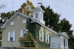
Queen Anne/Stick style house in the Blairstown Historic District
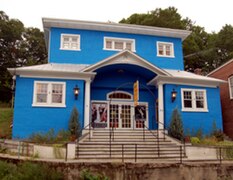
Painted bright blue, historic Roy's Hall is a highlight of Blairstown's Main Street.

Blairstown Museum


Popular culture[]
- Scenes from the horror film Friday the 13th were filmed on Blairstown's Main Street, and at the Blairstown Diner on Route 94; the Boy Scout camp No-Be-Bo-Sco in adjacent Hardwick Township was the site for Camp Crystal Lake.[93]
- The body of Princess Doe was discovered at the Cedar Ridge Cemetery in Blairstown on July 15, 1982. She became the first unidentified body entered into the FBI's NCIC computer system.[94]
- Scenes from the horror film Plasterhead[95] were filmed at the Blairstown Diner on Route 94.
Notable people[]
People who were born in, residents of, or otherwise closely associated with Blairstown include:
- Cathy Bao Bean (born 1942), lives in neighboring Frelinghuysen Township, author of The Chopsticks-Fork Principle: A Memoir and Manual.[96]
- Bennett Bean, studio potter, lives in neighboring Frelinghuysen Township.[97]
- Anthony D'Amato, songwriter and singer.[98]
- David T. Little (born 1978), composer.[99]
- Robert A. Belet (1914-1942), United States Marine Corps master technical sergeant who was awarded the Silver Star for his actions in the Guadalcanal Campaign.[100]
- DeWitt Clinton Blair (1833–1915), son of John Insley Blair.[citation needed]
- John Insley Blair (1802–1899), entrepreneur, railroad magnate, and Blairstown's most famous citizen. Gravel Hill was renamed Blairstown after Blair in 1839.[101]
- John A. Haggerty (1841-1910), Wisconsin legislator and businessman who was born in Blairstown.[102]
- Nancy Overton (1926-2009), singer best known for her work with The Chordettes.[103]
- Lou Reed (1942–2013), musician, singer, songwriter and record producer, lived in neighboring Hardwick Township.[104]
- Isaac Wildrick (1803–1892), represented New Jersey's 3rd congressional district in the United States House of Representatives from 1849 to 1853.[105]
References[]
- ^ Jump up to: a b c d e f 2019 Census Gazetteer Files: New Jersey Places, United States Census Bureau. Accessed July 1, 2020.
- ^ Jump up to: a b US Gazetteer files: 2010, 2000, and 1990, United States Census Bureau. Accessed September 4, 2014.
- ^ Jump up to: a b c TownshipCommittee Members, Blairstown Township. Accessed March 19, 2020. "The Township of Blairstown is governed by the Township form of government, registered voters directly elect members of the five-member Township Committee. The Committee selects the Mayor and Deputy Mayor, from amongst themselves, annually at the reorganization meeting held annually on January first. It is at the reorganization meeting when newly elected members of the Committee are sworn-in and committee assignments are delegated and members of Board/Committee are appointed."
- ^ 2020 New Jersey Mayors Directory, New Jersey Department of Community Affairs. Accessed February 1, 2020.
- ^ Township Clerk, Blairstown Township. Accessed March 19, 2020.
- ^ Jump up to: a b 2012 New Jersey Legislative District Data Book, Rutgers University Edward J. Bloustein School of Planning and Public Policy, March 2013, p. 103.
- ^ U.S. Geological Survey Geographic Names Information System: Township of Blairstown, Geographic Names Information System. Accessed March 4, 2013.
- ^ Jump up to: a b c d e f DP-1 - Profile of General Population and Housing Characteristics: 2010 for Blairstown township, Warren County, New Jersey, United States Census Bureau. Accessed September 19, 2012.
- ^ Jump up to: a b c d Municipalities Sorted by 2011-2020 Legislative District, New Jersey Department of State. Accessed February 1, 2020.
- ^ Jump up to: a b c Profile of General Demographic Characteristics: 2010 for Blairstown township Archived 2014-04-24 at the Wayback Machine, New Jersey Department of Labor and Workforce Development. Accessed September 19, 2012.
- ^ Jump up to: a b QuickFacts for Blairstown township, Warren County, New Jersey; Warren County, New Jersey; New Jersey from Population estimates, July 1, 2019, (V2019), United States Census Bureau. Accessed May 21, 2020.
- ^ Jump up to: a b GCT-PH1 Population, Housing Units, Area, and Density: 2010 - State -- County Subdivision from the 2010 Census Summary File 1 for New Jersey , United States Census Bureau. Accessed December 11, 2012.
- ^ Look Up a ZIP Code for Blairstown, NJ, United States Postal Service. Accessed September 19, 2012.
- ^ ZIP Codes, State of New Jersey. Accessed August 26, 2013.
- ^ Area Code Lookup - NPA NXX for Blairstown, NJ, Area-Codes.com. Accessed September 1, 2013.
- ^ Jump up to: a b U.S. Census website , United States Census Bureau. Accessed September 4, 2014.
- ^ Geographic Codes Lookup for New Jersey Archived June 4, 2019, at the Wayback Machine, Missouri Census Data Center. Accessed September 19, 2012.
- ^ US Board on Geographic Names, United States Geological Survey. Accessed September 4, 2014.
- ^ Table 7. Population for the Counties and Municipalities in New Jersey: 1990, 2000 and 2010 Archived August 7, 2017, at the Wayback Machine, New Jersey Department of Labor and Workforce Development, February 2011. Accessed September 19, 2012.
- ^ Bertholf, Kenneth Jr. Blairstown and Its Neighbors, p. 27. Arcadia Publishing, 2011. ISBN 9781439624227. Accessed April 2, 2015.
- ^ Snyder, John P. The Story of New Jersey's Civil Boundaries: 1606-1968, Bureau of Geology and Topography; Trenton, New Jersey; 1969. p. 245. Accessed September 19, 2012.
- ^ Hutchinson, Viola L. The Origin of New Jersey Place Names, New Jersey Public Library Commission, May 1945. Accessed August 27, 2015.
- ^ Gannett, Henry. The Origin of Certain Place Names in the United States, p. 48. United States Government Printing Office, 1905. Accessed August 27, 2015.
- ^ DP-1 - Profile of General Population and Housing Characteristics: 2010 Demographic Profile Data for Blairstown CDP, New Jersey, United States Census Bureau. Accessed June 1, 2013.
- ^ GCT-PH1 - Population, Housing Units, Area, and Density: 2010 - County -- County Subdivision and Place from the 2010 Census Summary File 1 for Warren County, New Jersey, United States Census Bureau. Accessed May 28, 2013.
- ^ 2006-2010 American Community Survey Geography for New Jersey, United States Census Bureau. Accessed May 28, 2013.
- ^ New Jersey: 2010 - Population and Housing Unit Counts - 2010 Census of Population and Housing (CPH-2-32), United States Census Bureau, p. III-5, August 2012. Accessed May 28, 2013.
- ^ Locality Search, State of New Jersey. Accessed December 21, 2014.
- ^ Municipal Directory, Warren County, New Jersey. Accessed March 3, 2020.
- ^ New Jersey Municipal Boundaries, New Jersey Department of Transportation. Accessed November 15, 2019.
- ^ Annual Estimates of the Resident Population for Minor Civil Divisions in New Jersey: April 1, 2010 to July 1, 2019, United States Census Bureau. Accessed May 21, 2020.
- ^ Census Estimates for New Jersey April 1, 2010 to July 1, 2019, United States Census Bureau. Accessed May 21, 2020.
- ^ Compendium of censuses 1726-1905: together with the tabulated returns of 1905, New Jersey Department of State, 1906. Accessed June 1, 2013.
- ^ Raum, John O. The History of New Jersey: From Its Earliest Settlement to the Present Time, Volume 1, p. 272, J. E. Potter and company, 1877. Accessed June 1, 2013. "Blairstown township contained in 1850, 1,405 inhabitants; in 1860, 1,542; and in 1870, 1,379."
- ^ Debow, James Dunwoody Brownson. The Seventh Census of the United States: 1850, p. 141. R. Armstrong, 1853. Accessed February 27, 2013.
- ^ Staff. A compendium of the ninth census, 1870, p. 260. United States Census Bureau, 1872. Accessed June 1, 2013.
- ^ Porter, Robert Percival. Preliminary Results as Contained in the Eleventh Census Bulletins: Volume III - 51 to 75, p. 100. United States Census Bureau, 1890. Accessed June 1, 2013.
- ^ Thirteenth Census of the United States, 1910: Population by Counties and Minor Civil Divisions, 1910, 1900, 1890, United States Census Bureau, p. 339. Accessed June 1, 2013.
- ^ Fifteenth Census of the United States : 1930 - Population Volume I, United States Census Bureau, p. 719. Accessed June 1, 2013.
- ^ New Jersey Resident Population by Municipality: 1930 - 1990 Archived May 10, 2015, at the Wayback Machine, Workforce New Jersey Public Information Network. Accessed June 28, 2015.
- ^ Jump up to: a b c d e Census 2000 Profiles of Demographic / Social / Economic / Housing Characteristics for Blairstown township, Warren County, New Jersey Archived 2014-07-12 at the Wayback Machine, United States Census Bureau. Accessed September 19, 2012.
- ^ Jump up to: a b c d e DP-1: Profile of General Demographic Characteristics: 2000 - Census 2000 Summary File 1 (SF 1) 100-Percent Data for Blairstown township, Warren County, New Jersey, United States Census Bureau. Accessed September 19, 2012.
- ^ DP03: Selected Economic Characteristics from the 2006-2010 American Community Survey 5-Year Estimates for Blairstown township, Warren County, New Jersey, United States Census Bureau. Accessed September 19, 2012.
- ^ Inventory of Municipal Forms of Government in New Jersey, Rutgers University Center for Government Studies, July 1, 2011. Accessed November 18, 2019.
- ^ "Forms of Municipal Government in New Jersey", p. 7. Rutgers University Center for Government Studies. Accessed June 3, 2015.
- ^ 2019 Municipal Data Sheet, Blairstown Township. Accessed March 19, 2020.
- ^ 2019 Official Directory Warren County, New Jersey, Warren County, New Jersey. Accessed March 3, 2020.
- ^ General Election November 5, 2019, Warren County Official Tally, Warren County, New Jersey, updated November 12, 2019. Accessed January 1, 2020.
- ^ General Election November 6, 2018, Warren County Official Tally, Warren County, New Jersey, updated November 11, 2018. Accessed January 1, 2019.
- ^ General Election November 7, 2017, Warren County Official Tally, Warren County, New Jersey, updated November 14, 2017. Accessed January 1, 2018.
- ^ Plan Components Report, New Jersey Redistricting Commission, December 23, 2011. Accessed February 1, 2020.
- ^ 2019 New Jersey Citizen's Guide to Government, New Jersey League of Women Voters. Accessed October 30, 2019.
- ^ Districts by Number for 2011-2020, New Jersey Legislature. Accessed January 6, 2013.
- ^ 2011 New Jersey Citizen's Guide to Government Archived 2013-06-04 at the Wayback Machine, p. 55, New Jersey League of Women Voters. Accessed May 22, 2015.
- ^ Directory of Representatives: New Jersey, United States House of Representatives. Accessed January 3, 2019.
- ^ Biography, Congressman Josh Gottheimer. Accessed January 3, 2019. "Josh now lives in Wyckoff, New Jersey with Marla, his wife who was a federal prosecutor, and their two young children, Ellie and Ben."
- ^ [1], United States Senate. Accessed April 30, 2021. "He now owns a home and lives in Newark's Central Ward community."
- ^ Biography of Bob Menendez, United States Senate, January 26, 2015. "Menendez, who started his political career in Union City, moved in September from Paramus to one of Harrison's new apartment buildings near the town's PATH station.."
- ^ [2]. United States Senate. Accessed April 30, 2021. "Booker, Cory A. - (D - NJ) Class II; Menendez, Robert - (D - NJ) Class I"
- ^ Legislative Roster 2018-2019 Session, New Jersey Legislature. Accessed January 22, 2018.
- ^ District 24 Legislators, New Jersey Legislature. Accessed January 22, 2018.
- ^ Board of Chosen Freeholders, Warren County, New Jersey. Accessed September 15, 2014.
- ^ County Clerk's Office, Warren County, New Jersey. Accessed September 15, 2014.
- ^ Message from Surrogate, Warren County, New Jersey. Accessed September 15, 2014.
- ^ Constitutional Officers, Warren County, New Jersey. Accessed September 15, 2014.
- ^ 2013 Official Directory, Warren County, New Jersey. Accessed September 15, 2014.
- ^ Jump up to: a b Voter Registration Summary - Warren, New Jersey Department of State Division of Elections, March 23, 2011. Accessed June 2, 2013.
- ^ GCT-P7: Selected Age Groups: 2010 - State -- County Subdivision; 2010 Census Summary File 1 for New Jersey , United States Census Bureau. Accessed June 2, 2013.
- ^ Presidential November 6, 2012 General Election Results - Warren County Archived January 18, 2014, at the Wayback Machine, New Jersey Department of State Division of Elections, March 15, 2013. Accessed June 2, 2013.
- ^ Number of Registered Voters and Ballots Cast November 6, 2012 General Election Results - Warren County Archived January 18, 2014, at the Wayback Machine, New Jersey Department of State Division of Elections, March 15, 2013. Accessed June 2, 2013.
- ^ 2008 Presidential General Election Results: Warren County, New Jersey Department of State Division of Elections, December 23, 2008. Accessed June 2, 2013.
- ^ 2004 Presidential Election: Warren County, New Jersey Department of State Division of Elections, December 13, 2004. Accessed June 2, 2013.
- ^ "Governor - Warren County" (PDF). New Jersey Department of Elections. January 29, 2014. Retrieved December 24, 2014.
- ^ "Number of Registered Voters and Ballots Cast - November 5, 2013 - General Election Results - Warren County" (PDF). New Jersey Department of Elections. January 29, 2014. Retrieved December 24, 2014.
- ^ 2009 Governor: Warren County Archived 2012-10-17 at the Wayback Machine, New Jersey Department of State Division of Elections, December 31, 2009. Accessed June 2, 2013.
- ^ District information for Blairstown Elementary Township School District, National Center for Education Statistics. Accessed November 1, 2019.
- ^ Novak, Stephen J. "Hardwick Township School District among 13 'nonoperating' districts eliminated Wednesday" Archived 2011-07-13 at the Wayback Machine, The Express-Times, July 2, 2009. Accessed March 15, 2011. "The Hardwick district had a board of education and a part-time board secretary. But without a school of its own, it paid tuition to send its students to Blairstown Township. They'll continue to go there next school year, when the neighboring district takes control through a state order."
- ^ Warren County 2019-2020 Public School Directory, Warren County, New Jersey. Accessed February 6, 2020.
- ^ North Warren Regional High School 2013 Report Card Narrative, New Jersey Department of Education. Accessed July 19, 2016. "The North Warren Regional School District is home to just under 1000 students from the communities of Blairstown, Frelinghuysen, Hardwick, and Knowlton. The district stretches almost 97 square miles from the Sussex County border to the Delaware River and the Delaware Water Gap National Recreation Area."
- ^ Home Page, North Warren Regional School District. Accessed June 1, 2013. "North Warren Regional is a public secondary school district, serving students in grades 7-12 in the townships of Blairstown, Frelinghuysen, Hardwick, and Knowlton. The district covers 96.8 square miles bordering the Delaware Water Gap National Recreation Area in scenic Warren County."
- ^ Municipal Guide to Public School Districts, Warren County, New Jersey. Accessed February 6, 2020.
- ^ School data for North Warren Regional School, National Center for Education Statistics. Accessed November 1, 2019.
- ^ F.A.Q., Ridge and Valley Charter School. Accessed November 3, 2016. "Enrollment is open, on a space available basis, to all K-8 students residing in N.J. with priority given to students residing in the districts of Blairstown, Hardwick, Knowlton, Frelinghuysen, and North Warren Regional School."
- ^ About Us Archived 2013-09-27 at the Wayback Machine, Warren County Technical School. Accessed September 12, 2013.
- ^ About Archived 2013-09-27 at the Wayback Machine, Warren County Special Services School District. Accessed September 12, 2013.
- ^ Public School Directory 2016-2017, Warren County, New Jersey Department of Education. Accessed October 30, 2017.
- ^ History of the Academy Archived 2012-10-19 at the Wayback Machine, Blair Academy. Accessed September 19, 2012.
- ^ Warren County Mileage by Municipality and Jurisdiction, New Jersey Department of Transportation, May 2010. Accessed November 13, 2013.
- ^ Blairstown Airport, AirNav.com. Accessed February 21, 2018.
- ^ Bertland, Dennis; Armstrong, Janice; Cox, James; Parsekian, Ann (February 28, 2005). "National Register of Historic Places Inventory/Nomination: Blairstown Historic District". National Park Service. With accompanying 54 photos
- ^ About Us Archived 2013-05-07 at the Wayback Machine, The Historic Blairstown Theater. Accessed June 1, 2013.
- ^ Blairstown Museum, VisitNJ.org. Accessed February 22, 2017.
- ^ Friday the 13th Filming Locations, accessed November 14, 2006.
- ^ Gallucci, Jaclyn. "Identifying Princess Doe: 30 Years After She Was Slain, New Technology May ID Her and The Killer", Long Island Press, August 2, 2012. Accessed August 26, 2013. "This headless mannequin dressed in red standing erect among the headstones is an eerie sight from the busy state road that borders the Cedar Ridge Cemetery in this small township of nearly 6,000. Here, in Blairstown, everyone seems to know each other—police, business owners, neighbors—everyone except for the teenage girl found barefoot, partially clothed and beaten beyond recognition the morning of July 15, 1982."
- ^ "Plasterhead". October 2, 2007 – via www.imdb.com.
- ^ Staff. "News beat", Rochester Democrat and Chronicle, September 11, 2004. Accessed June 5, 2011. "Bean of Blairstown N.J. is a writer-educator and author of The Chopsticks-Fork Principle: A Memoir and Manual."
- ^ Bischoff, Dan. "Jersey ceramics, from six different angles" Archived 2008-04-10 at the Wayback Machine, The Star-Ledger, April 9, 2008. Accessed May 5, 2008. "The headliner, as he is almost wherever he shows, is Bennett Bean, here displaying seven pit-fired and gilded ceramic compositions that exude the cool, Modernist, syncopated painted patterning for which he is so well known. Bean, of Blairstown, is no doubt the best-known artist in 'Uncommon Clay,' but his aesthetic does not dominate the show."
- ^ La Gorce, Tammy. "Aspiring Singer Finds Mentors Behind Ivy League Walls", The New York Times, January 21, 2011. Accessed October 21, 2014. "Starting in 2009, Mr. D'Amato, then a Princeton junior, met with Professor Muldoon every few weeks to pore over drafts of Mr. D'Amato's songs, which he started writing as a high school student at Blair Academy in Blairstown. "
- ^ Reich, Ronni. "David T. Little", The Star-Ledger, July 9, 2009. Accessed October 21, 2014. "At age 8, Little was fascinated by history. When the Colonial Musketeers drumrolled through New Jersey, he was entranced by their uniforms, replicas of those worn by the Continental Marines of the Revolutionary War. His parents had just separated, and he and his mother, Joanne, left rural Blairstown for 'parade marathons' around the state to raise their spirits, so that Little wound up seeing the Hackettstown-based fife-and-drum corps at least three times in one weekend."
- ^ Robert A. Belet Archived 2014-07-24 at the Wayback Machine, Military Times Hall of Valor. Accessed November 13, 2013.
- ^ Blairstown, Past and Present, Township of Blairstown, backed up by the Internet Archive as of July 25, 2008. Accessed March 23, 2017. "The name of the village was officially changed to Blairstown by a vote of the citizens at a public meeting held Jan. 24, 1939. John I. Blair was only 36 years of age at the time."
- ^ 'Wisconsin Blue Book 1901,' Biographical Sketch of J. A. Haggerty, pg. 744
- ^ Levin, Jay. "Chordette's Nancy Overton Dead at 83", copy of article from The Record, April 7, 2009. Accessed November 13, 2013. "The family moved to Englewood from New York City in 1966 at the urging of a friend, Dizzy Gillespie.... Mrs. Overton moved to Blairstown in 1982, 10 years after her husband died."
- ^ via Associated Press. "Lou Reed, iconic punk poet, dies at 71", The Express-Times, October 27, 2013. Accessed January 1, 2018. "Reed lived in Blairstown Township in Warren County from the early 1980s until sometime in the 1990s, although not much is known about his time there because he liked his privacy, according to The Express-Times archives."
- ^ Isaac Wildrick, Biographical Directory of the United States Congress. Accessed September 1, 2007.
External links[]
| Wikimedia Commons has media related to Blairstown, New Jersey. |
| show Municipalities and communities of Warren County, New Jersey, United States |
|---|

| show Places adjacent to Blairstown, New Jersey |
|---|
- Blairstown, New Jersey
- 1845 establishments in New Jersey
- Populated places established in 1845
- Township form of New Jersey government
- Townships in Warren County, New Jersey