Frelinghuysen Township, New Jersey
Frelinghuysen Township, New Jersey | |
|---|---|
| Township of Frelinghuysen | |
 Vista from Jenny Jump Mountain | |
 Map of Frelinghuysen Township in Warren County. Inset: Location of Warren County highlighted in the State of New Jersey. | |
 Census Bureau map of Frelinghuysen Township, New Jersey | |
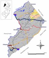
 Frelinghuysen Township Location in Warren County | |
| Coordinates: 40°57′34″N 74°53′43″W / 40.959486°N 74.895154°WCoordinates: 40°57′34″N 74°53′43″W / 40.959486°N 74.895154°W[1][2] | |
| Country | |
| state | |
| County | |
| Incorporated | March 7, 1848[3] |
| Named for | Theodorus Jacobus Frelinghuysen |
| Government | |
| • Type | Township |
| • Body | Township Committee |
| • Mayor | Christopher Stracco (R, December 31, 2020)[4][5] |
| • Municipal clerk | Donna Zilberfarb[6] |
| Area | |
| • Total | 23.87 sq mi (61.83 km2) |
| • Land | 23.62 sq mi (61.18 km2) |
| • Water | 0.25 sq mi (0.65 km2) 1.04% |
| Area rank | 117th of 565 in state 7th of 22 in county[1] |
| Elevation | 689 ft (210 m) |
| Population | |
| • Total | 2,230 |
| • Estimate (2019)[12] | 2,173 |
| • Rank | 479th of 566 in state 20th of 22 in county[13] |
| • Density | 95.6/sq mi (36.9/km2) |
| • Density rank | 544th of 566 in state 21st of 22 in county[13] |
| Time zone | UTC−05:00 (Eastern (EST)) |
| • Summer (DST) | UTC−04:00 (Eastern (EDT)) |
| ZIP Code | |
| Area code(s) | 908 exchanges: 850, 852[16] |
| FIPS code | 3404125320[1][17][18] |
| GNIS feature ID | 0882240[1][19] |
| Website | www |


Frelinghuysen Township /ˈfriːlɪŋhaɪzən/ is a township in Warren County, New Jersey, United States. As of the 2010 United States Census, the township's population was 2,230,[9][10][11] reflecting an increase of 147 (+7.1%) from the 2,083 counted in the 2000 Census, which had in turn increased by 304 (+17.1%) from the 1,779 counted in the 1990 Census.[20] The township is located in the far eastern region of the Lehigh Valley. In 2015, Frelinghuysen Township was rated fourth by New Jersey Family on its list of "New Jersey's Best Towns for Families".[21]
History[]
Frelinghuysen Township was incorporated from portions of Hardwick Township on March 7, 1848.[3] According to the book Historical Sites of Warren County, the township was named for Theodorus Jacobus Frelinghuysen, a minister and theologian of the Dutch Reformed Church who came to New Jersey in 1720.[22] Theodorus was the grandfather of Theodore Frelinghuysen, the noted statesman, educator and running mate of presidential candidate Henry Clay on the Whig Party ticket in the 1844 election, who is also credited as the inspiration for the township's name.[23]
Geography[]
According to the United States Census Bureau, the township had a total area of 23.87 square miles (61.83 km2), including 23.62 square miles (61.18 km2) of land and 0.25 square miles (0.65 km2) of water (1.04%).[1][2]
Johnsonburg (with a 2010 Census population of 101[24]) and Marksboro (population of 82 in 2010[25]) are unincorporated communities and census-designated places (CDPs) located within the township.[26][27][28] Other unincorporated communities, localities and place names located partially or completely within the township include Ebenezer, Glovers Pond, Kerrs Corners, Shiloh, Southtown and Yellow Frame.[29]
The township is located in the Kittatinny Valley which is a section of the Great Appalachian Valley that stretches for 700 miles (1,100 km) from Canada to Alabama.
Frelinghuysen Township borders the municipalities of Allamuchy Township, Blairstown, Hardwick Township, Hope Township and Independence Township in Warren County; and Fredon Township, Green Township and Stillwater Township in Sussex County.[30][31]
Demographics[]
| Historical population | |||
|---|---|---|---|
| Census | Pop. | %± | |
| 1850 | 1,277 | — | |
| 1860 | 1,297 | 1.6% | |
| 1870 | 1,113 | −14.2% | |
| 1880 | 1,042 | −6.4% | |
| 1890 | 879 | −15.6% | |
| 1900 | 797 | −9.3% | |
| 1910 | 1,074 | 34.8% | |
| 1920 | 682 | −36.5% | |
| 1930 | 696 | 2.1% | |
| 1940 | 715 | 2.7% | |
| 1950 | 779 | 9.0% | |
| 1960 | 845 | 8.5% | |
| 1970 | 1,118 | 32.3% | |
| 1980 | 1,435 | 28.4% | |
| 1990 | 1,779 | 24.0% | |
| 2000 | 2,083 | 17.1% | |
| 2010 | 2,230 | 7.1% | |
| 2019 (est.) | 2,173 | [12][32] | −2.6% |
| Population sources: 1850-1920[33] 1850-1870[34] 1850[35] 1870[36] 1880-1890[37] 1890-1910[38] 1910-1930[39] 1930-1990[40] 2000[41][42] 2010[9][10][11] | |||
Census 2010[]
The 2010 United States census counted 2,230 people, 760 households, and 615 families in the township. The population density was 95.6 per square mile (36.9/km2). There were 826 housing units at an average density of 35.4 per square mile (13.7/km2). The racial makeup was 97.22% (2,168) White, 0.63% (14) Black or African American, 0.00% (0) Native American, 0.54% (12) Asian, 0.00% (0) Pacific Islander, 0.58% (13) from other races, and 1.03% (23) from two or more races. Hispanic or Latino of any race were 2.56% (57) of the population.[9]
Of the 760 households, 32.6% had children under the age of 18; 69.1% were married couples living together; 8.3% had a female householder with no husband present and 19.1% were non-families. Of all households, 13.6% were made up of individuals and 5.1% had someone living alone who was 65 years of age or older. The average household size was 2.76 and the average family size was 3.07.[9]
21.6% of the population were under the age of 18, 5.8% from 18 to 24, 19.6% from 25 to 44, 35.2% from 45 to 64, and 17.8% who were 65 years of age or older. The median age was 46.3 years. For every 100 females, the population had 92.2 males. For every 100 females ages 18 and older there were 90.4 males.[9]
The Census Bureau's 2006-2010 American Community Survey showed that (in 2010 inflation-adjusted dollars) median household income was $94,688 (with a margin of error of +/- $10,942) and the median family income was $104,712 (+/- $8,336). Males had a median income of $81,667 (+/- $4,051) versus $53,857 (+/- $2,542) for females. The per capita income for the borough was $39,316 (+/- $3,207). About 2.2% of families and 5.1% of the population were below the poverty line, including 6.7% of those under age 18 and 3.8% of those age 65 or over.[43]
Census 2000[]
As of the 2000 United States Census[17] there were 2,083 people, 722 households, and 578 families residing in the township. The population density was 88.9 people per square mile (34.3/km2). There were 755 housing units at an average density of 32.2 per square mile (12.4/km2). The racial makeup of the township was 97.79% White, 0.34% African American, 0.05% Native American, 0.38% Asian, 0.19% Pacific Islander, 0.48% from other races, and 0.77% from two or more races. Hispanic or Latino of any race were 2.64% of the population.[41][42]
There were 722 households, out of which 37.5% had children under the age of 18 living with them, 71.5% were married couples living together, 5.7% had a female householder with no husband present, and 19.9% were non-families. 14.5% of all households were made up of individuals, and 4.7% had someone living alone who was 65 years of age or older. The average household size was 2.81 and the average family size was 3.13.[41][42]
In the township the population was spread out, with 26.1% under the age of 18, 4.8% from 18 to 24, 28.4% from 25 to 44, 29.7% from 45 to 64, and 11.0% who were 65 years of age or older. The median age was 40 years. For every 100 females, there were 97.4 males. For every 100 females age 18 and over, there were 94.0 males.[41][42]
The median income for a household in the township was $72,434, and the median income for a family was $78,464. Males had a median income of $56,818 versus $36,827 for females. The per capita income for the township was $28,792. About 1.1% of families and 2.3% of the population were below the poverty line, including 0.6% of those under age 18 and 1.5% of those age 65 or over.[41][42]
Government[]
Local government[]
Frelinghuysen Township is governed under the Township form of New Jersey municipal government, one of 141 municipalities (of the 565) statewide that use this form, the second-most commonly used form of government in the state.[44] The Township Committee is comprised of five members, who are elected directly by the voters at-large in partisan elections to serve three-year terms of office on a staggered basis, with either one or two seats coming up for election each year as part of the November general election in a three-year cycle.[7][45] The committee has an organizational meeting each January to appoint a Mayor and Deputy Mayor from among its members. These officers serve for one year, until the next organizational meeting.[4]
As of 2020, members of the Frelinghuysen Township Committee are Mayor Christopher Stracco (R, term on committee ends December 31, 2021; term as mayor ends 2020), Deputy Mayor Keith C. Ramos (R, term on committee ends 2022; term as deputy mayor ends 2020), David C. Boynton (I, 2020), Frank D. Desidero Jr. (R, 2022) and Todd McPeek (R, 2021).[4][46][47][48][49][50]
Federal, state and county representation[]
Frelinghuysen Township is located in the 5th Congressional District[51] and is part of New Jersey's 24th state legislative district.[10][52][53] Prior to the 2011 reapportionment following the 2010 Census, Frelinghuysen Township had been in the 23rd state legislative district.[54]
For the 117th United States Congress, New Jersey's Fifth Congressional District is represented by Josh Gottheimer (D, Wyckoff).[55][56] New Jersey is represented in the United States Senate by Democrats Cory Booker (Newark, term ends 2027)[57] and Bob Menendez (Harrison, term ends 2025).[58][59]
For the 2018–2019 session (Senate, General Assembly), the 24th Legislative District of the New Jersey Legislature is represented in the State Senate by Steve Oroho (R, Franklin) and in the General Assembly by Parker Space (R, Wantage Township) and Harold J. Wirths (R, Hamburg).[60][61]
Warren County is governed by a Board of Chosen Freeholders whose three members are chosen at-large on a staggered basis in partisan elections with one seat coming up for election each year as part of the November general election. At an annual reorganization meeting held in the beginning of January, the board selects one of its members to serve as Freeholder Director and other as Deputy Director. As of 2014, Warren County's Freeholders are Freeholder Director Edward J. Smith (R, Asbury / Franklin Township, 2015), Freeholder Deputy Director Richard D. Gardner (R, Asbury / Franklin Township, 2014) and Freeholder Jason Sarnoski (R, Lopatcong Township, 2016).[62] Constitutional officers elected on a countywide basis are County Clerk Patricia J. Kolb (Blairstown Township),[63] Sheriff David Gallant (Blairstown Township) and Surrogate Kevin O'Neill (Hackettstown).[64][65] The County Administrator, Steve Marvin, is responsible for overseeing the day-to-day operation of the county and its departments.[66]
Politics[]
As of March 23, 2011, there were a total of 1,583 registered voters in Frelinghuysen Township, of which 248 (15.7% vs. 21.5% countywide) were registered as Democrats, 700 (44.2% vs. 35.3%) were registered as Republicans and 634 (40.1% vs. 43.1%) were registered as Unaffiliated. There was one voter registered to another party.[67] Among the township's 2010 Census population, 71.0% (vs. 62.3% in Warren County) were registered to vote, including 90.6% of those ages 18 and over (vs. 81.5% countywide).[67][68]
In the 2012 presidential election, Republican Mitt Romney received 756 votes (65.3% vs. 56.0% countywide), ahead of Democrat Barack Obama with 368 votes (31.8% vs. 40.8%) and other candidates with 22 votes (1.9% vs. 1.7%), among the 1,157 ballots cast by the township's 1,582 registered voters, for a turnout of 73.1% (vs. 66.7% in Warren County).[69][70] In the 2008 presidential election, Republican John McCain received 802 votes (64.4% vs. 55.2% countywide), ahead of Democrat Barack Obama with 405 votes (32.5% vs. 41.4%) and other candidates with 19 votes (1.5% vs. 1.6%), among the 1,246 ballots cast by the township's 1,577 registered voters, for a turnout of 79.0% (vs. 73.4% in Warren County).[71] In the 2004 presidential election, Republican George W. Bush received 801 votes (66.3% vs. 61.0% countywide), ahead of Democrat John Kerry with 384 votes (31.8% vs. 37.2%) and other candidates with 20 votes (1.7% vs. 1.3%), among the 1,209 ballots cast by the township's 1,491 registered voters, for a turnout of 81.1% (vs. 76.3% in the whole county).[72]
In the 2013 gubernatorial election, Republican Chris Christie received 75.7% of the vote (535 cast), ahead of Democrat Barbara Buono with 21.1% (149 votes), and other candidates with 3.3% (23 votes), among the 720 ballots cast by the township's 1,591 registered voters (13 ballots were spoiled), for a turnout of 45.3%.[73][74] In the 2009 gubernatorial election, Republican Chris Christie received 623 votes (64.5% vs. 61.3% countywide), ahead of Democrat Jon Corzine with 219 votes (22.7% vs. 25.7%), Independent Chris Daggett with 95 votes (9.8% vs. 9.8%) and other candidates with 15 votes (1.6% vs. 1.5%), among the 966 ballots cast by the township's 1,560 registered voters, yielding a 61.9% turnout (vs. 49.6% in the county).[75]
Education[]
The Frelinghuysen Township School District serves children in public school in pre-kindergarten through sixth grade at Frelinghuysen Elementary School.[76][77] As of the 2018–19 school year, the district, comprised of one school, had an enrollment of 148 students and 10.7 classroom teachers (on an FTE basis), for a student–teacher ratio of 13.9:1.[78] In the 2016–17 school year, Frelinghuysen had the 28th smallest enrollment of any school district in the state, with 150 students.[79]
Students in seventh through twelfth grades for public school attend the North Warren Regional High School, a public secondary high school that also serves students from the townships of Blairstown (site of the school), Hardwick and Knowlton.[77][80][81][82] As of the 2018–19 school year, the high school had an enrollment of 799 students and 77.6 classroom teachers (on an FTE basis), for a student–teacher ratio of 10.3:1.[83]
Students from the township and from all of Warren County are eligible to attend Ridge and Valley Charter School in the township (for grades K-8, with Frelinghuysen residents among those receiving admissions preference)[84] or Warren County Technical School in Washington borough (for 9-12),[85] with special education services provided by local districts supplemented throughout the county by the Warren County Special Services School District in Oxford Township (for PreK-12).[86][77]
Transportation[]

As of May 2010, the township had a total of 51.83 miles (83.41 km) of roadways, of which 30.05 miles (48.36 km) were maintained by the municipality, 14.88 miles (23.95 km) by Warren County and 6.90 miles (11.10 km) by the New Jersey Department of Transportation.[87]
Interstate 80 (the Bergen-Passaic Expressway) traverses though the southern part of Frelinghuysen, but does not have any interchanges within the township; the closest exits are in both neighboring Allamuchy and Hope Townships. Route 94 runs through in the northern part of the township. CR 519 is the main county road that passes through roughly from the southwest to the northeast.
Notable people[]
People who were born in, residents of, or otherwise closely associated with Frelinghuysen Township include:
- Isaac Wildrick (1803–1892), former U.S. Member of Congress.[88]
References[]
- ^ Jump up to: a b c d e f 2019 Census Gazetteer Files: New Jersey Places, United States Census Bureau. Accessed July 1, 2020.
- ^ Jump up to: a b US Gazetteer files: 2010, 2000, and 1990, United States Census Bureau. Accessed September 4, 2014.
- ^ Jump up to: a b Snyder, John P. The Story of New Jersey's Civil Boundaries: 1606-1968, Bureau of Geology and Topography; Trenton, New Jersey; 1969. p. 245. Accessed June 4, 2013.
- ^ Jump up to: a b c Township Committee, Township of Frelinghuysen. Accessed March 31, 2020.
- ^ 2020 New Jersey Mayors Directory, New Jersey Department of Community Affairs. Accessed February 1, 2020.
- ^ Municipal Clerk, Township of Frelinghuysen. Accessed March 31, 2020.
- ^ Jump up to: a b 2012 New Jersey Legislative District Data Book, Rutgers University Edward J. Bloustein School of Planning and Public Policy, March 2013, p. 103.
- ^ U.S. Geological Survey Geographic Names Information System: Township of Frelinghuysen, Geographic Names Information System. Accessed March 5, 2013.
- ^ Jump up to: a b c d e f DP-1 - Profile of General Population and Housing Characteristics: 2010 for Frelinghuysen township, Warren County, New Jersey Archived 2020-02-12 at archive.today, United States Census Bureau. Accessed June 4, 2013.
- ^ Jump up to: a b c d Municipalities Sorted by 2011-2020 Legislative District, New Jersey Department of State. Accessed February 1, 2020.
- ^ Jump up to: a b c Profile of General Demographic Characteristics: 2010 for Frelinghuysen township Archived 2015-05-28 at the Wayback Machine, New Jersey Department of Labor and Workforce Development. Accessed June 4, 2013.
- ^ Jump up to: a b Annual Estimates of the Resident Population for Minor Civil Divisions in New Jersey: April 1, 2010 to July 1, 2019, United States Census Bureau. Accessed May 21, 2020.
- ^ Jump up to: a b GCT-PH1 Population, Housing Units, Area, and Density: 2010 - State -- County Subdivision from the 2010 Census Summary File 1 for New Jersey Archived 2020-02-12 at archive.today, United States Census Bureau. Accessed June 4, 2013.
- ^ Look Up a ZIP Code for Johnsonburg, NJ, United States Postal Service. Accessed June 4, 2013.
- ^ Zip Codes, State of New Jersey. Accessed September 8, 2013.
- ^ Area Code Lookup - NPA NXX for Johnsonburg, NJ, Area-Codes.com. Accessed September 8, 2013.
- ^ Jump up to: a b U.S. Census website , United States Census Bureau. Accessed September 4, 2014.
- ^ Geographic codes for New Jersey, Missouri Census Data Center. Accessed September 1, 2019.
- ^ US Board on Geographic Names, United States Geological Survey. Accessed September 4, 2014.
- ^ Table 7. Population for the Counties and Municipalities in New Jersey: 1990, 2000 and 2010, New Jersey Department of Labor and Workforce Development, February 2011. Accessed June 4, 2013.
- ^ Valet, Vicky. "New Jersey's Best Towns for Families 2015 - The List", New Jersey Family, March 26, 2015. Accessed August 7, 2016.
- ^ Alleman, Helen and Leedom, Helen P. Historical Sites of Warren County. (Warren County Tercentenary Committee and Warren County Board of Chosen Freeholders, New Jersey, 1965) pg. 45
- ^ Weaver & Kern. Warren County History and Directory: Or, The Farmers̓ Manual and Business Mens̓ Guide, p. 343. Press of the Review, 1886. Accessed June 4, 2013. "It was named in honor of Hon. Theodore Frelinghuysen."
- ^ DP-1 - Profile of General Population and Housing Characteristics: 2010 Demographic Profile Data for Johnsonburg CDP, New Jersey Archived 2020-02-12 at archive.today, United States Census Bureau. Accessed June 3, 2013.
- ^ DP-1 - Profile of General Population and Housing Characteristics: 2010 Demographic Profile Data for Marksboro CDP, New Jersey Archived 2020-02-12 at archive.today, United States Census Bureau. Accessed June 3, 2013.
- ^ GCT-PH1 - Population, Housing Units, Area, and Density: 2010 - County -- County Subdivision and Place from the 2010 Census Summary File 1 for Warren County, New Jersey Archived 2020-02-12 at archive.today, United States Census Bureau. Accessed June 4, 2013.
- ^ 2006-2010 American Community Survey Geography for New Jersey, United States Census Bureau. Accessed June 4, 2013.
- ^ New Jersey: 2010 - Population and Housing Unit Counts - 2010 Census of Population and Housing (CPH-2-32), United States Census Bureau, p. III-5, August 2012. Accessed June 4, 2013.
- ^ Locality Search, State of New Jersey. Accessed March 16, 2015.
- ^ Municipal Directory, Warren County, New Jersey. Accessed March 31, 2020.
- ^ New Jersey Municipal Boundaries, New Jersey Department of Transportation. Accessed November 15, 2019.
- ^ Census Estimates for New Jersey April 1, 2010 to July 1, 2019, United States Census Bureau. Accessed May 21, 2020.
- ^ Compendium of censuses 1726-1905: together with the tabulated returns of 1905, New Jersey Department of State, 1906. Accessed June 4, 2013.
- ^ Raum, John O. The History of New Jersey: From Its Earliest Settlement to the Present Time, Volume 1, p. 272, J. E. Potter and company, 1877. Accessed June 4, 2013. "Frelinghuysen contained in 1850, 1,277 inhabitants; in 1860, 1,297; and in 1870 1,113."
- ^ Debow, James Dunwoody Brownson. The Seventh Census of the United States: 1850, p. 141. R. Armstrong, 1853. Accessed February 27, 2013.
- ^ Staff. A compendium of the ninth census, 1870, p. 260. United States Census Bureau, 1872. Accessed June 4, 2013.
- ^ Porter, Robert Percival. Preliminary Results as Contained in the Eleventh Census Bulletins: Volume III - 51 to 75, p. 100. United States Census Bureau, 1890. Accessed June 4, 2013.
- ^ Thirteenth Census of the United States, 1910: Population by Counties and Minor Civil Divisions, 1910, 1900, 1890, United States Census Bureau, p. 339. Accessed June 4, 2013.
- ^ Fifteenth Census of the United States : 1930 - Population Volume I, United States Census Bureau, p. 719. Accessed June 4, 2013.
- ^ New Jersey Resident Population by Municipality: 1930 - 1990, Workforce New Jersey Public Information Network. Accessed June 28, 2015.
- ^ Jump up to: a b c d e Census 2000 Profiles of Demographic / Social / Economic / Housing Characteristics for Frelinghuysen township, New Jersey Archived 2004-01-14 at the Wayback Machine, United States Census Bureau. Accessed June 4, 2013.
- ^ Jump up to: a b c d e DP-1: Profile of General Demographic Characteristics: 2000 - Census 2000 Summary File 1 (SF 1) 100-Percent Data for Frelinghuysen township, Warren County, New Jersey Archived 2020-02-12 at archive.today, United States Census Bureau. Accessed June 4, 2013.
- ^ DP03: Selected Economic Characteristics from the 2006-2010 American Community Survey 5-Year Estimates for Frelinghuysen township, Warren County, New Jersey Archived 2020-02-12 at archive.today, United States Census Bureau. Accessed June 3, 2013.
- ^ Inventory of Municipal Forms of Government in New Jersey, Rutgers University Center for Government Studies, July 1, 2011. Accessed November 18, 2019.
- ^ "Forms of Municipal Government in New Jersey", p. 7. Rutgers University Center for Government Studies. Accessed June 3, 2015.
- ^ 2020 Municipal Data Sheet, Township of Frelinghuysen. Accessed March 31, 2020.
- ^ 2019 Official Directory Warren County, New Jersey, Warren County, New Jersey. Accessed March 3, 2020.
- ^ General Election November 5, 2019, Warren County Official Tally, Warren County, New Jersey, updated November 12, 2019. Accessed January 1, 2020.
- ^ General Election November 6, 2018, Warren County Official Tally, Warren County, New Jersey, updated November 11, 2018. Accessed January 1, 2019.
- ^ General Election November 7, 2017, Warren County Official Tally, Warren County, New Jersey, updated November 14, 2017. Accessed January 1, 2018.
- ^ Plan Components Report, New Jersey Redistricting Commission, December 23, 2011. Accessed February 1, 2020.
- ^ 2019 New Jersey Citizen's Guide to Government, New Jersey League of Women Voters. Accessed October 30, 2019.
- ^ Districts by Number for 2011-2020, New Jersey Legislature. Accessed January 6, 2013.
- ^ 2011 New Jersey Citizen's Guide to Government Archived 2013-06-04 at the Wayback Machine, p. 57, New Jersey League of Women Voters. Accessed May 22, 2015.
- ^ Directory of Representatives: New Jersey, United States House of Representatives. Accessed January 3, 2019.
- ^ Biography, Congressman Josh Gottheimer. Accessed January 3, 2019. "Josh now lives in Wyckoff, New Jersey with Marla, his wife who was a federal prosecutor, and their two young children, Ellie and Ben."
- ^ [1], United States Senate. Accessed April 30, 2021. "He now owns a home and lives in Newark's Central Ward community."
- ^ Biography of Bob Menendez, United States Senate, January 26, 2015. "Menendez, who started his political career in Union City, moved in September from Paramus to one of Harrison's new apartment buildings near the town's PATH station.."
- ^ [2]. United States Senate. Accessed April 30, 2021. "Booker, Cory A. - (D - NJ) Class II; Menendez, Robert - (D - NJ) Class I"
- ^ Legislative Roster 2018-2019 Session, New Jersey Legislature. Accessed January 22, 2018.
- ^ District 24 Legislators, New Jersey Legislature. Accessed January 22, 2018.
- ^ Board of Chosen Freeholders, Warren County, New Jersey. Accessed September 15, 2014.
- ^ County Clerk's Office, Warren County, New Jersey. Accessed September 15, 2014.
- ^ Message from Surrogate, Warren County, New Jersey. Accessed September 15, 2014.
- ^ Constitutional Officers, Warren County, New Jersey. Accessed September 15, 2014.
- ^ 2013 Official Directory, Warren County, New Jersey. Accessed September 15, 2014.
- ^ Jump up to: a b Voter Registration Summary - Warren, New Jersey Department of State Division of Elections, March 23, 2011. Accessed June 3, 2013.
- ^ GCT-P7: Selected Age Groups: 2010 - State -- County Subdivision; 2010 Census Summary File 1 for New Jersey Archived 2020-02-12 at archive.today, United States Census Bureau. Accessed June 3, 2013.
- ^ Presidential November 6, 2012 General Election Results - Warren County Archived January 18, 2014, at the Wayback Machine, New Jersey Department of State Division of Elections, March 15, 2013. Accessed June 3, 2013.
- ^ Number of Registered Voters and Ballots Cast November 6, 2012 General Election Results - Warren County Archived January 18, 2014, at the Wayback Machine, New Jersey Department of State Division of Elections, March 15, 2013. Accessed June 3, 2013.
- ^ 2008 Presidential General Election Results: Warren County, New Jersey Department of State Division of Elections, December 23, 2008. Accessed June 3, 2013.
- ^ 2004 Presidential Election: Warren County, New Jersey Department of State Division of Elections, December 13, 2004. Accessed June 3, 2013.
- ^ "Governor - Warren County" (PDF). New Jersey Department of Elections. January 29, 2014. Retrieved December 24, 2014.
- ^ "Number of Registered Voters and Ballots Cast - November 5, 2013 - General Election Results - Warren County" (PDF). New Jersey Department of Elections. January 29, 2014. Retrieved December 24, 2014.
- ^ 2009 Governor: Warren County Archived 2012-10-17 at the Wayback Machine, New Jersey Department of State Division of Elections, December 31, 2009. Accessed June 3, 2013.
- ^ Frelinghuysen Township Board of Education District Policy 0110 - Identification, Frelinghuysen Township School District. Accessed June 22, 2020. "Purpose: The Board of Education exists for the purpose of providing a thorough and efficient system of free public education in grades Pre-Kindergarten through six in the Frelinghuysen Township School District. Composition: The Frelinghuysen Township School District is comprised of all the area within the municipal boundaries of Frelinghuysen Township."
- ^ Jump up to: a b c Department of Education 2019-2020 Public School Directory, Warren County, New Jersey. Accessed June 22, 2020.
- ^ District information for Frelinghuysen Township School District, National Center for Education Statistics. Accessed April 1, 2020.
- ^ Guion, Payton. "These 43 N.J. school districts have fewer than 200 students", NJ Advance Media for NJ.com, September 2017. Accessed January 30, 2020. "Based on data from the state Department of Education from the last school year and the Census Bureau, NJ Advance Media made a list of the smallest of the small school districts in the state, excluding charter schools and specialty institutions....28. Frelinghuysen Township (tie); Enrollment: 150; Grades: Pre-K-6; County: Warren; Town population: 2,230"
- ^ North Warren Regional Board of Education District Policy 0110 - Identification, North Warren Regional High School. Accessed March 31, 2020. "Purpose: The Board of Education exists for the purpose of providing a thorough and efficient system of free public education in grades seven through twelve in the North Warren Regional High School District. Composition: The North Warren Regional High School District is comprised of all the area within the municipal boundaries of Blairstown Township, Frelinghuysen Township, Knowlton Township and Hardwick Township."
- ^ North Warren Regional High School 2014 Report Card Narrative, New Jersey Department of Education. March 31, 2020. "The North Warren Regional School District is home to approximately 950 students from the communities of Blairstown, Frelinghuysen, Hardwick, and Knowlton."
- ^ Home Page, North Warren Regional School District. Accessed June 4, 2013. "North Warren Regional is a public secondary school district, serving students in grades 7-12 in the townships of Blairstown, Frelinghuysen, Hardwick, and Knowlton. The district covers 96.8 square miles bordering the Delaware Water Gap National Recreation Area in scenic Warren County."
- ^ School data for North Warren Regional School, National Center for Education Statistics. Accessed April 1, 2020.
- ^ F.A.Q., Ridge and Valley Charter School. Accessed January 6, 2017. "Enrollment is open, on a space available basis, to all K-8 students residing in N.J. with priority given to students residing in the districts of Blairstown, Hardwick, Knowlton, Frelinghuysen, and North Warren Regional School."
- ^ About Us Archived 2013-09-27 at the Wayback Machine, Warren County Technical School. Accessed September 12, 2013.
- ^ About Archived 2013-09-27 at the Wayback Machine, Warren County Special Services School District. Accessed September 12, 2013.
- ^ Warren County Mileage by Municipality and Jurisdiction, New Jersey Department of Transportation, May 2010. Accessed July 18, 2014.
- ^ Isaac Wildrick, Biographical Directory of the United States Congress. Accessed September 1, 2007.
External links[]
| Wikimedia Commons has media related to Frelinghuysen Township, New Jersey. |
| show Municipalities and communities of Warren County, New Jersey, United States |
|---|

| show Places adjacent to Frelinghuysen Township, New Jersey |
|---|
- Frelinghuysen Township, New Jersey
- 1848 establishments in New Jersey
- Populated places established in 1848
- Township form of New Jersey government
- Townships in Warren County, New Jersey