Warren County, New Jersey
Warren County | |
|---|---|
 The Delaware Water Gap, between Warren County and neighboring Monroe County, Pennsylvania | |
 Flag  Seal | |
 Location within the U.S. state of New Jersey | |
 New Jersey's location within the U.S. | |
| Coordinates: 40°54′N 75°00′W / 40.9°N 75.0°WCoordinates: 40°54′N 75°00′W / 40.9°N 75.0°W | |
| Country | |
| State | |
| Founded | November 20, 1824[1] |
| Named for | Joseph Warren[2] |
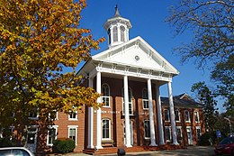
| Seat | Belvidere[3] |
| Largest city | Phillipsburg (population) Hardwick Township (area) |
| Government | |
| • Commissioner director | James R. Kern III (R, term ends December 31, 2021) |
| Area | |
| • Total | 362.86 sq mi (939.8 km2) |
| • Land | 356.92 sq mi (924.4 km2) |
| • Water | 5.94 sq mi (15.4 km2) 1.64% |
| Population (2010) | |
| • Total | 108,692 |
| • Estimate (2019) | 105,267 |
| • Density | 300/sq mi (120/km2) |
| Congressional districts | 5th, 7th |
| Website | www |


Warren County is a county located in the U.S. state of New Jersey. As of the 2019 Census estimate, the county's population was 105,267, making it the 19th-most populous of the state's 21 counties,[4][5][6] representing a decrease of 3.2% from the 108,692 enumerated in the 2010 United States Census,[7] in turn having increased by 6,255 (+6.1%) from 102,437 counted at the 2000 Census,[8][9][10] Its county seat is Belvidere.[3] It is part of the Allentown-Bethlehem-Easton, PA-NJ metropolitan area and is generally considered the eastern border of the Lehigh Valley.[11][12] It shares its eastern border with the New York City metropolitan area,[13] with its northwestern section bordering The Poconos. The most populous place was Phillipsburg, with 14,950 residents at the time of the 2010 Census, while Hardwick Township had both the largest area — 37.92 square miles (98.2 km2) — and the fewest people (1,696).[10]
Warren County was incorporated by an act of the New Jersey Legislature on November 20, 1824, from portions of Sussex County. At its creation, the county consisted of the townships of Greenwich, Independence, Knowlton, Mansfield, Oxford, and Pahaquarry (now defunct).[1] The county was named for Joseph Warren, an American Revolutionary War hero of the Battle of Bunker Hill.[2][14]
Geology and geography[]
According to the 2010 Census, the county had a total area of 362.86 square miles (939.8 km2), including 356.92 square miles (924.4 km2) of land (98.4%) and 5.94 square miles (15.4 km2) of water (1.6%).[10][15]
Warren County has rolling hills, with the Kittatinny Ridge in the west. Allamuchy Mountain and Jenny Jump Mountain are part of the New York – New Jersey Highlands, also known as the Reading Prong. Around 450 million years ago, a chain of volcanic islands collided with proto North America. The chain of islands went over the North American plate, thus the Highlands were created from the island rock and so was the Great Appalachian Valley. The Highlands is Allamuchy Mountains and the Jenny Jump Mountains. Thus, Warren County was born.
Around 400 million years ago, a small continent that was long and thin collided with proto North America. This created the Kittatinny Mountains, as the land was compressed from the collision. The quartzite that was lying in a shallow sea over top of the Martinsburg shale, folded and faulted due to pressure and heat. The quartzite lifted, thus the Kittatinny Mountain was born.
The final collision was when the African plate collided with the North American plate. This was the final episode of the building of the Appalachian Mountains. Then the African plate tore away from North America.
Then the Wisconsin Glacier covered the northern part of the county from 21,000 to 13,000 BC. This glacier covered the top of Kittatinny Mountain and carved the terrain in the northern part of the county. The terminal moraine runs from north of Belvidere to south of Great Meadows to north of Hackettstown, to north of Budd Lake. Blairstown Township, Hope Township, half of Independence Township, part of White Township, and all of Allamuchy Township was covered by the Glacier. When the glacier melted, a lake was formed at Great Meadows. Slowly the lake drained leaving a large flat area filled with organic material.
The county is drained by three rivers. All three rivers are shallow and narrow. They are fresh water rivers that are excellent for fishing. The Paulins Kill drains the western portion of the county. The river flows from Newton to Blairstown Township, and then through Knowlton Township where it drains into the Delaware River. The Pequest River drains the middle of the county flowing from Andover Township through Allamuchy, then to Independence Township where it turns west and flows through White Township and then empties into the Delaware River at Belvidere. The third river is the Musconetcong. Starting at Lake Musconetcong, the river divides the county from Morris and Hunterdon. This river drains the southern portion of the county and empties into the Delaware River near Warren Glen.
Warren County is located in two valleys of the Great Appalachian Valley. The first is the Kittatinny Valley, which is in the northern part of the county, and the Lehigh Valley, which is in the southern part of the county.
The Lehigh Valley starts at the terminal moraine of the Wisconsin Glacier slightly north of Belvidere. It extends from the Delaware River south to where the Musconetcong River goes into the Delaware River, northeast to the Jenny Jump Mountains and then along Route 80 to the Allamuchy Mountains to the terminal moraine near Hackettstown.
The Kittatinny Valley is north of the terminal moraine; it runs north of Belvidere, to south of Great Meadows, then east to the north of Hackettstown. Towns such as Blairstown, Johnsonburg, Hope and Allamuchy are in the Kittatinny Valley
The highest elevation is 1,600 feet (490 m) above sea level on the Kittatinny Ridge, at two areas just south of Upper Yards Creek Reservoir, west of Blairstown.[16] The lowest point is the confluence of the Delaware and Musconetcong rivers at the county's southern tip, at 160 feet (49 m) of elevation.
The highest elevation on Allamuchy Mountain is 1,240 feet (380 m) on the ridge northeast of Allamuchy. On Jenny Jump Mountain the highest point is 1,134 feet (346 m) east of the Shiloh area or south of Interstate 80. Sunfish Pond has an elevation of 1,379 feet (420 m) and upper Yards Creek Reservoir is at 1,555 feet (474 m).[citation needed]
Climate and weather[]
Warren County has a humid continental climate (Dfa/Dfb). Average monthly temperatures in downtown Phillipsburg range from 29.0 °F in January to 74.2 °F in July, while in Hackettstown they range from 27.0 °F in January to 71.5 °F in July. [1] The hardiness zones are 6a and 6b.
| Belvidere, New Jersey | ||||||||||||||||||||||||||||||||||||||||||||||||||||||||||||
|---|---|---|---|---|---|---|---|---|---|---|---|---|---|---|---|---|---|---|---|---|---|---|---|---|---|---|---|---|---|---|---|---|---|---|---|---|---|---|---|---|---|---|---|---|---|---|---|---|---|---|---|---|---|---|---|---|---|---|---|---|
| Climate chart (explanation) | ||||||||||||||||||||||||||||||||||||||||||||||||||||||||||||
| ||||||||||||||||||||||||||||||||||||||||||||||||||||||||||||
| ||||||||||||||||||||||||||||||||||||||||||||||||||||||||||||
In recent years, average temperatures in the county seat of Belvidere have ranged from a low of 19 °F (−7 °C) in January to a high of 85 °F (29 °C) in July, although a record low of −17 °F (−27 °C) was recorded in January 1994 and a record high of 101 °F (38 °C) was recorded in July 1999. Average monthly precipitation ranged from 2.77 inches (70 mm) in February to 4.65 inches (118 mm) in July.[17]
Adjacent counties[]
- Monroe County, Pennsylvania – northwest
- Sussex County – northeast
- Morris County – east
- Bucks County, Pennsylvania – south
- Hunterdon County – south
- Northampton County, Pennsylvania – west
National protected areas[]
- Delaware Water Gap National Recreation Area (part)
- Middle Delaware National Scenic River (part)
History[]
This section may need to be rewritten to comply with Wikipedia's quality standards. (March 2020) |
This section needs additional citations for verification. (March 2020) |
Prehistory[]
After the Wisconsin Glacier melted around 13,000 B.C., the area slowly warmed, but was still cold and wet. Cold water was everywhere due to glacial melt. Huge lakes and swamps were everywhere. There was a huge lake at Great Meadows. At first the area was Tundra, in which lichens and mosses grew. Later, grass lands filled in the landscape. As climate warmed over a thousand years, Taiga/Boreal Forests grew. The water drained slowly from the glacier and so grasslands grew first. Big game such as mastodons, mammoths, and caribou came into the area, as well as other game such as rabbits and fox. These animals ate the lichens, moss and grasses that grew. This is when Paleo Indians moved into the area. The area was rich in wildlife. Paleo Indians lived in small groups and traveled in search of game and plants to eat. They were hunter-gathers. They lived near water and moved after game became scarce in the area. They ate various berries and plants as well as game hunted. They also ate fresh water clams and fish that migrated north in the Delaware River to spawn such as shad and sturgeon. Fish were caught by spears or fish traps made of stones and sticks. The shallow riffles in rivers were used to catch fish.
They made spear points of jasper, quartz, shale, or black chert. They traveled to quarries in search of stones for spear points or they traded with other small groups for these points. They also used atl-atls, which is a stick that throws a dart with a lighter stone point than a spear. Later, coniferous forests grew as the area warmed. Paleo-Indian camp sites are many feet below the present ground surface, making them difficult to locate.
Mastodon bones dating back over 10,000 years have been found in Allamuchy, Blairstown, Hope, Independence, Liberty and Mansfield townships.[18]
The mega fauna of the tundra, such as the caribou, either moved north as the climate warmed or became extinct. Some Paleo Indians moved north with the caribou.
There are four Paleo Indians sites. One is in Warren County and the other three are nearby. The Plenge site located on the north side of the Musconetcong River in Franklin Township, Warren County. This site is estimated at 10,000 B.C. The Zierdt site is located near the Delaware River in Montague Township. The next is the Dutchess Cave in Orange County, New York, just east of the Wallkill River. This site is dated at 10,580 B.C. + or - 370 years. Caribou bones and a spear point was located at this site. The last is the Shawnee site located north of the Delaware Water Gap on the west side of the river, where Broadhead Creek enters the Delaware in Pennsylvania. This site is dated from charcoal found at 8640 B.C. + or - 300 years.
As climate warmed further, hemlock began to grow followed by deciduous trees around 8000 B.C. such as oaks, and maples. This was the beginning of the Archaic period, in which projectile points were no longer fluted but indented at the bottom of the stone point. Oak nuts and other seeds were eaten at this time. Harry's Farm site in Pahaquarry Township is an Archaic hunters camp with charcoal dating at 5430 B.C. + or - 120 years. Also the Plenge site was an Archaic camp in Franklin Township.
As climate warmed further around 3,000 B.C., beech, walnut, hickories, chestnut, and butternut grew. These trees produced nuts for feeding Archaic hunters; Archaic Indian populations grew more rapidly. As populations grew, large families became small tribes in various areas. During this time the 12 prominent hardwood tree species of Eastern North America existed in Warren County, which were Ash, Beech, Birch, Cherry, Chestnut, Elm, Hickory, Maple, Oak, Sweet Gum, Sycamore, and Walnut. The Chestnut tree is now extinct in Warren County, following the Chestnut blight that decimated the eastern U.S. in the earlier twentieth century. The Archaic period lasted from 8000 B.C. to 1000 B.C.
Native Americans[]
Around 1000 B.C. clay pottery was beginning to be used. This was the beginning of the Woodland Period. With this advancement in technology, Native people could cook food better as well as store food.
Technological innovations occurred around the year 500 A. D. with the invention of the bow and arrow; as projectile points became smaller to fit onto an arrow shaft. Now Native Americans could procure more food as they could be further away from game to kill it. Atl-atls were still being used. This allowed Native Americans at this time to procure more food, as game could be taken at a longer distance. Food such as nuts could be stored in clay pots or the pots were used for cooking
Various cultures of indigenous peoples occupied the area at that time.
Eventually ancestors of the Algonquian-speaking Lenape moved into the area, perhaps as early as 1000 AD from the Mississippi River area.
Agriculture also started around that time, with the cultivation of corn, beans, and squash. Seeds were probably procured from traveling groups or tribes. Settlements of family groups became more stable, as they could store food in pottery, as well as procure more game with the bow and arrow. Agriculture contributed to the rise of population density in areas where crops could be grown. The Lenape would tend their oval gardens during the spring and summer months. They fished with nets or by hand in the shallow rivers. The Lenape trapped game with deadfalls and snares.
Problems developed in the early 17th century when the Little Ice Age came to North America. With late frost in May and June and early frosts in August or September, made the growing of crops difficult. Cold weather also made big and small game more difficult to find. as game would go into semi hibernation. Also nut crops from oak, hickory, beech, walnut, butternut, and chestnut, failed at times; making the supply of these nuts scarce. Rivers froze early, and water became cold fast; so fishing became impossible. The Native populations had declined after epidemics of infectious diseases, for which they had no acquired immunity. Native American populations were separated from Europe for thousands of years and had no immunity to these diseases that the Europeans brought with them.[relevant?] Many Native American populations were weakened from starvation due to the Little Ice Age, which was coldest during the 17th century. Their important corn, bean and squash crops failed due to spring frosts and early frosts in autumn. As the Native American population declined, more land was available for European settlement. All these factors made the Native American populations decline dramatically.
Europeans purchased[clarification needed] land known as land patents so Native Americans moved west to Ohio or Canada.
European settlement[]
The Dutch settled the Hudson River Valley and claimed all lands west of the Hudson River in the early 17th century. They claimed all land between the 40th and 45th latitude. They traded with the Native Americans for furs, such as beaver, otter, muskrat, and deer. The Dutch built a fort at the southern end of Manhattan Island known as Fort Amsterdam.[relevant?] This was their main fort in North America. They also had other forts along the Hudson River up to Albany, New York.[relevant?] The English took over the Fort Amsterdam in August 1664 and gain control of the land the Dutch claimed. There was a ten-year war that followed with England and the Netherlands, but the English won.
Since the English owned the Province of New Jersey, it was divided into two parts; East and West Jersey. The Quintipartite Deed of 1674 to 1702; divided the province of Jersey with two surveys: the Keith Line and the Coxe-Barclay line, which created the border of eastern Sussex county from the headwaters of the Pequannock River with a line going northeast to the line of the Province of New Jersey and New York. The western border was the Delaware River.
The area which was to be Warren County was part of Burlington County in 1694. The area became Hunterdon County in 1714. In 1739, the area of Warren County was included in Morris County. Later Sussex County separated from Morris County but the area of which was to be Warren County was included in Sussex County in 1753.[1]
During the French and Indian War of 1754, fortified homes or small forts were built along the Delaware River from Phillipsburg to Port Jervis, New York. The mountains of Warren County were the frontier of the war.[citation needed] Hostilities between the British and the French began to spill over from the European continent into the colonies in the New World. This was due to land claims by the English and French in western Pennsylvania and the Ohio River Valley area.[relevant?] After the battle of Jumonville Glen in southwestern Pennsylvania in May 1754, French colonists in North America armed several Native American tribes. The Native Americans sided with the French due to poor treatment by the British; unfair land purchases, and the Walking Purchase in eastern Pennsylvania of September 1737.[relevant?]
During the French and Indian War (as the Seven Years' War's hostilities in North America were called), Sussex County was often raided by bands of Native Americans, among them members of the Lenape, Shawnee, and Iroquois who fought against white settlers. In 1756, a small band of Lenape raided the homes of local militia commanders, killing several members of the Swartout family and kidnapping other settlers during the Hunt-Swartout Raid. In response to these aggressions, Royal Governor Jonathan Belcher approved a plan for 8 forts to be constructed along the Delaware River to defend the New Jersey frontier from such incursions, and authorized the New Jersey Frontier Guard to man them. Several of these forts were little more than blockhouses, others were personal homes that were fortified. These forts went from Phillipsburg northward to Belvidere in Warren County. Then north of Blairstown to Van Campen's Inn. Then north along the eastern side of the Delaware River to Port Jervis, New York. The first fort was called Fort Reading. This fort was near the Pequest River on the south side of the river near the Belvidere-Riverton Bridge. This fort was built in 1757. The second fort was Ellison's Fort built of stone in Knowlton Township. This fort is located at the Delaware River Family Campground. The trail went through the Kittatinny Mountains north of Blairstown to Colonel Isaac Van Campen's Inn 1742, about 18 miles northeast of Fort Reading. Fort John also called Headquarters Fort was up a hill near Van Campens Fort. The next fortification was Fort Walpack build six miles north of Van Campens Fort in the bow of Walpack Bend around 1756. This is in Walpack Township.[relevant?] About six miles north of Walpack Fort is Fort Nominack 1756, which is located just north of Jager Road and Old Mine Road in Sandyston Township. The next fort was Fort Shipeconk 1757 located 4 miles north of the previous fort. A fortified house owned by Captain Abraham Shimer was very close to Fort Shipeconk. Further north the next fortified house was maintained west of Port Jervis, New York and it was called Fort Cole. After Fort Cole there was Fort Gardner which was located north of Port Jervis below the Great Mountain. After the war ended in 1763, there was very few Native Americans left in Warren county.
In the present-day Phillipsburg area, European settlement occurred in the late 17th century. Surveyors from Philadelphia went north along the Delaware River to survey land. Settlers from Philadelphia moved north into present-day Warren County after colonists purchased land from the Native Americans. As the Native American population declined, more land was available for European settlement.
By the late 1700s/early 1800s, Phillipsburg, Hackettstown, Belvidere, and Washington emerged as small settlements and served as the cornerstone communities in lower Sussex County. In 1824, Warren County was established and Belvidere was named as its county seat.[19]
Demographics[]
| Historical population | |||
|---|---|---|---|
| Census | Pop. | %± | |
| 1830 | 18,627 | — | |
| 1840 | 20,366 | 9.3% | |
| 1850 | 22,358 | 9.8% | |
| 1860 | 28,433 | 27.2% | |
| 1870 | 34,336 | 20.8% | |
| 1880 | 36,589 | 6.6% | |
| 1890 | 36,553 | −0.1% | |
| 1900 | 37,781 | 3.4% | |
| 1910 | 43,187 | 14.3% | |
| 1920 | 45,057 | 4.3% | |
| 1930 | 49,319 | 9.5% | |
| 1940 | 50,181 | 1.7% | |
| 1950 | 54,374 | 8.4% | |
| 1960 | 63,220 | 16.3% | |
| 1970 | 73,960 | 17.0% | |
| 1980 | 84,429 | 14.2% | |
| 1990 | 91,607 | 8.5% | |
| 2000 | 102,437 | 11.8% | |
| 2010 | 108,692 | 6.1% | |
| 2019 (est.) | 105,267 | [4] | −3.2% |
| Historical sources: 1790-1990[20] 1970-2010[10] 2000[8] 2010[7] 2000-2010[21] | |||
2010 Census[]
The 2010 United States census counted 108,692 people, 41,480 households, and 28,870 families in the county. The population density was 304.5 per square mile (117.6/km2). There were 44,925 housing units at an average density of 125.9 per square mile (48.6/km2). The racial makeup was 90.29% (98,137) White, 3.51% (3,818) Black or African American, 0.14% (155) Native American, 2.46% (2,673) Asian, 0.03% (30) Pacific Islander, 1.81% (1,964) from other races, and 1.76% (1,915) from two or more races. Hispanic or Latino of any race were 7.05% (7,659) of the population.[7]
Of the 41,480 households, 31.2% had children under the age of 18; 55.1% were married couples living together; 10.2% had a female householder with no husband present and 30.4% were non-families. Of all households, 25% were made up of individuals and 10.1% had someone living alone who was 65 years of age or older. The average household size was 2.57 and the average family size was 3.1.[7]
23.6% of the population were under the age of 18, 7.9% from 18 to 24, 24.1% from 25 to 44, 30.4% from 45 to 64, and 14.1% who were 65 years of age or older. The median age was 41.5 years. For every 100 females, the population had 94.6 males. For every 100 females ages 18 and older there were 91.5 males.[7]
2000 Census[]
As of the 2000 United States Census[22] there were 102,437 people, 38,660 households, and 27,487 families residing in the county. The population density was 286 people per square mile (111/km2). There were 41,157 housing units at an average density of 115 per square mile (44/km2). The racial makeup of the county was 94.54% White, 1.87% Black or African American, 0.11% Native American, 1.21% Asian, 0.02% Pacific Islander, 1.01% from other races, and 1.24% from two or more races. 3.66% of the population were Hispanic or Latino of any race.[8][23] Among those residents listing their ancestry, 24.1% were of German, 19.7% Irish, 18.7% Italian, 9.8% English, 8.9% Polish and 4.4% American ancestry.[23][24]
There were 38,660 households, out of which 34.70% had children under the age of 18 living with them, 58.20% were married couples living together, 9.20% had a female householder with no husband present, and 28.90% were non-families. 24.00% of all households were made up of individuals, and 10.00% had someone living alone who was 65 years of age or older. The average household size was 2.61 and the average family size was 3.12.[8]
In the county, the population was spread out, with 26.10% under the age of 18, 6.30% from 18 to 24, 31.30% from 25 to 44, 23.50% from 45 to 64, and 12.90% who were 65 years of age or older. The median age was 38 years. For every 100 females there were 94.90 males. For every 100 females age 18 and over, there were 91.10 males.[8]
The median income for a household in the county was $56,100, and the median income for a family was $66,223. Males had a median income of $47,331 versus $31,790 for females. The per capita income for the county was $25,728. About 3.6% of families and 5.4% of the population were below the poverty line, including 5.9% of those under age 18 and 6.7% of those age 65 or over.[23][25]
Municipalities[]


Municipalities in Warren County, with Census-designated places (CDPs) and other communities listed, are:[26]
| Municipality (with map key) |
Map key | Mun. type |
Pop. | Housing units |
Total area |
Water area |
Land Area |
Pop. density |
Housing density |
School district | Communities[27] |
|---|---|---|---|---|---|---|---|---|---|---|---|
| Allamuchy Township |
17 | township | 4,323 | 2,096 | 20.76 | 0.31 | 20.45 | 211.3 | 102.5 | Hackettstown (9-12) (S/R) Allamuchy (PK-8) |
Allamuchy CDP (78) Panther Valley CDP (3,327) |
| Alpha | 5 | borough | 2,369 | 1,032 | 1.70 | 0.03 | 1.67 | 1,417.2 | 617.4 | Phillipsburg (9-12) (S/R) Alpha (PK-8) |
|
| Belvidere | 3 | town | 2,681 | 1,140 | 1.49 | 0.04 | 1.45 | 1,847.0 | 785.4 | Belvidere | |
| Blairstown Township |
21 | township | 5,967 | 2,272 | 31.70 | 0.89 | 30.82 | 193.6 | 73.7 | North Warren (7-12) Blairstown (K-6) |
Blairstown CDP (515) Jacksonburg Paulina |
| Franklin Township |
10 | township | 3,176 | 1,219 | 24.13 | 0.09 | 24.04 | 132.1 | 50.7 | Warren Hills (7-12) Franklin Township (PK-6) |
Asbury CDP (273) Broadway CDP (244) New Village CDP (421) |
| Frelinghuysen Township |
18 | township | 2,230 | 826 | 23.57 | 0.24 | 23.32 | 95.6 | 35.4 | North Warren (7-12) Frelinghuysen (PK-6) |
Johnsonburg CDP (101) Marksboro CDP (82) |
| Greenwich Township |
7 | township | 5,712 | 1,870 | 10.54 | 0.01 | 10.53 | 542.5 | 177.6 | Phillipsburg (9-12) (S/R) Greenwich (PK-8) |
Greenwich CDP (2,755) Stewartsville CDP (349) Upper Stewartsville CDP (212) |
| Hackettstown | 1 | town | 9,724 | 3,755 | 3.71 | 0.10 | 3.61 | 2,696.1 | 1,041.1 | Hackettstown | |
| Hardwick Township |
22 | township | 1,696 | 619 | 37.92 | 1.32 | 36.60 | 46.3 | 16.9 | North Warren (7-12) Blairstown (K-6) |
|
| Harmony Township |
9 | township | 2,667 | 1,109 | 24.08 | 0.38 | 23.70 | 112.5 | 46.8 | Belvidere (9-12) (S/R) Harmony (PK-8) |
Brainards CDP (202) Harmony CDP (441) Hutchinson CDP (135) |
| Hope Township |
19 | township | 1,952 | 809 | 18.84 | 0.22 | 18.62 | 104.8 | 43.4 | Belvidere (9-12) (S/R) Hope Township (PK-8) |
Hope CDP (195) Mount Hermon CDP (141) Silver Lake CDP (368) |
| Independence Township |
16 | township | 5,662 | 2,325 | 19.89 | 0.15 | 19.74 | 286.8 | 117.8 | Hackettstown (9-12) (S/R) Great Meadows (K-8) |
Great Meadows CDP (303) Vienna CDP (981) |
| Knowlton Township |
20 | township | 3,055 | 1,212 | 25.33 | 0.58 | 24.75 | 123.4 | 49.0 | North Warren (7-12) Knowlton (PK-6) |
Columbia CDP (229) Delaware CDP (150) Hainesburg CDP (91) Warrington |
| Liberty Township |
14 | township | 2,942 | 1,151 | 11.87 | 0.26 | 11.60 | 253.6 | 99.2 | Hackettstown (9-12) (S/R) Great Meadows (K-8) |
Mountain Lake CDP (575) Townsbury |
| Lopatcong Township |
8 | township | 8,014 | 3,420 | 7.16 | 0.06 | 7.10 | 1,129.0 | 481.8 | Phillipsburg (9-12) (S/R) Lopatcong (PK-8) |
Delaware Park CDP (700) Lopatcong Overlook CDP (734) |
| Mansfield Township |
15 | township | 7,725 | 3,316 | 29.93 | 0.11 | 29.82 | 259.1 | 111.2 | Warren Hills (7-12) Mansfield (PK-6) |
Anderson CDP (342) Beattystown CDP (4,554) Port Murray CDP (129) |
| Oxford Township |
12 | township | 2,514 | 1,033 | 5.89 | 0.10 | 5.79 | 434.5 | 178.5 | Warren Hills (9-12) (S/R) Oxford (K-8) |
Oxford CDP (1,090) |
| Phillipsburg | 4 | town | 14,950 | 6,607 | 3.31 | 0.12 | 3.19 | 4,682.1 | 2,069.2 | Phillipsburg | |
| Pohatcong Township |
6 | township | 3,339 | 1,420 | 13.71 | 0.36 | 13.36 | 250.0 | 106.3 | Phillipsburg (9-12) (S/R) Pohatcong (PK-8) |
Carpentersville Finesville CDP (175) Hughesville Upper Pohatcong CDP (1,781) |
| Washington Borough |
2 | borough | 6,461 | 2,897 | 1.95 | 0.00 | 1.94 | 3,326.8 | 1,491.7 | Warren Hills (7-12) Washington Borough (PK-6) |
|
| Washington Township |
11 | township | 6,651 | 2,493 | 17.75 | 0.09 | 17.66 | 376.6 | 141.1 | Warren Hills (7-12) Washington Township (PK-6) |
Brass Castle CDP (1,555) Changewater Port Colden CDP (122) |
| White Township |
13 | township | 4,882 | 2,304 | 27.63 | 0.48 | 27.15 | 179.8 | 84.9 | Belvidere (9-12) (S/R) White Township (PK-8) |
Bridgeville CDP (106) Brookfield CDP (675) Buttzville CDP (146) Foul Rift (ghost town) |
| Warren County | county | 108,692 | 44,925 | 362.86 | 5.94 | 356.92 | 304.5 | 125.9 |
Zip Code locations[]
|
|
|
|
Government[]
Warren County is governed by a three-member Board of Chosen Freeholders. The members are elected at large to serve three-year terms. One Freeholder seat comes up for election each year. The Freeholder Board is the center of legislative and administrative responsibility and, as such, performs a dual role. As legislators they draw up and adopt a budget, and in the role of administrators they are responsible for spending the funds they have appropriated. In 2016, freeholders were paid $24,000 and the Freeholder director had an annual salary of $25,000.[30]
As of 2019, Warren County's Freeholders are:[31][32]
- Freeholder Director Jason J. Sarnoski (R, Franklin Township; term as freeholder and freeholder directory ends December 31, 2019)
- Freeholder Deputy Director Richard D. Gardner (R, Franklin Township; term as freeholder ends 2021, term as deputy director ends 2019)
- James R. Kern III (R, Pohatcong Township; 2022)
Pursuant to Article VII Section II of the New Jersey State Constitution, each county in New Jersey is required to have three elected administrative officials known as "constitutional officers." These officers are the County Clerk and County Surrogate (both elected for five-year terms of office) and the County Sheriff (elected for a three-year term).[33] Constitutional officers of Warren County are:[31][34]
- County Clerk Holly Mackey (R, Blairstown; 2017)[35][36]
- Sheriff James McDonald Sr. (R, Phillipsburg; 2019)[37][38]
- Surrogate Kevin O'Neill (R, Hackettstown; 2020)[39][40]
The County Prosecutor is Richard T. Burke of Hackettstown, who was nominated by Governor of New Jersey Chris Christie and sworn into office in March 2012 after being confirmed by the New Jersey Senate.[41][42]
Warren County is a part of Vicinage 13 of the New Jersey Superior Court (along with Somerset County and Hunterdon County), which is seated at the Somerset County Courthouse in Somerville; the Assignment Judge for Vicinage 15 is the Honorable Yolanda Ciccone. The Warren County Courthouse is in Belvidere.[43] Law enforcement at the county level is provided by the Warren County Sheriff's Office and the Warren County Prosecutor's Office.
Two Congressional Districts cover the county, including portions of the 5th District and 7th District.[44][45] For the 117th United States Congress, New Jersey's Fifth Congressional District is represented by Josh Gottheimer (D, Wyckoff).[46][47] For the 117th United States Congress. New Jersey's Seventh Congressional District is represented by Tom Malinowski (D, East Amwell Township).[48]
State Representatives[]
The 22 municipalities of Warren County are represented by two separate legislative districts .[49][50]
| District | Senator[51] | Assembly[51] | Municiaplties |
|---|---|---|---|
| 23rd | Michael J. Doherty (R) | John DiMaio (R)
Erik Peterson (R) |
Alpha (2,082), Franklin Township (3,046), Greenwich Township (5,712), Hackettstown (9,485), Harmony (2,486),
Lopatcong (8,322), Mansfield Township (7,384), Phillipsburg (14,344), Pohatcong (3,197), Washington Borough (6,490) and Washington Township (6,651). The remainder of this district covers portions of Hunterdon County & Somerset County. |
| 24th | Steve Oroho (R) | Parker Space (R)
Harold J. Wirths (R) |
Allamuchy (4,640), Belvidere (2,590), Blairstown (5,728), Frelinghuysen (2,178), Hardwick (1,631),
Hope (1,952), Independence (5,444), Knowlton (2,945), Liberty (2,820), Oxford Township (2,433) and White Township (4,687). The remainder of this district covers portions of Morris County and the entirety of Sussex County. |
Emergency services are provided by the Warren County Public Safety Department[52] and the county's municipal fire and police departments.
Freeholders[]
Current
- 2019- (present) James R. Kern III (R)
- 2011- (present) Jason Sarnoski (R)
- 2003- (present) Richard Gardner (R)
Former
- 2012-2018 Edward Smith (R)
- 2004-12 - Everett Chamberlain (R)
- 2010 - Angelo Accetturo (R)
- 2001-03 - Michael J. Doherty (R)
- 2001-09 - John DiMaio (R)
- 2000-02 - James DeBosh (D)
- 1997-99 - Stephen Lance (R)
- 1996-00 - Ann Stone (D)
- 1993-01 - Susan Dickey (R)
- 1989-94 - Jacob Matthenius (R)
- 1988-96 - Kenneth Miller (R)
- 1986-88 - Anthony Fowler (R)
- 1984-87 - Charles Lee (R)
- 1981-83 - George Thompson (R)
- 1980-82 - Kenneth Keyes (R)
- 1979-81 - Chuck Haytaian (R)
- 1977-79 - Christopher Maier (D)
- 1976-78 - Irene Smith (D)
- 1975-77 - Benjamin Bosco (D)
- 1974-76 - Raymond Stem (D)
- 1973-75 - Frank Seney (R)
- 1968-73 - Herman Shotwell (D)
Political outlook and elections[]
Warren County has long been consistently conservative county in local, state, and national elections, much like the neighboring counties of Sussex and Hunterdon. All of its state legislators and countywide elected officials are Republicans.
As of August 1, 2020, there were a total of 81,863 registered voters in Warren County, of which 21,116 (25.8%) were registered as Democrats, 32,004 (39.1%) were registered as Republicans and 27,721 (33.9%) were registered as Unaffiliated. There were 1,022 (1.3%) voters registered to other parties.[53]
In the 2004 U.S. presidential election, George W. Bush carried the county by a 24% margin over John Kerry, the second-highest margin for Bush in the state behind Sussex County.[54] In the 2008 U.S. presidential election, John McCain carried Warren County by a 14% margin over Barack Obama, with Obama winning statewide by 15.5% over McCain.[55] In the 2012 U.S. presidential election, Mitt Romney carried the county by a 15.4% margin over Barack Obama. In the 2016 U.S. presidential election, Donald Trump carried the county by a 25.3% margin over Hillary Clinton. In 2020, Trump carried Warren County by a 16.1% margin over Joe Biden.
In the state's 2005 gubernatorial election, Warren County voted for Doug Forrester by 21 points over statewide winner Jon Corzine.[57] In the 2009 Gubernatorial Election, Republican Chris Christie received 61% of the vote, defeating Democrat Jon Corzine, who received around 26%. In the 2013 gubernatorial election, Chris Christie received 72.6% of the vote, defeating Democratic challenger Barbara Buono, who received 25% of the vote. In the 2017 gubernatorial election, Republican Kim Guadango received 61.2% of the vote, while the eventual statewide winner Democrat Phil Murphy received 25.4% of the vote.
Transportation[]
Roads and highways[]
As of 2010, the county had a total of 1,055.07 miles (1,697.97 km) of roadways, of which 690.53 miles (1,111.30 km) were maintained by the local municipality, 256.15 miles (412.23 km) by Warren County and 103.20 miles (166.08 km) by the New Jersey Department of Transportation and 5.19 miles (8.35 km) by the Delaware River Joint Toll Bridge Commission.[58]
The county has a few notable state and federal roads. The chief state routes are Route 31, a north–south road that runs from Buttzville in White Township to Trenton, and Route 57 that runs between Lopatcong Township to Hackettstown. Route 94 in the northern part runs through Blairstown into New York via Newton and the rest of Sussex County. Route 173 runs near Bloomsbury into Hunterdon County, terminating at Clinton/Annandale, and Route 182 serves as one of the commercial areas of Hackettstown. The US Routes are U.S. Route 22 in the Phillipsburg area and U.S. Route 46 runs from Columbia to Hackettstown in the northern section. The two interstates that pass through are the Phillipsburg-Newark Expressway (Interstate 78), and the Bergen-Passaic Expressway (Interstate 80).
Rail and bus transportation[]
Warren County has a single NJ Transit train stop, located at the Hackettstown station on the Montclair-Boonton Line.[59]
The Norfolk Southern Railway's Lehigh Line (formerly the mainline of the Lehigh Valley Railroad), runs through the southern Warren County on its way to Phillipsburg.
Warren County also contracts with Easton Coach to provide demand-responsive service, as well as limited fixed-route service along the Route 31 and Route 57 corridors.[60][61] NJ Transit operates the #890 & #891 buses in the Phillipsburg area.
By air, the county is served by Lehigh Valley International Airport near Allentown, Pennsylvania to the west and Newark Liberty International Airport to the east.
Education[]
Colleges[]
- Centenary University is a private college located in Hackettstown that is affiliated with the United Methodist Church.[62]
- Warren County Community College, in Washington Township, offers both associate and bachelor's degree programs and certificate programs. The College serves approximately 1,700 full-time and part-time students, in addition to students in non-credit programs and courses. The college is able to offer bachelor programs through partnerships with four-year colleges.[63]
Private secondary schools[]
- Blair Academy is a college preparatory school located in Blairstown, founded in 1848 with a gift from John Insley Blair.[64]
Public education[]
- Belvidere High School, a part of the Belvidere School District (PreK-12) with students attending from Harmony, Hope and White townships[65]
- Hackettstown High School, a part of the Hackettstown School District (PreK-12) with students from Allamuchy, Independence, and Liberty townships[66]
- North Warren Regional High School, which serves the northern townships of Blairstown (where the school is located), Frelinghuysen, Hardwick and Knowlton[67]
- Phillipsburg High School, a part of the Phillipsburg School District (PreK-12) with students attending from Alpha Borough and the Townships of Greenwich, Lopatcong and Pohatcong.[68]
- Warren Hills Regional High School, a part of the Warren Hills Regional School District that serves the Borough of Washington, and the Townships of Washington, Mansfield, Franklin and Oxford (9-12 only)[69]
- Warren County Technical School serves the entire county. It includes grades 9-12 and also has a post secondary night school.
Agriculture[]

Most of Warren County is part of the Warren Hills Viticultural Area, and the county has 5 active wineries:
Recreation[]
Warren County borders the Delaware Water Gap National Recreation Area.
Warren County has many areas for hunting and fishing. The New Jersey Division of Fish and Wildlife houses its Pequest Fish Hatchery, which produces trout and other fish, in Warren County about five miles northeast of Oxford, along U.S. Route 46. Thousands of trout are raised in this hatchery and also serves as an educational center for other outdoor activity.[70] Wildlife Management Areas in the county include White Lake, Oxford Lake, and the Pequest River W.M.A. The five major rivers or creeks for fishing in Warren County are the Paulinskill, the Pequest, the Musconetcong, Pohatcong Creek, as well as the Delaware River. Merrill Creek Reservoir, located in Harmony Township, is also stocked with fish and has game in the surrounding woods.
See also[]
- National Register of Historic Places listings in Warren County, New Jersey
- Media in the Lehigh Valley
- Musconetcong County, New Jersey, a proposed county in the 19th Century from parts of Warren and Hunterdon Counties
References[]
- ^ Jump up to: a b c Snyder, John P. The Story of New Jersey's Civil Boundaries: 1606-1968 Archived 2012-06-05 at the Wayback Machine, Bureau of Geology and Topography; Trenton, New Jersey; 1969. p. 245. Accessed January 21, 2013.
- ^ Jump up to: a b Hutchinson, Viola L. The Origin of New Jersey Place Names Archived 2015-09-23 at Wikiwix, New Jersey Public Library Commission, May 1945. Accessed October 30, 2017.
- ^ Jump up to: a b New Jersey County Map Archived 2017-03-13 at the Wayback Machine, New Jersey Department of State. Accessed July 10, 2017.
- ^ Jump up to: a b QuickFacts - Warren County, New Jersey; New Jersey; United States Archived 2018-05-09 at the Wayback Machine, United States Census Bureau. Accessed March 24, 2018.
- ^ Annual Estimates of the Resident Population: April 1, 2010 to July 1, 2017 - 2017 Population Estimates Archived February 13, 2020, at archive.today, United States Census Bureau. Accessed March 24, 2018.
- ^ GCT-PEPANNCHG: Estimates of Resident Population Change and Rankings: July 1, 2016 to July 1, 2017 - State -- County / County Equivalent from the 2017 Population Estimates for New Jersey Archived February 13, 2020, at archive.today, United States Census Bureau. Accessed March 24, 2018.
- ^ Jump up to: a b c d e DP1 - Profile of General Population and Housing Characteristics: 2010 Demographic Profile Data for Warren County, New Jersey, United States Census Bureau. Accessed March 26, 2016.
- ^ Jump up to: a b c d e DP-1 - Profile of General Demographic Characteristics: 2000; Census 2000 Summary File 1 (SF 1) 100-Percent Data for Warren County, New Jersey, United States Census Bureau. Accessed September 30, 2013.
- ^ NJ Labor Market Views Archived 2013-09-20 at the Wayback Machine, New Jersey Department of Labor and Workforce Development, March 15, 2011. Accessed October 7, 2013.
- ^ Jump up to: a b c d New Jersey: 2010 - Population and Housing Unit Counts; 2010 Census of Population and Housing Archived 2013-07-23 at the Wayback Machine, p. 6, CPH-2-32. United States Census Bureau, August 2012. Accessed August 29, 2016.
- ^ May 2012 Metropolitan and Nonmetropolitan Area Definitions Archived June 2, 2013, at the Wayback Machine, Bureau of Labor Statistics. Accessed October 7, 2013.
- ^ Revised Delineations of Metropolitan Statistical Areas, Micropolitan Statistical Areas, and Combined Statistical Areas, and Guidance on Uses of the Delineations of These Areas Archived 2017-01-21 at the Wayback Machine, Office of Management and Budget, February 28, 2013. Accessed October 7, 2013.
- ^ New York-Newark, NY-NJ-CT-PA Combined Statistical Area Archived 2014-12-29 at the Wayback Machine, United States Census Bureau. Accessed February 8, 2018.
- ^ About Warren County...Past and Present Archived October 23, 2013, at the Wayback Machine, Warren County, New Jersey. Accessed October 7, 2013. "The county was named in honor of Dr. Joseph Warren who, although he had no known association with the area, earned a heroic reputation throughout the original 13 states for his devotion to the revolutionary cause, which led to his death in the battle of Bunker Hill."
- ^ Census 2010 U.S. Gazetteer Files: New Jersey Counties, United States Census Bureau, Backed up by the Internet Archive as of June 11, 2012. Accessed October 7, 2013.
- ^ New Jersey County High Points Archived 2015-05-18 at the Wayback Machine, Peakbagger.com. Accessed October 2, 2013.
- ^ Jump up to: a b Monthly Averages for Belvidere, New Jersey, [[ The Weather Channel]]. Accessed October 13, 2012.
- ^ "Garden State Mastodons" (PDF). New Jersey Geologic and Water Survey. 2018.
- ^ Morgan, Susan. "HISTORIC SITES OF WARREN COUNTY" (PDF). Warren County Cultural and Heritage Commission. Archived (PDF) from the original on January 13, 2020.
- ^ Forstall, Richard L. Population of states and counties of the United States: 1790 to 1990 from the Twenty-one Decennial Censuses, pp. 108-109. United States Census Bureau, March 1996. ISBN 9780934213486. Accessed October 7, 2013.
- ^ U.S. Census Bureau Delivers New Jersey's 2010 Census Population Totals Archived February 8, 2011, at the Wayback Machine, United States Census Bureau, February 3, 2011. Accessed February 5, 2011.
- ^ U.S. Census website , United States Census Bureau. Accessed September 4, 2014.
- ^ Jump up to: a b c Tables DP-1 to DP-4 from Census 2000 for Warren County, New Jersey, United States Census Bureau, backed up by the Internet Archive as of May 18, 2011. Accessed October 1, 2013.
- ^ DP-2 - Profile of Selected Social Characteristics: 2000 from the Census 2000 Summary File 3 (SF 3) - Sample Data for Warren County, New Jersey, United States Census Bureau. Accessed September 30, 2013.
- ^ DP-3 - Profile of Selected Economic Characteristics: 2000 from Census 2000 Summary File 3 (SF 3) - Sample Data for Warren County, New Jersey, United States Census Bureau. Accessed September 30, 2013.
- ^ GCT-PH1: Population, Housing Units, Area, and Density: 2010 – County – County Subdivision and Place from the 2010 Census Summary File 1 for Warren County, New Jersey, United States Census Bureau. Accessed March 26, 2017.
- ^ Locality Search Archived July 9, 2016, at the Wayback Machine, State of New Jersey. Accessed March 26, 2017.
- ^ https://www.zip-codes.com/state/nj.asp
- ^ https://www.cccarto.com/nj/warren_zipcodes/index.html
- ^ Gallo Jr., Bill. "Which N.J. county freeholders are paid the most?" Archived 2017-10-26 at the Wayback Machine, NJ.com, March 11, 2016. Accessed October 25, 2017. "Freeholder director: $25,000; Other freeholders: $24,000"
- ^ Jump up to: a b Archived 2016-10-12 at the Wayback Machine, Warren County, New Jersey. Accessed October 22, 2017.
- ^ Board of Chosen Freeholders Archived 2007-03-07 at the Wayback Machine, Warren County, New Jersey. Accessed October 22, 2017.
- ^ New Jersey State Constitution (1947), Article VII, Section II, Paragraph 2 Archived 2014-11-01 at the Wayback Machine, New Jersey Department of State. Accessed October 26, 2017.
- ^ Constitutional Officers Archived 2013-08-09 at the Wayback Machine, Warren County, New Jersey. Accessed October 22, 2017.
- ^ County Clerk's Office Archived 2017-10-20 at the Wayback Machine, Warren County, New Jersey. Accessed October 22, 2017.
- ^ Members List: Clerks Archived 2017-10-23 at the Wayback Machine, Constitutional Officers Association of New Jersey. Accessed October 22, 2017.
- ^ About the Warren County Sheriff's Office Archived 2017-09-25 at the Wayback Machine, Warren County Sheriff's Office. Accessed October 22, 2017.
- ^ Members List: Sheriffs Archived 2017-10-23 at the Wayback Machine, Constitutional Officers Association of New Jersey. Accessed October 22, 2017.
- ^ Office of the Surroagte Archived 2017-10-23 at the Wayback Machine, Warren County, New Jersey. Accessed October 22, 2017.
- ^ Members List: Surrogates Archived 2017-10-23 at the Wayback Machine, Constitutional Officers Association of New Jersey. Accessed October 22, 2017.
- ^ Brenzel, Kathryn. "New Warren County Prosecutor Richard T. Burke sworn in" Archived 2017-10-23 at the Wayback Machine, The Express-Times, March 30, 2012. Accessed October 22, 2017. "Richard T. Burke was sworn in today as the 24th prosecutor of Warren County in a ceremony at the county courthouse in Belvidere. Gov. Chris Christie nominated Burke in December and renominated him in January at the start of a new legislative session. The state Senate confirmed him March 15 to succeed Prosecutor Thomas S. Ferguson."
- ^ "Governor Chris Christie Files Nominations" Archived 2016-06-21 at the Wayback Machine, Governor of New Jersey Chris Christie, press release dated January 18, 2012. Accessed November 1, 2017. "WARREN COUNTY PROSECUTOR - Nominate for appointment Richard T. Burke (Hackettstown, Warren)"
- ^ Somerset / Hunterdon / Warren Vicinage Archived 2017-10-11 at the Wayback Machine, New Jersey Courts. Accessed October 22, 2017.
- ^ 2012 Congressional Districts by County Archived 2012-05-26 at the Wayback Machine, New Jersey Department of State Division of Elections. Accessed October 7, 2013.
- ^ Plan Components Report Archived 2013-12-04 at the Wayback Machine, New Jersey Department of State Division of Elections, December 23, 2011. Accessed October 7, 2013.
- ^ Directory of Representatives: New Jersey, United States House of Representatives. Accessed January 3, 2019.
- ^ Biography, Congressman Josh Gottheimer. Accessed January 3, 2019. "Josh now lives in Wyckoff, New Jersey with Marla, his wife who was a federal prosecutor, and their two young children, Ellie and Ben."
- ^ Directory of Representatives: New Jersey, United States House of Representatives. Accessed June 1, 2020.
- ^ "County of Warren, NJ - All about Warren County...Institutions of Learning". www.co.warren.nj.us. Retrieved 2021-04-30.
- ^ "County of Warren, NJ - Freeholders". www.co.warren.nj.us. Retrieved 2021-04-30.
- ^ Jump up to: a b "New Jersey Legislature - Legislative Roster". www.njleg.state.nj.us. Retrieved 2021-04-30.
- ^ Warren County Department of Public Safety Archived 2017-10-21 at the Wayback Machine, Warren County, New Jersey. Accessed October 22, 2017.
- ^ "NJ Voter Registration by County" (PDF). NJ DOS - NJ Division of Elections.
- ^ New Jersey Presidential Election Returns by County 2004 Archived 2008-09-14 at the Wayback Machine, Eagleton Institute of Politics at Rutgers University. Accessed August 28, 2008.
- ^ Leip, David. "Dave Leip's Atlas of U.S. Presidential Elections". www.uselectionatlas.org. Archived from the original on 22 July 2010. Retrieved 9 May 2018.
- ^ Leip, David. "Dave Leip's Atlas of U.S. Presidential Elections". uselectionatlas.org. Archived from the original on March 23, 2018. Retrieved May 9, 2018.
- ^ 2005 Gubernatorial General Election Results – Warren County, NJ Archived June 5, 2011, at the Wayback Machine, Atlas of U.S. Presidential Elections. Accessed August 28, 2008.
- ^ Warren County Mileage by Municipality and Jurisdiction Archived 2014-07-23 at the Wayback Machine, New Jersey Department of Transportation, May 2010. Accessed July 18, 2014.
- ^ Montclair-Boonton Line Archived December 1, 2010, at the Wayback Machine, NJ Transit. Accessed October 7, 2013.
- ^ Warren County Transportation (WCT) Shuttles And Demand Response Archived 2015-03-13 at the Wayback Machine, Warren County, New Jersey. Accessed December 30, 2017.
- ^ 31 Ride Archived 2017-09-22 at the Wayback Machine, Warren County, New Jersey. Accessed December 30, 2017.
- ^ History Archived 2012-07-08 at the Wayback Machine, Centenary College of New Jersey. Accessed October 7, 2013.
- ^ College History, Warren County Community College. Accessed October 7, 2013.
- ^ Blair at a Glance Archived December 19, 2012, at the Wayback Machine, Blair Academy. Accessed October 7, 2013.
- ^ Belvidere High School 2016 Report Card Narrative Archived 2017-08-08 at the Wayback Machine, New Jersey Department of Education. Accessed November 1, 2017. "The District serves students from the Belvidere K-12 district and three surrounding K-8 districts; Hope, Harmony, and White."
- ^ Hackettstown High School 2013 Report Card Narrative Archived 2016-06-24 at the Wayback Machine, New Jersey Department of Education. Accessed November 1, 2017. "Hackettstown High School serves the communities of Hackettstown, Allamuchy, Independence, and Liberty."
- ^ North Warren Regional High School 2014 Report Card Narrative Archived 2016-06-24 at the Wayback Machine, New Jersey Department of Education. Accessed November 1, 2017. "The North Warren Regional School District is home to approximately 950 students from the communities of Blairstown, Frelinghuysen, Hardwick, and Knowlton.
- ^ Phillipsburg High School 2016 Report Card Narrative Archived 2017-04-14 at the Wayback Machine, New Jersey Department of Education. Accessed November 1, 2017. "At the secondary level, the district serves not only students from the town of Phillipsburg which makes up 41% of the high school population, but also students from the surrounding boroughs of Alpha and Bloomsbury, as well as the townships of Greenwich, Lopatcong, and Pohatcong."
- ^ Warren Hills Regional School District 2014 Report Card Narrative Archived 2016-06-24 at the Wayback Machine, New Jersey Department of Education. Accessed November 1, 2017. "From the receiving districts of Franklin Township, Mansfield Township, Oxford (high school tuition students), Washington Borough and Washington Township, students progress along the academic continuum led by a faculty committed to planning and implementing a variety of instructional strategies and activities that facilitate the preparation of our students for the challenge of mastering the New Jersey Core Curriculum Content Standards and the Common Core State Standards."
- ^ The Pequest Trout Hatchery and Natural Resource Education Center Archived 2005-09-20 at the Wayback Machine, New Jersey Department of Environmental Protection Division of Fish and Wildlife. Accessed November 1, 2017.
External links[]
 Media related to Warren County, New Jersey at Wikimedia Commons
- Official County Website
- "Living in the Greater Lehigh Valley," by The Allentown Morning Call
- Warren County news at Lehigh Valley Live
| show Places adjacent to Warren County, New Jersey |
|---|
| show Municipalities and communities of Warren County, New Jersey, United States |
|---|

| show |
|---|
| show Authority control |
|---|
- New Jersey counties
- Warren County, New Jersey
- 1824 establishments in New Jersey
- North Jersey
- Populated places established in 1824