Blue Jay, Ohio
Blue Jay, Ohio | |
|---|---|
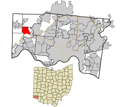 Location in Hamilton County and the state of Ohio. | |
| Coordinates: 39°13′37″N 84°44′13″W / 39.22694°N 84.73694°WCoordinates: 39°13′37″N 84°44′13″W / 39.22694°N 84.73694°W | |
| Country | United States |
| State | Ohio |
| County | Hamilton |
| Area | |
| • Total | 4.4 sq mi (11.4 km2) |
| • Land | 4.4 sq mi (11.3 km2) |
| • Water | 0.04 sq mi (0.1 km2) |
| Elevation | 782 ft (238 m) |
| Population (2010) | |
| • Total | 959 |
| • Density | 220/sq mi (84/km2) |
| FIPS code | 39-07377[2] |
| GNIS feature ID | 1064459[1] |

Blue Jay is a census-designated place (CDP) in Whitewater Township, Hamilton County, Ohio, United States. The population was 959 at the 2010 census. Abundant with wild life and directly adjacent to white water park.[3]
Geography[]
Blue Jay is located at 39°13′37″N 84°44′13″W / 39.22694°N 84.73694°W,[4] along Harrison Pike, 18 miles (29 km) northwest of Cincinnati. An interchange between Interstate 74 and Interstate 275 is south of the center of the CDP. Harrison, Ohio is located just west of Blue Jay.
According to the United States Census Bureau, the CDP has a total area of 4.4 square miles (11.4 km2), of which 4.4 square miles (11.3 km2) is land and 0.04 square miles (0.1 km2), or 0.79%, is water.[3]
Recreation[]
The Miami View Golf Club is located just east of Blue Jay in Miamitown, Ohio. It is an 18- hole golf course established in 1960.
References[]
- ^ a b "US Board on Geographic Names". United States Geological Survey. 2007-10-25. Retrieved 2008-01-31.
- ^ "U.S. Census website". United States Census Bureau. Retrieved 2008-01-31.
- ^ a b "Geographic Identifiers: 2010 Demographic Profile Data (G001): Blue Jay CDP, Ohio". U.S. Census Bureau, American Factfinder. Archived from the original on February 12, 2020. Retrieved November 13, 2012.
- ^ "US Gazetteer files: 2010, 2000, and 1990". United States Census Bureau. 2011-02-12. Retrieved 2011-04-23.
Municipalities and communities of Hamilton County, Ohio, United States | ||
|---|---|---|
| Cities |  | |
| Villages | ||
| Townships | ||
| CDPs |
| |
| Other communities | ||
| Footnotes | ‡This populated place also has portions in an adjacent county or counties | |
| ||
- Census-designated places in Hamilton County, Ohio
- Census-designated places in Ohio