Bourscheid, Luxembourg
Bourscheid
Buerschent | |
|---|---|
Commune | |
 | |
 Coat of arms | |
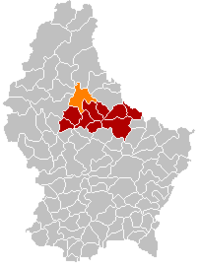 Map of Luxembourg with Bourscheid highlighted in orange, and the canton in dark red | |
| Coordinates: 49°54′33″N 6°03′46″E / 49.909167°N 6.062778°ECoordinates: 49°54′33″N 6°03′46″E / 49.909167°N 6.062778°E | |
| Country | |
| Canton | Diekirch |
| Area | |
| • Total | 36.86 km2 (14.23 sq mi) |
| Area rank | 17th of 102 |
| Highest elevation | 513 m (1,683 ft) |
| • Rank | 17th of 102 |
| Lowest elevation | 207 m (679 ft) |
| • Rank | 27th of 102 |
| Population (2018) | |
| • Total | 1,764 |
| • Rank | 83rd of 102 |
| • Density | 48/km2 (120/sq mi) |
| • Density rank | 96th of 102 |
| Time zone | UTC+1 (CET) |
| • Summer (DST) | UTC+2 (CEST) |
| LU0000602 | |

Bourscheid (Luxembourgish: Buerschent [ˈbuːɐ̯ʃənt]; German: Burscheid) is a commune and small town in north-eastern Luxembourg. It is part of the canton of Diekirch, which is part of the district of Diekirch.
As of 2005, the town of Bourscheid, which lies in the centre of the commune, had a population of 266, which subsequently increased to 529 by 2019.[1] Other settlements within the commune include Goebelsmuhle, Lipperscheid, Michelau, Schlindermanderscheid, and Welscheid.
Bourscheid Castle located close to the village is Luxembourg's largest and one of the most important medieval castles between the Meuse and the Rhine.[2]

Bourscheid Castle
References[]
- ^ "De Buurschter" (PDF). June 2019. p. 11.
- ^ "Château de Bourscheid" Archived December 20, 2009, at the Wayback Machine, Bourscheid castle. (in English) Retrieved 18 October 2012.
External links[]
 Media related to Bourscheid at Wikimedia Commons
| show Places adjacent to Bourscheid, Luxembourg |
|---|

| show Authority control |
|---|
This article related to the geography of Diekirch canton is a stub. You can help Wikipedia by . |
Categories:
- Bourscheid, Luxembourg
- Communes in Diekirch (canton)
- Towns in Luxembourg
- Luxembourg geography stubs