Boyacá, Boyacá
Boyacá | |
|---|---|
Municipality and town | |
 Church of Boyacá | |
 Flag | |
 Location of the municipality and town of Boyacá in the Boyacá department of Colombia | |
| Country | |
| Department | Boyacá Department |
| Province | Márquez Province |
| Founded | 8 August 1537 |
| Founded by | Gonzalo Jiménez de Quesada |
| Government | |
| • Mayor | Rafael Antonio Rátiva Díaz (2020-2023) |
| Area | |
| • Municipality and town | 48 km2 (19 sq mi) |
| Elevation | 2,420 m (7,940 ft) |
| Population (2015) | |
| • Municipality and town | 4,472 |
| • Density | 93/km2 (240/sq mi) |
| • Urban | 403 |
| Time zone | UTC-5 (Colombia Standard Time) |
| Website | Official website |
Boyacá is a town and municipality in the Márquez Province, part of the department of Boyacá, Colombia. It is located approximately 15 kilometres (9.3 mi) from the city of Tunja, the capital of the department. Boyacá limits Tunja and Soracá in the north, Jenesano in the south, Nuevo Colón and Ramiriquí in the west and Ventaquemada in the east.[1]
Etymology[]
The name of both the municipality and the department, Boyacá, comes from Chibcha and means "Region of the blankets" or "Enclosure of the cacique".[1][2]
History[]
Boyacá in the times before the Spanish conquest was ruled by the zaque of nearby Hunza, the ruler of the Muisca, who were organised in their loose Muisca Confederation.
Modern Boyacá was founded on August 8, 1537, by Spanish conquistador Gonzalo Jiménez de Quesada who was searching for the mythical El Dorado.[1]
Gallery[]

Church of Boyacá

Council building

San Isidro Festival
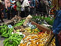
Fruits at the San Isidro Festival

Principal Park

Streets of Boyacá (Boyacá)


References[]
- ^ Jump up to: a b c (in Spanish) Official website Boyacá Archived 2015-05-30 at archive.today
- ^ (in Spanish) Etymology Boyacá - Excelsio.net
| Wikimedia Commons has media related to Boyacá, Boyacá. |
Bibliography[]
- Senado de la República de Colombia (1989), Municipios colombianos. Bogotá: Pama Editores Ltda. ISBN 958-9077-02-1
| show Authority control |
|---|

- Municipalities of Boyacá Department
- Populated places established in 1537
- 1537 establishments in the Spanish Empire
- 1537 disestablishments in the Muisca Confederation
- Muysccubun