Sáchica
Sáchica | |
|---|---|
Municipality and town | |
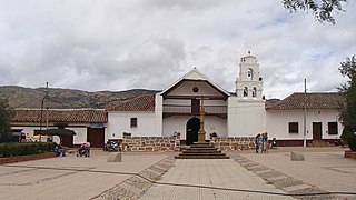
 Church of Sáchica | |
 Flag  Seal | |
| Nickname(s): City of onions | |
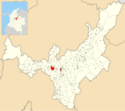 Location of the municipality and town of Sáchica in the Boyacá Department of Colombia | |
| Country | |
| Department | Boyacá Department |
| Province | Ricaurte Province |
| Founded | 16 July 1556 |
| Founded by | Juan Velasco and Carlos Rojas |
| Government | |
| • Mayor | Hugo Buitrago (2020-2023) |
| Area | |
| • Municipality and town | 62.4 km2 (24.1 sq mi) |
| Elevation | 2,150 m (7,050 ft) |
| Population (2015) | |
| • Municipality and town | 3,791 |
| • Density | 61/km2 (160/sq mi) |
| • Urban | 1,875 |
| Time zone | UTC-5 (Colombia Standard Time) |
| Website | Official website |
Sáchica is a municipality of Colombia situated approximately 34 km (21 mi) west of Tunja in the Ricaurte Province of the department of Boyacá. Sáchica borders Sutamarchán and Villa de Leyva in the north, in the east Chíquiza, Samacá and Ráquira in the south and in the west Ráquira and Sutamarchán.[1] Sáchica is known as the national capital of onions.[1]
History[]
In the centuries before the arrival of the Spanish conquistadores, Sáchica was ruled by a cacique loyal to the zaque of Hunza. Evidence of long inhabitation has been found in the form of petroglyphs made by the Muisca who were organized in the Muisca Confederation. The Muisca had their own religion where their main gods were Sué (the Sun) and Chía; the Moon. In Sáchica monuments to both celestial bodies have been constructed.
Modern Sáchica was founded on July 16, 1556 by Juan Velasco and Carlos Rojas.[1] In 1574 a total of 2500 indigenous people were living in Sáchica, presently only 5% is indigenous, the remainder mestizo.[1]
In the Chibcha language of the Muisca, Sáchica means "our present domain",[2] "fortress" or "mansion of the sovereign".[1]
Rock art[]


In a rock shelter in Sáchica, rock art in the form of pictographs has been discovered. The archaeologist Eliécer Silva Celis pioneered in the study of them in the 1960s. Later research has been performed by Carl Henrik Langebaek, Diego Martínez, Álvaro Botiva, Pedro Argüello García, and others. The black, red and white rock art is present at an altitude of 2,210 m (7,250 ft) at 5°35′29.058″N 73°31′15.926″W / 5.59140500°N 73.52109056°W and shows human faces, Suns, maize, eyes, mountains, masks, and other figures.[3] The rock art has been produced in rock shelters of Lower Cretaceous formations.[4]
Economy[]
Sachiquense economy is based on religious tourism, agriculture; onions and tomatoes, and mining; gypsum, marble and clay.[1]
Trivia[]
- The ichthyosaur Platypterygius sachicarum, found in the Paja Formation of Villa de Leyva, has been named after Sáchica
Gallery[]
Central square and church

Central square

Church interior

Gondava Lake
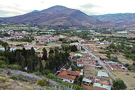
View of Sáchica

View of Sáchica
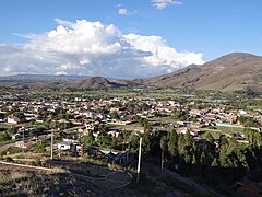
View of Sáchica


View of Sáchica

Farmlands

Farmlands

Onion fields

Sedimentary rocks

Monument to the Sun

Monument to the Moon


References[]
- ^ Jump up to: a b c d e f (in Spanish) Official website Sáchica - accessed 07-05-2016
- ^ (in Spanish) Etymology Sáchica - accessed 07-05-2016
- ^ (in Spanish) Las pictografias de Sáchica desde las narraciones orales de sus vecinos - Rupestreweb
- ^ Silva Celis, 1962, p.12
Bibliography[]
- . 1962. Pinturas rupestres precolombinas de Sáchica, Valle de Leiva - Pre-Columbian rock art of Sáchica, Leyva Valley. Revista Colombiana de Antropología X. 9-36. Accessed 2016-07-08.
| Wikimedia Commons has media related to Sáchica. |
| show Authority control |
|---|

- Municipalities of Boyacá Department
- Populated places established in 1556
- 1556 establishments in the Spanish Empire
- Muisca Confederation
- Muysccubun
- Muisca and pre-Muisca sites
- Rock art in South America