British Columbia Highway 15
  | |||||||||
|---|---|---|---|---|---|---|---|---|---|
| Pacific Highway 176th Street | |||||||||
 Highways 15 and 543 highlighted in red. | |||||||||
| Route information | |||||||||
| Maintained by B.C. MoT and WSDOT | |||||||||
| Length | 21.77 km (13.53 mi) | ||||||||
| History | BC: 1913 – present WA: 1919 – present[1] | ||||||||
| Washington State Route 543 | |||||||||
| Length | 1.75 km[2] (1.09 mi) | ||||||||
| South end | |||||||||
| North end | Canada–US border | ||||||||
| British Columbia Highway 15 | |||||||||
| Length | 20.02 km[3][4] (12.44 mi) | ||||||||
| South end | Canada–US border | ||||||||
| Major intersections | Golden Ears Way in Surrey | ||||||||
| North end | |||||||||
| Highway system | |||||||||
British Columbia provincial highways
| |||||||||
Highway 15 (BC 15), known locally as the Pacific Highway, is a 20.99-kilometre-long (13.04 mi) north–south highway primarily located in the City of Surrey, British Columbia. The southern terminus is with Interstate 5 (I-5) near Blaine, Washington, as Washington State Route 543 (SR 543). SR 543 is a 1.75-kilometre-long (1.09 mi) connector between I-5 and the Canada–US border, linking with BC 15. Over 3,000 trucks per day pass through the border crossing along SR 543 and BC 15,[5] because the Peace Arch border crossing does not allow commercial trucks.
Route description[]
SR 543 starts at an incomplete trumpet interchange with I-5 and heads north, passing the former Blaine Municipal Airport. An at-grade interchange with H Street is next, before the road widens and an interior lane diamond interchange with D street, providing access to Blaine and the last northbound exit before the border.[6] Traffic from 12th Street can access both northbound and southbound SR 543, and traffic from southbound SR 543 can access 12th Street as the final interchange before the Canada–US border.[7]
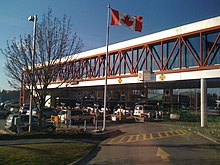
The border features both a NEXUS lane for passenger vehicles,[8] as well as a Free and Secure Trade (FAST) lane for commercial trucks.[9] Border crossing times can become significantly delayed such as in the event of certain Seattle Mariners baseball games and summer holiday travel.[10] During the reconstruction of the Peace Arch border crossing, delays at the Pacific Highway crossing were similar to times seen right after the attacks of September 11.[11]
Continuing north, now as BC 15, the highway passes farmland and intersects 8 Avenue, which provides access to British Columbia Highway 99 to the west. The highway turns west slightly before entering Cloverdale and crossing over railroad tracks of the Southern Railway of British Columbia. BC 10 is intersected before the highway moves back towards the east and its original alignment on 176th Street. Farmland once again surrounds the highway, and it then intersects the Fraser Highway and then the Golden Ears Way. It terminates just north of the last intersection at a Parclo A4 interchange with BC 1.[12][13] On December 21, 2013, the C$1 billion South Fraser Perimeter Road opened, linking the northern terminus of BC 15 to Delta in the west.[14]
History[]
The Pacific Highway was opened as a gravel road on July 12, 1913, and again on August 3, 1923, as a paved road.[15] For a time between 1942 and 1958, BC 15 was designated number 99A after the King George Highway (Hwy. 99 from 1942 to 1972, Hwy. 99A from 1973 to 2006) superseded it as the primary route to the Canada–US border. In 2008, the highway was widened to four lanes as part of the Gateway Program to improve provincial highways in Metro Vancouver.[16] In 2009, the city of Surrey renamed "King George Highway" to "King George Boulevard".[17]
Prior to the current Washington route numbering system, this route was designated as Primary State Highway 1 Truck Route.[18] Reconstruction of the truck route and crossing to expressway standards was completed in January 1972 as part of upgrades to I-5 in the Blaine area.[19]
A construction project was completed in August 2008[20] on the United States side, at a total cost of US$50.8 million, which improved the interchange with D street, which is now raised above SR 543. The left lane from SR 543 in each direction is raised above for travelers wishing to access D Street, while the rest of the traffic continues below the intersection. Two additional lanes have been added going northbound, and one additional lane has been added southbound.[21]
Major intersections[]
| State/Province | County/Regional District | Location | km[2][3] | mi | Destinations | Notes |
|---|---|---|---|---|---|---|
| Washington | Whatcom | Blaine | 0.00 | 0.00 | Exit 275 on I-5; northbound entrance, southbound exit; SR 543 southern terminus | |
| 1.32 | 0.82 | D Street – Blaine City Center | Interchange | |||
| Pacific Highway Border Crossing | 1.75 0.00 | 1.09 0.00 | Canada–United States border | |||
| British Columbia | Metro Vancouver | Surrey | 1.53 | 0.95 | Hwy 914:3186 is unsigned | |
| 11.29 | 7.02 | |||||
| 15.19 | 9.44 | Fraser Highway – New Westminster, Langley | Former Hwy 1A | |||
| 19.45 | 12.09 | Golden Ears Way (Hwy 916 east) / 96th Avenue – Maple Ridge | Hwy 916 is unsigned | |||
| 20.02 | 12.44 | Exit 53 on Hwy 1; Hwy 15 northern terminus | ||||
1.000 mi = 1.609 km; 1.000 km = 0.621 mi
| ||||||
References[]
- ^ Staff. "Forty Years with the Washington Department of Highways" (PDF). Washington State Department of Transportation. Archived from the original (PDF) on October 30, 2008. Retrieved August 17, 2008.
- ^ a b Strategic Planning and Programming Division (2007). State Highway Log: Planning Report (PDF) (Report). Washington State Department of Transportation. p. 1562. Archived from the original (PDF) on June 16, 2010. Retrieved August 17, 2008.
- ^ a b Landmark Kilometre Inventory (PDF). British Columbia Ministry of Transportation and Infrastructure (Report). Cypher Consulting. July 2016. pp. 221–223. Archived from the original (PDF) on 2017-03-11. Retrieved 2017-02-15.
- ^ Google (January 3, 2017). "Highway 99 in British Columbia" (Map). Google Maps. Google.
- ^ Blake, Abbey (November 20, 2004). "Omnibus Spending Bill Includes 2nd District Priorities" (Press release). Office of Representative Rick Larsen. Archived from the original on August 4, 2008. Retrieved August 17, 2008.
- ^ SR 543 lane configuration (Map). Washington State Department of Transportation. Archived from the original on 2010-02-14. Retrieved September 2, 2009.
- ^ Staff. "§ 47.17.797". Revised Code of Washington. Washington State Legislature. Retrieved September 3, 2009.
- ^ Staff (August 13, 2008). "Directory of CBSA Offices". Canada Border Services Agency. Archived from the original on 2008-08-21. Retrieved August 17, 2008.
- ^ Staff. "Where is FAST available?". Canada Border Services Agency. Retrieved September 6, 2009.
- ^ "Expect delays when traveling across the border this weekend". CKWX-AM. August 13, 2009. Archived from the original on August 20, 2009. Retrieved September 6, 2009.
- ^ Bolt, Kristen Millares (March 9, 2007). "Wait at Canadian border going from bad to brutal". Seattle Post-Intelligencer. Retrieved September 6, 2009.
- ^ Google (September 2, 2009). "BC 15 / SR 543" (Map). Google Maps. Google. Retrieved September 2, 2009.
- ^ Highway Planning Section (May 28, 2008). "Official Numbered Routes in British Columbia". British Columbia Ministry of Transportation. Retrieved September 3, 2009.
- ^ "South Fraser Perimeter Road, B.C.'s newest highway, opens". British Columbia Ministry of Transportation and Infrastructure. December 21, 2013. Archived from the original on December 23, 2013. Retrieved January 16, 2013.
- ^ "Grandview Heights Heritage Study" (PDF). Donald Luxton & Associates. City of Surrey. May 2005. Retrieved January 2, 2018.
- ^ "Highway 15 to be widened from Surrey to U.S. border" (Press release). Ministry of Transportation. February 19, 2007. Retrieved May 6, 2019.
- ^ Lalonde, Vincent (November 12, 2009). "Corporate Report No: R207 – Street Name Changes" (PDF). City of Surrey Council. Retrieved February 2, 2020.
- ^ Prahl, C. G. (December 2, 1965). "Identification of State Highways" (PDF). Washington State Highway Commission. Retrieved September 10, 2008.
- ^ "The People of Interstate 5". Washington Highway News. 23 (1). Washington State Department of Highways. February 1972. p. 20. OCLC 29654162. Retrieved September 12, 2018 – via WSDOT Library Digital Collections.
- ^ "SR 543 - I-5 to Canadian Border: Additional Lanes for Freight". Washington State Department of Transportation. August 2008. Archived from the original on 2008-07-24. Retrieved August 17, 2008.
- ^ Lane diagram of SR-543 (Map). Washington State Department of Transportation. Archived from the original on 2008-08-26. Retrieved August 17, 2008.
External links[]
Route map:

| ( • help)
|
| Wikimedia Commons has media related to British Columbia Highway 15. |
- Camera facing queuing area for US Border control
- Border wait times (from BC Government)
- Border wait times (from WSDoT)
| ||
| ||
- U.S. Route 99
- Canada–United States border crossings
- British Columbia provincial highways
- Highways in Greater Vancouver
- Transport in Surrey, British Columbia
- Transportation in Whatcom County, Washington
- 1913 establishments in British Columbia