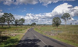
Brooklands, Queensland
| Brooklands Queensland | |||||||||||||||
|---|---|---|---|---|---|---|---|---|---|---|---|---|---|---|---|
 | |||||||||||||||
 Brooklands | |||||||||||||||
| Coordinates | 26°43′39″S 151°49′46″E / 26.7275°S 151.8294°ECoordinates: 26°43′39″S 151°49′46″E / 26.7275°S 151.8294°E | ||||||||||||||
| Population | 294 (2016 census)[1] | ||||||||||||||
| • Density | 3.267/km2 (8.461/sq mi) | ||||||||||||||
| Postcode(s) | 4615 | ||||||||||||||
| Area | 90.0 km2 (34.7 sq mi) | ||||||||||||||
| Time zone | AEST (UTC+10:00) | ||||||||||||||
| LGA(s) | South Burnett Region | ||||||||||||||
| State electorate(s) | Nanango | ||||||||||||||
| Federal division(s) | Maranoa | ||||||||||||||
| |||||||||||||||
Brooklands is a rural locality in the South Burnett Region, Queensland, Australia.[2] In the 2016 census, Brooklands had a population of 294 people.[1]
History[]
Barker's Creek Provisional School opened on 16 September 1895. In 1909 it became Barker's Creek State School in 1909. It closed in 1954.[3] It was located on the western bank of Barker Creek between Taabinga Road and Nanango Brooklands Road (26°42′40″S 151°51′19″E / 26.7111°S 151.8554°E).[4][5][6][7]
Middle Creek Provisional School opened on 16 October 1916. On 1 September 1920 it became Middle Creek State School. In 1971 it was renamed Brooklands State School. It closed on 29 June 1973.[8]
In the 2016 census, Brooklands had a population of 294 people.[1]
References[]
- ^ a b c Australian Bureau of Statistics (27 June 2017). "Brooklands (SSC)". 2016 Census QuickStats. Retrieved 20 October 2018.

- ^ "Brooklands – locality in South Burnett Region (entry 46199)". Queensland Place Names. Queensland Government. Retrieved 19 September 2020.
- ^ "Agency ID 8856, Barker's Creek State School". Queensland State Archives. Retrieved 14 July 2021.
- ^ "The Education Report". Queensland Times, Ipswich Herald And General Advertiser. Vol. XXXVI, no. 5455. Queensland, Australia. 25 June 1896. p. 2. Archived from the original on 29 December 2020. Retrieved 14 January 2018 – via National Library of Australia.
- ^ "Our Nanango Letter". Queensland Times, Ipswich Herald And General Advertiser. Vol. XXXVI, no. 5348. Queensland, Australia. 17 October 1895. p. 6. Archived from the original on 14 July 2021. Retrieved 14 July 2021 – via National Library of Australia.
- ^ "Kumbia" (Map). Queensland Government. 1943. Archived from the original on 18 February 2021. Retrieved 14 July 2021.
- ^ "Queensland Globe". State of Queensland. Retrieved 14 July 2021.
- ^ Queensland Family History Society (2010), Queensland schools past and present (Version 1.01 ed.), Queensland Family History Society, ISBN 978-1-921171-26-0
Categories:
- South Burnett Region
- Localities in Queensland
- South Burnett Region geography stubs
