Murgon
| Murgon Queensland | |||||||||||||||
|---|---|---|---|---|---|---|---|---|---|---|---|---|---|---|---|
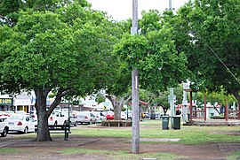 The park on the main street of Murgon | |||||||||||||||
 Murgon The location of Murgon in Queensland | |||||||||||||||
| Coordinates | 26°14′0″S 151°57′0″E / 26.23333°S 151.95000°ECoordinates: 26°14′0″S 151°57′0″E / 26.23333°S 151.95000°E | ||||||||||||||
| Population | 2,378 (2016 census)[1] | ||||||||||||||
| Postcode(s) | 4605 | ||||||||||||||
| Location |
| ||||||||||||||
| LGA(s) | South Burnett Region | ||||||||||||||
| State electorate(s) | Nanango | ||||||||||||||
| Federal division(s) | Wide Bay | ||||||||||||||
| |||||||||||||||

Murgon is a rural town and locality in the South Burnett Region, Queensland, Australia.[2][3] It is situated on the Bunya Highway 270 kilometres (170 mi) north-west of the state capital, Brisbane. At the 2016 Australian Census, the town recorded a population of 2,378.[1]
Geography[]
Murgon is in the region of Queensland known as the South Burnett, the southern part of the Burnett River catchment. Attractions of Murgon include winemaking, fishing on the nearby Bjelke-Petersen Dam and gem-fossicking. Industries include peanuts, dairy farming, beef and cattle production and wine. The Indigenous Australian settlement of Cherbourg is just south of Murgon.
History[]

Wakka Wakka (Waka Waka, Wocca Wocca, Wakawaka) is an Australian Aboriginal language spoken in the Burnett River catchment. The Wakka Wakka language region includes the landscape within the local government boundaries of the North and South Burnett Regional Council, particularly the towns of Cherbourg, Murgon, Kingaroy, Gayndah, Eidsvold and Mundubbera.[4]
In July 1906, 32 allotments were advertised for selection by the Department of Public Lands Office. The map advertising the land selection states the allotments are portions in the Parishes of Murgon, Goomeribong and Barambah.[5] The portions were left over from April 5.[6]
Murgon State School opened on 24 February 1908.[7]
Murgon Post Office opened by June 1908 (a receiving office had been open from 1904).[8]
The foundation stone of the Murgon War Memorial was laid on 25 April 1920 (ANZAC Day) by Lieutenant Colonel . On 11 November 1921, the digger memorial was dedicated by RSL chairman, Major General Spencer Browne.[9][10]
In the early 20th century the Nanango railway line reached the town.[when?]
The town was the administrative centre for the former Shire of Murgon which existed from 1914 until 2008.
Christ Church Anglican was dedicated in 1920.[11]
Murgon Baptist Church opened in 1921.[12][13] A tender to build the church was accepted in August 1921.[14]
St Joseph's Catholic School opened 27 February 1937.[7][15]

Murgon State High School opened on 27 January 1959.[7]
Murgon Special School closed on 31 December 1980.[7]
The current Murgon Library facility opened in 2010.[16]
Heritage listings[]

Murgon has a number of heritage-listed sites, including:
- 91 Gore Street: Murgon State School[17]
- Macalister Street: former South Burnett Co-operative Dairy Association Factory[18]
- 62-70 Lamb Street: Murgon Civic Centre[19]

Fossils[]
Murgon is also close to a famous fossil site. The Murgon fossil site is the only such site in Australia with a diverse vertebrate fauna dating to the early Eocene epoch, around 55 million years ago, only 10 million years after the extinction of the dinosaurs.
Education[]
Murgon State School is a government primary (Early Childhood-6) school for boys and girls at 91 Gore Street (26°14′23″S 151°56′36″E / 26.2397°S 151.9433°E).[20][21] In 2018, the school had an enrolment of 242 students with 21 teachers and 23 non-teaching staff (14 full-time equivalent).[22] It includes a special education program.[20][23]
St Joseph's School is a Catholic primary (Prep-6) school for boys and girls at 32 Angel Avenue (26°14′22″S 151°56′46″E / 26.2394°S 151.9462°E).[20][24] In 2018, the school had an enrolment of 107 students with 12 teachers and 14 non-teaching staff (9 full-time equivalent).[22]
Murgon State High School is a government secondary (7-12) school for boys and girls at 2 Dutton Street (26°14′14″S 151°56′41″E / 26.2372°S 151.9446°E).[20][25] In 2018, the school had an enrolment of 347 students with 43 teachers (41 full-time equivalent) and 30 non-teaching staff (24 full-time equivalent).[22] It includes a special education program.[20]
Amenities[]
The South Burnett Regional Council operates a public library in Murgon at 42 Stephens Street West (26°14′27″S 151°56′32″W / 26.2407°S 151.9421°W).[26] Public Wi-Fi is available at this facility.[16]
Christ Church Anglican is at 29 Taylor Street East (26°14′48″S 151°56′32″E / 26.2466°S 151.9423°E).[11][27]
Attractions[]
The Queensland Dairy and Heritage Museum is at 2 Sommerville Street (26°13′51″S 151°55′45″E / 26.2307°S 151.9291°E).[28]
Notable residents[]
Notable residents of Murgon include:
- Gavin Cooper, Australian rugby league player born in Murgon
- John Mickel, Member of the Queensland Legislative Assembly born in Murgon
- Steve Renouf, Australian rugby league player born in Murgon
- Leah Purcell, Australian actress, director and writer was born in Murgon.
See also[]
References[]
- ^ a b Australian Bureau of Statistics (27 June 2017). "Murgon (State Suburb)". 2016 Census QuickStats. Retrieved 29 March 2018.

- ^ "Murgon – town (entry 23555)". Queensland Place Names. Queensland Government. Retrieved 15 July 2016.
- ^ "Murgon – locality (entry 46250)". Queensland Place Names. Queensland Government. Retrieved 15 July 2016.
- ^
 This Wikipedia article incorporates CC-BY-4.0 licensed text from: "Queensland's Aboriginal and Torres Strait Islander Languages map". State Library of Queensland. Retrieved 5 June 2020.
- ^ "Sketch map of portions 61, 62, ..., parish of Murgon, portions 168 & 169, parish of Goomeribong & portions 49, 50 & 53, parish of Barambah ... county of Fitzroy". 5 July 1906. hdl:10462/deriv/264327. Cite journal requires
|journal=(help) - ^ "Notes and News". Gympie Times And Mary River Mining Gazette. XXXVIII (5003). Queensland, Australia. 26 June 1906. p. 6. Retrieved 25 March 2019 – via National Library of Australia.
- ^ a b c d "Opening and closing dates of Queensland Schools". Queensland Government. Retrieved 18 April 2019.
- ^ Premier Postal History. "Post Office List". Premier Postal Auctions. Retrieved 10 May 2014.
- ^ "Murgon War Memorial". Monument Australia. Archived from the original on 7 April 2014. Retrieved 5 April 2014.
- ^ "A WAR MEMORIAL.,". The Brisbane Courier. National Library of Australia. 16 November 1921. p. 4. Retrieved 6 April 2014.
- ^ a b "Year Book" (PDF). Anglican Archdiocese of Brisbane. 2019. p. 132. Archived (PDF) from the original on 15 September 2020. Retrieved 15 September 2020.
- ^ "Queensland Baptist churches by date of erection/opening". Baptist Church Archives Queensland. Retrieved 29 November 2021.
- ^ "1921 Murgon". Baptist Church Archives Queensland. Retrieved 29 November 2021.
- ^ "RELIGIOUS". The Brisbane Courier (19, 832). Queensland, Australia. 13 August 1921. p. 14. Retrieved 30 November 2021 – via National Library of Australia.
- ^ Queensland Family History Society (2010), Queensland schools past and present (Version 1.01 ed.), Queensland Family History Society, ISBN 978-1-921171-26-0
- ^ a b "Queensland Public Libraries Statistical Bulletin 2016-2017" (PDF). Public Libraries Connect. November 2017. Archived (PDF) from the original on 30 January 2018. Retrieved 31 January 2018.
- ^ "650003". Queensland Heritage Register. Queensland Heritage Council. Retrieved 11 February 2018.
- ^ "South Burnett Co-operative Dairy Association Factory (former) (entry 602811)". Queensland Heritage Register. Queensland Heritage Council. Retrieved 12 July 2013.
- ^ "Murgon Civic Centre (entry 602812)". Queensland Heritage Register. Queensland Heritage Council. Retrieved 12 July 2013.
- ^ a b c d e "State and non-state school details". Queensland Government. 9 July 2018. Archived from the original on 21 November 2018. Retrieved 21 November 2018.
- ^ "Murgon State School". Retrieved 21 November 2018.
- ^ a b c "ACARA School Profile 2018". Australian Curriculum, Assessment and Reporting Authority. Retrieved 28 January 2020.
- ^ "Barambah Cluster - Special Education Program". Retrieved 21 November 2018.
- ^ "St Joseph's School". Retrieved 21 November 2018.
- ^ "Murgon State High School". Retrieved 21 November 2018.
- ^ "Murgon Library". Public Libraries Connect. 15 August 2017. Archived from the original on 31 January 2018. Retrieved 31 January 2018.
- ^ "Christ Church Anglican Church | Churches Australia". Churches Australia. Retrieved 15 September 2020.
- ^ "Dairy & Heritage Museum". Queensland Dairy & Heritage Museum. Archived from the original on 30 August 2020. Retrieved 30 August 2020.
External links[]
![]() Media related to Murgon at Wikimedia Commons
Media related to Murgon at Wikimedia Commons
- Towns in Queensland
- Murgon
- South Burnett Region
- Localities in Queensland