Buffalo Narrows
Buffalo Narrows | |
|---|---|
Northern village[1] | |
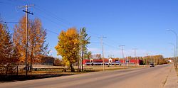 New village centre in Buffalo Narrows | |
 Buffalo Narrows Location within Saskatchewan | |
| Coordinates: 55°52′37″N 108°31′28″W / 55.87694°N 108.52444°WCoordinates: 55°52′37″N 108°31′28″W / 55.87694°N 108.52444°W | |
| Country | Canada |
| Province | Saskatchewan |
| District | Northern Saskatchewan Administration District |
| Census division | 18 |
| Government | |
| • Type | Mayor and council [2] |
| • Mayor | Sandy Ericson |
| • Town Manager | Patty Young |
| • Governing body | Buffalo Narrows Town Council |
| • MLA Athabasca | Buckley Belanger |
| • MP Desnethé—Missinippi—Churchill River | Gary Vidal |
| Area | |
| • Total | 68.63 km2 (26.50 sq mi) |
| Elevation | 422 m (1,385 ft) |
| Population (2016)[3] | |
| • Total | 1,110 |
| • Density | 16.2/km2 (42/sq mi) |
| Time zone | UTC−6 (Central Standard Time) |
| • Summer (DST) | UTC−5 |
| Postal code | S0M 0J0 |
| Area code(s) | 306 |
| Highways | |
| Post office established | 1936 |
| Website | Official website |
| [4][5][6] | |


Buffalo Narrows is a northern village in Saskatchewan, Canada. It is a community of 1,110 people.[3] Located at the "Narrows" between Peter Pond Lake and Churchill Lake, tourism and resource extraction (logging, fishing) are its main economic activities.
History[]

Buffalo Narrows or Détroit du Boeuf as it was called in French was founded in the early 20th century as trapping, mink ranching and fishing settlement by Scandinavian traders.[7]
The community developed around an earlier Dene settlement. John Macoun, who was travelling the fur trade route from Methye Portage to Lac Île-à-la-Crosse visited the "Narrows" in September 1875. He described his visit to this old community in the following lines: "After sunrise, a headwind sprang up with which we battled all day and reached the "Narrows," that connect Buffalo and Clearwater lakes, before dark. "Chipewyan House" is situated at the eastern end of the "Narrows," and at the head of Clearwater Lake. Here the Chipewyans have built themselves several houses."[8]
Chipewyan House where Macoun stayed for about four days was probably a small outpost of the Hudson's Bay Company much like Buffalo House at Dillon and Bull's House on the La Loche River.
Clearwater Lake (or Clear Lake) was renamed Churchill Lake in 1944[9] and Buffalo Lake was renamed Peter Pond Lake in 1932.[9]
1969 axe massacre[]
On January 30, 1969, the community was the site of the killing of the Pedersen family, and their friend John Herman. Seven people were killed by 19-year-old Métis Labourer Frederick Moses McCallum (b. 1949), who was arrested, diagnosed with schizophrenia and found not guilty by reason of insanity. As of February 2019, he is being held at the Saskatchewan Federal Penitentiary.[10]
Demographics[]
| hideCanada census – Buffalo Narrows community profile | |||
|---|---|---|---|
| 2016 | 2011 | ||
| Population: | 1,110 (-3.7% from 2011) | 1,153 (+6.7% from 2006) | |
| Land area: | 68.63 km2 (26.50 sq mi) | 68.63 km2 (26.50 sq mi) | |
| Population density: | 16.2/km2 (42/sq mi) | 16.8/km2 (44/sq mi) | |
| Median age: | 30.8 (M: 29.4, F: 33.3) | 27.6 (M: 26.1, F: 30.2) | |
| Total private dwellings: | 430 | 449 | |
| Median household income: | |||
| References: 2016[11] 2011[12] earlier[13] | |||
Climate[]
Buffalo Narrows has a humid continental climate (Koppen: Dfb) bordering on a subarctic climate (Dfc). Summers are comfortably warm with cool nights, while winters are very cold and dry.[14]
| hideClimate data for Buffalo Narrows | |||||||||||||
|---|---|---|---|---|---|---|---|---|---|---|---|---|---|
| Month | Jan | Feb | Mar | Apr | May | Jun | Jul | Aug | Sep | Oct | Nov | Dec | Year |
| Record high °C (°F) | 13.0 (55.4) |
15.0 (59.0) |
18.0 (64.4) |
29.6 (85.3) |
31.5 (88.7) |
36.0 (96.8) |
33.5 (92.3) |
35.0 (95.0) |
30.9 (87.6) |
27.2 (81.0) |
13.5 (56.3) |
10 (50) |
36.0 (96.8) |
| Average high °C (°F) | −12.7 (9.1) |
−8.7 (16.3) |
−1.4 (29.5) |
7.6 (45.7) |
14.8 (58.6) |
20.1 (68.2) |
22.8 (73.0) |
21.1 (70.0) |
14.7 (58.5) |
6.3 (43.3) |
−4.6 (23.7) |
−10.7 (12.7) |
5.8 (42.4) |
| Daily mean °C (°F) | −17.5 (0.5) |
−13.9 (7.0) |
−7.1 (19.2) |
2.0 (35.6) |
9.1 (48.4) |
14.9 (58.8) |
17.7 (63.9) |
16.3 (61.3) |
10.3 (50.5) |
2.7 (36.9) |
−7.8 (18.0) |
−14.9 (5.2) |
1.0 (33.8) |
| Average low °C (°F) | −22.3 (−8.1) |
−19.1 (−2.4) |
−12.8 (9.0) |
−3.5 (25.7) |
3.4 (38.1) |
9.6 (49.3) |
12.6 (54.7) |
11.4 (52.5) |
5.8 (42.4) |
−0.9 (30.4) |
−11.0 (12.2) |
−19.1 (−2.4) |
−3.8 (25.2) |
| Record low °C (°F) | −47.0 (−52.6) |
−44.0 (−47.2) |
−43.5 (−46.3) |
−31.8 (−25.2) |
−11.5 (11.3) |
−1.5 (29.3) |
3.5 (38.3) |
0.1 (32.2) |
−5.5 (22.1) |
−20.0 (−4.0) |
−39.2 (−38.6) |
−42.4 (−44.3) |
−47.0 (−52.6) |
| Average precipitation mm (inches) | 20.6 (0.81) |
18.6 (0.73) |
16.6 (0.65) |
26.0 (1.02) |
40.0 (1.57) |
61.5 (2.42) |
80.1 (3.15) |
62.3 (2.45) |
43.6 (1.72) |
32.5 (1.28) |
25.5 (1.00) |
21.9 (0.86) |
449.1 (17.68) |
| Average rainfall mm (inches) | 0.5 (0.02) |
0.4 (0.02) |
2.1 (0.08) |
9.5 (0.37) |
35.8 (1.41) |
61.5 (2.42) |
80.1 (3.15) |
62.3 (2.45) |
43.0 (1.69) |
19.3 (0.76) |
2.0 (0.08) |
0.8 (0.03) |
317.4 (12.50) |
| Average snowfall cm (inches) | 21.7 (8.5) |
19.7 (7.8) |
15.5 (6.1) |
16.7 (6.6) |
4.4 (1.7) |
0.0 (0.0) |
0.0 (0.0) |
0.0 (0.0) |
0.6 (0.2) |
13.2 (5.2) |
24.7 (9.7) |
22.4 (8.8) |
138.8 (54.6) |
| Average precipitation days (≥ 0.2 mm) | 12.7 | 10.5 | 8.7 | 7.7 | 9.8 | 12.9 | 14.9 | 12.9 | 12.1 | 11.6 | 13.0 | 11.3 | 138.0 |
| Average rainy days (≥ 0.2 mm) | 0.5 | 0.3 | 1.2 | 4.0 | 9.0 | 12.9 | 14.9 | 12.9 | 12.0 | 7.2 | 1.3 | 0.6 | 76.7 |
| Average snowy days (≥ 0.2 cm) | 12.6 | 10.5 | 8.0 | 4.8 | 1.7 | 0.0 | 0.0 | 0.0 | 0.41 | 5.5 | 12.2 | 11.5 | 67.3 |
| Average relative humidity (%) (at 3pm) | 72.3 | 67.1 | 57.8 | 50.7 | 48.3 | 52.4 | 55.6 | 57.2 | 59.7 | 64.4 | 76.8 | 77.0 | 61.6 |
| Source: Environment Canada[15] | |||||||||||||
Attractions[]


Buffalo Narrows is notable for its scenery and its bridge that crosses the Kisis Channel.[9] The bridge was officially opened in 1981 replacing a ferry that was set up in 1957. This channel links Peter Pond Lake and Churchill Lake.
Buffalo Narrows Sand Dunes Park[]
The dunes of Buffalo Narrows Sand Dunes Park located 5 kilometres (3.1 mi) north of downtown create a 10 kilometres (6.2 mi) fine sandy beach along the southwest shore of Big Peter Pond Lake (55°53′35.90″N 108°36′39.64″W / 55.8933056°N 108.6110111°W). The park, which is 3,650 hectares (14.1 sq mi) in size, includes the peninsula that nearly cuts Peter Pond Lake in two creating Little Peter Pond, the southern section and Big Peter Pond, the northern section. Formerly Crown land, the recreation area was transferred to the Northern Village of Buffalo Narrows in 2003. The community has assumed the responsibility for its maintenance and development.[16][17] The beach is a nesting site of the vulnerable sparrow-sized piping plover.[18]
Governance[]
As set out by the Northern Saskatchewan Municipal Government Act, and overseen by Municipal Relations, the village is governed by six Councillors, who are elected at-large every four years. Robert Woods is the mayor.[2]
Transportation[]
Buffalo Narrows is connected to the rest of Saskatchewan by Highway 155. Highway 155 is paved along its whole length. The community is served by the Buffalo Narrows Airport and the Buffalo Narrows Water Aerodrome.
Financial Services[]
Innovation Credit Union has an Advice Centre located at #3-1491 Pederson Ave. The location includes a full service automated teller machine.[19]
Education[]
The school in Buffalo Narrows is called Twin Lakes Community School or "TLCS". The K-12 school has approximately 310 students and about 30 teachers and is part of the Northern Lights School Division # 113.[18] Northlands College maintains a satellite campus in Buffalo Narrows.
See also[]
- List of communities in Northern Saskatchewan
- List of communities in Saskatchewan
- Villages of Saskatchewan
References[]
- ^ "Search for Municipal Information". Government of Saskatchewan. Archived from the original on 10 March 2014. Retrieved 7 April 2014.
- ^ Jump up to: a b "Search for Municipal Information". Government of Saskatchewan. Retrieved 18 April 2019.
- ^ Jump up to: a b "Census Profile, 2016 Census Buffalo Narrows, Northern village [Census subdivision], Saskatchewan and Division No. 18, Census division [Census division], Saskatchewan". Statistics Canada. Government of Canada. Retrieved 7 June 2020.
- ^ National Archives, Archivia Net. "Post Offices and Postmasters". Archived from the original on 6 October 2006. Retrieved 6 September 2009.
- ^ Government of Saskatchewan, MRD Home. "Municipal Directory System". Archived from the original on 15 January 2016. Retrieved 6 September 2009.
- ^ Commissioner of Canada Elections, Chief Electoral Officer of Canada (2005). "Elections Canada On-line". Archived from the original on 21 April 2007. Retrieved 6 September 2009.
- ^ "History of Buffalo Narrows". Retrieved 31 March 2013.
- ^ John Macoun (1922), Autobiography of John Macoun, M.A (page 121), Ottawa: Ottawa Field-Naturalists' Club, Library of Congress QH31.M15
- ^ Jump up to: a b c "Geographical Names Query". Archived from the original on 6 April 2013. Retrieved 16 April 2013.
- ^ Yard, Bridget (2 February 2020). "Generations of grief: Family still reeling 50 years after little-known mass axe murder".
- ^ "2016 Community Profiles". 2016 Canadian Census. Statistics Canada. 21 February 2017. Retrieved 9 August 2019.
- ^ "2011 Community Profiles". 2011 Canadian Census. Statistics Canada. 5 July 2013. Retrieved 30 May 2012.
- ^ "2001 Community Profiles". 2001 Canadian Census. Statistics Canada. 17 February 2012.
- ^ Canada, Environment and Climate Change (25 September 2013). "Canadian Climate Normals 1981-2010 Station Data - Climate - Environment and Climate Change Canada". climate.weather.gc.ca. Retrieved 28 May 2020.
- ^ Environment Canada Canadian Climate Normals 1981–2010, accessed 10 November 2016
- ^ "Government of Saskatchewan (COMMUNITY OF BUFFALO NARROWS WILL BE GETTING NEW RECREATION SITE)". 7 October 2003. Archived from the original on 23 February 2014. Retrieved 17 February 2014.
- ^ "Buffalo Narrows Assumes Control of Beach Site". 1 August 2010. Retrieved 17 February 2014.
- ^ Jump up to: a b "Northern Lights School Division # 113". Archived from the original on 14 July 2014. Retrieved 2 July 2014.
- ^ Innovation Credit Union Branch and ATM locator. https://www.innovationcu.ca/ToolsAndCalculators/FindBranchATM/
| show Places adjacent to Buffalo Narrows |
|---|
| show |
|---|

| show Authority control |
|---|
- Division No. 18, Saskatchewan
- Northern villages in Saskatchewan