Cacho Island
 | |
 Cacho Island Location of Cacho Island | |
| Geography | |
|---|---|
| Location | Antarctica |
| Coordinates | 62°49′57.4″S 61°28′35″W / 62.832611°S 61.47639°W |
| Archipelago | South Shetland Islands |
| Area | 19 ha (47 acres) |
| Length | 750 m (2460 ft) |
| Width | 350 m (1150 ft) |
| Administration | |
| Administered under the Antarctic Treaty System | |
| Demographics | |
| Population | uninhabited |

Cacho Island (Bulgarian: остров Качо, romanized: ostrov Cacho, IPA: [ˈɔstrof ˈkat͡ʃo]) is the conspicuous 250 m long in east-west direction and 100 m wide rocky island separated by a 160 m wide passage from Aktinia Beach on the southwest coast of Snow Island in the South Shetland Islands. Surface area 1.63 ha.[1] The area was visited by early 19th century sealers.[2]
The feature is named after the Spanish physicist, polar explorer and author Javier Cacho Gómez, participant in the 1986/87 Spanish Antarctic expedition and base commander at Juan Carlos I base in subsequent seasons, for his contribution to the promotion of Antarctica and support for the Bulgarian Antarctic programme.[1]
Location[]
Cacho Island is located at 62°49′57.4″S 61°28′35″W / 62.832611°S 61.47639°WCoordinates: 62°49′57.4″S 61°28′35″W / 62.832611°S 61.47639°W, which is 315 m south of Rebrovo Point and 2.5 km west-northwest of Cape Conway. Bulgarian mapping in 2009.
Maps[]
- South Shetland Islands. Scale 1:200000 topographic map. DOS 610 Sheet W 62 60. Tolworth, UK, 1968
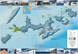
- L. Ivanov. Antarctica: Livingston Island and Greenwich, Robert, Snow and Smith Islands. Scale 1:120000 topographic map. Troyan: Manfred Wörner Foundation, 2010. ISBN 978-954-92032-9-5 (First edition 2009. ISBN 978-954-92032-6-4)
- Antarctic Digital Database (ADD). Scale 1:250000 topographic map of Antarctica. Scientific Committee on Antarctic Research (SCAR). Since 1993, regularly upgraded and updated
See also[]
Notes[]
- ^ a b Cacho Island. SCAR Composite Gazetteer of Antarctica
- ^ L. Ivanov. General Geography and History of Livingston Island. In: Bulgarian Antarctic Research: A Synthesis. Eds. C. Pimpirev and N. Chipev. Sofia: St. Kliment Ohridski University Press, 2015. pp. 17–28.
References[]
- Cacho Island. SCAR Composite Gazetteer of Antarctica
- Bulgarian Antarctic Gazetteer. Antarctic Place-names Commission. (details in Bulgarian, basic data in English)
External links[]
- Cacho Island. Adjusted Copernix satellite image
This article includes information from the Antarctic Place-names Commission of Bulgaria which is used with permission.
This Snow Island location article is a stub. You can help Wikipedia by . |
- Islands of the South Shetland Islands
- Bulgaria and the Antarctic
- Snow Island (South Shetland Islands) geography stubs