Zavala Island
 Zavala Island (the right one in the foreground) from Miziya Peak, Livingston Island, with Zed Islands in the background. | |
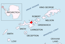 Location of Varna Peninsula in South Shetland Islands | |
 Zavala Island Location on Antarctic Peninsula | |
| Geography | |
|---|---|
| Location | Antarctica |
| Coordinates | 62°28′12″S 60°09′52″W�� / 62.47000°S 60.16444°W |
| Archipelago | Dunbar Islands |
| Area | 14 ha (35 acres)[1] |
| Length | 0.7 km (0.43 mi) |
| Width | 0.25 km (0.155 mi) |
| Administration | |
| Administered under the Antarctic Treaty System | |
| Demographics | |
| Population | Uninhabited |


Zavala Island (Bulgarian: остров Завала, romanized: ostrov Zavala, IPA: [ˈɔstrov ˈzavɐɫɐ]) is an ice-free island in the Dunbar group off the northwest coast of Varna Peninsula on Livingston Island in the South Shetland Islands, Antarctica. It is extending 700 by 250 m (770 by 270 yd), with surface area 14 hectares (35 acres).[1] The area was visited by early 19th century sealers.
The island is named after the settlement of and the homonymous in western Bulgaria.
Location[]
Zavala Island is located at 62°28′12″S 60°09′52″W / 62.47000°S 60.16444°WCoordinates: 62°28′12″S 60°09′52″W / 62.47000°S 60.16444°W, which is 1.3 km (0.81 mi) east-northeast of Balsha Island, 750 m (820 yd) southwest of Aspis Island, 800 m (870 yd) north of Slab Point, and 350 m (380 yd) west of Organpipe Point. Bulgarian topographic survey by the Tangra 2004/05 expedition. British mapping in 1968, Chilean in 1971, Argentine in 1980, and Bulgarian in 2005 and 2009.

Maps[]
- L.L. Ivanov. Antarctica: Livingston Island and Greenwich, Robert, Snow and Smith Islands. Scale 1:120000 topographic map. Troyan: Manfred Wörner Foundation, 2010. ISBN 978-954-92032-9-5 (First edition 2009. ISBN 978-954-92032-6-4)
- Antarctic Digital Database (ADD). Scale 1:250000 topographic map of Antarctica. Scientific Committee on Antarctic Research (SCAR). Since 1993, regularly upgraded and updated.
- L.L. Ivanov. Antarctica: Livingston Island and Smith Island. Scale 1:100000 topographic map. Manfred Wörner Foundation, 2017. ISBN 978-619-90008-3-0
See also[]
- Composite Gazetteer of Antarctica
- List of Antarctic islands south of 60° S
- SCAR
- Territorial claims in Antarctica
References[]
- ^ a b L.L. Ivanov. Antarctica: Livingston Island and Greenwich, Robert, Snow and Smith Islands. Archived April 24, 2008, at the Wayback Machine Scale 1:120000 topographic map. Troyan: Manfred Wörner Foundation, 2009. ISBN 978-954-92032-6-4
External links[]
- Zavala Island. SCAR Composite Antarctic Gazetteer
- Bulgarian Antarctic Gazetteer. Antarctic Place-names Commission. (details in Bulgarian, basic data in English)
- Zavala Island. Adjusted Copernix satellite image
This article includes information from the Antarctic Place-names Commission of Bulgaria which is used with permission.
Antarctica | ||
|---|---|---|
| General |
|  |
| Regions |
| |
| Waterways |
| |
| Famous explorers |
| |
This Livingston Island location article is a stub. You can help Wikipedia by . |
- Islands of Livingston Island
- Bulgaria and the Antarctic
- Livingston Island geography stubs