Cairo Precinct, Alexander County, Illinois
Cairo Precinct | |
|---|---|
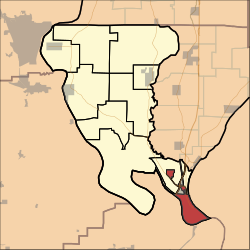 Location of Cairo Precinct in Alexander County | |
| Coordinates: 36°59′51″N 089°10′39″W / 36.99750°N 89.17750°WCoordinates: 36°59′51″N 089°10′39″W / 36.99750°N 89.17750°W | |
| Country | United States |
| State | Illinois |
| County | Alexander |
| Area | |
| • Total | 9.13 sq mi (23.65 km2) |
| • Land | 7.05 sq mi (18.26 km2) |
| • Water | 2.08 sq mi (5.39 km2) 22.79% |
| Elevation | 315 ft (96 m) |
| Population (2010) | |
| • Total | 2,831 |
| • Density | 401/sq mi (155.0/km2) |
| GNIS feature ID | 1928457[1] |

Cairo Precinct is located in Alexander County, Illinois, United States. As of the 2010 census, its population was 2,831.[2]
Geography[]
Cairo Precinct covers an area of 23.65 square kilometres (9.13 sq mi). It contains the southernmost point in Illinois.
References[]
- ^ U.S. Geological Survey Geographic Names Information System: Cairo Precinct, Alexander County, Illinois
- ^ "Geographic Identifiers: 2010 Demographic Profile Data (G001): Cairo precinct, Alexander County, Illinois". U.S. Census Bureau, American Factfinder. Archived from the original on February 12, 2020. Retrieved May 8, 2013.
Municipalities and communities of Alexander County, Illinois, United States | ||
|---|---|---|
| City | ||
| Villages | ||
| Precincts | ||
| CDPs | ||
| Other communities | ||
| Ghost town | ||
| ||
This Alexander County, Illinois location article is a stub. You can help Wikipedia by . |
Categories:
- Precincts in Alexander County, Illinois
- Southern Illinois geography stubs