Camden, Michigan
Camden, Michigan | |
|---|---|
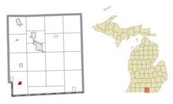 Location within Hillsdale County | |
 Camden Location within the state of Michigan | |
| Coordinates: 41°45′18″N 84°45′25″W / 41.75500°N 84.75694°WCoordinates: 41°45′18″N 84°45′25″W / 41.75500°N 84.75694°W | |
| Country | United States |
| State | Michigan |
| County | Hillsdale |
| Township | Camden |
| Area | |
| • Total | 0.80 sq mi (2.07 km2) |
| • Land | 0.80 sq mi (2.07 km2) |
| • Water | 0.00 sq mi (0.00 km2) |
| Elevation | 1,020 ft (311 m) |
| Population | |
| • Total | 512 |
| • Estimate (2019)[3] | 501 |
| • Density | 625.47/sq mi (241.53/km2) |
| Time zone | UTC-5 (Eastern (EST)) |
| • Summer (DST) | UTC-4 (EDT) |
| ZIP code(s) | 49232 |
| Area code(s) | 517 |
| FIPS code | 26-12760[4] |
| GNIS feature ID | 0622509[5] |

Camden is a village in Hillsdale County in the U.S. state of Michigan. The population was 512 at the 2010 census. The village is located within Camden Township.
Geography[]
According to the United States Census Bureau, the village has a total area of 0.84 square miles (2.18 km2), all land.[6]
Demographics[]
| Historical population | |||
|---|---|---|---|
| Census | Pop. | %± | |
| 1880 | 191 | — | |
| 1900 | 376 | — | |
| 1910 | 392 | 4.3% | |
| 1920 | 398 | 1.5% | |
| 1930 | 316 | −20.6% | |
| 1940 | 385 | 21.8% | |
| 1950 | 380 | −1.3% | |
| 1960 | 434 | 14.2% | |
| 1970 | 405 | −6.7% | |
| 1980 | 420 | 3.7% | |
| 1990 | 482 | 14.8% | |
| 2000 | 550 | 14.1% | |
| 2010 | 512 | −6.9% | |
| 2019 (est.) | 501 | [3] | −2.1% |
| U.S. Decennial Census[7] | |||
2010 census[]
As of the census[2] of 2010, there were 512 people, 176 households, and 123 families living in the village. The population density was 609.5 inhabitants per square mile (235.3/km2). There were 211 housing units at an average density of 251.2 per square mile (97.0/km2). The racial makeup of the village was 99.4% White, 0.2% Native American, and 0.4% from two or more races. Hispanic or Latino of any race were 0.2% of the population.
There were 176 households, of which 42.6% had children under the age of 18 living with them, 48.3% were married couples living together, 16.5% had a female householder with no husband present, 5.1% had a male householder with no wife present, and 30.1% were non-families. 24.4% of all households were made up of individuals, and 10.8% had someone living alone who was 65 years of age or older. The average household size was 2.89 and the average family size was 3.41.
The median age in the village was 32.6 years. 31.2% of residents were under the age of 18; 7.3% were between the ages of 18 and 24; 28.9% were from 25 to 44; 23.3% were from 45 to 64; and 9.4% were 65 years of age or older. The gender makeup of the village was 49.4% male and 50.6% female.
2000 census[]
As of the census[4] of 2000, there were 550 people, 198 households, and 134 families living in the village. The population density was 651.5 per square mile (252.8/km2). There were 214 housing units at an average density of 253.5 per square mile (98.4/km2). The racial makeup of the village was 97.27% White, 0.55% Native American, 0.55% Asian, and 1.64% from two or more races. Hispanic or Latino of any race were 0.36% of the population.
There were 198 households, out of which 39.9% had children under the age of 18 living with them, 46.0% were married couples living together, 14.1% had a female householder with no husband present, and 32.3% were non-families. 25.8% of all households were made up of individuals, and 13.1% had someone living alone who was 65 years of age or older. The average household size was 2.78 and the average family size was 3.36.
In the village, the population was spread out, with 34.0% under the age of 18, 11.1% from 18 to 24, 28.4% from 25 to 44, 16.5% from 45 to 64, and 10.0% who were 65 years of age or older. The median age was 29 years. For every 100 females, there were 103.0 males. For every 100 females age 18 and over, there were 85.2 males.
The median income for a household in the village was $34,028, and the median income for a family was $36,429. Males had a median income of $29,643 versus $21,042 for females. The per capita income for the village was $13,846. About 9.2% of families and 12.1% of the population were below the poverty line, including 10.9% of those under age 18 and 11.3% of those age 65 or over.
Transportation[]
Education[]
The local school district is Camden-Frontier, which incorporates residents from Camden as well as Frontier and Montgomery. Since Hillsdale County has county-wide school of choice, the local school district has many students from the surrounding areas.
Camden Frontier High School[1]
Enrollment: 196
Class: D
Grades: K-12
Colors: Red & White
Nickname: Redskins
Primary League: Southern Central Athletic Association
Camden Frontier Schools [2]
References[]
- ^ "2019 U.S. Gazetteer Files". United States Census Bureau. Retrieved July 25, 2020.
- ^ a b "U.S. Census website". United States Census Bureau. Retrieved 2012-11-25.
- ^ a b "Population and Housing Unit Estimates". United States Census Bureau. May 24, 2020. Retrieved May 27, 2020.
- ^ a b "U.S. Census website". United States Census Bureau. Retrieved 2008-01-31.
- ^ "US Board on Geographic Names". United States Geological Survey. 2007-10-25. Retrieved 2008-01-31.
- ^ "US Gazetteer files 2010". United States Census Bureau. Archived from the original on 2012-07-02. Retrieved 2012-11-25.
- ^ "Census of Population and Housing". Census.gov. Retrieved June 4, 2015.
Municipalities and communities of Hillsdale County, Michigan, United States | ||
|---|---|---|
| Cities |  | |
| Villages | ||
| Civil townships | ||
| CDPs | ||
| Other communities | ||
| ||
- Villages in Hillsdale County, Michigan
- Villages in Michigan