Waldron, Michigan
Waldron, Michigan | |
|---|---|
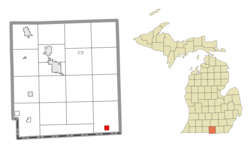 Location within Hillsdale County | |
 Waldron Location within the state of Michigan | |
| Coordinates: 41°43′35″N 84°25′5″W / 41.72639°N 84.41806°WCoordinates: 41°43′35″N 84°25′5″W / 41.72639°N 84.41806°W | |
| Country | United States |
| State | Michigan |
| County | Hillsdale |
| Township | Wright |
| Area | |
| • Total | 1.00 sq mi (2.59 km2) |
| • Land | 1.00 sq mi (2.59 km2) |
| • Water | 0.00 sq mi (0.00 km2) |
| Elevation | 899 ft (274 m) |
| Population | |
| • Total | 538 |
| • Estimate (2019)[3] | 523 |
| • Density | 523.00/sq mi (202.00/km2) |
| Time zone | UTC-5 (Eastern (EST)) |
| • Summer (DST) | UTC-4 (EDT) |
| ZIP code(s) | 49288 |
| Area code(s) | 517 |
| FIPS code | 26-82880[4] |
| GNIS feature ID | 1615686[5] |

Waldron is a village in Hillsdale County in the U.S. state of Michigan. The population was 538 at the 2010 census. The village is located within Wright Township.
Geography[]
According to the United States Census Bureau, the village has a total area of 1.00 square mile (2.59 km2), all land.[6]
Demographics[]
| Historical population | |||
|---|---|---|---|
| Census | Pop. | %± | |
| 1890 | 365 | — | |
| 1910 | 435 | — | |
| 1920 | 457 | 5.1% | |
| 1930 | 307 | −32.8% | |
| 1940 | 424 | 38.1% | |
| 1950 | 427 | 0.7% | |
| 1960 | 454 | 6.3% | |
| 1970 | 564 | 24.2% | |
| 1980 | 570 | 1.1% | |
| 1990 | 581 | 1.9% | |
| 2000 | 590 | 1.5% | |
| 2010 | 538 | −8.8% | |
| 2019 (est.) | 523 | [3] | −2.8% |
| U.S. Decennial Census[7] | |||
2010 census[]
As of the census[2] of 2010, there were 538 people, 211 households, and 137 families living in the village. The population density was 538.0 inhabitants per square mile (207.7/km2). There were 253 housing units at an average density of 253.0 per square mile (97.7/km2). The racial makeup of the village was 97.6% White, 0.6% African American, 0.9% Native American, and 0.9% from two or more races. Hispanic or Latino of any race were 0.7% of the population.
There were 211 households, of which 40.3% had children under the age of 18 living with them, 44.1% were married couples living together, 14.2% had a female householder with no husband present, 6.6% had a male householder with no wife present, and 35.1% were non-families. 32.2% of all households were made up of individuals, and 10.9% had someone living alone who was 65 years of age or older. The average household size was 2.55 and the average family size was 3.18.
The median age in the village was 34.1 years. 30.1% of residents were under the age of 18; 7.8% were between the ages of 18 and 24; 26% were from 25 to 44; 24.2% were from 45 to 64; and 11.9% were 65 years of age or older. The gender makeup of the village was 47.4% male and 52.6% female.
2000 census[]
As of the census[4] of 2000, there were 590 people, 231 households, and 152 families living in the village. The population density was 575.6 per square mile (223.3/km2). There were 249 housing units at an average density of 242.9 per square mile (94.3/km2). The racial makeup of the village was 97.80% White, 0.34% African American, 0.34% Native American, and 1.53% from two or more races. Hispanic or Latino of any race were 1.02% of the population.
There were 231 households, out of which 35.9% had children under the age of 18 living with them, 47.6% were married couples living together, 14.3% had a female householder with no husband present, and 33.8% were non-families. 29.0% of all households were made up of individuals, and 10.4% had someone living alone who was 65 years of age or older. The average household size was 2.54 and the average family size was 3.13.
In the village, the population was spread out, with 29.8% under the age of 18, 9.0% from 18 to 24, 30.0% from 25 to 44, 18.3% from 45 to 64, and 12.9% who were 65 years of age or older. The median age was 33 years. For every 100 females, there were 92.2 males. For every 100 females age 18 and over, there were 86.5 males.
The median income for a household in the village was $30,417, and the median income for a family was $36,125. Males had a median income of $28,958 versus $19,375 for females. The per capita income for the village was $15,083. About 10.3% of families and 16.4% of the population were below the poverty line, including 21.0% of those under age 18 and 5.9% of those age 65 or over.
Notable people[]
- Don A. Jones (1912–2000), admiral and civil engineer, seventh Director of the United States Coast and Geodetic Survey and second Director of the Environmental Science Services Administration Corps, born in Waldron.
References[]
- ^ "2019 U.S. Gazetteer Files". United States Census Bureau. Retrieved July 25, 2020.
- ^ a b "U.S. Census website". United States Census Bureau. Retrieved 2012-11-25.
- ^ a b "Population and Housing Unit Estimates". United States Census Bureau. May 24, 2020. Retrieved May 27, 2020.
- ^ a b "U.S. Census website". United States Census Bureau. Retrieved 2008-01-31.
- ^ "US Board on Geographic Names". United States Geological Survey. 2007-10-25. Retrieved 2008-01-31.
- ^ "US Gazetteer files 2010". United States Census Bureau. Retrieved 2012-11-25.
- ^ "Census of Population and Housing". Census.gov. Retrieved June 4, 2015.
Municipalities and communities of Hillsdale County, Michigan, United States | ||
|---|---|---|
| Cities |  | |
| Villages | ||
| Civil townships | ||
| CDPs | ||
| Other communities | ||
| ||
- Villages in Hillsdale County, Michigan
- Villages in Michigan