Campbell, Ohio
City of Campbell | |
|---|---|
| Nickname(s): Soup City | |
| Motto(s): "A Small City With a Big Heart" | |
 Location of Campbell, Ohio | |
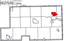 Location of Campbell in Mahoning County | |
| Coordinates: 41°04′41″N 80°35′24″W / 41.078013°N 80.589968°WCoordinates: 41°04′41″N 80°35′24″W / 41.078013°N 80.589968°W | |
| Country | United States |
| State | Ohio |
| County | Mahoning |
| Incorporated | 1908 |
| Government | |
| • Type | Mayor/Council |
| • Mayor | Nick Phillips[1] |
| • Council President | George Levendis |
| Area | |
| • Total | 3.75 sq mi (9.71 km2) |
| • Land | 3.72 sq mi (9.63 km2) |
| • Water | 0.03 sq mi (0.08 km2) |
| Elevation | 1,030 ft (314 m) |
| Population (2010) | |
| • Total | 8,235 |
| • Estimate (2019)[5] | 7,785 |
| • Density | 2,094.43/sq mi (808.67/km2) |
| Time zone | UTC-5 (Eastern (EST)) |
| • Summer (DST) | UTC-4 (EDT) |
| Area code(s) | 234/330 |
| FIPS code | 39-11066[4] |
| GNIS feature ID | 1056760[3] |
| Website | http://www.campbellohio.gov/ |

Campbell (/ˈkæməl/;[6] "CAM-ell") is a city in Mahoning County, Ohio, United States. The population was 8,235 at the 2010 census. It is part of the Youngstown-Warren-Boardman, OH-PA Metropolitan Statistical Area.
Campbell was first called East Youngstown and this designation still appears on real estate deeds between 1902 and 1926, when the city was renamed for local industrialist James Campbell, then chairman of the Youngstown Sheet and Tube Company.[7]
History[]
In 1902, the Youngstown Iron Sheet and Tube Company established a factory near the Mahoning River in Coitsville Township. A settlement grew around the factory, called East Youngstown, due to its location just southeast from downtown Youngstown.[8] The village was incorporated in 1908, as its population swelled with young immigrants to work in the steel industry. Many immigrants to the village were Greeks. In 1926, the town officially became known as the City of Campbell, to recognize James Anson Campbell, president of the iron company during the founding of the city.[9]
Campbell is sometimes referred to as the "City of Churches" because of the wide variety of religious structures found throughout the community.
Geography[]

Campbell is located on the north bank of the Mahoning River. It is located at 41°04′41″N 80°35′24″W / 41.078013°N 80.589968°W.[10] The city has a total area of 3.74 square miles (9.69 km2), of which 3.71 square miles (9.61 km2) is land and 0.03 square miles (0.08 km2) is water.[11]
Demographics[]
| Historical population | |||
|---|---|---|---|
| Census | Pop. | %± | |
| 1910 | 4,972 | — | |
| 1920 | 11,237 | 126.0% | |
| 1930 | 14,673 | 30.6% | |
| 1940 | 13,785 | −6.1% | |
| 1950 | 12,882 | −6.6% | |
| 1960 | 13,406 | 4.1% | |
| 1970 | 12,577 | −6.2% | |
| 1980 | 11,619 | −7.6% | |
| 1990 | 10,038 | −13.6% | |
| 2000 | 9,460 | −5.8% | |
| 2010 | 8,235 | −12.9% | |
| 2019 (est.) | 7,785 | [5] | −5.5% |
| Sources:[4][12][13] | |||
2000 census[]
As of the 2000 United States Census,[4] there were 9,460 people, 3,729 households, and 2,602 families in the city. The population density was 2,548/sqmi (984/km2). There were 4,099 housing units at an average density of 1,104/sqmi (426/km2). The racial makeup of the city was 77.21% White, 16.69% African American, 0.10% Native American, 0.21% Asian, 3.48% from other races, and 2.32% from two or more races. Hispanic or Latino of any race were 10.97% of the population.
There were 3,729 households, out of which 28.3% had children under the age of 18 living with them, 45.9% were married couples living together, 18.2% had a female householder with no husband present, and 30.2% were non-families. 28.0% of all households were made up of individuals, and 16.5% had someone living alone who was 65 years of age or older. The average household size was 2.54 and the average family size was 3.10.
The city population contained 25.0% under the age of 18, 8.1% from 18 to 24, 23.9% from 25 to 44, 22.1% from 45 to 64, and 21.0% who were 65 years of age or older. The median age was 39.7 years. For every 100 females, there were 86.2 males. For every 100 females age 18 and over, there were 81.9 males.
The median income for a household in the city was $29,803, and the median income for a family was $37,500. Males had a median income of $33,558 versus $20,121 for females. The per capita income for the city was $17,981. About 16.1% of families and 18.3% of the population were below the poverty line, including 29.2% of those under age 18 and 8.2% of those age 65 or over.
76.8% spoke English, 8.7% Greek, 8.5% Spanish, 2.7% Italian, and 1.8% Slovak.[14]
2010 census[]
As of the 2010 United States Census,[15] there were 8,235 people, 3,393 households, and 2,209 families in the city. The population density was 2,218/sqmi (857/km2). There were 3,974 housing units at an average density of 1071/sqmi (413/km2). The racial makeup of the city was 69.1% White, 21.2% African American, 0.3% Native American, 0.4% Asian, 5.2% from other races, and 3.8% from two or more races. Hispanic or Latino of any race were 15.8% of the population.
There were 3,393 households, of which 29.1% had children under the age of 18 living with them, 39.5% were married couples living together, 19.3% had a female householder with no husband present, 6.3% had a male householder with no wife present, and 34.9% were non-families. 31.2% of all households were made up of individuals, and 15.3% had someone living alone who was 65 years of age or older. The average household size was 2.43 and the average family size was 3.03.
The median age in the city was 41.5 years. 23.2% of residents were under the age of 18; 8.7% were between the ages of 18 and 24; 21.7% were from 25 to 44; 26.8% were from 45 to 64; and 19.6% were 65 years of age or older. The gender makeup of the city was 47.4% male and 52.6% female.
Education[]
Campbell City Schools operates one elementary (Campbell K-6 School) and one secondary school (Campbell Memorial High School).[16]
Campbell has one public library, a branch of the Public Library of Youngstown and Mahoning County.[17]
Notable people[]
- Betty Allen, opera singer
References[]
- ^ "Administration". City of Campbell, OH. Retrieved 19 July 2016.
- ^ "2019 U.S. Gazetteer Files". United States Census Bureau. Retrieved July 27, 2020.
- ^ Jump up to: a b "US Board on Geographic Names". United States Geological Survey. 25 October 2007. Retrieved 31 January 2008.
- ^ Jump up to: a b c "U.S. Census website". United States Census Bureau. Retrieved 31 January 2008.
- ^ Jump up to: a b "Population and Housing Unit Estimates". Retrieved May 21, 2020.
- ^ ""Pronunciation" Scripps J School". Archived from the original on 2017-07-25. Retrieved 2008-12-17.
- ^ Overman, William Daniel (1958). Ohio Town Names. Akron OH: Atlantic Press. p. 22.
- ^ Youngstown OH - Google Maps (accessed 6 June 2019)
- ^ "History" City of Campbell (accessed 6 June 2019)
- ^ "US Gazetteer files". US Census Bureau. 12 February 2011. Retrieved 23 April 2011.
- ^ "US Gazetteer files 2010". US Census Bureau. Archived from the original on 2 July 2012. Retrieved 6 January 2013.
- ^ "Number of Inhabitants: Ohio" (PDF). 18th Census of the United States. US Census Bureau. 1960. Retrieved 17 May 2020.
- ^ "Ohio: Population and Housing Unit Counts" (PDF). US Census Bureau. Retrieved 22 November 2013.
- ^ Map Data Results
- ^ "U.S. Census website". US Census Bureau. Retrieved 6 January 2013.
- ^ "Our schools". Campbell City Schools. Retrieved 26 February 2018.
- ^ "Locations & Hours". Public Library of Youngstown and Mahoning County. Retrieved 26 February 2018.
External links[]
| show Municipalities and communities of Mahoning County, Ohio, United States |
|---|

| show Authority control |
|---|
- Cities in Mahoning County, Ohio
- Greek-American culture in Ohio
- Puerto Rican culture in Ohio
- 1926 establishments in Ohio
- Cities in Ohio
- Populated places established in 1926