Cape Broyle
Cape Broyle | |
|---|---|
Town | |
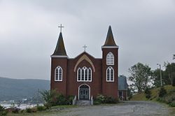 | |
 Cape Broyle Location of Cape Broyle in Newfoundland | |
| Coordinates: 47°05′00″N 52°57′00″W / 47.08333°N 52.95000°WCoordinates: 47°05′00″N 52°57′00″W / 47.08333°N 52.95000°W | |
| Country | |
| Province | |
| Government | |
| • Mayor | Beverley O'Brien |
| Area | |
| • Land | 10.05 km2 (3.88 sq mi) |
| Population | |
| • Total | 489 |
| Time zone | UTC-3:30 (Newfoundland Time) |
| • Summer (DST) | UTC-2:30 (Newfoundland Daylight) |
| Area code(s) | 709 |
| Highways | |

The Town of Cape Broyle (population: 489)[1] is an incorporated community located on the Avalon Peninsula in Newfoundland and Labrador, Canada. During King William's War, the village was destroyed in the Avalon Peninsula Campaign.
References[]
- ^ a b c "Census Profile, 2016 Census: Cape Broyle, Town [Census subdivision], Newfoundland and Labrador". Statistics Canada. Retrieved October 25, 2019.
External links[]
 Media related to Cape Broyle at Wikimedia Commons
- Cape Broyle -Encyclopedia of Newfoundland and Labrador, vol. 1, p. 329-330.

| |
| Subdivisions and statistical units |
|
| Communities |
|
| Cities |
|
| Towns |
|
| Inuit community governments |
|
| |
This Newfoundland and Labrador location article is a stub. You can help Wikipedia by . |
Categories:
- Towns in Newfoundland and Labrador
- Newfoundland and Labrador geography stubs