Cape May Point, New Jersey
Cape May Point, New Jersey | |
|---|---|
| Borough of Cape May Point | |
 | |
 Cape May Point Borough highlighted in Cape May County. Inset map: Cape May County highlighted in the State of New Jersey. | |
 | |
 Cape May Point Location in Cape May County | |
| Coordinates: 38°56′13″N 74°57′55″W / 38.936909°N 74.965374°WCoordinates: 38°56′13″N 74°57′55″W / 38.936909°N 74.965374°W[1][2] | |
| Country | |
| State | |
| County | |
| Incorporated | April 19, 1878 |
| Named for | Cape May / Cornelius Jacobsen May |
| Government | |
| • Type | Walsh Act |
| • Body | Board of Commissioners |
| • Mayor | Robert J. Moffatt (term ends December 31, 2020)[3][4] |
| • Administrator | Steve O'Connor[5] |
| • Municipal clerk | Elaine L. Wallace[6] |
| Area | |
| • Total | 0.31 sq mi (0.81 km2) |
| • Land | 0.30 sq mi (0.76 km2) |
| • Water | 0.02 sq mi (0.05 km2) 5.81% |
| Area rank | 553rd of 565 in state 16th of 16 in county[1] |
| Elevation | 7 ft (2 m) |
| Population | |
| • Total | 291 |
| • Estimate (2019)[12] | 275 |
| • Rank | 561st of 566 in state 16th of 16 in county[13] |
| • Density | 984.5/sq mi (380.1/km2) |
| • Density rank | 384th of 566 in state 7th of 16 in county[13] |
| Time zone | UTC−05:00 (Eastern (EST)) |
| • Summer (DST) | UTC−04:00 (Eastern (EDT)) |
| ZIP Code | |
| Area code(s) | 609 exchanges: 884, 898[16] |
| FIPS code | 3400910330[1][17][18] |
| GNIS feature ID | 0885179[1][19] |
| Website | www |


Cape May Point is a borough located at the tip of the Cape May Peninsula in Cape May County, New Jersey and is the southernmost point in the state. It is part of the Ocean City Metropolitan Statistical Area. As of the 2010 United States Census, the resident population was 291,[9][10][11] reflecting an increase of 50 (+20.7%) from the 241 counted in the 2000 Census, which had in turn declined by 7 (-2.8%) from the 248 counted in the 1990 Census.[20] The summer population can reach 4,500.[21]
The Cape May Light is located in Lower Township, but is also a point of identity for Cape May Point as it uses the lighthouse as a logo for municipal-owned vehicles. Mayors of the two municipalities previously had a conflict over in which municipality it was located.[22]
Cape May Point is a dry town, one of three municipalities in Cape May County where alcohol cannot be sold.[23][24] Cape May Point, Ocean City and Wildwood Crest are Cape May County's only remaining dry municipalities.[25]
History[]
Cape May Point was called Stites Beach until 1876 when the name was changed to Seagrove.[26] It was incorporated as a borough by an act of the New Jersey Legislature on April 19, 1878, from portions of Lower Township, based on the results of a referendum held three days earlier. It was reincorporated on August 19, 1891 and returned to Lower Township on April 8, 1896. Cape May Point re-emerged as an independent municipality on April 6, 1908, based on the results of a referendum held on April 21, 1908.[27] The borough's name derives from Cape May, which was named for 1620 Dutch captain named Cornelius Jacobsen May who explored and charted the area between 1611–1614, and established a claim for the province of New Netherland.[28][29]
The remains of SS Atlantus World War I-era concrete ship are located of the coast of Cape May Point, next to Sunset Beach.[30]
Geography[]
According to the United States Census Bureau, the borough had a total area of 0.31 square miles (0.81 km2), including 0.30 square miles (0.76 km2) of land and 0.02 square miles (0.05 km2) of water (5.81%).[1][2]
Cape May Point borders Lower Township, the Atlantic Ocean and Delaware Bay.[31][32][33]
Cityscape[]
As of 2004 it had about 600 houses. Circa 2004 prices of housing increased, and in 2004 a four bedroom house typically had a price of $1 million.[34]
In 2021 the median price of a house is $1,090,000, which is the highest of any municipality on Cape Island. Most houses are on 50 feet (15 m) by 100 feet (30 m) lots and are below 2,100 square feet (200 m2) in area due to the borough's zoning regulations. Julie Lasky of The New York Times wrote that "the houses appear relatively modest", and that the borough "lacks the fanciful architecture of Cape May".[35]
In 2004 the only two businesses in Cape May Point were the Cape May Bird Observatory bird shop and the Cape May Point General Store.[34]
Demographics[]
| Historical population | |||
|---|---|---|---|
| Census | Pop. | %± | |
| 1880 | 198 | — | |
| 1890 | 167 | −15.7% | |
| 1900 | 153 | −8.4% | |
| 1910 | 162 | 5.9% | |
| 1920 | 121 | −25.3% | |
| 1930 | 104 | −14.0% | |
| 1940 | 126 | 21.2% | |
| 1950 | 198 | 57.1% | |
| 1960 | 263 | 32.8% | |
| 1970 | 204 | −22.4% | |
| 1980 | 255 | 25.0% | |
| 1990 | 248 | −2.7% | |
| 2000 | 241 | −2.8% | |
| 2010 | 291 | 20.7% | |
| 2019 (est.) | 275 | [12][36] | −5.5% |
| Population sources:1880-2000[37] 1880-1920[38] 1880-1890[39] 1890-1910[40] 1910-1930[41] 1930-1990[42] 2000[43][44] 2010[9][10][11] | |||
Census 2010[]
The 2010 United States census counted 291 people, 164 households, and 100 families in the borough. The population density was 984.5 per square mile (380.1/km2). There were 619 housing units at an average density of 2,094.2 per square mile (808.6/km2). The racial makeup was 94.50% (275) White, 2.75% (8) Black or African American, 0.00% (0) Native American, 0.34% (1) Asian, 0.00% (0) Pacific Islander, 0.34% (1) from other races, and 2.06% (6) from two or more races. Hispanic or Latino of any race were 0.34% (1) of the population.[9]
Of the 164 households, 4.3% had children under the age of 18; 55.5% were married couples living together; 3.7% had a female householder with no husband present and 39.0% were non-families. Of all households, 34.1% were made up of individuals and 20.7% had someone living alone who was 65 years of age or older. The average household size was 1.77 and the average family size was 2.17.[9]
4.1% of the population were under the age of 18, 1.7% from 18 to 24, 3.8% from 25 to 44, 34.7% from 45 to 64, and 55.7% who were 65 years of age or older. The median age was 66.4 years. For every 100 females, the population had 84.2 males. For every 100 females ages 18 and older there were 83.6 males.[9]
The Census Bureau's 2006-2010 American Community Survey showed that (in 2010 inflation-adjusted dollars) median household income was $51,250 (with a margin of error of +/- $36,659) and the median family income was $71,875 (+/- $10,854). Males had a median income of $108,125 (+/- $225,840) versus $ (+/- $) for females. The per capita income for the borough was $37,269 (+/- $13,473). About 8.7% of families and 9.4% of the population were below the poverty line, including none of those under age 18 and 12.7% of those age 65 or over.[45]
Census 2000[]
As of the 2000 United States Census[17] there were 241 people, 133 households, and 77 families residing in the borough. The population density was 819.4 people per square mile (320.9/km2). There were 501 housing units at an average density of 1,703.4 per square mile (667.0/km2). The racial makeup of the borough was 95.02% White, 2.07% African American, 0.41% Asian, and 2.49% from two or more races. Hispanic or Latino of any race were 1.66% of the population.[43][44]
There were 133 households, out of which 6.8% had children under the age of 18 living with them, 54.1% were married couples living together, 3.8% had a female householder with no husband present, and 41.4% were non-families. 35.3% of all households were made up of individuals, and 23.3% had someone living alone who was 65 years of age or older. The average household size was 1.81 and the average family size was 2.27.[43][44]
In the borough the population was spread out, with 6.6% under the age of 18, 0.8% from 18 to 24, 10.4% from 25 to 44, 34.4% from 45 to 64, and 47.7% who were 65 years of age or older. The median age was 64 years. For every 100 females, there were 95.9 males. For every 100 females age 18 and over, there were 89.1 males.[43][44]
The median income for a household in the borough was $55,313, and the median income for a family was $69,750. Males had a median income of $63,250 versus $30,833 for females. The per capita income for the borough was $52,689. None of the families and 1.7% of the population were living below the poverty line.[43][44]
Summer population[]
Circa 2004 the summer population was about 4,500.[34]
Government[]
Local government[]

Cape May Point operates under the Walsh Act commission form of government, first created to rebuild the city of Galveston, Texas after the devastating Hurricane of 1900.[7] Cape May Point is one of 30 municipalities statewide to use this form of government, most in shore communities, down from a peak of 60 early in the 20th century.[46][47] In three-member Commissions, as in Cape May Point, the Departments of Public Affairs and Public Safety are combined, as are the Departments of Public Works and Parks and Public Property. Revenue and Finance is the third portfolio. The borough adopted this form of government in 1916.[48][49] The governing body is comprised of three commissioners, who are elected at-large on a non-partisan basis in the November general election to serve concurrent four-year terms of office. Cape May Point shifted its municipal elections from May to November, extending the term-end dates from June 30 to December 31 for the commissioners elected in 2012.[50][51] The Commissioners exercise complete control of the operation of the borough, with each Commissioner having all aspects of Administrative, Executive, Judicial, and Legislative powers over their department. The three Commissioners choose a mayor from among themselves at a reorganization meeting following each election, with the mayor responsible for leading municipal meetings and general oversight of community affairs.

As of 2020, the members of the Board of Commissioners of Cape May Point are Mayor Robert J. Moffatt (Commissioner of Public Affairs and Public Safety) Deputy Mayor Anita vanHeeswyk (Commissioner of Revenue and Finance) and Robert Mullock (Commissioner of Public Works), all serving concurrent terms of office ending December 31, 2020.[3][52][53][54][55]
In October 2013, Robert Mullock was appointed to fill the vacant seat of George "Skip" Stanger, who had resigned citing health reasons.[56] In the November 2014 general election, Mullock was elected to serve the balance of the unexpired term.[57]
Federal, state and county representation[]

Cape May Point is located in the 2nd Congressional District[58] and is part of New Jersey's 1st state legislative district.[10][59][60]
For the 117th United States Congress, New Jersey's Second Congressional District is represented by Jeff Van Drew (R, Dennis Township).[61] New Jersey is represented in the United States Senate by Democrats Cory Booker (Newark, term ends 2027)[62] and Bob Menendez (Harrison, term ends 2025).[63][64]
For the 2020–2021 session (Senate, General Assembly), the 1st Legislative District of the New Jersey Legislature is represented in the State Senate by Mike Testa (R, Vineland) and in the General Assembly by Antwan McClellan (R, Ocean City) and Erik K. Simonsen (R, Lower Township).[65][66]
Cape May County is governed by a Board of Chosen Freeholders consisting of five members, elected at-large in partisan elections to three-year terms of office on a staggered basis, with one or two seats coming up for election each year; At an annual reorganization held each January, the freeholders select one member to serve as Director and another to serve as Vice-Director.[67] As of 2018, Cape May County's Freeholders are Freeholder Director Gerald M. Thornton (Republican Party, Cape May Court House in Middle Township; term as freeholder expires December 31, 2019, term as freeholder director ends 2018),[68] Freeholder Vice-Director Leonard C. Desiderio (R, Sea Isle City; term as freeholder and as freeholder vice-director ends 2018),[69] E. Marie Hayes (R, Ocean City; 2019),[70] Will Morey (R, Wildwood Crest; 2020)[71] and Jeffrey L. Pierson (R. Upper Township; 2020).[72][67][73][74] The county's constitutional officers are County Clerk Rita Marie Fulginiti (R, 2020, Ocean City),[75][76] Sheriff Robert Nolan (R, 2020, Lower Township)[77][78] and Surrogate Dean Marcolongo (R, 2022, Upper Township).[79][80][81][73]
Politics[]
As of March 23, 2011, there were a total of 212 registered voters in Cape May Point, of which 99 (46.7%) were registered as Republicans, 63 (29.7%) were registered as Democrats, and 50 (23.6%) were registered as Unaffiliated. There were no voters registered to other parties.[82]
In the 2012 presidential election, Democrat Barack Obama received 52.0% of the vote (91 cast), ahead of Republican Mitt Romney with 47.4% (83 votes), and other candidates with 0.6% (1 vote), among the 176 ballots cast by the borough's 225 registered voters (1 ballot was spoiled), for a turnout of 78.2%.[83][84] In the 2008 presidential election, Democrat Barack Obama received 53.9% of the vote (103 cast), ahead of Republican John McCain, who received 44.5% (85 votes), with 191 ballots cast among the borough's 203 registered voters, for a turnout of 94.1%.[85] In the 2004 presidential election, Democrat John Kerry received 53.3% of the vote (114 ballots cast), outpolling Republican George W. Bush, who received around 45.8% (98 votes), with 214 ballots cast among the borough's 237 registered voters, for a turnout percentage of 90.3.[86]
In the 2013 gubernatorial election, Republican Chris Christie received 66.9% of the vote (85 cast), ahead of Democrat Barbara Buono with 30.7% (39 votes), and other candidates with 2.4% (3 votes), among the 129 ballots cast by the borough's 209 registered voters (2 ballots were spoiled), for a turnout of 61.7%.[87][88] In the 2009 gubernatorial election, Republican Chris Christie received 47.0% of the vote (79 ballots cast), ahead of both Democrat Jon Corzine with 43.5% (73 votes) and Independent Chris Daggett with 9.5% (16 votes), with 168 ballots cast among the borough's 220 registered voters, yielding a 76.4% turnout.[89]
Law enforcement and public safety[]
Cape May Point Volunteer Fire Department provides fire department services. The spring 1908 Lankenau Villa fire prompted Cape May Point officials to ask for a fire department to be organized the following July, and the borough had two fire carts by 1911. In 1923 a borough ordinance allowed the Cape May Point Volunteer Fire Department to be established, with a truck and fire station acquired and established, respectively, in 1924.[90]
Cape May Point currently relies on Cape May City and West Cape May Borough police for patrols. From the establishment of Cape May Point borough it had an independent police department using ordinary residents filling in as "special" police instead of salaried police, although eventually its police department was reformed into a standard one. Cape May Point began contracting with West Cape May Police in 1986 and with Cape May City police in 2001.[91]
Cape May Point, upon incorporation, had a one-room jail. Joe Jordan, author of Cape May Point, The Illustrated History-1875 to the Present, stated that "if one is to believe local gossip" that the jail likely served as a drunk tank, and Jordan wrote that it "may have held several world's records as the smallest jail, with the fewest inmates, and the shortest periods of incarceration."[92] The borough put the facility for sale in 1927 but rejected the sole bid and turned it into storage for the fire department after moving it behind the current fire station location. It was moved to Historic Cold Spring Village in Cold Spring in 1983.[92]
Infastructure[]
Cape May Point began using Cape May City's water system circa 1970s as Cape May Point's well water system was almost to the maximum salt content that New Jersey law allowed. The water distribution system was rebuilt in the 1980s and 1990s, and a new water tank replaced the previous one in 1995, with the former water tank dismantled. Its water costs increased when Cape May City built a desalinization plant in the late 1990s.[93]
The Cape May Point Water and Sewer Utility, created in 1980, is an agency that is separate from the Cape May Point borough government. A sewage treatment plant opened in 1938, but it put untreated sewage into the water, so Cape May Point agreed to use Cape May City sewage facilities after the New Jersey Department of Health in October 1941 demanded that Cape May Point change its practices with a fine as possible punishment. Cape May Point also helped pay for a new sewage plant Cape May City opened circa 1960-1961.[93]
Education[]

Cape May Point School District is a non-operating school district, with all students sent to schools outside of the district.[94][95] It opened a two story grade 1-8 school in the 1870. It began sending students to Lower Township School District in 1931 and closed the former school, which is now a house.[96] Cape May Point under Frank Rutherford, the mayor, chose not to join the Lower Cape May Regional School District when it was formed. The borough never joined a regional school system.[97] Therefore, in 2004, it had among the lowest property tax rates in New Jersey.[34]
For pre-kindergarten through sixth grade, public school students attend Cape May City Elementary School in Cape May City, as part of a sending/receiving relationship with the Cape May City School District.[98] Most students in the Cape May elementary district come from the United States Coast Guard Training Center Cape May.[99] As of the 2017–18 school year, the district, comprised of one school, had an enrollment of 176 students and 21.2 classroom teachers (on an FTE basis), for a student–teacher ratio of 8.3:1.[100] Starting in 2010, discussions were under way regarding a possible consolidation of the districts of Cape May City, Cape May Point and the West Cape May School District.[101]
For seventh through twelfth grades, public school students attend the schools of the Lower Cape May Regional School District, which serves students from Cape May City, Cape May Point, Lower Township and West Cape May.[102] Schools in the district (with 2017-18 enrollment data from the National Center for Education Statistics[103]) are Richard M. Teitelman Middle School[104] (grades 7 and 8; 458 students) and Lower Cape May Regional High School[105] (9-12; 871).[106]
Students are also eligible to attend Cape May County Technical High School in Cape May Court House, which serves students from the entire county in its comprehensive and vocational programs, which are offered without charge to students who are county residents.[107][108] Special needs students may be referred to Cape May County Special Services School District in the Cape May Court House area.
Transportation[]

As of May 2010, the borough had a total of 7.39 miles (11.89 km) of roadways, of which 5.52 miles (8.88 km) were maintained by the municipality and 1.87 miles (3.01 km) by Cape May County.[109]
No Interstate, U.S., state or major county highways serve Cape May Point. The most significant roads in the borough are minor county routes, such as County Route 629.
Climate[]
According to the Köppen climate classification system, Cape May Point, New Jersey has a humid subtropical climate (Cfa) with hot, moderately humid summers, cool winters and year-around precipitation. Cfa climates are characterized by all months having an average mean temperature > 32.0 °F (> 0.0 °C), at least four months with an average mean temperature ≥ 50.0 °F (≥ 10.0 °C), at least one month with an average mean temperature ≥ 71.6 °F (≥ 22.0 °C) and no significant precipitation difference between seasons. During the summer months in Cape May Point, a cooling afternoon sea breeze is present on most days, but episodes of extreme heat and humidity can occur with heat index values ≥ 95 °F (≥ 35 °C). During the winter months, episodes of extreme cold and wind can occur with wind chill values < 0 °F (< -18 °C). The plant hardiness zone at Cape May Point Beach is 7b/8a with an average annual extreme minimum air temperature of 8.1 °F (-13.3 °C).[110] The average seasonal (Nov-Apr) snowfall total is around 12 (31 cm), and the average snowiest month is February which corresponds with the annual peak in nor'easter activity.
| hideClimate data for Cape May Point Beach, NJ (1981-2010 Averages) | |||||||||||||
|---|---|---|---|---|---|---|---|---|---|---|---|---|---|
| Month | Jan | Feb | Mar | Apr | May | Jun | Jul | Aug | Sep | Oct | Nov | Dec | Year |
| Average high °F (°C) | 41.9 (5.5) |
43.7 (6.5) |
50.4 (10.2) |
59.4 (15.2) |
68.6 (20.3) |
77.7 (25.4) |
82.0 (27.8) |
81.1 (27.3) |
75.8 (24.3) |
66.1 (18.9) |
56.3 (13.5) |
46.7 (8.2) |
62.6 (17.0) |
| Daily mean °F (°C) | 35.3 (1.8) |
37.0 (2.8) |
43.3 (6.3) |
52.3 (11.3) |
61.4 (16.3) |
70.8 (21.6) |
75.6 (24.2) |
74.9 (23.8) |
69.5 (20.8) |
59.1 (15.1) |
49.7 (9.8) |
40.2 (4.6) |
55.8 (13.2) |
| Average low °F (°C) | 28.6 (−1.9) |
30.2 (−1.0) |
36.3 (2.4) |
45.3 (7.4) |
54.2 (12.3) |
63.8 (17.7) |
69.1 (20.6) |
68.6 (20.3) |
63.1 (17.3) |
52.2 (11.2) |
43.0 (6.1) |
33.8 (1.0) |
49.1 (9.5) |
| Average precipitation inches (mm) | 3.36 (85) |
2.80 (71) |
4.16 (106) |
3.64 (92) |
3.63 (92) |
3.19 (81) |
3.79 (96) |
4.07 (103) |
3.24 (82) |
3.62 (92) |
3.23 (82) |
3.61 (92) |
42.34 (1,075) |
| Average relative humidity (%) | 68.9 | 67.7 | 66.0 | 64.5 | 68.9 | 73.0 | 72.9 | 75.4 | 72.1 | 71.0 | 69.7 | 69.4 | 70.0 |
| Average dew point °F (°C) | 26.1 (−3.3) |
27.3 (−2.6) |
32.7 (0.4) |
40.7 (4.8) |
51.1 (10.6) |
61.7 (16.5) |
66.3 (19.1) |
66.6 (19.2) |
60.1 (15.6) |
49.7 (9.8) |
40.2 (4.6) |
31.0 (−0.6) |
46.2 (7.9) |
| Source: PRISM[111] | |||||||||||||
| hideClimate data for North Cape May, NJ Ocean Water Temperature (2 N Cape May Point) | |||||||||||||
|---|---|---|---|---|---|---|---|---|---|---|---|---|---|
| Month | Jan | Feb | Mar | Apr | May | Jun | Jul | Aug | Sep | Oct | Nov | Dec | Year |
| Daily mean °F (°C) | 37 (3) |
37 (3) |
42 (6) |
50 (10) |
59 (15) |
68 (20) |
73 (23) |
74 (23) |
72 (22) |
61 (16) |
52 (11) |
42 (6) |
56 (13) |
| Source: NOAA[112] | |||||||||||||
Ecology[]
According to the A. W. Kuchler U.S. potential natural vegetation types, Cape May Point would have a dominant vegetation type of Northern Cordgrass (73) with a dominant vegetation form of Coastal Prairie (20).[113]
Religion[]
The Sisters of St. Joseph maintain the Queen of the Sea facility, a convent called the Saint Joseph House, and a retreat facility called Saint Mary by-the-Sea.[114] Bill Barlow of the Press of Atlantic City wrote that it is "A beloved local landmark".[115] Its facilities are not connected with the Roman Catholic Diocese of Camden.[116]
Saint Mary opened as the Shoreham Hotel in 1889. Due to business failure it became a nursing home for African Americans in 1898, known as Home for Aged and Infirm Colored People. It later closed, and the sisters spent $9,000 to buy the property in 1909, which it called Saint Mary. This building has a "U-shape" and 38,000 square feet (3,500 m2) of space. In 2016 the sisters announced that they intended to close Saint Mary. The COVID-19 pandemic in New Jersey, starting in 2020, meant that the group could no longer hold retreats there, and in 2021 the order announced Saint Mary was closing.[114] In 2018 the order stated that upon closure St. Mary's should be demolished.[117] In 2021 the order did not anticipate demolishing the facility.[114]
Parks and recreation[]
The "Miss Cape May Point" contest was held in the borough.[93]
Notable people[]
People who were born in, residents of, or otherwise closely associated with Cape May Point include:
- Benjamin Harrison (1833–1901), 23rd President of the United States from 1889 to 1893, who was given a cottage in Cape May Point in 1890 by John Wanamaker and his associates.[118]
- Mary O'Hara (1885–1980), author known for her novel My Friend Flicka.[119]
- Bill Pilczuk (born 1971), swimmer.[120]
- David Allen Sibley (born 1961), ornithologist who is the author and illustrator of The Sibley Guide to Birds.[121]
- John Wanamaker (1838–1922), retailer.[122]
Gallery[]

Cape May Point Public Works Complex

Cape May Point Volunteer Fire Company

Cape May Point State Park (in Lower Township)


References[]
- Jordan, Joe (2003). Cape May Point, The Illustrated History-1875 to the Present. Schiffer Pub. ISBN 9780764318306.
Reference notes[]
- ^ Jump up to: a b c d e f 2019 Census Gazetteer Files: New Jersey Places, United States Census Bureau. Accessed July 1, 2020.
- ^ Jump up to: a b US Gazetteer files: 2010, 2000, and 1990, United States Census Bureau. Accessed September 4, 2014.
- ^ Jump up to: a b Board of Commissioners, Borough of Cape May Point. Accessed March 22, 2020. "Cape May Point is governed under the Walsh Act, in which each elected official has a specific area of responsibility which combines executive and legislative responsibilities. The Walsh Act, enacted in 1911, requires that commissioners be elected at large in nonpartisan elections and serve four-year, concurrent terms of office. The Borough Commission is composed of three members and, as a group, have complete control over all affairs of the municipality. The Mayor is chosen by the three Commissioners immediately following the election."
- ^ 2020 New Jersey Mayors Directory, New Jersey Department of Community Affairs. Accessed February 1, 2020.
- ^ Administrator, Borough of Cape May Point. Accessed March 22, 2020.
- ^ Clerk / Registrar, Borough of Cape May Point. Accessed March 22, 2020.
- ^ Jump up to: a b 2012 New Jersey Legislative District Data Book, Rutgers University Edward J. Bloustein School of Planning and Public Policy, March 2013, p. 8.
- ^ U.S. Geological Survey Geographic Names Information System: Borough of Cape May Point, Geographic Names Information System. Accessed March 5, 2013.
- ^ Jump up to: a b c d e f DP-1 - Profile of General Population and Housing Characteristics: 2010 for Cape May Point borough, Cape May County, New Jersey, United States Census Bureau. Accessed October 16, 2012.
- ^ Jump up to: a b c d Municipalities Sorted by 2011-2020 Legislative District, New Jersey Department of State. Accessed February 1, 2020.
- ^ Jump up to: a b c Profile of General Demographic Characteristics: 2010 for Cape May Point borough Archived 2012-04-30 at the Wayback Machine, New Jersey Department of Labor and Workforce Development. Accessed October 16, 2012.
- ^ Jump up to: a b Annual Estimates of the Resident Population for Minor Civil Divisions in New Jersey: April 1, 2010 to July 1, 2019, United States Census Bureau. Accessed May 21, 2020.
- ^ Jump up to: a b GCT-PH1 Population, Housing Units, Area, and Density: 2010 - State -- County Subdivision from the 2010 Census Summary File 1 for New Jersey , United States Census Bureau. Accessed October 16, 2012.
- ^ Look Up a ZIP Code for Cape May Point, NJ, United States Postal Service. Accessed December 3, 2011.
- ^ ZIP Codes, State of New Jersey. Accessed September 18, 2013.
- ^ Area Code Lookup - NPA NXX for Cape May Point, NJ, Area-Codes.com. Accessed September 2, 2013.
- ^ Jump up to: a b U.S. Census website , United States Census Bureau. Accessed September 4, 2014.
- ^ Geographic Codes Lookup for New Jersey Archived June 4, 2019, at the Wayback Machine, Missouri Census Data Center. Accessed September 1, 2019.
- ^ US Board on Geographic Names, United States Geological Survey. Accessed September 4, 2014.
- ^ Table 7. Population for the Counties and Municipalities in New Jersey: 1990, 2000 and 2010 Archived August 7, 2017, at the Wayback Machine, New Jersey Department of Labor and Workforce Development, February 2011. Accessed October 16, 2012.
- ^ Lawlor, Julia. "Cape May Point, N.J.", The New York Times, September 3, 2004. Accessed June 28, 2016. "Its population of 241 rises to 4,500 in summer, and it has 600 houses and two businesses, the Cape May Point General Store and the gift shop at the Cape May Bird Observatory."
- ^ Degener, Richard. "New Lower Township police cars roll in black and white", The Press of Atlantic City, May 22, 2009. Accessed July 3, 2011. Article info and Image caption - Quote: "The department on Thursday unveiled its new emblem featuring a picture of the Cape May Lighthouse, which is located next to Cape May Point State Park, and, like the park itself, is actually in Lower Township. Mayors in Lower Township Cape May and Cape May Point have sparred in years past over claims to the lighthouse."
- ^ New Jersey Division of Alcoholic Beverage Control. New Jersey ABC list of dry towns (May 1, 2013)
- ^ Giordano, Rita. "More towns catching liquor-license buzz; Moorestown considers ending its dry spell", The Philadelphia Inquirer, June 24, 2007. Accessed February 16, 2014.
- ^ Procida, Lee. "Cape May County towns relaxing liquor laws as area's alcohol culture changes", Press of Atlantic City, April 14, 2012. Accessed October 16, 2017. "Wildwood Crest and Cape May Point join Ocean City as the only remaining dry communities in Cape May County."
- ^ Cape May County: Cape May Point, getnj.com. Accessed September 9, 2007.
- ^ Snyder, John P. The Story of New Jersey's Civil Boundaries: 1606-1968, Bureau of Geology and Topography; Trenton, New Jersey; 1969. p. 114. Accessed October 16, 2012.
- ^ Hutchinson, Viola L. The Origin of New Jersey Place Names, New Jersey Public Library Commission, May 1945. Accessed August 28, 2015.
- ^ Gannett, Henry. The Origin of Certain Place Names in the United States, p. 68. United States Government Printing Office, 1905. Accessed August 28, 2015.
- ^ "Concrete ship wreck at Cape May Point", The Press of Atlantic City, April 24, 2010. Accessed October 15, 2017.
- ^ Areas touching Cape May Point, MapIt. Accessed March 22, 2020.
- ^ Cape May County, Coalition for a Healthy NJ. Accessed March 22, 2020.
- ^ New Jersey Municipal Boundaries, New Jersey Department of Transportation. Accessed November 15, 2019.
- ^ Jump up to: a b c d Lawlor, Julia (September 3, 2004). "Havens: Cape May Point, N.J." The New York Times. Retrieved June 20, 2021.
- ^ Lasky, Julie (June 16, 2021). "Cape May, N.J.: Salt Air and Cultural Riches". The New York Times. Retrieved June 16, 2021.
- ^ Census Estimates for New Jersey April 1, 2010 to July 1, 2019, United States Census Bureau. Accessed May 21, 2020.
- ^ Barnett, Bob. Population Data for Cape May County Municipalities, 1810 - 2000, WestJersey.org, January 6, 2011. Accessed October 16, 2012.
- ^ Compendium of censuses 1726-1905: together with the tabulated returns of 1905, New Jersey Department of State, 1906. Accessed October 7, 2013.
- ^ Porter, Robert Percival. Preliminary Results as Contained in the Eleventh Census Bulletins: Volume III - 51 to 75, p. 97. United States Census Bureau, 1890. Accessed October 7, 2013.
- ^ Thirteenth Census of the United States, 1910: Population by Counties and Minor Civil Divisions, 1910, 1900, 1890, United States Census Bureau, p. 336. Accessed October 16, 2012.
- ^ Fifteenth Census of the United States: 1930 - Population Volume I, United States Census Bureau, p. 715. Accessed October 16, 2012.
- ^ New Jersey Resident Population by Municipality: 1930 - 1990 Archived May 10, 2015, at the Wayback Machine, Workforce New Jersey Public Information Network. Accessed June 28, 2015.
- ^ Jump up to: a b c d e Census 2000 Profiles of Demographic / Social / Economic / Housing Characteristics for Cape May Point borough, New Jersey Archived 2014-07-04 at the Wayback Machine, United States Census Bureau. Accessed October 16, 2012.
- ^ Jump up to: a b c d e DP-1: Profile of General Demographic Characteristics: 2000 - Census 2000 Summary File 1 (SF 1) 100-Percent Data for Cape May Point borough, Cape May County, New Jersey, United States Census Bureau. Accessed October 16, 2012.
- ^ DP03: Selected Economic Characteristics from the 2006-2010 American Community Survey 5-Year Estimates for Cape May Point borough, Cape May County, New Jersey, United States Census Bureau. Accessed October 16, 2012.
- ^ Inventory of Municipal Forms of Government in New Jersey, Rutgers University Center for Government Studies, July 1, 2011. Accessed November 18, 2019.
- ^ Proctor, Owen; and Sobko, Katie. "Town commissions have become a New Jersey rarity", The Record, April 30, 2018, updated May 6, 2018. Accessed October 27, 2019. "Commissions rose in popularity, up to 60 statewide in the early part of the last century, from large cities and older suburbs to seaside resorts.... Today, only about 30 of New Jersey’s 565 municipalities are commissions, including six in North Jersey. There are North Bergen, Union City and West New York in Hudson County, Lyndhurst and Ridgefield Park in Bergen County, and Nutley in Essex County."
- ^ "The Commission Form of Municipal Government", p. 53. Accessed June 3, 2015.
- ^ "Forms of Municipal Government in New Jersey", p. 8. Rutgers University Center for Government Studies. Accessed June 3, 2015.
- ^ Ianieri, Brian. "State will let New Jersey municipalities abandon May elections next year — if they want to", The Press of Atlantic City, May 9, 2010. Accessed June 28, 2016.
- ^ Municipal Elections, Cape May County, New Jersey. Accessed June 28, 2016.
- ^ 2020 Municipal User Friendly Budget, Borough of Cape May Point. Accessed March 22, 2020.
- ^ The Official Cape May County 2019 Directory, Cape May County, New Jersey. Accessed March 22, 2020.
- ^ 2020 County and Municipal Elected Officials Cape May County, NJ -- January 2020, Cape May County, New Jersey, January 7, 2020. Accessed March 22, 2020.
- ^ Cape May County Summary of Vote for 2016 Cape May County General Election, Cape May County, New Jersey, updated November 18, 2016. Accessed January 30, 2017.
- ^ Degener, Richard. "Bob Mullock Joins Cape May Point Borough Commission", The Press of Atlantic City, October 11, 2013. Accessed February 13, 2015. "Borough Commission has appointed Lake Drive resident Bob Mullock to take the seat vacated by Mayor George Stanger.Mullock, 63, will serve at least until the November 2014 election. Stanger's seat does not expire until 2016."
- ^ 2014 General Election Results, Cape May County. Accessed February 13, 2015.
- ^ Plan Components Report, New Jersey Redistricting Commission, December 23, 2011. Accessed February 1, 2020.
- ^ 2019 New Jersey Citizen's Guide to Government, New Jersey League of Women Voters. Accessed October 30, 2019.
- ^ Districts by Number for 2011-2020, New Jersey Legislature. Accessed January 6, 2013.
- ^ Directory of Representatives: New Jersey, United States House of Representatives. Accessed January 3, 2019.
- ^ [1], United States Senate. Accessed April 30, 2021. "He now owns a home and lives in Newark's Central Ward community."
- ^ Biography of Bob Menendez, United States Senate, January 26, 2015. "Menendez, who started his political career in Union City, moved in September from Paramus to one of Harrison's new apartment buildings near the town's PATH station.."
- ^ [2]. United States Senate. Accessed April 30, 2021. "Booker, Cory A. - (D - NJ) Class II; Menendez, Robert - (D - NJ) Class I"
- ^ Legislative Roster 2020–2021 Session, New Jersey Legislature. Accessed April 16, 2020.
- ^ District 1 Legislators, New Jersey Legislature. Accessed April 16, 2020.
- ^ Jump up to: a b Cape May County Freeholders Home Page, Cape May County, New Jersey. Accessed June 6, 2018.
- ^ Gerald M. Thornton, Cape May County, New Jersey. Accessed June 6, 2018.
- ^ Leonard C. Desiderio, Cape May County, New Jersey. Accessed June 6, 2018.
- ^ E. Marie Hayes, Cape May County, New Jersey. Accessed June 6, 2018.
- ^ Will Morey, Cape May County, New Jersey. Accessed June 6, 2018.
- ^ Jeffrey L. Pierson, Cape May County, New Jersey. Accessed June 6, 2018.
- ^ Jump up to: a b The Official Cape May County 2018 Directory, Cape May County, New Jersey. Accessed June 6, 2018.
- ^ 2018 County Data Sheet, Cape May County, New Jersey. Accessed June 6, 2018.
- ^ County Clerk, Cape May County, New Jersey. Accessed June 6, 2018.
- ^ Members List: Clerks, Constitutional Officers Association of New Jersey. Accessed June 6, 2018.
- ^ Home Page, Cape May County Sheriff. Accessed June 6, 2018.
- ^ Members List: Sheriffs, Constitutional Officers Association of New Jersey. Accessed June 6, 2018.
- ^ Surrogate, Cape May County, New Jersey. Accessed June 6, 2018.
- ^ Members List: Surrogates, Constitutional Officers Association of New Jersey. Accessed June 6, 2018.
- ^ Constitutional Officers, Cape May County, New Jersey. Accessed June 6, 2018.
- ^ Voter Registration Summary - Cape May, New Jersey Department of State Division of Elections, March 23, 2011. Accessed October 16, 2012.
- ^ "Presidential General Election Results - November 6, 2012 - Cape May County" (PDF). New Jersey Department of Elections. March 15, 2013. Retrieved December 24, 2014.
- ^ "Number of Registered Voters and Ballots Cast - November 6, 2012 - General Election Results - Cape May County" (PDF). New Jersey Department of Elections. March 15, 2013. Retrieved December 24, 2014.
- ^ 2008 Presidential General Election Results: Cape May County, New Jersey Department of State Division of Elections, December 23, 2008. Accessed October 16, 2012.
- ^ 2004 Presidential Election: Cape May County, New Jersey Department of State Division of Elections, December 13, 2004. Accessed October 16, 2012.
- ^ "Governor - Cape May County" (PDF). New Jersey Department of Elections. January 29, 2014. Retrieved December 24, 2014.
- ^ "Number of Registered Voters and Ballots Cast - November 5, 2013 - General Election Results - Cape May County" (PDF). New Jersey Department of Elections. January 29, 2014. Retrieved December 24, 2014.
- ^ 2009 Governor: Cape May County Archived 2012-10-17 at the Wayback Machine, New Jersey Department of State Division of Elections, December 31, 2009. Accessed October 16, 2012.
- ^ Jordan, ISBN 0-7643-1830-6, p. 81.
- ^ Jordan, ISBN 0-7643-1830-6, p. 113.
- ^ Jump up to: a b Jordan, ISBN 0-7643-1830-6, p. 80.
- ^ Jump up to: a b c Jordan, ISBN 0-7643-1830-6, p. 117.
- ^ Non-operating School Districts in New Jersey for 2018-19, New Jersey Department of Education, updated July 2019. Accessed July 24, 2020.
- ^ 13 Non-Operating School Districts Eliminated, New Jersey Department of Education press release dated July 1, 2009. Accessed December 26, 2009. "The remaining 13 non-operating districts that will be addressed at a later date are [...] Cape May Point (Cape May)[...]"
- ^ Degener, Richard (March 27, 2013). "No students to support in Cape May Point school budget". Press of Atlantic City. Retrieved June 6, 2021.
- ^ Keough, Buzz (April 25, 2014). "In Cape May Point, school budget tax rate never more than a penny". Press of Atlantic City. Retrieved June 5, 2021.
- ^ Comprehensive Annual Financial Report of the Cape May Point School District, New Jersey Department of Education, for year ending June 30, 2020. p. 2 (PDF p. 7). Accessed March 31, 2021. "The District is a sending district and operates no schools and/or facilities. Students are sent on a tuition basis to Cape May City Elementary School for grades PreK-6 and to Lower Cape May Regional School District for grades 7-12."
- ^ Cape May City School District 2016 Report Card Narrative, New Jersey Department of Education. Accessed June 18, 2017. "The District is a one-school district. 60% of the students come from the United States Coast Guard Training Center based in Cape May; 25% from Cape May City residents; and 15% from the Low-income Housing Authority, one student from the sending district of Cape May Point and 2 homeless students."
- ^ District information for Cape May City School District, National Center for Education Statistics. Accessed October 27, 2019.
- ^ Crowley, Terrence J. Cape May County Report on Consolidation and Regionalization, New Jersey Department of Education, March 15, 2010, available through the Asbury Park Press. Accessed October 4, 2014. "The school districts of Cape May City, West Cape May, and Cape May Point (non-operating) are currently conducting a feasibility study to merge the districts. A consultant is currently collecting and analyzing data and will be finalizing his report in late spring 2010."
- ^ School Choice Brochure, Lower Cape May Regional School District. Accessed March 21, 2018. "Lower Cape May Regional High School is a four year comprehensive public High School that serves students from Cape May, West Cape May, Lower Township, Cape May Point and now Choice School students."
- ^ School Data for the Lower Cape May Regional High School District, National Center for Education Statistics. Accessed October 27, 2019.
- ^ General Information, Richard M. Teitelman Middle School. Accessed March 21, 2018.
- ^ General Information, Lower Cape May Regional High School. Accessed March 21, 2018.
- ^ New Jersey School Directory for the Lower Cape May Regional School District, New Jersey Department of Education. Accessed December 26, 2016.
- ^ Frequently Asked Questions, Cape May County Technical High School. Accessed October 27, 2019. "All residents of Cape May County are eligible to attend Cape May County Technical High School.... The Cape May County Technical High School is a public school so there is no cost to residents of Cape May County."
- ^ Technical High School Admissions, Cape May County Technical High School. Accessed October 27, 2019. "All students who are residents of Cape May County may apply to the Technical High School."
- ^ Cape May County Mileage by Municipality and Jurisdiction[permanent dead link], New Jersey Department of Transportation, May 2010. Accessed July 18, 2014.
- ^ "USDA Interactive Plant Hardiness Map". United States Department of Agriculture. Retrieved August 5, 2019.
- ^ Time Series Values for Individual Locations, PRISM Climate Group Oregon State University. Accessed March 18, 2020.
- ^ Water Temperature Table of All Coastal Regions Archived September 5, 2017, at the Wayback Machine, National Oceanic and Atmospheric Administration. Accessed March 18, 2020.
- ^ U.S. Potential Natural Vegetation, Original Kuchler Types, v2.0 (Spatially Adjusted to Correct Geometric Distortions), Data Basin. Accessed March 18, 2020.
- ^ Jump up to: a b c "Sisters of St. Joseph close iconic Cape May retreat: 'It's beyond sad'". Philadelphia Inquirer. February 12, 2021. Retrieved May 22, 2021.
- ^ Barlow, Bill (February 10, 2021). "After more than a century, Cape May Point's St. Mary's retreat may have seen its last summer". The Press of Atlantic City. Retrieved May 22, 2021.
- ^ Rosenberg, Amy S. (June 28, 2007). "Faith in face of adversity". Philadelphia Inquirer. Retrieved May 22, 2021.
The homes are owned separately by the individual orders and have no connection with the archdioceses in the area.
- ^ "Nuns plan to demolish Cape May Point retreat center". WHYY. October 25, 2018. Retrieved May 22, 2021.
- ^ Fox, Karen. "The Halls Presidents Walked", CapeMay.com, February 1, 2012. Accessed August 20, 2020.
- ^ O'Hara, Mary. My Friend Flicka Archived 2012-10-23 at the Wayback Machine, HarperCollins. Accessed July 3, 2011. "About the Author: Mary O'Hara was born July 10, 1885, in Cape May Point, New Jersey."
- ^ Brown, Scott. "Pilczuk Finds Fulfilling Career In Pool: The Cape May Point Native Says He Is Successful, Without A Trip To The Olympics.", The Philadelphia Inquirer, April 18, 1999. Accessed June 1, 2008.
- ^ Lemongello, Steven. "Professional birder, author, got start in Cape May Point", The Press of Atlantic City, October 24, 2009. Accessed September 12, 2019. "Like a migrating bird returning to its nesting grounds, noted birding guide author David Allen Sibley has returned to the town where he first learned about birdwatching.... The writer, now based out of Concord, Mass., first came to Cape May Point in the fall of 1980, 'when I essentially dropped out of college to go birdwatching full time.'"
- ^ Cape May Point, Cape May County Chamber of Commerce. Accessed November 15, 2016. "Wanamaker also built a summer cottage at the Point and later, when he was Postmaster General in President Benjamin Harrison's Cabinet, he invited the President and First Lady to visit Cape May Point and use Congress Hall in Cape May as the summer White House."
Further reading[]
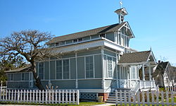
- "Beadle Memorial Presbyterian Church, 506 Cape Avenue, Cape May Point, Cape May County, NJ". Library of Congress.
External links[]
| Wikimedia Commons has media related to Cape May Point, New Jersey. |
| show Municipalities and communities of Cape May County, New Jersey, United States |
|---|

| show Authority control |
|---|
- Cape May Point, New Jersey
- Boroughs in Cape May County, New Jersey
- Jersey Shore communities in Cape May County
- New Jersey District Factor Group none
- Populated places established in 1878
- 1878 establishments in New Jersey
- Walsh Act