Carnestown, Florida
Carnestown, Florida | |
|---|---|
 | |
 Carnestown Location within the state of Florida | |
| Coordinates: 25°54′38″N 81°21′52″W / 25.91056°N 81.36444°WCoordinates: 25°54′38″N 81°21′52″W / 25.91056°N 81.36444°W | |
| Country | |
| State | |
| County | |
| Time zone | UTC-5 (Eastern (EST)) |
| • Summer (DST) | UTC-4 (EDT) |


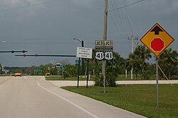
Carnestown is an uninhabited unincorporated area in Collier County, Florida, United States,[1] located at the intersection of United States Route 41 and State Road 29. The area is named for Juliet Gordon Carnes, whom Barron Collier, the county's namesake, married in 1907.
Before the 1920s, Carnestown was the endpoint of the Tamiami Trail from Southwest Florida; those wishing to continue to Everglades City or Miami had to abandon their vehicles and travel on foot.[2] During the 1920s, Carnestown served as a major workcamp for the connection of the trail.[3] After construction was completed, Carnestown was demolished between 1928 and 1929.[4]
References[]
- ^ "US Gazetteer files: 2010, 2000, and 1990". United States Census Bureau. 2011-02-12. Retrieved 2011-04-23.
- ^ Holmes, F. Irving (1928-04-22). "Early Travel On Trail Told By F. I. Holmes". The Miami News. p. 29. Retrieved 2021-08-15 – via Newspapers.com.
- ^ Pertuit, Eddie (1974-04-21). "Rugged Men Blasted Tamiami Trail Out Of Solid Rock". Fort Myers News-Press. p. 31. Retrieved 2021-08-15 – via Newspapers.com.
- ^ "Carnestown, Trail Settlement Being Erased From Map". The Tampa Tribune. 1928-12-22. p. 5. Retrieved 2021-08-15 – via Newspapers.com.
Municipalities and communities of Collier County, Florida, United States | ||
|---|---|---|
| Cities |  | |
| CDPs | ||
| Unincorporated communities | ||
| Ghost towns | ||
| ||
Categories:
- Unincorporated communities in Collier County, Florida
- Unincorporated communities in Florida
- Southwest Florida geography stubs