Cayos de Caña Gorda
This article needs additional citations for verification. (May 2021) |
 Cayo Aurora (western cay) from ferry boat | |
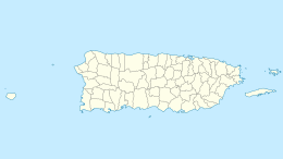
 Census 2000 map of Cayos de Caña Gorda | |
 Cayos de Caña Gorda | |
| Geography | |
|---|---|
| Coordinates | 17°56′32″N 066°52′17″W / 17.94222°N 66.87139°WCoordinates: 17°56′32″N 066°52′17″W / 17.94222°N 66.87139°W |
| Administration | |
| Territory | Puerto Rico |


| Part of a series on |
| Tourism in Puerto Rico |
|---|
| Tourism Regions |
| Beaches |
|
| Caves |
| Cays and islets |
| Convention centers |
| Culture |
|
| Islands |
|
The Cayos de Caña Gorda (English: Caña Gorda Cays or Keys) is a group of three uninhabited, mangrove-covered cays, located at 17°56′32″N 066°52′17″W / 17.94222°N 66.87139°W off the southwestern coast of Puerto Rico. They belong to barrio Carenero of Guánica municipio. The eastern cay, Isla Ballena is separated from the Puerto Rican mainland close to Punta Ballena only by a 66 foot (20 m) wide channel. The western cay was given the name Gilligan's Island (after the TV series) in the 1970s by the Keegan/Barnett family, who had recently moved to Guanica from Philadelphia, Pennsylvania. Cayo Aurora is served by boat (1,969 ft (600 m) from the mainland at Punta Jacinto) and has public beaches. Between the two is Cayo Honda, the central cay. The total land area is 0.069 sq mi (44 acres; 0.18 km2) (Block 1069, Block Group 1, Census tract 9611, Guánica Municipio, Puerto Rico).
The area is good for snorkeling and can be reached by kayak.[1]
Gallery[]

On the shore of Cayo Aurora

Ferry boat to Gilligan's Island

Coral formations behind Gilligan's Island

Welcome sign at boat landing of Cayo Aurora, mangrove forest in the background
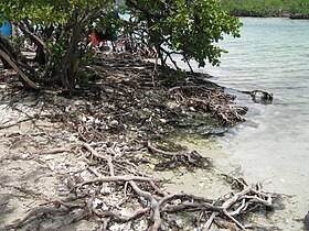
Northern mangrove-covered shore of Cayo Aurora


References[]
- ^ "Gilligan's Island". Discover Puerto Rico. Puerto Rico Department of Tourism. Retrieved 14 May 2021.
This Guánica, Puerto Rico location article is a stub. You can help Wikipedia by . |
- Cays and islets of Puerto Rico
- Uninhabited islands of Puerto Rico
- Guánica, Puerto Rico
- Puerto Rico Senatorial district V geography stubs