Isleta de San Juan
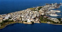 Aerial view of Isleta de San Juan in Old San Juan | |
 | |
 Isleta de San Juan | |
| Geography | |
|---|---|
| Location | Caribbean Sea |
| Coordinates | 18°28′0.43″N 66°6′26.47″W / 18.4667861°N 66.1073528°WCoordinates: 18°28′0.43″N 66°6′26.47″W / 18.4667861°N 66.1073528°W |
| Archipelago | Puerto Rico Archipielago, Greater Antilles |
| Area | 7.8 km2 (3.0 sq mi) |
| Territory | Puerto Rico |
| Demographics | |
| Population | ~7000 (2010) |
| Additional information | |
| Time zone |
|


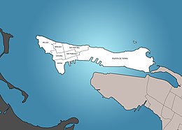
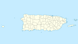
The Isleta de San Juan is a 3-square-mile (7.8 km2) island off the coast of Puerto Rico on the San Juan Bay, connected to the mainland by bridges and a causeway. It is the site of Old San Juan, the historic quadrant of the territory's capital, San Juan. Its eastern part constitutes the neighborhood of Puerta de Tierra, location of many of Puerto Rico's government buildings.
Its population in 2010 was about 7000.[1] Traffic into the island is normally closed during the San Sebastián Street Festival.[2][3]
The historic Normandie Hotel is located in the Isleta de San Juan.[4]
Gallery[]

Silhouette of Statues in Isleta de San Juan
Traffic in Isleta de San Juan

Fort and building in Isleta de San Juan

Street art, statues in Isleta de San Juan
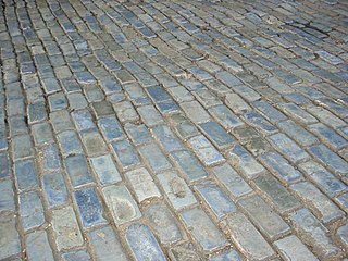
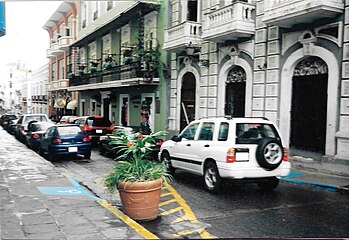
Blue cobblestone streets of Old San Juan


References[]
- ^ "Charming Colonial Streets of San Juan to Go Car Free". TreeHugger. Archived from the original on 2019-04-04. Retrieved 2019-04-04.
- ^ "Cierran el acceso vehicular al Viejo San Juan para la SanSe". El Nuevo Dia (in Spanish). 20 January 2019. Archived from the original on 4 April 2019. Retrieved 4 April 2019.
- ^ Ríos, Melissa Cruz (1 December 2019). "Para subir y bajar el Viejo San Juan". El Vocero de Puerto Rico (in Spanish). Archived from the original on 4 April 2019. Retrieved 4 April 2019.
- ^ "National Register of Historic Places Inventory Nomination Form" (PDF). agencias pr gov. Puerto Rico. Retrieved 25 December 2019.
This San Juan, Puerto Rico location article is a stub. You can help Wikipedia by . |
- Geography of San Juan, Puerto Rico
- Islands of Puerto Rico
- Puerto Rico Senatorial district I geography stubs