Monito Island
 Monito Island, Puerto Rico | |
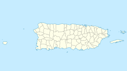 Monito Location in Puerto Rico | |
| Geography | |
|---|---|
| Coordinates | 18°9′29″N 67°56′47″W / 18.15806°N 67.94639°W |
| Area | .147 km2 (0.057 sq mi) |
| Highest elevation | 65 m (213 ft) |
| Administration | |
| Commonwealth | Puerto Rico |
| Municipality | Mayagüez |
| Barrio | Isla de Mona e Islote Monito |
| Demographics | |
| Population | 0 |
| Pop. density | 0/km2 (0/sq mi) |
| Designated | 1975 |


Monito Island (English: Little Mona, Spanish: Islote Monito) is an uninhabited island about 3.1 mi (5.0 km) northwest of the much larger Mona Island. Monito is the masculine diminutive form of Mona in Spanish, which also translates to little monkey in Spanish. It is one of three islands in the Mona Passage, and part of the Isla de Mona e Islote Monito barrio, a subdivision of the municipality of Mayagüez, Puerto Rico.
Description[]

The island is uninhabited. The high altitude of the island's shoreline makes it inaccessible by sea. Monito has an area of 0.06 sq mi (0.16 km2) or 36.25 acres (14.67 ha), its highest point is 213 ft (65 m), and is barren. The US coast guard has rescued migrants off Monito Island. The Monito gecko is found only on Monito Island.[1]
Gallery[]

US 2010 Census map of the two islands off Mayagüez
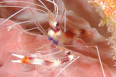
Banded Coral Shrimp

Green Moray Eel
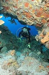
Diver in cave

Diver and anemone

Diver and old anchor


See also[]
References[]
- ^ "Monito gecko". FWS.gov. Retrieved October 6, 2019.
External links[]
 Media related to Monito Island at Wikimedia Commons
- Monito Island summary from the University of Puerto Rico-Mayagüez Department of Biology Herbarium
Coordinates: 18°09′30″N 67°56′48″W / 18.158208°N 67.94662°W
| Authority control |
|
|---|
- Uninhabited islands of Puerto Rico
- Mayagüez, Puerto Rico
- National Natural Landmarks in Puerto Rico