Cerro, New Mexico
The Village of Cerro | |
|---|---|
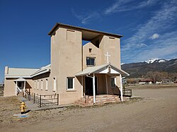 Nuestra Senora de Guadalupe Catholic Church in Cerro, March 2021 | |
 The Village of Cerro | |
| Coordinates: 36°54′14″N 105°36′46″W / 36.90389°N 105.61278°W | |
| Country | United States |
| State | New Mexico |
| County | Taos |
| Elevation | 7,461 ft (2,274 m) |
| Population (2000) | |
| • Total | 428 |
| Time zone | UTC-7 (Mountain (MST)) |
| • Summer (DST) | UTC-6 (MDT) |
| ZIP code | 87519 |
| Area code(s) | 575 |
| Website | http://www.laplaza.org/government/cerro/ |

Cerro is an unincorporated community in Taos County, New Mexico, United States[1] located along New Mexico State Road 378. It was founded in 1854 by settlers from Taos and Questa and was named for Cerro Guadalupe.[2]
See also[]
Notes[]
- ^ "Cerro, New Mexico". Geographic Names Information System. United States Geological Survey.
- ^ Julyan, Robert (1996). The Place Names of New Mexico. University of New Mexico Press. p. 73. ISBN 0826316891.
Municipalities and communities of Taos County, New Mexico, United States | ||
|---|---|---|
| Towns |  | |
| Villages | ||
| CDPs | ||
| Other communities | ||
| Ghost towns | ||
| Indian reservation | ||
| Footnotes | ‡This populated place also has portions in an adjacent county or counties | |
| ||
Coordinates: 36°45′14″N 105°36′46″W / 36.75389°N 105.61278°W
Categories:
- Unincorporated communities in Taos County, New Mexico
- Unincorporated communities in New Mexico