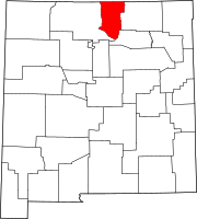
Twining, New Mexico
Twining, New Mexico | |
|---|---|
 Twining, New Mexico | |
| Coordinates: 36°35′41″N 105°27′01″W / 36.59472°N 105.45028°WCoordinates: 36°35′41″N 105°27′01″W / 36.59472°N 105.45028°W | |
| Country | United States |
| State | New Mexico |
| County | Taos |
| Elevation | 9,429 ft (2,874 m) |
| Time zone | UTC-7 (Mountain (MST)) |
| • Summer (DST) | UTC-6 (MDT) |
| Area code(s) | 575 |
| GNIS feature ID | 911939[1] |
Twining is a ghost town in Taos County, New Mexico, United States.[1][2]
Originally called Amizette, this was a small mining district with copper, gold and silver lodes, established in 1893 but abandoned by 1895. About 1902, Prospector William Frazer discovered further copper and gold in the canyon east of the townsite, and persuaded New Jersey banker Albert C. Twining to invest $300,000 in a smelter. On its first firing, molten ore froze to the sides of the furnace, making it unusable. Bankruptcy followed, and the townsite was abandoned by 1910. [3]
In 1955 the site was acquired by Ernie Blake, who developed it into Taos Ski Valley. Virtually no trace now remains of the original village.
Notes[]
- ^ a b "Twining, New Mexico". Geographic Names Information System. United States Geological Survey.
- ^ Twining Topo Map in Taos County MN
- ^ Pearce, T.M. ed.,’’New Mexico Place Names: A Geographical Dictionary’’, UNM Press 1965, ISBN 0-8263-0082-0
Categories:
- Ghost towns in New Mexico
- Unincorporated communities in Taos County, New Mexico
- Unincorporated communities in New Mexico
- New Mexico geography stubs

