Che Kung Temple station
This article needs additional citations for verification. (December 2009) |
Che Kung Temple 車公廟 | |||||||||||||||||||||||||||||||||||||||||||||||||||||||||||||||
|---|---|---|---|---|---|---|---|---|---|---|---|---|---|---|---|---|---|---|---|---|---|---|---|---|---|---|---|---|---|---|---|---|---|---|---|---|---|---|---|---|---|---|---|---|---|---|---|---|---|---|---|---|---|---|---|---|---|---|---|---|---|---|---|
| MTR rapid transit station | |||||||||||||||||||||||||||||||||||||||||||||||||||||||||||||||
 Platform 1 of Che Kung Temple station in November 2017 | |||||||||||||||||||||||||||||||||||||||||||||||||||||||||||||||
| Chinese name | |||||||||||||||||||||||||||||||||||||||||||||||||||||||||||||||
| Traditional Chinese | 車公廟 | ||||||||||||||||||||||||||||||||||||||||||||||||||||||||||||||
| Simplified Chinese | 车公庙 | ||||||||||||||||||||||||||||||||||||||||||||||||||||||||||||||
| Literal meaning | Common car temple | ||||||||||||||||||||||||||||||||||||||||||||||||||||||||||||||
| |||||||||||||||||||||||||||||||||||||||||||||||||||||||||||||||
| General information | |||||||||||||||||||||||||||||||||||||||||||||||||||||||||||||||
| Location | Near Chun Shek Estate, , Tai Wai Sha Tin District, Hong Kong | ||||||||||||||||||||||||||||||||||||||||||||||||||||||||||||||
| Coordinates | 22°22′29″N 114°11′10″E / 22.3748°N 114.1861°ECoordinates: 22°22′29″N 114°11′10″E / 22.3748°N 114.1861°E | ||||||||||||||||||||||||||||||||||||||||||||||||||||||||||||||
| Owned by | KCR Corporation | ||||||||||||||||||||||||||||||||||||||||||||||||||||||||||||||
| Operated by | MTR Corporation | ||||||||||||||||||||||||||||||||||||||||||||||||||||||||||||||
| Line(s) | |||||||||||||||||||||||||||||||||||||||||||||||||||||||||||||||
| Platforms | 2 (2 side platforms) | ||||||||||||||||||||||||||||||||||||||||||||||||||||||||||||||
| Tracks | 2 | ||||||||||||||||||||||||||||||||||||||||||||||||||||||||||||||
| Connections | |||||||||||||||||||||||||||||||||||||||||||||||||||||||||||||||
| Construction | |||||||||||||||||||||||||||||||||||||||||||||||||||||||||||||||
| Structure type | Elevated | ||||||||||||||||||||||||||||||||||||||||||||||||||||||||||||||
| Disabled access | Yes | ||||||||||||||||||||||||||||||||||||||||||||||||||||||||||||||
| Other information | |||||||||||||||||||||||||||||||||||||||||||||||||||||||||||||||
| Station code | CKT | ||||||||||||||||||||||||||||||||||||||||||||||||||||||||||||||
| History | |||||||||||||||||||||||||||||||||||||||||||||||||||||||||||||||
| Opened |
| ||||||||||||||||||||||||||||||||||||||||||||||||||||||||||||||
| Services | |||||||||||||||||||||||||||||||||||||||||||||||||||||||||||||||
| |||||||||||||||||||||||||||||||||||||||||||||||||||||||||||||||
| |||||||||||||||||||||||||||||||||||||||||||||||||||||||||||||||
| Location | |||||||||||||||||||||||||||||||||||||||||||||||||||||||||||||||
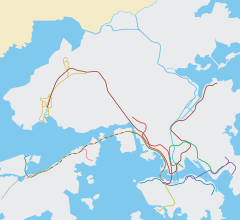 Che Kung Temple Location within the MTR system | |||||||||||||||||||||||||||||||||||||||||||||||||||||||||||||||

Che Kung Temple (Chinese: 車公廟; Cantonese Yale: Chēgūngmiuh) is a station on Hong Kong's Tuen Ma line. It is located on in Sha Tin in the New Territories. Its position was Sha Tin Tau Temporary Housing Area, so it was provisionally called "Sha Tin Tau" before the Ma On Shan line (the precursor to this section of the Tuen Ma line) opened.
It is located near the Che Kung Miu temple. On the third day of the first month in the Chinese calendar (also known as the third day of the Lunar New Year) many people use the station to get to the temple. The station is always crowded during those days.
Che Kung Temple station serves residential areas such as Chun Shek Estate, Fung Shing Court and Sha Tin Tau New Village. It also serves five schools, three churches and three temples. Although it is called "Che Kung Temple station", Tai Wai station is nearer to Che Kung Miu (the temple) than this station.[1]
History[]
On 21 December 2004, Che Kung Temple station opened to the public together with other KCR Ma On Shan Rail stations.[2]
On 14 February 2020, the Ma On Shan line was extended south to a new terminus in Kai Tak, as part of the first phase of the Shatin to Central Link Project. The Ma On Shan Line was renamed Tuen Ma Line Phase 1 at the time. Che Kung Temple station became an intermediate station on this temporary new line.
On 27 June 2021, the Tuen Ma line Phase 1 officially merged with the West Rail line in East Kowloon to form the new Tuen Ma line, as part of the Shatin to Central link project. Hence, Che Kung Temple was included in the project and is now an intermediate station on the Tuen Ma line, Hong Kong's longest railway line.
Station layout[]
| P Platforms |
Exits E and F | |
| Side platform, doors will open on the right | ||
| Platform 1 | ← Tuen Ma line towards Tuen Mun (Tai Wai) | |
| Platform 2 | Tuen Ma line towards Wu Kai Sha (Sha Tin Wai) → | |
| Side platform, doors will open on the right | ||
| C | Concourse | Exits A to D, shops, washrooms |
| Customer Service | ||

Like Tai Wai and Hin Keng, Che Kung Temple is one of three Tuen Ma line stations with side platforms. Passengers must choose the right escalator to go to the corresponding platform.[3]
Exits[]
- A: Hong Kong Heritage Museum
 [4]
[4] - B: Che Kung Temple [4]
- C: Shing Mun River [4]
- D: Sha Tin Tau [4]
- E: The Riverpark (for residents only)[4]
- F: The Riverpark[4]
Nearby attractions[]
Hong Kong Heritage Museum (Exit A)[]
The Hong Kong Heritage Museum can be seen on the left on a northbound Tuen Ma line train as it approaches the station. The museum itself can be reached by leaving Che Kung Temple station through Exit A and turning left and crossing the bridge over the Shing Mun River.[4]
Che Kung Temple (Exit B)[]
The Che Kung Temple can be reached by exiting the station through Exit B and turning right. The temple can be seen after a short 300m walk south along Che Kung Miu Road. It should be said, though, that Che Kung Temple is actually closer to Tai Wai station than Che Kung Temple station.[4]
References[]
- ^ 九廣馬鐵 (in Chinese).
- ^ "Kowloon-Canton Railway Corporation Annual Report 2004" (PDF). Kowloon-Canton Railway Corporation. Retrieved 9 June 2021.
- ^ "Che Kung Temple Station layout" (PDF). MTR Corporation. Retrieved 30 October 2016.
- ^ a b c d e f g h "Che Kung Temple Station street map" (PDF). MTR Corporation. Retrieved 30 October 2016.
External links[]
 Media related to Che Kung Temple Station at Wikimedia Commons
- MTR stations in the New Territories
- Ma On Shan line
- Tuen Ma line
- Tai Wai
- Former Kowloon–Canton Railway stations
- Railway stations in Hong Kong opened in 2004