Chicoloapan de Juárez
{{Infobox settlement
|official_name =
|name = Chicoloapan de Juárez
|other_name =
|native_name =
|nickname =
|settlement_type = Town & Municipality
|total_type =Municipality
|motto =
|image_skyline =
|imagesize =
|image_caption =
|image_flag =
|flag_size =
|image_seal =
|seal_size =
|image_shield =
|shield_size =
|city_logo =
|citylogo_size =
|image_map =
|mapsize =
|map_caption =
|image_map1 =
|mapsize1 =
|map_caption1 =
|image_dot_map =
|dot_mapsize =
|dot_map_caption =
|dot_x = |dot_y =
|pushpin_map =
|pushpin_label_position =
|pushpin_map_caption =
|pushpin_mapsize = 300
|subdivision_type = Country
|subdivision_name = ![]() Mexico
|subdivision_type1 = State
|subdivision_name1 = State of Mexico
|subdivision_type2 =
|subdivision_name2 =
|subdivision_type3 =
|subdivision_name3 =
|subdivision_type4 =
|subdivision_name4 =
|government_footnotes =
|government_type =
|leader_title = Municipal President
|leader_name = Andrés Aguirre Romero (2013-2015)
|leader_title1 =
|leader_name1 =
|leader_title2 =
|leader_name2 =
|leader_title3 =
|leader_name3 =
|leader_title4 =
|leader_name4 =
|established_title = Founded
|established_date =
|established_title2 = Municipal Status
|established_date2 = 1822
|established_title3 =
|established_date3 =
|area_magnitude =
|unit_pref =
|area_footnotes =
|area_total_km2 =
|area_land_km2 =
|area_water_km2 =
|area_total_sq_mi =
|area_land_sq_mi =
|area_water_sq_mi =
|area_water_percent =
|area_urban_km2 =
|area_urban_sq_mi =
|area_metro_km2 =
|area_metro_sq_mi =
|area_blank1_title =
|area_blank1_km2 =
|area_blank1_sq_mi =
|population_as_of = 2010
|population_footnotes = Municipality
|population_note =
|population_total = 175,053
|population_density_km2 =
|population_density_sq_mi =
|population_blank1_title = Seat
|population_blank1 = 168,591
|population_blank2_title =
|population_blank2 =
|population_density_blank1_km2 =
|population_density_blank1_sq_mi =
|timezone = Central (US Central)
|utc_offset = -6
|timezone_DST = Central
|utc_offset_DST = -5
|coordinates = 19°24′55″N 98°54′04″W / 19.41528°N 98.90111°W
| |elevation_point = of seat
|elevation_m = 2250
|elevation_ft =
|postal_code_type = Postal code (of seat)
|postal_code = 56370
|area_code =
|blank_name =
|blank_info =
|blank1_name = Demonym
|blank1_info =
|website = http://www.chicoloapan.gob.mx
|footnotes =
}}
Mexico
|subdivision_type1 = State
|subdivision_name1 = State of Mexico
|subdivision_type2 =
|subdivision_name2 =
|subdivision_type3 =
|subdivision_name3 =
|subdivision_type4 =
|subdivision_name4 =
|government_footnotes =
|government_type =
|leader_title = Municipal President
|leader_name = Andrés Aguirre Romero (2013-2015)
|leader_title1 =
|leader_name1 =
|leader_title2 =
|leader_name2 =
|leader_title3 =
|leader_name3 =
|leader_title4 =
|leader_name4 =
|established_title = Founded
|established_date =
|established_title2 = Municipal Status
|established_date2 = 1822
|established_title3 =
|established_date3 =
|area_magnitude =
|unit_pref =
|area_footnotes =
|area_total_km2 =
|area_land_km2 =
|area_water_km2 =
|area_total_sq_mi =
|area_land_sq_mi =
|area_water_sq_mi =
|area_water_percent =
|area_urban_km2 =
|area_urban_sq_mi =
|area_metro_km2 =
|area_metro_sq_mi =
|area_blank1_title =
|area_blank1_km2 =
|area_blank1_sq_mi =
|population_as_of = 2010
|population_footnotes = Municipality
|population_note =
|population_total = 175,053
|population_density_km2 =
|population_density_sq_mi =
|population_blank1_title = Seat
|population_blank1 = 168,591
|population_blank2_title =
|population_blank2 =
|population_density_blank1_km2 =
|population_density_blank1_sq_mi =
|timezone = Central (US Central)
|utc_offset = -6
|timezone_DST = Central
|utc_offset_DST = -5
|coordinates = 19°24′55″N 98°54′04″W / 19.41528°N 98.90111°W
| |elevation_point = of seat
|elevation_m = 2250
|elevation_ft =
|postal_code_type = Postal code (of seat)
|postal_code = 56370
|area_code =
|blank_name =
|blank_info =
|blank1_name = Demonym
|blank1_info =
|website = http://www.chicoloapan.gob.mx
|footnotes =
}}
 WikiMiniAtlas
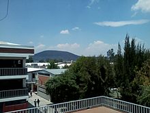
Chicoloapan de Juárez is the municipal seat and largest city in the municipality of Chicoloapan in State of Mexico, Mexico. It is located in the eastern part of the state, just east of Chimalhuacán and northeast of the Federal District (Distrito Federal), within the Greater Mexico City urban area.
The city[]
It had a 2005 census population of 168,591 inhabitants, or over 99 percent of its municipality's total of 170,035.
The municipality[]
As municipal seat, Chicoloapan de Juárez has governing jurisdiction over the following communities:
- Barrio San Patricio
- Buenavista ()
- Ejido de Chicoloapan (Centro Turístico Ejidal)
- Ejido La Copalera
- La Noria
- Loma de Guadalupe
- Loma San Pedro
- Pozo Número Cuatro (San Juan)
- Pozo Número Dos (La Campana)
- Pozo Número Seis (La Longaniza)
- Pozo Número Uno (La Trinidad)
- Rancho Coronel Baena (La Cabañita)
- Rancho la Cabaña
The municipality has an area of 60.89 km² (23.51 sq mi).
Archaeology[]
Chicoloapan is the site of an unprotected ancient Mesoamerican city of the same name. The first settlements in the area were before the rise of Teotihuacan around 200 BCE, and it prospered for generations after the fall of Teotihuacan around 550-600 CE.[1] The site's long history of settlement provides important insight into the relationship between urban centers and their hinterlands.
Mass media[]
The government has a website where information about its activities through newsletters. Most public and private high schools have websites.
As for secondary or primary, only a few individuals have this service.
The city has, since 2006, a community portal which generates collaborative contents such as news, photos, radio and TV programs online. The portal is an initiative of civil society independent from the local government, the religion or the political party. In 2010 it received the UVM Social Development[2] Award for its commitment to the dissemination of community activities to build the social fabric.[3]
References[]
- ^ Clayton, Sarah (2016). "After Teotihuacan: A View of Collapse and Reorganization from the Southern Basin of Mexico". American Anthropologist. 118: 104–120. doi:10.1111/aman.12522.
- ^ Chicoloapan, Portal de. "La UVM reconoce a jóvenes emprendedores sociales de México - Portal de Chicoloapan por sus habitantes - Medio Comunitario". sanvicentechicoloapan.com.mx.
- ^ "YouthActionNet". www.youthactionnet.org.
Sources[]
- Link to tables of population data from Census of 2005 INEGI: Instituto Nacional de Estadística, Geografía e Informática
- México Enciclopedia de los Municipios de México
External links[]
| Wikimedia Commons has media related to Chicoloapan de Juárez. |
Government:
Schools:
- Preparatoria Oficial (Official High School) No. 15
- Preparatoria Oficial No. 55
- Preparatoria Oficial No. 143
- Alumni Community of CECyTEM Chicoloapan
- COBAEM 31 Chicoloapan
Mass media:
- Chicoloapan Portal of Chicoloapan. Chicoloapan by its inhabitants, Community Media
- Photographs of Chicoloapan
- Radio Chicoloapan
- Tv Chicoloapan

| show Authority control |
|---|
- Populated places in the State of Mexico
- Municipalities of the State of Mexico