Jilotepec de Abasolo
Jilotepec de Molina Enríquez | |
|---|---|
City | |
 | |
 Seal | |
 Jilotepec de Molina Enríquez | |
| Coordinates: 19°57′07″N 99°31′58″W / 19.95194°N 99.53278°WCoordinates: 19°57′07″N 99°31′58″W / 19.95194°N 99.53278°W | |
| Country | |
| State | |
| Municipality | Jilotepec |
| City | Jilotepec de Molina Enríquez |
| Founded | about 1561 |
| Municipality Established | March 11, 1824 |
| Colonias | show
Colonias |
| Government | |
| • Municipal President | Agustín Bonilla Rodríguez (2019-2021) (MORENA) |
| Area | |
| • City | 588.73 km2 (227.31 sq mi) |
| • Water | 12.165 km2 (4.697 sq mi) |
| • Urban | 26.74 km2 (10.32 sq mi) |
| Elevation (of seat) | 2,452 m (8,045 ft) |
| Population (2018) Municipality | |
| • City | 100,808 |
| • Density | 171.23/km2 (443.5/sq mi) |
| • Seat | 10,513 |
| Demonym(s) | Jilotepequense |
| Time zone | UTC-6 (Central (US Central)) |
| • Summer (DST) | UTC-5 (Central) |
| Postal code (of seat) | 54240 |
| Area code(s) | 761 |
| Website | (in Spanish) http://www.jilotepec-edomex.gob.mx/ |

Jilotepec de Molina Enríquez, known as Jilotepec de Abasolo until 1986, commonly known as Jilotepec, is a city located northwest zone of the State of Mexico in Mexico. This name comes from Náhuatl, meaning "hill of corncobs". It is the municipal seat and largest city of the municipality of Jilotepec (not Jilotepec de Molina Enríquez). It is located in hilly and forested terrain an hour from Mexico City, Toluca, 40 minutes from San Juan del Río, 30 minutes from Tula and 20 from Tepeji. The Mexico City–Querétaro and the new Transoceanic Freeways converge within its territory that unite the coasts of Mexico from Veracruz to Michoacán.[1]
Jilotepec is located at 1670 meters over sea level it has 586.53 km2 being the fourth largest municipality of Mexico State. According to INEGIs data Jilotepec de Abasolo has 71624 inhabitants.[2] The municipality borders the municipalities of Polotitlan, Aculco, Timilpan, Chapa de Mota, Villa del Carbón, Soyaniquilpan and the state of Hidalgo. At the end of the 18th century, Jilotepec was part of the municipality of Huichapan, in the District of Tula. On March 11, 1824, Jilotepec de Abasolo was created from parts of Huichapan Chapa de Mota, Villa del Carbón, and Acambay.[1]
The town of Jilotepec de Molina Enríquez[]
The city had a population of 10,503 as of 2005.[2]
The region was originally inhabited by Otomis then conquered in 1379 by Acamapichtli the Aztec tlatoani (chief), later during the Viceroyalty of New Spain and the porfirian era, Jilotepec received waves of mostly Spanish and French settlers. After the Spanish Conquest, Jilotepec was recorded in ecclesiastical records as a village with a single priest, administrated by the Franciscans with the Brothers Alonso de Rangel and Antonio de Ciudad Rodrigo being the first to evangelize the area. Sometime in the middle of the 16th century, silver was discovered in Zacatecas and Guanajuato, leading to the construction of the (Royal Road to Zacatecas) with passed through>
Geography[]
Jilotepec lies in the north of the state of Mexico. To its north is the state of Hidalgo, to the south are the municipalities of Chapa de Mota and Timilpan, to the southeast is Villa del Carbón, to the east is Soyanilquilpan, and to the west are Polotitlán and Aculco.
Political Geography[]
There is one city in the municipality of Jilotepec, the municipal head Jilotepec de Molina Enríquez which is divided into six neighborhoods, or colonias: Colonia Centro, Javier Barrios, La Merced, El Deni, La Cruz de Dendho, and Xhisda.
There is only one village, or villa, the Villa de Canalejas
There are 23 towns, or pueblos:[3][4]
| Name | showPopulation (2010) |
|---|
There are 24 small towns, or rancherías:[3][4]
| Name | showPopulation (2010) |
|---|
Physical Geography[]
The primary geographical features of the region are fertile plains interrupted by hills and canyons. The municipality sits at the northern edge of the Trans-Mexican Volcanic Belt physiographic region on the Sierra Nevada mountain range. The municipality is further divided by the subregions of the plains and mountains of Querétaro and Hidalgo to the north, and the lakes and volcanoes of Anáhuac comprising a small part of the municipality to the south.[5][3][6] It is the fifth largest municipality in the state of Mexico.[7]
Geology[]
The geological substrate of the municipality is primarily extrusive igneous rock, that is, volcanic in origin. These rocks are notable for the presence of basaltic lava flows, deposits of basaltic ash, slag, and pyroclastic rocks. Many of the older buildings in Jilotepec were built using these basaltic rocks.[4]
The soil is mostly luvisolic, comprises 75% of the municipality's soil, and is particularly suited to agricultural industry though susceptible to erosion. About 15% of the soil is vertisolic and is located in the east of the municipality. This soil is prone to contraction in the dry season and is suited for grasses and grazing.[3]
The primary mineral resource of the region is kaolin, a white clay that is useful in porcelain and medicine making. Other minerals that can be found in the municipality include chalcedony and tezontle.[3]
Hydrology[]
Jilotepec is in the Alto Pánuco hydrologic region of the state of Mexico in the San Juan river basin. The most notable river in the municipality is the Coscomate which feeds into the Danxho reservoir and numerous streams such as Los Charcos, El Colorado, Dedeni, La Mina and 40 others. The Huapango reservoir is the municipality's largest at 120 million m3, followed by the Danxho with 31 million m3, and the Santa Elena with 5 million m3. In addition to other smaller streams and reservoirs the municipality is supplied with water by the San Pablo Huantepec spring which flows at 10 L/s.[3][4]
The municipality has a good supply of underground water thanks to the high permeability of the soil in most of the region. The quality of the water is "acceptable" though it is contaminated with waste and untreated water, especially in the municipal head where the Coscomate River and Colorado Stream flow.[4]
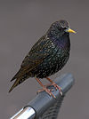
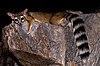
Fauna[]
Jilotepec has not done an exhaustive survey of the wildlife within its municipal borders but they do have an informal registry of species. There is a diversity of frogs, lizards, and snakes (only three of which are venomous) in Jilotepec. The birds of the region concentrate around the forests and lakes and represent the greatest diversity of wildlife in the municipality. The mammals of the region include common herbivores and carnivores such as weasels, coyotes, squirrels, and possums.[3]
Fish[]
Only the charal is common to the region. It is commonly fished for food and typically dried. The charal has a wide tolerance for changes in weather common to the municipality throughout the year. Though it is easily found and commonly consumed, there is no industry actively exploiting the charal population in Jilotepec. Though not native to the region, carp (Cyprinus carpio) and largemouth bass (Micropterus salmoides) are commercially farmed, recently being introduced to the Huapango reservoir.[3]
Amphibian Species[3][]
| Common Name (English) | Common Name (Spanish) | Scientific Name | showImage |
|---|


Reptile Species[3][]
| Common Name (English) | Common Name (Spanish) | Scientific Name | showImage |
|---|


Bird Species[3][]
| Common Name (English) | Common Name (Spanish) | Scientific Name | showImage |
|---|


Mammal Species[3][]
| Common Name (English) | Common Name (Spanish) | Scientific Name | showImage |
|---|


Flora[]
Jilotepec's vegetation is predominantly semiarid grassland. In the north, the oak forests of Las Peñas are the largest in the state of Mexico.[8] Throughout the municipality maguey, nopal, and tejocote are common, as well as many plants used in traditional medicinal recipes. There are two protected areas in Jilotepec: the state park El Llano Canalejas and the municipal park Las Sequoias as well as many smaller local parks and forests.[3]
Climate[]
The climate of Jilotepec varies between Cwa and Cwb on the Köppen climate classification, meaning it's in a temperate zone with dry winters and warm to hot summers. The southern portion of the region is noticeably cooler than the northern region which is closer to the warmer region of the Bajío. Likewise, rain is more intense in the south of the state than in the north.
Economy[]
6,416 hectares of the municipality is dedicated to the production of corn (the major crop), beans, wheat and livestock which is very important activity in the economic life of Jilotepec. Livestock includes cows pigs, sheep, and deer being a major dairy and meat producer. There are also farms with 8.5 millions birds for the production of meat and eggs. The raising of freshwater fish is a growing industry in the municipality as well.[1]
The municipality has two types of industry, the first being family workshops which produce clothes, ceramics and pottery. The second are factories focused on the production and embroidery of clothes for men and the manufacturing of plastic containers and other wool products.[1]
References[]
- ^ Jump up to: a b c d "Enciclopedia de los Municipios de Mexico Estado de Mexico Jilotepec de Abasolo". Archived from the original on May 26, 2007. Retrieved 2008-03-08.
- ^ Jump up to: a b "Principales resultados por localidad 2005 (ITER)". Archived from the original on 2011-06-13. Retrieved 2008-03-08.
- ^ Jump up to: a b c d e f g h i j k l m Plan de desarrollo Municipal 2016-2018 Jilotepec, México [Municipal Plan of Development 2016-2018 Jilotepec, México] (PDF) (in Spanish). Jilotepec, Estado de México: Ayuntamiento Constitucional de Jilotepec. 2016.
- ^ Jump up to: a b c d e Plan de Desarrollo Municipal 2019-2021 (PDF) (in Spanish). Jilotepec, Estado de México: Ayuntamiento Constitucional de Jilotepec. 2019.
- ^ "Estado de México - Jilotepec de Abasolo". www.inafed.gob.mx. Retrieved 2019-05-29.
- ^ Geografía (INEGI), Instituto Nacional de Estadística y. "Mapas. Fisiográficos". en.www.inegi.org.mx (in Spanish). Retrieved 2019-05-30.
- ^ Figueroa Noguez, Areli Alejandra (2018). "Iniciativas de Desarrollo Económico Local en el Municipio de Jilotepec, Estado de México" [Local Economic Development Initiatives in the Municipality of Jilotepec, State of Mexico] (PDF). Agenda Pública para el Desarrollo Regional, la Metropolización y la Sostenibilidad [Public Agenda for Regional Development, Metropolitanization, and Sustainability] (PDF) (in Spanish). 3. México: Universidad Nacional Autónoma de México. pp. 427–438.
- ^ "Las Peñas – Ayuntamiento Constitucional de Jilotepec 2019-2021" (in Spanish). Retrieved 2019-05-31.
- ^ "Average Weather in Jilotepec de Molina Enríquez, Mexico, Year Round - Weather Spark". weatherspark.com. Retrieved 2019-05-30.
External links[]
- (in Spanish) Municipal Official Site

| show Authority control |
|---|
- Municipalities of the State of Mexico
- Populated places in the State of Mexico
- Otomi settlements
- Municipality seats in the State of Mexico