Ecatepec de Morelos
Ecatepec de Morelos
Ecatepec | |
|---|---|
City & Municipality | |
 | |
| Motto(s): Autonomía, Unión, Trabajo (Autonomy, Union, Work) | |
 Location of Ecatepec in the State of Mexico | |
| Coordinates: 19°36′35″N 99°03′36″W / 19.60972°N 99.06000°W | |
| Country | Mexico |
| State | State of Mexico |
| Metro area | Greater Mexico City |
| Municipal Status | October 13, 1877[2] |
| Municipal Seat | San Cristóbal Ecatepec |
| Government | |
| • Type | Ayuntamiento |
| • Mayor | Fernando Vilchis Contreras (2019-2021) |
| Area | |
| • Total | 156.2 km2 (60.3 sq mi) |
| • Water | 0.00 km2 (0.00 sq mi) |
| Elevation (of seat) | 2,250 m (7,380 ft) |
| Population (2020) | |
| • Total | 1,645,352[1] |
| • Density | 10,533.6/km2 (27,282/sq mi) |
| • Seat | 1,643,623 |
| • Metro area | 21,804,515 |
| Time zone | UTC−6 (CST) |
| • Summer (DST) | UTC−5 (CDT) |
| Postal code (of seat) | 55000 |
| Area code(s) | 55 |
| Demonym | Ecatepequense |
| Website | Official website (in Spanish) |

Ecatepec (Spanish: [ekateˈpek] (![]() listen)), officially Ecatepec de Morelos, is a municipality in the State of Mexico. The municipal seat is San Cristóbal Ecatepec.
listen)), officially Ecatepec de Morelos, is a municipality in the State of Mexico. The municipal seat is San Cristóbal Ecatepec.
The city is practically co-extensive with the municipality, comprising 99% of the total municipal population of 1,645,352.[1] It is Mexico's fourth most-populous municipality after Tijuana, León and Puebla,[1] and the most populated suburb of Greater Mexico City.
The name "Ecatepec" is derived from Nahuatl, and means "windy hill" or "hill devoted to Ehecatl." It was also an alternative name or invocation to Quetzalcoatl.[3] "Morelos" is the last name of José María Morelos, a hero of the Mexican War of Independence. Saint Christopher is the city's patron saint, celebrated on July 25.[3]
The Mexico City metro subway system extends into Ecatepec.
Points of interest include the newest Catholic Cathedral in Mexico, Sagrado Corazón de Jesús, several colonial era churches, and the Morelos Museum in "Casa de los Virreyes".[3]
Geography[]

The municipality is located north of Mexico City, in the geographical coordinates of North 19º29'23" minimum, 19º40'28" maximum, West longitude 98°58'30" minimum, 99°08'35" maximum.[4]
San Cristóbal Ecatepec, the municipal seat, has governing jurisdiction over the following communities: San Pedro Xoloxtoc, Tulpetlac, Chiconautla, Ciudad Azteca and Villa de Aragón. It has an area of 156.2 square kilometres (60.3 sq mi)[5] and borders the municipalities of Tlalnepantla de Baz, Tecámac, Coacalco de Berriozábal, Jaltenco, Acolman, Texcoco, Atenco, Nezahualcóyotl, as well as the Mexico City borough of Gustavo A. Madero.
The human settlements in Ecatepec de Morelos are located in an elongated valley, spreading from the Valley of Mexico to Sierra de Guadalupe.
Flora and fauna[]
The municipality is highly urbanized, so most of the local flora and fauna live in the Sierra de Guadalupe. There are no big animals, with the fauna consisting of small mammals like mice, rabbits, gray squirrels and gophers; and birds, such as cenzontles and sparrows. The flora is represented by oyamel pines, oaks, ocote pines, century plants, prickly pears, zacatón (mountain grass) and other.[6]
History[]
Aztec Era[]


Remains of earliest human inhabitation of the area have been found on the nearby Cerro (Hill) de Ecatepec. The area was initially settled by successive waves of Otomis; however, because of the later arrival of Toltec-Chichimecas that dominated the rest of the Valley of Mexico, this area eventually assimilated to the rest of the Valley, ending with its domination by the Aztec Empire.[7] Ecatepec was an Aztec altepetl or city-state in the Valley of Mexico.
From 1428 to 1539, Ecatepec was ruled by a tlatoani (literally "speaker"). The tlatoque (plural of tlatoani) of Ecatepec were closely related to the ruling dynasty of Tenochtitlan.[8] - Chimalpilli I, grandson of Moctezuma I. - Tezozomoc, son of Chimalpopoca. - Matlaccohuatl, whose daughter Teotlalco married Moctezuma II. - Chimalpilli II, son of Ahuitzotl. - Diego de Alvarado Huanitzin, grandson of Axayacatl.
Diego Huanitzin was subsequently made tlatoani of Tenochtitlan by Antonio de Mendoza, viceroy of New Spain.
During the Aztec empire, the Mexicas used the town to control trade routes going north.[3]
Spanish rule and Independence[]
Ecatepec was considered a "República de Indios" (Indian Republic) in 1560, allowing the village to maintain a certain amount of autonomy and keeping the succession of tlatoanis or chiefs. However, in the first part of the 17th century, this was changed to a mayorship, with the Spanish administrating, along with the communities of Zumpango and Xalostoc.[7]
National hero José María Morelos y Pavón was executed in Ecatepec in 1815 by the Spanish Army during the Mexican War of Independence. The house in which he was executed is now a museum, Museo Casa de Morelos.
The municipality was officially created on October 13, 1874.[3] On October 1, 1877, San Cristóbal Ecatepec was declared a village and "de Morelos" was added to its name.[7]
Contemporary events[]
Ecatepec experienced expontential population growth from 1970, as a result of rural migration to the Valley of Mexico. The seat was declared a city on December 1, 1980,[3] and by 2010, it had become the most populated municipality in the country. Population growth stagnated since then.
The Roman Catholic Diocese of Ecatepec is the newest in the country, erected on June 28, 1995 around the Sagrado Corazón de Jesús Cathedral.[9]
In April 1995, the remains of a mammoth were found in Colonia Ejidos de San Cristóbal, where the ancient lakes of Xaltocan-Ecatepec and Texcoco came together and where the Aztecs build a dam to keep the fresh and salty waters separate. The bones have been tentatively dated to around 10,500 years B.C.[7]
In February 2016, Pope Francis celebrated Mass in the city in front of a crowd of 300,000. The Pope's message was one of encouragement and opposition to the violence and drug trade that permeates the region.[10]
Politics[]
This section needs expansion. You can help by . (March 2021) |

| Mayor | Time |
|---|---|
| Luis Fernando Vilchis Contreras | 2019–present |
| Indalecio Ríos Velázquez | 2016–2019 |
Demography[]
Almost all of the population (99.934%) of the municipality lives in San Cristóbal Ecatepec, the third most populous city in Mexico. There are also three rural localities in the municipality.[1]
| Locality | 2020 Census Population |
|---|---|
| San Cristóbal Ecatepec | 1,643,623 |
| Mesa de los Leones | 1,043 |
| Tierra Blanca 2a Sección (Ejido Ecatepec) | 615 |
| Vista Hermosa | 71 |
| Total Municipality | 1,645,352 |
Economy[]
Ecatepec is an industrial center. Manufacturing, along with commerce and services, are the main pillars of the economy.[11]
Jumex has its headquarters in the city.[12][13]
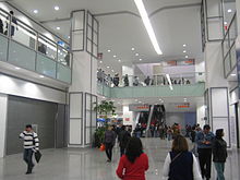
Plaza Las Américas shopping mall is located in Ecatepec, in which are located Liverpool, Sears and Suburbia department stores as well as a Walmart.
Transportation[]
Ecatepec is served by Line B of the Mexico City Metro system, including stations Muzquiz, Ecatepec (a.k.a. Tecnológico), Olímpica, Plaza Aragón, and Ciudad Azteca[14][15]
In 2016, a new transportation system was introduced to Ecatepec's inhabitants: Mexicable. This project is a cable car which main purpose is to help people get around faster (contrary to most cable cars which have tourists as their main users), especially in areas with complicated geography. The idea was originally developed in South America, with Colombia being the first country to add a cable car system, called Metrocable, as part of their metro. The Mexicable, the first cable car constructed in Mexico as a form of public transportation, has a length of almost 5 kilometres (3 miles), 190 cars and it runs the entire line in about 17 minutes.[16]
Ecatepec is located on Fed 85, the Mexico City-Pachuca highway, Fed 57/Fed 57D (Circuito Exterior Mexiquense), and Fed 132 (Ecatepec-Teotihuacán highway).
Sister cities[]
| City | State | Country | Reference |
|---|---|---|---|
| Caracas | Miranda | ||
| Cuautla | |||
| Guadalupe | [18] | ||
| Guangzhou | |||
| Namyangju | [19] | ||
| San Jose | [20] | ||
| Guarulhos | [21] |
References[]
- ^ Jump up to: a b c d "Censo de Población y Vivienda 2020 - SCITEL" (in Spanish). INEGI. Retrieved 2021-01-27.
- ^ "Bando Municipal de Ecatepec de Morelos 2015" (PDF). H. Ayuntamiento de Ecatepec de Morelos 2013-2015. Archived from the original (PDF) on September 23, 2015. Retrieved August 18, 2015.
- ^ Jump up to: a b c d e f "Historia de Ecatepec". Ecatepec.com. Retrieved 2008-03-08.
- ^ "Ecatepec de Morelos municipality" (PDF). 3.inegi.org.mx. Archived from the original (PDF) on 2016-05-28. Retrieved 2017-08-28.
- ^ "México en cifras - Medio Ambenciente - Estado de México" (in Spanish). INEGI. Retrieved February 12, 2021.
- ^ "Estado de México - Ecatepec". Inafed.gob.mx. Retrieved 28 August 2017.
- ^ Jump up to: a b c d "Enciclopedia de los Municipios de México Estado de Mexico Ecatepec". Archived from the original on 2007-09-30. Retrieved 2008-03-08.
- ^ Explorations in ethnohistory: Indians of central Mexico in the sixteenth century by H. R. Harvey, Hanns J. Prem
- ^ "Diocese of Ecatepec". Catholic Hierarchy. Retrieved March 13, 2021.
- ^ "Pope Francis warns Mexico City crowd against 'dialogue with the devil'". The Guardian. 14 February 2016.
- ^ "Ecatepec de Morelos". Encyclopedia.com. Retrieved March 13, 2021.
- ^ "Contacto Archived 2014-02-09 at the Wayback Machine" (Archive). Jumex. Retrieved on May 27, 2014. "Antigua Carretera Mexico Pachuca, Km 12.5 Xalostoc Estado De Mexico, CP 55340"
- ^ "Aviso de privacidad" (Archive). Jumex. Retrieved on May 27, 2014. "[...]GRUPO JUMEX, S.A. de C.V., con domicilio en Carretera México-Pachuca KM 12.5, Colonia Rústica Xalostoc, Ecatepec de Morelos, Estado de México, C.P. 55340, México"
- ^ "Ecatepec". Metro.df.gob.mx (in Spanish). Archived from the original on 25 August 2012. Retrieved 6 August 2011.
- ^ Archambault, Richard. "Ecatepec » Mexico City Metro System". Mexicometro.org. Retrieved 6 August 2011.
- ^ "President inaugurates cable car system". Mexico News Daily. Retrieved 1 February 2017.
- ^ "The Medical Blog". Multilingualarchive.com. Archived from the original on 11 February 2012. Retrieved 28 August 2017.
- ^ "Archived copy". Archived from the original on 2012-04-29. Retrieved 2012-03-22.CS1 maint: archived copy as title (link)
- ^ "Organización Editorial Mexicana". Oem.com.mx. Retrieved 28 August 2017.
- ^ "Convenios Nacionales e Internacionales". msj.go.cr (in Spanish). San José. Retrieved 2021-01-25.
- ^ "Cooperação Internacional". guarulhos.sp.gov.br (in Portuguese). Guarulhos. Retrieved 2020-06-11.
External links[]
| Wikimedia Commons has media related to Ecatepec de Morelos Municipality. |
- (in Spanish) Portal of Ecatepec de Morelos
- (in Spanish) Ayuntamiento Constitucional de Ecatepec de Morelos Official website
Coordinates: 19°36′35″N 99°03′36″W / 19.60972°N 99.06000°W

| Authority control |
|
|---|
- Ecatepec de Morelos
- Cities in Mexico
- Mexico City metropolitan area
- Populated places in the State of Mexico
- Altepetl
- Aztec sites
- Tlatoque of Ecatepec
- 1815 in Mexico