Tecámac
Tecámac | |
|---|---|
Town & Municipality | |
 Seal | |
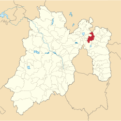
 Location of the municipality in Mexico State | |
 Tecámac Location in Mexico | |
| Coordinates: 19°42′47″N 98°58′06″W / 19.71306°N 98.96833°WCoordinates: 19°42′47″N 98°58′06″W / 19.71306°N 98.96833°W | |
| Country | |
| State | |
| Metro area | Greater Mexico City |
| Municipal Status | September 12, 1825[1] |
| Municipal Seat | Tecámac de Felipe Villanueva |
| Government | |
| • Type | Ayuntamiento |
| • Municipal President | Rocío Díaz Montoya |
| Area | |
| • Total | 157.34 km2 (60.75 sq mi) |
| • Land | 157.34 km2 (60.75 sq mi) |
| • Water | 0.00 km2 (0.00 sq mi) |
| Elevation | 2,260 m (7,410 ft) |
| Population (2010) | |
| • Total | 364,579 |
| Time zone | UTC-6 (CST) |
| • Summer (DST) | UTC-5 (CDT) |
| Postal code (of seat) | 55740 |
| Area code(s) | 55 |
| Demonym | Tecamaquense |
| Website | Official website (in Spanish) |
Tecámac is a municipality in State of Mexico in Mexico. The municipality covers an area of 157.34 km². The municipal seat lies in the town (locality) of Tecámac de Felipe Villanueva. Its largest town, Ojo de Agua, with a population of 242,283 inhabitants, is the largest locality in Mexico that is not a municipal seat.
As of the 2010 census, the municipality had a total population of 364,579 inhabitants.[2]
Geography[]

The town of , a municipal seat, has governing jurisdiction over the following communities: Ozumbilla, Santa María Ajoloapan, San Lucas Xolox, Los Reyes Acozac and Ojo de Agua. The total municipality extends 157.34 km2 and borders with the municipalities of Zumpango, Temascalapa, Tonanitla, Teotihuacán and Ecatepec de Morelos.
Politics[]

| Mayor | Time |
|---|---|
| Aaron Urbina Bedolla | 2012–2015 |
| Rocío Díaz Montoya | 2016– |
Demography[]
The largest localities (cities, towns, and villages) are:[3]
| Populated place | 2010 Census Population |
|---|---|
| Ojo de Agua | 242,283 |
| San Martín Azcatepec | 35,390 |
| Los Reyes Acozac | 21,910 |
| Santa María Ajoloapan | 17,784 |
| Tecámac de Felipe Villanueva | 15,911 |
| San Lucas Xolox | 20,478 |
| Fraccionamiento Social Progresivo Santo Tomás Chiconautla | 15,061 |
| Total Municipality | 364,590 |
References[]
- ^ "Bando Municipal de Tecámac 2015" (PDF). H. Ayuntamiento de Tecámac 2013-2015. Retrieved September 9, 2015.
- ^ "Tecámac". Enciclopedia de los Municipios de México. Instituto Nacional para el Federalismo y el Desarrollo Municipal. Archived from the original on May 20, 2007. Retrieved June 6, 2009.
- ^ 2010 census tables: INEGI Archived 2013-05-02 at the Wayback Machine
- Tecámac
- Populated places in the State of Mexico
- State of Mexico geography stubs

